Naranja, Florida | |
---|---|
![]() Location in Miami-Dade County and the state of Florida | |
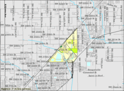
![]() U.S. Census Bureau map showing CDP boundaries | |
Coordinates: 25°31′N80°25′W / 25.517°N 80.417°W | |
Country | ![]() |
State | ![]() |
County | ![]() |
Area | |
• Total | 1.68 sq mi (4.36 km2) |
• Land | 1.50 sq mi (3.88 km2) |
• Water | 0.18 sq mi (0.48 km2) |
Elevation | 7 ft (2 m) |
Population | |
• Total | 13,509 |
• Density | 9,012.01/sq mi (3,480.67/km2) |
Time zone | UTC-5 (Eastern (EST)) |
• Summer (DST) | UTC-4 (EDT) |
ZIP codes | 33032, 33092 |
Area code(s) | 305, 786, 645 |
FIPS code | 12-47700 [3] |
GNIS feature ID | 0287532 [4] |
Naranja is an unincorporated community and census-designated place (CDP) in Miami-Dade County, Florida, United States. Many orange groves were once located in this area, so the community name came from the Spanish word for orange, naranja, though the pronunciation among the local residents is "Na-Ran-Jah". [5] Naranja was also a stop for the Florida East Coast Railroad that once ran through this area. It is part of the Miami metropolitan area of South Florida. The population was 13,509 at the 2020 census, [2] up from 8,303 in 2010. [6]
Naranja is located 25 miles (40 km) southwest of downtown Miami at 25°31′N80°25′W / 25.517°N 80.417°W (25.5174, -80.4217). [7] It is bordered to the north and east by Princeton and to the south by Leisure City, and the city of Homestead is 5 miles (8 km) to the southwest.
U.S. Route 1 (Dixie Highway) runs along the northwest edge of the community. The Homestead Extension of Florida's Turnpike touches the southeast corner of the community, with partial access from Exit 6 (Tallahassee Road) and full access from Exit 5 (Biscayne Drive) in Leisure City.
According to the United States Census Bureau, the Naranja CDP has a total area of 1.7 square miles (4.4 km2), of which 1.5 square miles (3.9 km2) are land and 0.2 square miles (0.5 km2), or 10.99%, are water. [1]
Census | Pop. | Note | %± |
---|---|---|---|
1960 | 2,309 | — | |
1990 | 5,790 | — | |
2000 | 4,034 | −30.3% | |
2010 | 8,303 | 105.8% | |
2020 | 13,509 | 62.7% | |
source: [8] [9] [10] |
Race / Ethnicity (NH = Non-Hispanic) | Pop 2010 [11] | Pop 2020 [12] | % 2010 | % 2020 |
---|---|---|---|---|
White (NH) | 519 | 696 | 6.25% | 5.15% |
Black or African American (NH) | 3,172 | 4,150 | 38.20% | 30.72% |
Native American or Alaska Native (NH) | 11 | 14 | 0.13% | 0.10% |
Asian (NH) | 193 | 224 | 2.32% | 1.66% |
Pacific Islander or Native Hawaiian (NH) | 1 | 2 | 0.01% | 0.01% |
Some other race (NH) | 31 | 89 | 0.37% | 0.66% |
Mixed race or Multiracial (NH) | 91 | 203 | 1.10% | 1.50% |
Hispanic or Latino (any race) | 4,285 | 8,131 | 51.61% | 60.19% |
Total | 8,303 | 13,509 | 100.00% | 100.00% |
As of the 2020 United States census, there were 13,509 people, 3,365 households, and 2,798 families residing in the CDP. [13]
As of the 2010 United States census, there were 8,303 people, 2,081 households, and 1,537 families residing in the CDP. [14]
As of the census [3] of 2000, there were 4,034 people, 1,196 households, and 875 families residing in the CDP. The population density was 2,654.6 inhabitants per square mile (1,024.9/km2). There were 1,630 housing units at an average density of 1,072.7 per square mile (414.2/km2). The racial makeup of the CDP was 32.99% White (12.7% were Non-Hispanic White), [15] 57.54% African American, 0.42% Native American, 1.39% Asian, 0.15% Pacific Islander, 3.89% from other races, and 3.62% from two or more races. Hispanic or Latino of any race were 26.97% of the population.
As of 2000, there were 1,196 households, out of which 48.7% had children under the age of 18 living with them, 30.4% were married couples living together, 36.0% had a female householder with no husband present, and 26.8% were non-families. 20.6% of all households were made up of individuals, and 5.9% had someone living alone who was 65 years of age or older. The average household size was 3.23 and the average family size was 3.73.
In 2000, in the CDP, the population was spread out, with 39.5% under the age of 18, 11.3% from 18 to 24, 27.8% from 25 to 44, 14.0% from 45 to 64, and 7.4% who were 65 years of age or older. The median age was 24 years. For every 100 females, there were 90.6 males. For every 100 females age 18 and over, there were 82.7 males.
In 2000, the median income for a household in the CDP was $18,825, and the median income for a family was $19,443. Males had a median income of $22,614 versus $19,167 for females. The per capita income for the CDP was $7,346. About 42.3% of families and 50.5% of the population were below the poverty line, including 62.7% of those under age 18 and 19.8% of those age 65 or over.
As of 2000, speakers of English as a first language accounted for 66.25% of residents, while Spanish made up 28.14%, French Creole was at 4.64%, and Tagalog was the mother tongue of 0.95% of the population. [16]
Miami-Dade County Public Schools operates area public schools.
Dr. William A. Chapman Elementary School, which opened in 1976, serves the Naranja community, [17] and is located in the CDP. [18] [19] Also serving the Naranja community is, Coconut Palm K-8 Academy, which replaced the former Naranja Elementary School. This school is located approximately 3 miles from the former Naranja Elementary School.
Young Men's Academy for Academic and Civic Development (YMAACD) at Miami Douglas MacArthur Senior High School South (MacArthur South), an alternative school, was scheduled to move to the Naranja area for the 2009-2010 school year, in the location of the former Naranja Elementary School. [20] The name has since been changed to Miami Macarthur Educational Center.
Miami MacArthur South Senior High School is also in the CDP. [18] [21] This is a public, alternative school located in Naranja, Florida. It has approximately 107 students in grades 6-12 with a teacher student ratio of 5-1. According to state test scores, at least 10% of the students are proficient in math and 10% in reading.
Brownsville is an unincorporated community and census-designated place (CDP) that is part of the Miami metropolitan area of South Florida. As of the 2020 US census, the population was 16,583, up from 15,313 in 2010. After three decades of population loss, Brownsville gained population for the first time in over 40 years in the 2010 US Census.
Country Club is a suburban census-designated place located in northwest Miami-Dade County, Florida, United States. It is located in the Miami metropolitan area of South Florida. The CDP is named after the Country Club of Miami, which was established in 1961 in what was then an unpopulated and undeveloped section of the county. The population was 49,967 at the 2020 census, up from 3,408 in 1990.
Fontainebleau(incorrectly spelled "Fountainebleau" in the 2000 census) is a census-designated place (CDP) in Miami-Dade County, Florida, United States. It is part of the Miami metropolitan area of South Florida. The population was 59,870 during the 2020 census.
Gladeview is a census-designated place (CDP) in Miami-Dade County, Florida, United States. It is part of the Miami metropolitan area of South Florida. The population was 14,927 at the 2020 census, up from 11,535 in 2010.
Ives Estates is a census-designated place (CDP) in Miami-Dade County, Florida. It is part of the Miami metropolitan area of South Florida. The population was 25,005 at the 2020 census, up from 19,525 in 2010.
Kendall West is a census-designated place and unincorporated community in Miami-Dade County, Florida, west of the Florida Turnpike. It is located in the Miami metropolitan area of South Florida. The population was 36,536 at the 2020 census.
Leisure City is an unincorporated community and census-designated place (CDP) in Miami-Dade County, Florida, United States, that includes the smaller, older community of Modello in its northwestern section. The CDP is most notable for the Coral Castle Museum, located in the Modello area. It is located in the Miami metropolitan area of South Florida. The population was 26,324 at the 2020 census, up from 22,655 in 2010.
Norland, also known as Norwood, is a former census-designated place located in northern Miami-Dade County, Florida. The population was 22,995 at the 2000 census. The latest estimated population stands at 23,500. In 2003 the majority of this CDP was incorporated into the city of Miami Gardens, and it now serves as one of the city's neighborhoods.
Olympia Heights is a census-designated place in Miami-Dade County, Florida, United States. It is located in the Miami metropolitan area of South Florida. The population was 12,873 at the 2020 census.
Palm Springs North is an unincorporated community and census-designated place (CDP) in Miami-Dade County, Florida, United States. It is part of the Miami metropolitan area of South Florida. The population was 5,030 at the 2020 census.
Pinewood is an unincorporated community and census-designated place (CDP) in Miami-Dade County, Florida, United States. It is part of the Miami metropolitan area of South Florida. The population was 17,246 at the 2020 census.
Princeton is a census-designated place (CDP) and unincorporated community in Miami-Dade County, Florida, United States. It is part of the Miami metropolitan area of South Florida. The population was 39,208 at the 2020 census, up from 22,038 at the 2010 census.
Richmond West is a census-designated place (CDP) in Miami-Dade County, Florida, United States. It is part of the Miami metropolitan area of South Florida. The population was 35,884 at the 2020 census, up from 31,973 at the 2010 census.
Sunset is a census-designated place (CDP) in Miami-Dade County, Florida, United States. It is part of the Miami metropolitan area of South Florida. The population was 15,912 at the 2020 census. The U.S. Postal Service uses the ZIP Codes of 33173 and 33183 for Sunset.
Tamiami is a census-designated place (CDP) in Miami-Dade County, Florida, United States. It is part of the Miami metropolitan area of South Florida. The population was 54,212 at the 2020 census.
The Crossings is a census-designated place (CDP) and suburb of Miami in Miami-Dade County, Florida, United States. It is part of the Miami metropolitan area of South Florida. The CDP includes the neighborhoods of The Crossings, Devon Aire, and Calusa. The population was 23,276 at the 2020 census.
The Hammocks is a planned community and census-designated place in Miami-Dade County, Florida, United States. It is part of the Miami metropolitan area of South Florida. The population was 59,480 at the 2020 census, up from 51,003 in 2010.
West Little River is a census-designated place (CDP) in Miami-Dade County, Florida, United States. It is part of the Miami metropolitan area of South Florida. The population was 34,128 at the 2020 census.
Westchester is a census-designated place (CDP) and neighborhood in Miami-Dade County, Florida. It is part of the Miami metropolitan area of South Florida. Prior to the 2020 U.S. Census, the neighboring University Park CDP was merged into Westchester CDP, effectively doubling its geography and population. Per the 2020 census, the population was 56,384.
Westwood Lakes is a census-designated place and unincorporated community of Miami-Dade County, Florida, United States. It is part of the Miami metropolitan area of South Florida. The population was 11,373 at the 2020 census.