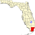
El Portal, Florida

Last updated

El Portal, Florida
Village of El Portal
El Portal neighborhood 20110216.jpg
Typical street in El Portal
Seal of El Portal, Florida.png
Miami-Dade County Florida Incorporated and Unincorporated areas El Portal Highlighted.svg
Location in Miami-Dade County and the state of Florida
El Portal.png
U.S. Census Bureau map showing village boundaries
Coordinates: 25°51′18.62″N80°11′39.01″W / 25.8551722°N 80.1941694°W / 25.8551722; -80.1941694
Country Flag of the United States.svg  United States of America
State Flag of Florida.svg  Florida
County Flag of Miami-Dade County, Florida.png Miami-Dade
Incorporated December 6, 1937
Government
  Type Council–Manager
   Mayor Omarr C. Nickerson
   Vice Mayor Luis Pirela
   Councilpersons Dr. Anna E. Lightfoot-Ward,
Darian Martin, and,
Anders Urbom
   Village Manager Christia E. Alou
   Village Clerk Yenise Jacobi
Area
[1]
  Total
0.42 sq mi (1.09 km2)
  Land0.42 sq mi (1.08 km2)
  Water0.01 sq mi (0.01 km2)
Elevation
7 ft (2 m)
Population
 (2020) [2]
  Total
1,986
  Density4,774.04/sq mi (1,844.35/km2)
Time zone UTC-5 (EST)
  Summer (DST) UTC-4 (EDT)
ZIP Codes
33138, 33150
Area code(s) 305, 786, 645
FIPS code 12-20650 [3]
GNIS feature ID0282132 [4]
Website www.elportalvillage.com

El Portal is a village in Miami-Dade County, Florida, United States. The name is derived from the Spanish term for "the gate", after two wooden gates that once stood as a gateway to the village. El Portal was originally annexed into the city of Miami in 1925. [5] With the arrival of the Great Depression, Miami gave up its jurisdiction, and El Portal was incorporated as its own village in 1937. [5] The village is part of the Miami metropolitan area of South Florida. As of the 2020 census, the population of El Portal was 1,986, [2] down from 2,325 in 2010.

Contents

History

The Village of El Portal is a small, diverse enclave between Miami Shores and Miami. It was incorporated on December 6, 1937. The enclave was originally the capital of the Tequesta tribal area, and was visited by Pedro Menéndez de Avilés in the 1560s. [6] Three small subdivisions (now neighborhoods)—Sherwood Forest, El Jardin (Spanish for "The Garden"), and El Portal—merged into the Village of El Portal. [7] Its borders include 91st Street on the north, the Little River Canal on the south, Northeast Fifth Avenue on the east and Northwest Fifth Avenue on the west.

The village's name is a Spanish term meaning "the gate," referring to two huge wooden gates on Northeast Second Avenue that were taken down in the 1940s. [6]

The village was designated as a bird sanctuary by the state for more than 50 years, which means that the birds and trees cannot be harmed in any way. A nature trail winds its way through the village. El Portal also boasts links to prehistoric Indian life at the Little River Mound, a four-foot-high, innocuous grassy knoll that is actually an ancient burial ground. The Little River Mound, located in the Sherwood Forest neighborhood, is the first archaeological site to be publicly recognized and preserved in Miami-Dade County. [8]

Geography

El Portal is located 6 miles (10 km) north of downtown Miami at 25°51′19″N80°11′39″W / 25.85528°N 80.19417°W / 25.85528; -80.19417 (25.855173, –80.194168). [9] It is bordered to the south and east by the city of Miami, to the north by the village of Miami Shores, and to the southwest by unincorporated West Little River.

According to the United States Census Bureau, the village has a total area of 0.4 square miles (1.0 km2), of which 0.005 square miles (1.3 ha), or 1.19%, are water. [1]

Surrounding areas

Climate

The Village of El Portal has a tropical climate, similar to the climate found in much of the Caribbean. It is part of the only region in the 48 contiguous states that falls under that category. More specifically, it generally has a tropical savanna climate (Köppen climate classification: Aw), bordering a tropical monsoon climate (Köppen climate classification: Am). [10]

Demographics

Historical population
CensusPop.Note
1940 365
1950 1,371275.6%
1960 2,07951.6%
1970 2,068−0.5%
1980 2,055−0.6%
1990 2,45719.6%
2000 2,5052.0%
2010 2,325−7.2%
2020 1,986−14.6%
U.S. Decennial Census [11]
El Portal, Florida – Racial and ethnic composition
Note: the US Census treats Hispanic/Latino as an ethnic category. This table excludes Latinos from the racial categories and assigns them to a separate category. Hispanics/Latinos may be of any race.
Race / Ethnicity (NH = Non-Hispanic)Pop 2010 [12] Pop 2020 [13] % 2010% 2020
White (NH)44148018.97%24.17%
Black or African American (NH)1,10668447.57%34.44%
Native American or Alaska Native (NH)340.13%0.20%
Asian (NH)28431.20%2.17%
Pacific Islander or Native Hawaiian (NH)130.04%0.15%
Some other race (NH)23230.99%1.16%
Mixed race or Multiracial (NH)58732.49%3.68%
Hispanic or Latino (any race)66567628.60%34.04%
Total2,3251,986100.00%100.00%

2020 census

As of the 2020 United States census, there were 1,986 people, 770 households, and 451 families residing in the village. [14]

2010 census

As of the 2010 United States census, there were 2,325 people, 836 households, and 581 families residing in the village. [15]

2000 census

In 2000, 33.8% had children under the age of 18 living with them, 39.2% were married couples living together, 21.7% had a female householder with no husband present, and 32.5% were non-families. 24.7% of all households were made up of individuals, and 6.2% had someone living alone who was 65 years of age or older. The average household size was 2.98 and the average family size was 3.59.

In 2000, the village population was spread out, with 25.4% under the age of 18, 9.3% from 18 to 24, 30.6% from 25 to 44, 24.4% from 45 to 64, and 10.4% who were 65 years of age or older. The median age was 36 years. For every 100 females, there were 97.1 males. For every 100 females age 18 and over, there were 96.7 males.

In 2000, the median income for a household in the village was $39,681, and the median income for a family was $41,029. Males had a median income of $27,222 versus $22,409 for females. The per capita income for the village was $14,782. About 16.3% of families and 22.2% of the population were below the poverty line, including 28.9% of those under age 18 and 9.3% of those age 65 or over.

As of 2000, speakers of English was spoken as a first language by 51.96% of residents, while speakers of French Creole made up 23.72% of the populace, Spanish at 22.38%, French 1.08%, and Jamaican Patois was the mother tongue for 0.86% of the population. [16]

Religion

Catholicism is the most prevalent practice religion in El Portal (24%) according to city-stats.org, with 4% Judaism. [17]

There has been a Rader Methodist church, considered the oldest church in Miami, since the 1920s. [18] In early 2016, two developers have plans to convert the church into mixed-used space to offer tenants affordable rent. [19]

See also

Related Research Articles

<span class="mw-page-title-main">Hallandale Beach, Florida</span> City in Florida

Hallandale Beach is a city in southern Broward County, Florida, United States. The city is named after Luther Halland, the son of a Swedish worker for Henry Flagler's Florida East Coast Railroad. It is also part of the Miami metropolitan area of South Florida. As of the 2020 census, the population was 41,217.

<span class="mw-page-title-main">Lauderdale Lakes, Florida</span> City in Florida

Lauderdale Lakes is a city in Broward County, Florida, United States. It is part of the Miami metropolitan area of South Florida. As of the 2020 United States Census, the city's population was 35,954.

<span class="mw-page-title-main">Florida City, Florida</span> City in Florida

Florida City is a city in Miami-Dade County, Florida, United States. It is the southernmost municipality in the South Florida metropolitan area. Florida City is primarily a Miami suburb and a major agricultural area. As of the 2020 census, it had a population of 13,085, up from 11,245 in 2010.

<span class="mw-page-title-main">Gladeview, Florida</span> Census-designated place in Florida

Gladeview is a census-designated place (CDP) in Miami-Dade County, Florida, United States. It is part of the Miami metropolitan area of South Florida. The population was 14,927 at the 2020 census, up from 11,535 in 2010.

<span class="mw-page-title-main">Golden Beach, Florida</span> Town in Florida

Golden Beach is a town in Miami-Dade County, Florida, United States, between the Intracoastal Waterway and Atlantic Ocean. The town is part of the Miami metropolitan area of South Florida. As of the 2020 US census, the town had a population of 961.

<span class="mw-page-title-main">Indian Creek, Florida</span> Village in Florida

Indian Creek is a village, gated community, and man-made barrier island in Miami-Dade County, Florida, United States. It has 41 residential home sites and the Indian Creek Country Club. The village is part of the Miami metropolitan area of South Florida. The concentration of highly affluent people on the island has earned it the nickname "Billionaire Bunker". The population was 84 at the 2020 census. The village has its own government and law enforcement.

<span class="mw-page-title-main">Kendall, Florida</span> Census-designated place in Florida

Kendall is an unincorporated area and census-designated place in Miami-Dade County, Florida, United States. It is part of the Miami metropolitan area. At the 2020 census, the area had a population of 80,241.

<span class="mw-page-title-main">Kendall West, Florida</span> Census-designated place in Florida

Kendall West is a census-designated place and unincorporated community in Miami-Dade County, Florida, west of the Florida Turnpike. It is located in the Miami metropolitan area of South Florida. The population was 36,536 at the 2020 census.

<span class="mw-page-title-main">Leisure City, Florida</span> Census-designated place in Florida

Leisure City is an unincorporated community and census-designated place (CDP) in Miami-Dade County, Florida, United States, that includes the smaller, older community of Modello in its northwestern section. The CDP is most notable for the Coral Castle Museum, located in the Modello area. It is located in the Miami metropolitan area of South Florida. The population was 26,324 at the 2020 census, up from 22,655 in 2010.

<span class="mw-page-title-main">Medley, Florida</span> Town in the state of Florida, United States

Medley is a town in Miami-Dade County, Florida, United States. The town is part of the Miami metropolitan area of South Florida. As of the 2020 US census, the population was at 1,056 residents.

<span class="mw-page-title-main">Miami Lakes, Florida</span> Town in the state of Florida, United States

Miami Lakes, officially the Town of Miami Lakes, is an incorporated town in Miami-Dade County, Florida, United States. The town is part of the Miami metropolitan area of South Florida. As of the 2020 census, the population was 30,467.

<span class="mw-page-title-main">North Miami Beach, Florida</span> City in Florida

North Miami Beach is a city in Miami-Dade County, Florida, United States. The City of North Miami Beach is part of the Miami metropolitan area of South Florida. Originally named "Fulford-by-the-Sea" in 1926, after Captain William H. Fulford of the U.S. Coast Guard, the city was renamed "North Miami Beach" in 1931. The population was 43,676 at the 2020 US census.

<span class="mw-page-title-main">Pinewood, Florida</span> Census-designated place in Florida

Pinewood is an unincorporated community and census-designated place (CDP) in Miami-Dade County, Florida, United States. It is part of the Miami metropolitan area of South Florida. The population was 17,246 at the 2020 census.

<span class="mw-page-title-main">Richmond Heights, Florida</span> Census-designated place in Florida

Richmond Heights is a census-designated place (CDP) in Miami-Dade County, Florida, United States. It is part of the Miami metropolitan area of South Florida. The population was 8,944 at the 2020 census.

<span class="mw-page-title-main">West Little River, Florida</span> CDP in Miami-Dade County, Florida, US

West Little River is a census-designated place (CDP) in Miami-Dade County, Florida, United States. It is part of the Miami metropolitan area of South Florida. The population was 34,128 at the 2020 census.

<span class="mw-page-title-main">Westchester, Florida</span> Census-designated place in Florida

Westchester is a census-designated place (CDP) and neighborhood in Miami-Dade County, Florida. It is part of the Miami metropolitan area of South Florida. Prior to the 2020 U.S. Census, the neighboring University Park CDP was merged into Westchester CDP, effectively doubling its geography and population. Per the 2020 census, the population was 56,384.

<span class="mw-page-title-main">Westwood Lakes, Florida</span> Census-designated place in Florida

Westwood Lakes is a census-designated place and unincorporated community of Miami-Dade County, Florida, United States. It is part of the Miami metropolitan area of South Florida. The population was 11,373 at the 2020 census.

<span class="mw-page-title-main">Layton, Florida</span> City in Florida, United States

Layton is a city located on the island of Long Key in Monroe County, Florida, United States. The city is part of the Florida Keys. The population was 210 at the 2020 census.

<span class="mw-page-title-main">Palm Beach Shores, Florida</span> Town in the state of Florida, United States

Palm Beach Shores is a town in Palm Beach County, Florida, United States. The town is part of the Miami metropolitan area of South Florida. The population was 1,330 at the 2020 US census.

<span class="mw-page-title-main">Miami metropolitan area</span> Metropolis in the U.S. state of Florida

The Miami metropolitan area is a coastal metropolitan area in southeastern Florida. It is the ninth-largest metropolitan statistical area (MSA) in the United States, the fifth-largest metropolitan area in the Southern United States, and the largest metropolitan area in Florida. It is also known as South Florida, SoFlo, SoFla, the Gold Coast, Southeast Florida, the Tri-County Area, or Greater Miami, and officially as the Miami–Fort Lauderdale–West Palm Beach Metropolitan Statistical Area. With a population of 6.18 million, its population exceeds 31 of the nation's 50 states as of 2023. It comprises the three most populated counties in the state, Miami-Dade County, Broward County, and Palm Beach County, which rank as the first, second, and third-most populous counties in the state, respectively. Miami-Dade County, with 2,701,767 people in 2020, is the seventh-most populous county in the United States.

References

  1. 1 2 "2022 U.S. Gazetteer Files: Florida". United States Census Bureau. Retrieved December 29, 2022.
  2. 1 2 "P1. Race – El Portal village, Florida: 2020 DEC Redistricting Data (PL 94-171)". U.S. Census Bureau. Retrieved December 29, 2022.
  3. "U.S. Census website". United States Census Bureau . Retrieved January 31, 2008.
  4. "US Board on Geographic Names". United States Geological Survey. October 25, 2007. Retrieved January 31, 2008.
  5. 1 2 "Original Miami, incorporated 1896, with subsequent annexations, dis-annexations & re-annexations". Digital Public Library of America . Retrieved August 15, 2023.
  6. 1 2 "Village Archives - El Portal Village". El Portal Village. Retrieved April 18, 2016.
  7. "Village Archives — The History of El Portal". Village of El Portal. Retrieved May 24, 2010.
  8. "Miami Real Estate and Area Information". www.realmiamibeach.com. Archived from the original on May 24, 2007.
  9. "US Gazetteer files: 2010, 2000, and 1990". United States Census Bureau. February 12, 2011. Retrieved April 23, 2011.
  10. "Köppen Climate Classification Map: South Florida=Am/Aw=tropical wet & dry". Archived from the original on July 6, 2011.
  11. "Census of Population and Housing". Census.gov. Retrieved June 4, 2015.
  12. "P2 Hispanic or Latino, and Not Hispanic or Latino by Race – 2010: DEC Redistricting Data (PL 94-171) - El Portal, Florida". United States Census Bureau . Retrieved January 19, 2022.
  13. "P2 Hispanic or Latino, and Not Hispanic or Latino by Race – 2020: DEC Redistricting Data (PL 94-171) - El Portal, Florida". United States Census Bureau . Retrieved January 19, 2022.
  14. "S1101 HOUSEHOLDS AND FAMILIES - 2020: El Portal village, Florida". United States Census Bureau .
  15. "S1101 HOUSEHOLDS AND FAMILIES - 2010: El Portal village, Florida". United States Census Bureau .
  16. "MLA Data Center Results for El Poral, FL". Modern Language Association . Retrieved October 29, 2007.
  17. "El Portal, Florida (FL) religion - Faith and religion in El Portal, Florida (FL)". city-stats.org. Archived from the original on October 3, 2016. Retrieved April 17, 2016.
  18. "Village Archives - El Portal Village". El Portal Village. Retrieved April 17, 2016.
  19. "El Portal church to be converted to affordable mixed-use space". miamiherald. Retrieved April 17, 2016.