Biscayne Park, Florida

Last updated

Biscayne Park, Florida
Village of Biscayne Park
City Hall, Biscayne Park, Florida (28 October 2003).jpg
The historic Village Hall Log Cabin, which serves as Commission chambers for all meetings, as well as other Board meetings, and for special events.
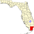
Miami-Dade County Florida Incorporated and Unincorporated areas Biscayne Park Highlighted.svg
Location in Miami-Dade County and the state of Florida
Biscayne Park.png
U.S. Census Bureau map showing village boundaries
Coordinates: 25°52′18.62″N80°10′55.13″W / 25.8718389°N 80.1819806°W / 25.8718389; -80.1819806
Country Flag of the United States.svg  United States of America
State Flag of Florida.svg  Florida
County Flag of Miami-Dade County, Florida.png Miami-Dade
Incorporated (town) December 31, 1931
Incorporated (village) June 16, 1933
Government
  Type Council-Manager
   Mayor Jonathan E. Groth
   Vice Mayor Art Gonzalez
   Commissioners Veronica Amsler,
MacDonald Kennedy, and
Veronica L. Olivera
   Village Manager Mario A. Diaz
   Village Clerk Shantay J. Bingham
Area
[1]
  Total0.64 sq mi (1.65 km2)
  Land0.62 sq mi (1.61 km2)
  Water0.02 sq mi (0.05 km2)  0%
Elevation
7 ft (2 m)
Population
 (2020) [2]
  Total3,117
  Density5,027.42/sq mi (1,941.47/km2)
Time zone UTC-5 (EST)
  Summer (DST) UTC-4 (EDT)
ZIP Code
33161
Area codes 305, 786
FIPS code 12-06600 [3]
GNIS feature ID0278854 [4]
Website www.biscayneparkfl.gov

Biscayne Park is a village in Miami-Dade County, Florida, United States. It's also part of South Florida's Miami metropolitan area. As of the 2020 census, the population was at 3,117 residents. [2]
Contents

History

Biscayne Park was developed in the 1920s by Arthur Griffing and annexed into the city of Miami in 1925. With the arrival of the Great Depression, Miami gave up its jurisdiction, and Biscayne Park was incorporated as its own town in 1931. In 1933, the town decided to become a village, and changed its name to the Village of Biscayne Park.

Geography

Biscayne Park is located 9 miles (14 km) north of downtown Miami at 25°52′55″N80°10′51″W / 25.88194°N 80.18083°W / 25.88194; -80.18083 (25.881972, –80.180868). [5] It is bordered to the north by the city of North Miami and to the south by the village of Miami Shores. The Biscayne Canal forms the southwest border of the village, and the Florida East Coast Railway forms the southeast border.

According to the United States Census Bureau, the village has a total area of 0.6 square miles (1.6 km2), of which 0.02 square miles (0.05 km2), or 2.82%, are water. [1]

Surrounding areas

Demographics

Historical population
CensusPop.Note
1940 500
1950 2,009301.8%
1960 2,91144.9%
1970 2,717−6.7%
1980 3,08813.7%
1990 3,068−0.6%
2000 3,2696.6%
2010 3,055−6.5%
2020 3,1172.0%
U.S. Decennial Census [6]

2020 census

Biscayne Park racial composition
(Hispanics excluded from racial categories)
(NH = Non-Hispanic) [7]
RaceNumberPercentage
White (NH)1,20238.56%
Black or African American (NH)33410.72%
Native American or Alaska Native (NH)50.16%
Asian (NH)862.76%
Pacific Islander or Native Hawaiian (NH)10.03%
Some other race (NH)190.61%
Two or more races/Multiracial (NH)1223.91%
Hispanic or Latino 1,34843.25%
Total3,117

As of the 2020 United States census, there were 3,117 people, 1,075 households, and 645 families residing in the village.

2010 census

Biscayne Park Demographics
2010 Census Biscayne ParkMiami-Dade CountyFlorida
Total population3,0552,496,43518,801,310
Population, percent change, 2000 to 2010–6.5%+10.8%+17.6%
Population density4,843.1/sq mi1,315.5/sq mi350.6/sq mi
White or Caucasian (including White Hispanic)72.4%73.8%75.0%
(Non-Hispanic White or Caucasian)43.4%15.4%57.9%
Black or African-American 17.6%18.9%16.0%
Hispanic or Latino (of any race) 35.2%65.0%22.5%
Asian 3.3%1.5%2.4%
Native American or Native Alaskan 0.2%0.2%0.4%
Pacific Islander or Native Hawaiian 0.1%0.0%0.1%
Two or more races (Multiracial) 3.6%2.4%2.5%
Some Other Race 2.8%3.2%3.6%

As of 2010, there were 1,324 households, out of which 9.3% were vacant.

2000 census

In 2000, 31.3% had children under the age of 18 living with them, 44.9% were married couples living together, 14.8% had a female householder with no husband present, and 35.2% were non-families. 25.0% of all households were made up of individuals, and 7.2% had someone living alone who was 65 years of age or older. The average household size was 2.55 and the average family size was 3.12. Estimated median household income in 2015: $82,888. Estimated per capita income in 2015: $32,505.

In 2000, the village population was spread out, with 23.8% under the age of 18, 6.3% from 18 to 24, 34.1% from 25 to 44, 24.6% from 45 to 64, and 11.3% who were 65 years of age or older. The median age was 37 years. For every 100 females, there were 93.5 males. For every 100 women aged 18 and over, there were 89.8 men.

In 2000, the median income for a household in the village was $48,313, and the median income for a family was $53,409. Men had a median income of $39,964 versus $33,125 for women. The per capita income for the village was $22,923. In 2000, speakers of English as a first language was at 59.60%, with Spanish at 29.27%, French Creole at 9.40%, and French at 1.74% of the population. [8]

Government

The village is governed by a mayor, vice mayor and three commissioners. It also has a village manager. [9]

The village has a twelve-man police department. [10]

Related Research Articles

<span class="mw-page-title-main">Aventura, Florida</span> City in Florida

Aventura is a planned, suburban city in northeastern Miami-Dade County, Florida, United States, 15 miles (24 km) north of Miami and part of South Florida's Miami metropolitan area. The city is especially known for Aventura Mall, the third largest mall in the United States by total square feet of retail space and the largest mall in Florida.

<span class="mw-page-title-main">Bay Harbor Islands, Florida</span> Town in Florida

Bay Harbor Islands is a town in Miami-Dade County, Florida, United States. The city is part of South Florida's Miami metropolitan area. It is separated from the mainland by Biscayne Bay. The population was 5,922 at the 2020 US census.

<span class="mw-page-title-main">Country Club, Florida</span> Census-designated place in Florida, United States

Country Club is a census-designated place and a suburban unincorporated community located in northwest Miami-Dade County, Florida, United States. It is named after the Country Club of Miami, which was established in 1961 in what was then an unpopulated and undeveloped section of the county. The population was 49,967 at the 2020 census, up from 3,408 in 1990.

<span class="mw-page-title-main">Cutler Bay, Florida</span> Town in the state of Florida, United States

Cutler Bay is an incorporated town in Miami-Dade County, Florida, United States, established in 2005. With a population of 45,425 as of the 2020 census, Cutler Bay is the 9th most populous of the 34 municipalities that make up Miami's urban core, and the 33rd most populous of the 163 municipalities that make up South Florida's Miami metropolitan area.

<span class="mw-page-title-main">El Portal, Florida</span> Village in Florida

El Portal is a village in Miami-Dade County, Florida, United States. The name is derived from the Spanish term for "the gate", after two wooden gates that once stood as a gateway to the village. El Portal was originally annexed into the city of Miami in 1925. With the arrival of the Great Depression, Miami gave up its jurisdiction, and El Portal was incorporated as its own village in 1937. The village is part of South Florida's Miami metropolitan area. As of the 2020 census, the population of El Portal was 1,986, down from 2,325 in 2010.

<span class="mw-page-title-main">Fisher Island, Florida</span> Census-designated place in Florida, United States

Fisher Island is a census-designated place in Miami-Dade County, Florida, United States, located on a barrier island of the same name. Since 2015, Fisher Island has the highest per capita income of any place in the United States. As of the 2020 census, the population was 561.

<span class="mw-page-title-main">Florida City, Florida</span> City in Florida

Florida City is a city in Miami-Dade County, Florida, United States. It is the southernmost municipality in the South Florida metropolitan area. Florida City is primarily a Miami suburb and a major agricultural area. As of the 2020 census, it had a population of 13,085, up from 11,245 in 2010.

<span class="mw-page-title-main">Golden Beach, Florida</span> Town in Florida

Golden Beach is a town in Miami-Dade County, Florida, United States, between the Intracoastal Waterway and Atlantic Ocean. The town is part of South Florida's Miami metropolitan area. As of the 2020 US census, the town had a population of 961.

<span class="mw-page-title-main">Indian Creek, Florida</span> Village in Florida

Indian Creek is a village in Miami-Dade County, Florida, United States. It has 41 residential home sites and the Indian Creek Country Club. The village is part of South Florida's Miami metropolitan area. The population was 84 at the 2020 census.

<span class="mw-page-title-main">Islandia, Florida</span> Unincorporated community in Florida, United States

Islandia is an unincorporated community and former city in Miami-Dade County, Florida, United States. It is located in the upper Florida Keys on the islands of Elliott Key and other nearby keys, such as Totten Key. It was the only municipality in the Florida Keys not located in neighboring Monroe County. The population was 18 at the 2010 Census. Most residents of the city were National Park Service employees.

<span class="mw-page-title-main">Ives Estates, Florida</span> Census-designated place in Florida, United States

Ives Estates is a census-designated place (CDP) in Miami-Dade County, Florida. The population was 25,005 at the 2020 census, up from 19,525 in 2010.

<span class="mw-page-title-main">Key Biscayne, Florida</span> Village in Miami-Dade County, Florida

Key Biscayne is an island village in Miami-Dade County, Florida, United States. The village is part of South Florida's Miami metropolitan area. The population was 14,809 at the 2020 census, up from 12,344 in 2010.

<span class="mw-page-title-main">Miami Shores, Florida</span> Village in Florida

Miami Shores or Miami Shores Village is a village in Miami-Dade County, Florida. The village is part of South Florida's Miami metropolitan area. As of the 2020 census, the population was 11,567, up from 10,493 in 2010.

<span class="mw-page-title-main">North Bay Village, Florida</span> City in Florida

North Bay Village is a city located in Miami-Dade County, Florida. The city is part of South Florida's Miami metropolitan area. As of the 2020 census, the city had a total population of 8,159.

<span class="mw-page-title-main">North Miami, Florida</span> City in Florida

North Miami is a suburban city located in northeast Miami-Dade County, Florida, United States, about 10 miles (16 km) north of Miami. The city lies on Biscayne Bay and hosts the Biscayne Bay Campus of Florida International University.. Originally the town of "Arch Creek", the area was incorporated as the "Town of Miami Shores", which was renamed the "Town of North Miami" in 1931. It was reincorporated as a city in 1953. The city is part of South Florida's Miami metropolitan area.

<span class="mw-page-title-main">Ojus, Florida</span> Census-designated place in Florida, United States

Ojus is a census-designated place and formerly incorporated town in Miami-Dade County, Florida, United States. The population was 19,673 at the 2020 census, up from 18,036 in 2010.

<span class="mw-page-title-main">Olympia Heights, Florida</span> Census-designated place in Florida, United States

Olympia Heights is a census-designated place in Miami-Dade County, Florida, United States. The population was 12,873 at the 2020 census.

<span class="mw-page-title-main">Sunny Isles Beach, Florida</span> City in Florida

Sunny Isles Beach is a city located on a barrier island in northeast Miami-Dade County, Florida, United States. The city is part of South Florida's Miami metropolitan area and is bounded by the Atlantic Ocean on the east and the Intracoastal Waterway on the west. As of the 2020 census, it had a population of 22,342.

<span class="mw-page-title-main">Virginia Gardens, Florida</span> Village in Florida

Virginia Gardens is a village in Miami-Dade County, Florida, United States. The village is a part of South Florida's Miami metropolitan area. According to the U.S. Census Bureau, the village had a population of 2,364 in 2020.

<span class="mw-page-title-main">West Miami, Florida</span> City in Florida, United States

West Miami is a city in Miami-Dade County, Florida, United States. The city is part of South Florida's Miami metropolitan area. The population was 7,233 at the 2020 census, up from 5,965 in 2010.

References

  1. 1 2 "2022 U.S. Gazetteer Files: Florida". United States Census Bureau. Retrieved December 29, 2022.
  2. 1 2 "P1. Race – Biscayne Park village, Florida: 2020 DEC Redistricting Data (PL 94-171)". U.S. Census Bureau. Retrieved December 29, 2022.
  3. "U.S. Census website". United States Census Bureau . Retrieved January 31, 2008.
  4. "US Board on Geographic Names". United States Geological Survey. October 25, 2007. Retrieved January 31, 2008.
  5. "US Gazetteer files: 2010, 2000, and 1990". United States Census Bureau. February 12, 2011. Retrieved April 23, 2011.
  6. "Census of Population and Housing". Census.gov. Retrieved June 4, 2015.
  7. "Explore Census Data". data.census.gov. Retrieved February 9, 2022.
  8. "MLA Data Center Results of Biscayne Park, FL". Modern Language Association . Retrieved October 29, 2007.
  9. "Mayor and Commissioners". Village of Bicayne Park. Retrieved July 28, 2018.
  10. "Police Department". Village of Biscayne Park. Retrieved July 28, 2018.