Sweetwater, Miami-Dade County, Florida

Last updated

Sweetwater, Florida
City of Sweetwater
2013-0811-DolphinMall.JPG
Dolphin Mall, Sweetwater
Seal of Sweetwater, Miami-Dade County, Florida.png
Nickname: 
Little Nicaragua
Motto(s): 
"Family, God, Education"
Sweetwater.gif
U.S. Census Bureau map showing city limits prior to the 2010 annexation
Coordinates: 25°47′57.52″N80°22′25.04″W / 25.7993111°N 80.3736222°W / 25.7993111; -80.3736222
Country Flag of the United States.svg  United States of America
State Flag of Florida.svg  Florida
County Flag of Miami-Dade County, Florida.png Miami-Dade
Incorporated October 10, 1941
Government
  Type Mayor-Commission
   Mayor Jose "Pepe" Diaz
   Commission President Reinaldo Rey
   Commissioners Isidro Ruiz,
Saul Diaz,
Marcos Villanueva,
Ian Vallecillo,
Jose Marti, and
Idania Llano
   City Manager Mayor Jose "Pepe" Diaz
   City Clerk Carmen Garcia
Area
[1]
  Total2.30 sq mi (10.96 km2)
  Land2.19 sq mi (5.68 km2)
  Water0.11 sq mi (0.28 km2)
Population
 (2020) [2]
  Total19,363
  Density8,833.49/sq mi (3,410.48/km2)
Time zone UTC-5 (EST)
  Summer (DST) UTC-4 (EDT)
ZIP Codes
33172, 33174 (Miami)
Area code(s) 305, 786, 645
FIPS code 12-70345 [3]
GNIS feature ID2405554 [4]
Website www.cityofsweetwater.fl.gov

Sweetwater is a city in Miami-Dade County, Florida, United States. The city is part of the Miami metropolitan area of South Florida. As of the 2020 census, the population was 19,363, [2] up from 13,499 in 2010. [5]

Contents

Geography

Sweetwater is located 12 miles (19 km) west of downtown Miami at 25°45′58″N80°22′25″W / 25.76611°N 80.37361°W / 25.76611; -80.37361 (25.765977, –80.373624). [6] It is bordered to the north and northeast by the city of Doral, to the southeast by Fontainebleau, to the south by Westchester, and to the west by Tamiami. The Ronald Reagan Turnpike forms the western edge of the city, and the Dolphin East-West Expressway crosses the center. U.S. Route 41 (Southwest 8th Street) follows the city's southern border.

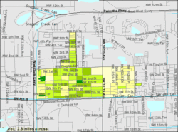
According to the United States Census Bureau, Sweetwater has a total area of 4.3 square miles (11 km2), of which 3.9 square miles (10 km2) are land and 0.4 square miles (1.0 km2), or 9.58%, are water. [1] The city tripled in size in 2010 upon the annexation of additional areas, including where Dolphin Mall is located. The annexed area is roughly bounded by Northwest Seventh and 25th streets, 107th Avenue and Florida's Turnpike extension. [7] The city on December 1, 2021, received approval from the county commission to annex 2 square miles of unincorporated land, bounded by NW 25th Street to the north, NW 12th Street to the south, Florida's Turnpike extension to the east and NW 137th Avenue to the west. It doubled the size of Sweetwater, and the area includes the headquarters of the Telemundo television network, as well as many companies like Topgolf, Amazon, Goya, Home Depot, and City Furniture.

Surrounding areas

History

The history of Sweetwater began during the Florida land boom of the 1920s when the Miami-Pittsburgh Land Company purchased land and laid out the original plat of "Sweetwater Groves". However, the 1926 Miami Hurricane and subsequent South Florida real estate "bust" put an abrupt end to the development venture. [8]

In 1938, Clyde Andrews acquired most of the "Sweetwater Groves" tract and began to market lots. Among his buyers was a troupe of Russian dwarves seeking a place to retire after a career with the circus. They built several mini-scaled homes suited to their needs. For years, Sweetwater was known as the "midget" community. [8]

In 1941, Sweetwater held a successful election for incorporation. The new town's first mayor was Joe Sanderlin, the dwarfs’ guardian and manager. By 1959, Sweetwater had attracted 500 residents and contained a town hall, church, grocery store, service station and 183 homes. It also had a two-man police force and a volunteer fire department. In 1970, Sweetwater was still a relatively small community of about 3,000 residents. [8]

During the 1970s, several events dramatically changed the "sleepy little country town" of Sweetwater forever. These events included the establishment of Florida International University to the south of the city, the construction of the two major expressways to the north and west, and the discovery of Sweetwater by Dade County's Hispanic community. The growth and development which was precipitated by these occurrences caused Sweetwater to more than double in population and lead all other Dade cities in growth during the 1970s. [8]

In March 1996, Sweetwater made national news as 69 animals were found dead on two properties in the city. Dade County police and the local zoologist blamed a large dog, while some residents blamed the killings on the chupacabra. [9]

In the 2010s, there are only a few vacant lots left to develop. By 2010, the city's population had burgeoned to 13,499 persons, of which 95.5% were of Hispanic origin. The city now has a full-service police department, four parks, an elementary school, a county fire station, 4,353 residential housing units, 14 shopping centers, over 600 businesses, several churches and a bank. Sweetwater is also located near Miami International Mall. After a December 2010 vote, Dolphin Mall is now part of the city. [10]

Demographics

Historical population
CensusPop.Note
1950 230
1960 645180.4%
1970 3,357420.5%
1980 8,067140.3%
1990 13,90972.4%
2000 14,2262.3%
2010 13,499−5.1%
2020 19,36343.4%
U.S. Decennial Census [11]

2020 census

Sweetwater racial composition
(Hispanics excluded from racial categories)
(NH = Non-Hispanic) [12]
RaceNumberPercentage
White (NH)7263.75%
Black or African American (NH)1260.65%
Native American or Alaska Native (NH)140.07%
Asian (NH)1920.99%
Pacific Islander or Native Hawaiian (NH)00.00%
Some Other Race (NH)610.32%
Two or more races/Multiracial (NH)990.51%
Hispanic or Latino (any race)18,14593.71%
Total19,363100.00%

As of the 2020 United States census, there were 19,363 people, 6,177 households, and 4,522 families residing in the city. [13]

2010 census

Sweetwater Demographics
2010 Census SweetwaterMiami-Dade CountyFlorida
Total population13,4992,496,43518,801,310
Population, percent change, 2000 to 2010–5.1%+10.8%+17.6%
Population density17,023.0/sq mi1,315.5/sq mi350.6/sq mi
White or Caucasian (including White Hispanic)92.4%73.8%75.0%
(Non-Hispanic White or Caucasian)3.5%15.4%57.9%
Black or African-American 1.8%18.9%16.0%
Hispanic or Latino (of any race) 95.5%65.0%22.5%
Asian 0.5%1.5%2.4%
Native American or Native Alaskan 0.2%0.2%0.4%
Pacific Islander or Native Hawaiian 0.0%0.0%0.1%
Two or more races (Multiracial) 2.1%2.4%2.5%
Some Other Race 3.0%3.2%3.6%

As of the 2010 United States census, there were 13,499 people, 4,434 households, and 3,536 families residing in the city. [14]

As of 2013, Spanish was the mother tongue for 95.30% of the population, while English was spoken by 2.90% of all residents. Speakers of other Indo-European languages accounted for 0.30%, while the combined total of those who spoke an Asian language or Pacific Islander language made up 0.80%. The rest of the people who spoke any other languages in Sweetwater were at 0.70%. In total, 97.10% of the populace spoke something other than English as their first language. [15]

2000 census

In 2000, 39.3% had children under the age of 18 living with them, 57.7% were married couples living together, 19.1% had a female householder with no husband present, and 16.8% were non-families. 12.8% of all households were made up of individuals, and 7.3% had someone living alone who was 65 years of age or older. The average household size was 3.33 and the average family size was 3.55.

In 2000, the city population was spread out, with 24.2% under the age of 18, 9.6% from 18 to 24, 29.7% from 25 to 44, 23.0% from 45 to 64, and 13.6% who were 65 years of age or older. The median age was 36 years. For every 100 females, there were 92.7 males. For every 100 females age 18 and over, there were 87.9 males.

In 2000, the median income for a household in the city was $29,333, and the median income for a family was $30,823. Males had a median income of $22,378 versus $17,020 for females. The per capita income for the city was $11,098. About 08.4% of families and 11.1% of the population were below the poverty line, including 21.3% of those under age 18 and 21.7% of those age 65 or over.

Economy

The Miami Herald is headquartered in Sweetwater. [16]

Education

Sweetwater is within the Miami-Dade County Public Schools. [17]

Percentage of college graduates 13% of Sweetwater residents age 25 and older have a bachelor's or advanced college degree.[ citation needed ]

Elementary schools

Public middle schools

K-8

Public high schools

Universities

The Roman Catholic Archdiocese of Miami previously operated Our Lady of Divine Providence School in Fontainebleau CDP, [25] [26] in proximity to Sweetwater. It closed in 2009. [27]

Related Research Articles

<span class="mw-page-title-main">Aventura, Florida</span> City in Florida

Aventura is a planned suburban city in northeastern Miami-Dade County, Florida, United States, 15 miles (24 km) north of Miami and part of the Miami metropolitan area of South Florida. The city is especially known for Aventura Mall, the third largest mall in the United States by total square feet of retail space and the largest mall in Florida.

<span class="mw-page-title-main">Bunche Park, Florida</span> Neighborhood of Miami Gardens in Miami-Dade, Florida, United States

Bunche Park is a neighborhood in Miami Gardens, Florida, United States. It was formerly a census-designated place.

<span class="mw-page-title-main">Doral, Florida</span> City in Florida

Doral is a city in Miami-Dade County, Florida, United States. One of 34 municipalities in the county, it is located 5 miles (8 km) west of Miami International Airport and 13 miles (21 km) west of Downtown Miami. Doral occupies 15 square miles (39 km2) bordered on the west by the Ronald Reagan Turnpike and the Florida Everglades, on the north by the town of Medley, on the east by the Palmetto Expressway and on the south by the Dolphin Expressway and the city of Sweetwater. The city is part of the Miami metropolitan area of South Florida. As of the 2020 census, Doral had a population of 75,874, up from 45,704 in 2010.

<span class="mw-page-title-main">Fontainebleau, Florida</span> Census-designated place in Florida

Fontainebleau(incorrectly spelled "Fountainebleau" in the 2000 census) is a census-designated place (CDP) in Miami-Dade County, Florida, United States. It is part of the Miami metropolitan area of South Florida. The population was 59,870 during the 2020 census.

<span class="mw-page-title-main">Kendale Lakes, Florida</span> Census-designated place in Florida

Kendale Lakes is a census-designated place (CDP) and a suburb of Miami in Miami-Dade County, Florida, United States. It is located in the Miami metropolitan area of South Florida. The population was 55,646 at the 2020 census.

<span class="mw-page-title-main">Kendall, Florida</span> Census-designated place in Florida

Kendall is an unincorporated area and census-designated place in Miami-Dade County, Florida. It is part of the Miami metropolitan area of South Florida. At the 2020 census, the area had a population of 80,241.

<span class="mw-page-title-main">Medley, Florida</span> Town in the state of Florida, United States

Medley is a town in Miami-Dade County, Florida, United States. The town is part of the Miami metropolitan area of South Florida. As of the 2020 US census, the population was at 1,056 residents.

<span class="mw-page-title-main">Miami Springs, Florida</span> City in Florida

Miami Springs is a city in Miami-Dade County, Florida, United States. The city is part of the Miami metropolitan area of South Florida. As of 2020, the population recorded by the U.S. Census Bureau was 13,859.

<span class="mw-page-title-main">Tamiami, Florida</span> Census-designated place in Florida

Tamiami is a census-designated place (CDP) in Miami-Dade County, Florida, United States. It is part of the Miami metropolitan area of South Florida. The population was 54,212 at the 2020 census.

<span class="mw-page-title-main">West Little River, Florida</span> CDP in Miami-Dade County, Florida, US

West Little River is a census-designated place (CDP) in Miami-Dade County, Florida, United States. It is part of the Miami metropolitan area of South Florida. The population was 34,128 at the 2020 census.

<span class="mw-page-title-main">West Miami, Florida</span> City in Florida, United States

West Miami is a city in Miami-Dade County, Florida, United States. The city is part of the Miami metropolitan area of South Florida. The population was 7,233 at the 2020 census, up from 5,965 in 2010.

<span class="mw-page-title-main">Westchester, Florida</span> Census-designated place in Florida

Westchester is a census-designated place (CDP) and neighborhood in Miami-Dade County, Florida. It is part of the Miami metropolitan area of South Florida. Prior to the 2020 U.S. Census, the neighboring University Park CDP was merged into Westchester CDP, effectively doubling its geography and population. Per the 2020 census, the population was 56,384.

<span class="mw-page-title-main">Miami metropolitan area</span> Metropolis in the U.S. state of Florida

The Miami metropolitan area, also known as South Florida, SoFlo, SoFla, the Gold Coast, the Tri-County Area, or Greater Miami, and officially the Miami–Fort Lauderdale–West Palm Beach Metropolitan Statistical Area, is a coastal metropolitan area in southeastern Florida. It is the ninth-largest metropolitan statistical area (MSA) in the United States, the second-largest metropolitan area in the Southern United States, and the largest metropolitan area in Florida. With a population of 6.14 million, its population exceeds 31 of the nation's 50 states as of 2022. It comprises the three most populated counties in the state, Miami-Dade County, Broward County, and Palm Beach County, which rank as the first, second, and third-most populous counties in the state, respectively. Miami-Dade County, with 2,716,940 people in 2019, is the seventh-most populous county in the United States.

<span class="mw-page-title-main">Miami Gardens, Florida</span> City in the United States

Miami Gardens is a city in north-central Miami-Dade County, Florida, United States. It is located 16 miles (26 km) north of Downtown Miami with city boundaries that stretch from I-95 and Northeast 2nd Avenue to its east to Northwest 47th and Northwest 57th Avenues to its west, and from the Broward County line to its north to 151st Street to its south. The city's name originated from Florida State Road 860, a major roadway through the area also known as Miami Gardens Drive. Miami Gardens had a population of 111,640 as of 2020. It is Florida's most populous city with a majority African American population and also home to the largest percentage of African Americans of any city in Florida, according to the U.S. Census Bureau. It is a principal city in the Miami metropolitan area of South Florida, which is the nation's ninth-largest, and world's 65th-largest metropolitan area with a population of 6.158 million people as of 2020. Miami Gardens is the home of Hard Rock Stadium, a 64,767 capacity multi-purpose stadium that serves as the home field for both the Miami Dolphins of the National Football League and the Miami Hurricanes, the University of Miami's NCAA Division I college football team, which has won five national championships since 1983.

<span class="mw-page-title-main">Florida State Road 826</span> Highway in Florida

State Road 826 is a bypass route around the greater Miami area, traveling approximately 30 miles (48 km) in a northeasterly arc from U.S. Route 1 in Pinecrest to its terminus at State Road A1A in Sunny Isles Beach. Between its southern terminus and the Golden Glades Interchange, State Road 826 is known as the Palmetto Expressway, a heavily traveled freeway with portions of the road carrying in excess of 250,000 vehicles a day. Unlike many of the other non-interstate freeways in Miami-Dade County, the Palmetto Expressway is untolled. East of the interchange, State Road 826 is a surface road connecting North Miami and North Miami Beach to Sunny Isles Beach over the Intracoastal Waterway.

<span class="mw-page-title-main">Florida State Road 985</span> State highway in Florida, United States

State Road 985, locally known as West 107th Avenue, FIU Avenue, and Avenue of the Americas, is a 7.604-mile (12.237 km) long north–south street in western Miami-Dade County, Florida, serving the communities of Kendall, University Park, Sweetwater, Fontainebleau, and Doral.

<span class="mw-page-title-main">Galloway Road</span> State highway in Miami-Dade County, Florida, United States

Galloway Road, also known as West 87th Avenue, is a north–south route through the western areas of suburban Miami-Dade County, Florida, from the Black Point area south of Cutler Bay almost to the Broward County line north of Miami Lakes. It exists in seven different unconnected segments that total 27.5 miles (44.3 km) in length, acting as connecting roads, neighborhood streets, and arterial routes. Approximately 9.5 miles (15.3 km) of Galloway Road, between Pinecrest and Doral, is designated as State Road 973.

<span class="mw-page-title-main">Miccosukee Indian Reservation</span>

The Miccosukee Indian Reservation is the homeland of the Miccosukee tribe of Native Americans. It is divided into three sections in two counties of southern Florida, United States. Their total land area is 128.256 sq mi (332.18 km2). The Miccosukee Reservation have members living on and off the reservation.

<span class="mw-page-title-main">Miami-Dade County, Florida</span> County in Florida, United States

Miami-Dade County is a county located in the southeastern part of the U.S. state of Florida. The county had a population of 2,701,767 as of the 2020 census, making it the most populous county in Florida and the seventh-most populous county in the United States. It is Florida's third largest county in terms of land area with 1,946 square miles (5,040 km2). The county seat is Miami, the core of the nation's ninth-largest and world's 65th-largest metropolitan area with a 2020 population of 6.138 million people, exceeding the population of 31 of the nation's 50 states as of 2022.

References

  1. 1 2 "2022 U.S. Gazetteer Files: Florida". United States Census Bureau. Retrieved December 28, 2022.
  2. 1 2 "P1. Race – Sweetwater city, Florida: 2020 DEC Redistricting Data (PL 94-171)". U.S. Census Bureau. Retrieved December 28, 2022.
  3. "U.S. Census website". United States Census Bureau . Retrieved January 31, 2008.
  4. "Sweetwater (Miami-Dade County)". Roadside Thoughts. Retrieved June 16, 2017.
  5. "P1. Race – Sweetwater city, Florida: 2010 DEC Redistricting Data (PL 94-171)". U.S. Census Bureau. Retrieved December 28, 2022.
  6. "US Gazetteer files: 2010, 2000, and 1990". United States Census Bureau. February 12, 2011. Retrieved April 23, 2011.
  7. "Sweetwater gets a lot bigger as it annexes busy mall" . Retrieved April 28, 2011.
  8. 1 2 3 4 "Sweetwater, FL: History and Development". www.cityofsweetwaterfl.gov. Archived from the original on January 5, 2012. Retrieved November 1, 2007.
  9. "Monster accused of killing farm animals in Florida (March 28, 1996)". CNN . Retrieved November 1, 2007.
  10. Dolphin Mall
  11. "Census of Population and Housing". Census.gov. Retrieved June 4, 2015.
  12. "Explore Census Data". data.census.gov. Retrieved February 8, 2022.
  13. "S1101 HOUSEHOLDS AND FAMILIES - 2020: Sweetwater city, Florida". United States Census Bureau .
  14. "S1101 HOUSEHOLDS AND FAMILIES - 2010: Sweetwater city, Florida". United States Census Bureau .
  15. "SELECTED SOCIAL CHARACTERISTICS IN THE UNITED STATES 2009-2013 American Community Survey 5-Year Estimates for Sweetwater, FL". United States Census Bureau . Retrieved January 13, 2015.
  16. "Miami Herald". McClatchy . Retrieved January 8, 2023. 11410 NW 20th St. Suite 222 Sweetwater Fl, 33172
  17. "Zoning Map" (PDF). Sweetwater, Florida. Retrieved January 8, 2023. - Use this map to compare to attendance boundaries or to written descriptions of attendance boundaries. Note that some parcels to the north are zoned for residential purposes.
  18. "Sweetwater ES". Miami-Dade County Public Schools . Retrieved January 8, 2023.
  19. "Sweetwater city, Florida [ permanent dead link ]." U.S. Census Bureau. Retrieved on September 28, 2009.
  20. "Dr. Carlos J. Finlay ES". Miami-Dade County Public Schools . Retrieved January 8, 2023.
  21. "Ruben Dario MS". Miami-Dade County Public Schools . Retrieved January 8, 2023.
  22. "Eugenia B. Thomas K-8 Center". Miami-Dade County Public Schools . Retrieved January 8, 2023.
  23. "Miami Coral Park SHS". Miami-Dade County Public Schools . Retrieved January 8, 2023.
  24. "G. Holmes Braddock SHS". Miami-Dade County Public Schools . Retrieved January 8, 2023.
  25. "Our Lady of Divine Providence". Roman Catholic Archdiocese of Miami. December 30, 2003. Archived from the original on December 30, 2003. Retrieved May 10, 2020. Our Lady of Divine Providence 10207 West Flagler Street Miami, Florida 33174
  26. "2000 Census Block Map: Fontainebleau CDP" (PDF). U.S. Census Bureau . Retrieved May 10, 2020. - The area with Our Lady of Divine Providence is on page 2
  27. Johnson, Akilah (January 23, 2009). "Six schools to close as Archdiocese retrenches". South Florida Sun Sentinel . Retrieved May 10, 2020. - The article identifies Our Lady of Divine Providence as being in Sweetwater though as of 2000 it was in the Fontainebleau CDP (location seen here)