Hurricane Ivan was a large,long-lived,and devastating tropical cyclone that caused widespread damage in the Caribbean and United States. The ninth named storm,the sixth hurricane,and the fourth major hurricane of the active 2004 Atlantic hurricane season,Ivan formed in early September and reached Category 5 strength on the Saffir–Simpson Hurricane Scale (SSHS). Ivan caused catastrophic damage in Grenada as a strong Category 3 storm,heavy damage in Jamaica as a strong Category 4 storm,and then severe damage in Grand Cayman,Cayman Islands,and the western tip of Cuba as a Category 5 hurricane. After peaking in strength,the hurricane moved north-northwest across the Gulf of Mexico to strike Pensacola/Milton,Florida and Alabama as a strong Category 3 storm,causing significant damage. Ivan dropped heavy rain on the Southeastern United States as it progressed northeastward and eastward through the Eastern United States,becoming an extratropical cyclone on September 18. The remnant low of the storm moved into the western subtropical Atlantic and regenerated into a tropical cyclone on September 22,which then moved across Florida and the Gulf of Mexico,and then into Louisiana and Texas,causing minimal damage. Ivan degenerated into a remnant low on September 24,before dissipating on the next day.
Ivan caused an estimated US$26.1 billion (equivalent to $44 billion in 2025) in damage along its path,of which $20.5 billion occurred in the United States.
The origins of Ivan were from a tropical wave, which developed into a tropical depression on September2 to the southwest of Cape Verde. It moved westward and strengthened into a tropical storm on September3, namedIvan by the National Hurricane Center (NHC). Two days later, Ivan reached hurricane strength while moving at a low latitude across the Atlantic Ocean. The hurricane intensified rapidly, reaching Category4 intensity on the Saffir-Simpson scale at 00:00UTC on September6. Ivan briefly weakened before restrengthening, passing just north of Grenada late on September7 with winds of 125mph (205km/h). After entering the Caribbean Sea, Ivan strengthened further and became a Category5 hurricane on September9, just north of the Netherlands Antilles. Two days later, the hurricane passed 23mi (37km) south of Jamaica. It fluctuated between Category4 and 5 intensity in the Caribbean, reaching peak winds of 165mph (265km/h) and a minimum pressure of 910 millibars (27inHg). The hurricane passed within 30 miles (50km) of Grand Cayman on September12, and two days later passed 17mi (28km) west of the westernmost tip of Cuba. Once over the Gulf of Mexico, Ivan weakened slightly as it turned to the north toward the Gulf Coast of the United States. At 06:50UTC on September16, Ivan made landfall at Gulf Shores, Alabama, as a Category3 hurricane, with sustained winds of 120mph (195km/h). It weakened quickly over land, falling to tropical depression status over Alabama, and becoming an extratropical cyclone over Virginia on September18. The remnant low of Ivan drifted off the U.S. mid-Atlantic coast into the Atlantic Ocean, turning southward and moving across Florida. It redeveloped into a tropical depression in the Gulf of Mexico on September22, and became a tropical storm with a secondary peak of 60mph (95km/h). Ivan weakened before making landfall late on September23 near Cameron, Louisiana as a tropical depression. It dissipated on September24.[1][2]
Records
On September3, Ivan became the southernmost Atlantic hurricane at 9.5°N.[3] Later that day, it became the southernmost major hurricane in the Atlantic at 10.2°N.[1] At the time, Ivan was also the southernmost Category5 hurricane in the Atlantic, at 13.7°N, until it was surpassed by Hurricane Matthew in 2016.[1][4] Ivan's duration as a Category4 hurricane or stronger was longer than any other tropical cyclone on record, with a total of 198hours. It was surpassed by Hurricane Ioke in 2006, which held the intensity for 216hours.[5] When Ivan entered the Gulf of Mexico, it produced a 91-foot (28-metre)rogue wave that became the largest ocean wave ever recorded. An ocean-floor pressure sensors measured the wave from peak to trough, and computer models estimated that the wave could have reached 131ft (40m). The wave also had a length of 660 feet (200m). The hurricane also produced the fastest seafloor current, at 2.25 metres per second (5.0mph; 8.1km/h).[6][7][8][9] After hitting the United States, Ivan produced the largest tornado outbreak associated with a tropical cyclone, with at least 118confirmed twisters.[10]
Preparations
Satellite images of Hurricane Ivan in stages across the storm's path
Caribbean
Due to the threat from Ivan, the first tropical cyclone warnings and watches were issued on September5. Hurricane warnings were issued from Trinidad and Tobago to Saint Lucia, including Barbados and Grenada. Tropical storm warnings were also issued for the northern coast of Venezuela through the Guajira Peninsula of Colombia. A hurricane watch was also issued for the ABC islands.[1] Over 1,000people evacuated to emergency shelters on Grenada,[11] including hundreds in low-lying areas in the capital city.[12] Some shelters were damaged during the hurricane, forcing the evacuees to go elsewhere.[11] Overall, the population responded little to the official advisories and recommendations, which potentially contributed to the death toll on the island.[13] More than 1,000residents of Saint Vincent and the Grenadines evacuated to 28emergency shelters.[14][15] Barbadian officials closed schools and government buildings, opened shelters, and turned off the power grid as a preventative measure.[16] Saint Lucia opened four shelters,[15] and Tobago opened seven shelters, housing around 560people. Schools, businesses, and airports closed in Trinidad and Tobago.[17][18] Many schools and businesses were closed in the Netherlands Antilles,[19] and about 300people evacuated their homes on Curaçao.[20] Oil refineries were closed in Curaçao and Aruba, while offshore production halted in Trinidad and Tobago. In Venezuela, thousands of people evacuated from coastal areas. Four airports closed in the country.[11][21][22]
As Ivan progressed westward, hurricane warnings were issued for both Jamaica and the Cayman Islands.[1] About 500,000Jamaicans were told to evacuate from coastal areas. More than 1,000shelters were set up across the country.[23][24] Jamaican Prime Minister P.J. Patterson declared a public emergency.[25] The national blood bank requested residents to donate blood, in anticipation of potential injuries.[26]Air Jamaica canceled all flights to and from the island, as well as inter-island flights; aircraft were transported to the United States until the storm passed.[27] Businesses in Kingston were closed, and fishermen secured their boats to trees.[28] Residents in the Cayman Islands stayed in emergency shelters during the hurricane.[13] A tropical storm warning was issued for the southern coast of Haiti, and a hurricane watch was issued for the southern coast of the Dominican Republic.[1] Shelters housed about 4,000people in Haiti.[29] The World Health Organization and the Pan American Health Organization distributed four emergency kits to southern Haiti, capable of covering basic needs for 40,000people.[30] A flight from Port-au-Prince to Miami was canceled.[31] The Cuban government issued a hurricane warning for the western portion of the country, including Isla de la Juventud.[1] Throughout Cuba, 2,266,068people evacuated due to Ivan, about 60% of whom to the houses of relatives.[13] Off Mexico's Yucatán Peninsula, about 12,000people evacuated from Isla Mujeres.[32]
United States
As early as September9, the NHC anticipated that Ivan would hit southern Florida as a major hurricane within five days.[33] On September10, Florida Governor Jeb Bush issued a state of emergency.[34] The NHC first issued a tropical storm watch for the Florida Keys on September12.[1] A mandatory evacuation was issued for all residents and visitors of the Florida Keys, and about half of Monroe County residents evacuated the islands.[35] The NHC amended the forecast and predicted that Ivan would move ashore between Alabama and the western Florida panhandle.[1] Alabama Governor Bob Riley issued a state of emergency for Alabama on September13.[36] On September14, the NHC issued hurricane watches for the northern gulf coast, and later that day issued a hurricane warning between from Grand Isle, Louisiana to Apalachicola, Florida.[1] The threat of the hurricane led to widespread evacuations across the gulf coast, estimated at over 1million people.[37] Mandatory evacuations were issued for coastal areas of Alabama south of Interstate 10, including parts of Mobile.[38] As a result of the evacuations, all lanes on I-65 were rerouted to go north, successfully allowing more people to leave South Alabama.[39] Along the Florida Panhandle, officials in Escambia and Bay counties issued mandatory evacuations for residents in low-lying areas. Schools closed across the panhandle.[40] In Mississippi, evacuation of mobile homes and vulnerable areas took place in Hancock, Jackson, and Harrison counties.[41] Around 600,000people evacuated across southeastern Louisiana, including residents in Greater New Orleans who were advised to evacuate. The Louisiana Superdome was used for special needs residents unable to evacuate. Along parts of Interstate 10 (I-10), lanes were reversed to assist in evacuations. However, there were still significant traffic jams, and four elderly women in Louisiana died during the evacuations.[37][42]
After Ivan reformed, a tropical storm warning was issued from the mouth of the Mississippi River to Sargent, Texas, which included areas that were under hurricane warnings six days earlier.[1]
Along its path, Ivan led to 124fatalities, either directly or indirectly related to the hurricane. The death toll in the Caribbean reached 64, mainly in Grenada and Jamaica. There were also 57fatalites in the United States, including 25directly related to the hurricane. Ivan produced more than $21billion in damage, including $3billion in the Caribbean, and $18.8billion in the United States.[1]
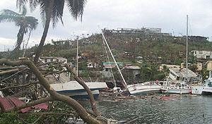
Passing just north of Grenada, Ivan produced sustained winds of 120mph (190km/h), with gusts to 133mph (214km/h) at Point Salines International Airport. The airport also recorded 5.26 inches (134mm) of precipitation during the hurricane's passage.[13] Ivan was considered the worst hurricane to strike the nation since Hurricane Janet in 1955.[50] Ivan's passage resulted in 39fatalities and $1.1billion in damage,[13] about 200% of its GDP.[51] About 90% of the nation's houses were damaged, of which 30% were destroyed, with more than 14,000homes impacted. Housing damage consisted of about 45% of the overall damage cost.[50][52][53] An estimated 18,000people were left homeless by the hurricane, and about 700people sustained injuries from the storm.[52] In the capital city of St. George's, every major building was either damaged or destroyed, including York House, home of the Parliament of Grenada.[50][12][54] Ivan's passage either damaged or destroyed 85% of the structures on the island,[55] including the nation's emergency operations center[11] and a 17th-century prison, which allowed many inmates to briefly escape during the height of the storm.[50] The hurricane damaged or destroyed 75primary or secondary schools, with only two left in working condition.[51] All of Grenada was left without power or running water.[52] An estimated 60% of hotel rooms were damaged, which adversely affected tourism.[51] The winds downed 80% of the nutmeg trees on the island while also causing severe damage to other crops.[50][51]
Wave heights from the hurricane reached 20 feet (6.1m) along coastline portions of Saint Vincent and the Grenadines,[11] which washed away 2homes;[50] the storm surge destroyed 19homes and damaged 40more.[14] On Union Island, the winds damaged the roof of a hospital, while the northern portion of the island sustained heavy damage from the waves.[18] Moderate damage was also reported on Palm Island and Carriacou and Petite Martinique.[17] The winds left more than two-thirds of the island without power,[50] and also damaged the island's banana crop.[56] Damage in the country totaled $40million.[50] On Saint Lucia, three people sustained serious injuries.[18] Strong winds and rough surf affected the southern coast of the island, damaging homes near the coast. Damage on the island totaled $2.6million. The storm also damaged bananas on the island.[13][50] In Dominica, winds reached 43mph (69km/h).[50] High waves from Ivan caused light damage to southwestern Martinique and Guadeloupe.[13] On Tobago, one person died due to a falling tree.[19] Wind gusts on the island reached 46mph (74km/h).[13] Power outages affected 30% of the island, and at least 45homes lost their roofs, leaving 22people homeless.[17][50][13] At least one home collapsed and fell into the ocean.[50] Rainfall reached 16.2 inches (410mm) on the island,[50] producing mudslides. Damage on Tobago was estimated at $4.9million.[13] Damage in neighboring Trinidad was minimal.[14]
In Venezuela, the hurricane killed three people, including two people who drowned and a man killed by a toppled wall. Along the northern coastline of Venezuela, the hurricane produced heavy precipitation and a storm surge of about 13 feet (4.0m). The hurricane destroyed 21houses and damaged 60others, leaving 80people homeless. The hurricane also caused water and power outages.[57][19][58] While passing north of the ABC Islands, Ivan produced high winds, strong waves, and heavy rainfall, causing $1.1worth of damage. High winds blew away roof shingles.[59][60]
Greater Antilles
While passing south of Puerto Rico, Ivan generated high waves that washed rocks and debris ashore the southern coast near Salinas. A portion of Highway 109 was closed for 12hours at Las Ochenta due to debris.[61] Along the southern coast of the Dominican Republic, high waves killed four people.[62] Strong surf also affected the southern coast of Haiti, causing damage to the port and wrecking three houses at Jacmel.[31] High waves killed one person, while two people drowned in floodwaters after refusing to evacuate their house.[29] Heavy storm rainfall, which reached 72mm (2.8in) at Les Cayes,[31] flooded irrigation channels along the Artibonite River in Haiti.[63] Throughout Haiti, Ivan damaged or destroyed the houses of 2,500people, mostly on the Tiburon Peninsula.[29]
The center of Ivan passed just 23mi (37km) south of Portland Point, the southernmost point in Jamaica. On Pedro Bank, located southwest of Jamaica, an anemometer recorded winds of 133mph (214km/h) averaged over ten minutes, before the instrument stopped reporting. Doppler weather radar suggested winds of 112mph (180km/h) in Jamaica's mountainous peaks. Ivan dropped torrential rainfall across the island that damaged rain gauges in southern Jamaica. The highest total was 28.37in (721mm) in Ritchies, located in northwestern Clarendon Parish.[50] Throughout Jamaica, Hurricane Ivan killed 17people and left $575million in damage. Hurricane-force winds affected the entire island, while heavy rainfall triggered mudslides and flooding.[13] The storm destroyed 5,600houses and damaged another 41,400, and most of the island's utilities were damaged.[50] Overall, Ivan left 18,000people homeless as a result of the flood waters and high winds.[50] The storm was described as one of the most intense hurricanes in Jamaica's recorded history.[64] Ivan caused severe damage, damaging and destroying houses, and triggering mudslides that washed out roads. In Kingston, the winds downed trees and poles and caused flooding.[65] Waves flooded a causeway to an airport near Kingston.[66] Some roads throughout the region were left impassible due to downed trees and utility poles.[67] In Montego Bay, the Barnett River overflowed its banks; businesses were flooded with up to 4 feet (1.2m) of water. Roads suffered flooding, and part of the A1 Road, the primary northern coastal highway, was washed away.[68] Most of the major resorts and hotels fared well, and were reopened only a few days after Ivan had passed.[69]
As a Category5 hurricane, Ivan passed just 25mi (40km) southwest of George Town, the capital of the Cayman Islands, on September12. Sustained winds there reached 150mph (240km/h), with gusts to 171mph (275km/h). The 8 to 10ft (2.4 to 3.0m)storm surge, in addition to waves 20 to 30ft (6.1 to 9.1m) waves, submerged nearly all of Grand Cayman, except for the extreme northeastern portion of the island. Owen Roberts International Airport and several homes were inundated by the floodwaters from the surge. Rainfall also reached 12.14in (308mm) on Grand Cayman. On Cayman Brac to the northeast of Grand Cayman, Ivan produced wind gusts of 67mph (108km/h) and 4.92in (125mm) of rainfall.[50] Two people died in the Cayman Islands, and damage in the territory was estimated at $3.5billion, representing 183% of the territory's GDP.[13][48] The strong winds damaged or destroyed 95% of buildings.[50] Much of Grand Cayman still remained without power, water, or sewer services for several months later. After five months, barely half the pre-Ivan hotel rooms were usable.[13]
The core of Ivan approached within 17mi (27km) of Cape San Antonio, the westernmost point of Cuba, which briefly experienced the edge of the eyewall. A station there recorded sustained winds of 110mph (180km/h), with gusts to 119mph (192km/h), before the instrument failed; peak gusts at the location were estimated at 168mph (270km/h). Hurricane-force winds affected Pinar del Río Province, while gale-force winds extended into Artemisa Province and Isla de la Juventud.[13] A 6 to 12ft (1.8 to 3.7m) storm surge washed ashore the southern coast,[50] causing flooding along the coast and in low-lying areas. Rainfall reached 13.33 inches (339mm) in Isabel Rubio, and several areas recorded over 4 inches (100mm). Throughout Cuba, Hurricane Ivan left $1.223billion in damage. The storm caused widespread damage to crops, power systems, and homes. In Santiago de Cuba in the eastern portion of the country, heavy rainfall caused landslides. In western Pinar del Río Province, Ivan's strong winds shredded the roofs of several homes. The heavy rainfall flooded houses and farms, causing mudslides that cut off two houses.[50][13]
Hurricane Ivan sank and stacked numerous boats at Bayou Grande Marina at NAS Pensacola.
Throughout the United States, Ivan caused or contributed to 57fatalities, including 25deaths directly related to the hurricane's impacts.[1] Nationwide damage was estimated at $20.5billion, making it the second-costliest U.S. hurricane at the time, only behind Hurricane Andrew in 1992.[70] Ivan produced an outbreak of 120tornadoes from Alabama to Maryland, becoming the largest tornado outbreak associated with a tropical cyclone in the United States. The tornadoes caused at least eight fatalities and injured 17people.[1][71] In Florida, Blountstown, Marianna, and Panama City Beach suffered three of the most devastating tornadoes. A Panama City Beach news station was nearly hit by an F2 tornado during the storm.[72]
As it passed over the Gulf of Mexico off the coast of Louisiana, Ivan caused the destruction of Taylor Energy's Mississippi Canyon 20-A production platform,[73]550ft (170m) above 28 producing oil and gas wells drilled in water 479ft (146m) deep. Waves estimated to be 71 feet (22m) caused tremendous pressures below the surface, causing a landslide that obliterated the platform. Hundreds of gallons of oil per day[74] were still leaking onto the surface of the Gulf fourteen years later. The United States Coast Guard reported that the spill had been contained in 2019.[75]
When Ivan made landfall in Alabama, it brought strong winds, heavy rain, and storm surge.[76] In Wolf Bay in Baldwin County, a wind gust of 145mph (233km/h) was reported,[77] along with a storm surge ranging from 10 to 15ft (3.0 to 4.6m) high, and a peak of 10.16in (258mm) of rainfall.[78] Thousands of homes in Escambia, Baldwin County, and Mobile County were damaged or destroyed.[1] In Orange Beach, 60% of all wooden structures were damaged.[79] During the peak of the storm, 825,000customers lost power.[80] Major damage was reported at the Gulf Shore Zoo, and despite efforts to evacuate all animals, several deer and six alligators escaped after their enclosures were destroyed.[81] The Alabama Forestry Commission reported $610million in damage to timber over around 2,700,000 acres (1,100,000 hectares) of land.[1] Despite initial reports of Mobile being in the direct path of the hurricane, Ivan made landfall to the east of the city, causing damage to be less severe than initially expected. However, there were still reports of downed trees, power lines, and damaged billboards across the city.[82] Around 6–9in (150–230mm) inches of rain fell in Birmingham over a one day period, the most the city had recorded in over 100years.[83] High winds extended far inland. The city of Demopolis, which is almost 100 miles inland, received wind gusts of up to 90mph (140km/h). Similarly, Montgomery saw wind gusts of up to 60 to 70mph (97 to 113km/h).[84] Away from the core of the storm, Ivan brought tropical storm-force winds to southwest Alabama. In Dothan, a sustained wind of 50mph (80km/h) with a gust to 62mph (100km/h). High winds caused damage to trees, power lines, and businesses in the counties of Coffee and Geneva.[85] After the remnants of Ivan reemerged in the Gulf, it brought high surf to beaches on the coast, hindering cleanup efforts.[86]
Although there were no direct deaths due to Ivan in the state, at least 9indirect deaths were associated with the storm.[87][88][89] Hurricane Ivan was also the strongest hurricane to hit Alabama since Hurricane Frederic in 1979, which was a Category 4.[90][91]
Florida
Although Ivan moved ashore Alabama, it produced Category3 hurricane conditions across portions of extreme western Florida. The strongest winds in the state were at Naval Air Station Pensacola, which recorded sustained winds of 87mph (141km/h). A police department in Pensacola recorded wind gusts of 124mph (200km/h) at a height of 70ft (21m). Also in the city, the WEAR-TV station measured the state's highest rainfall from Ivan with 15.75in (400mm) of precipitation. Ivan produced a storm surge along Florida's west coast, estimated from 10 to 15ft (3.0 to 4.6m) from Destin westward.[1][92][93] The west bank of the Escambia Bay Bridge carrying I-10 recorded a storm surge of 12.92ft (3.94m).[94] The high waves destroyed 3,500ft (1,100m) of roadway along both spans of the bridge.[95] The causeway carrying U.S. Highway 90 across the northern part of the same bay was also heavily damaged.[1] Ivan's high tides led to extensive beach erosion in the western Florida panhandle, while the heavy rains caused flash flooding and river flooding.[96]
About 400,000customers lost power along the Florida panhandle.[97] There was heavy damage as observed in Pensacola, Gulf Breeze, Navarre Beach, and Pensacola Beach. Dwellings situated far inland, as much as 20 miles (32km) from the Gulf coast, along the shorelines of Escambia Bay, East Bay, Blackwater Bay, and Ward Basin in Escambia County and Santa Rosa County, and Fort Walton Beach, Florida on the eastern side of the storm. The area just west of Pensacola, including the community of Warrington (which includes Pensacola NAS), Perdido Key, and Innerarity Point, took the brunt of the storm. Some of the subdivisions in this part of the county were completely destroyed, with a few key roads in the Perdido area only opened in late 2005, over a year after the storm hit. Shattered windows from gusts and flying projectiles experienced throughout the night of the storm were common. As of December 2007, roads remained closed on Pensacola Beach because of damage from Ivan's storm surge.[98] Virtually all of Perdido Key, an area on the outskirts of Pensacola that bore the brunt of Ivan's winds and rain, was essentially leveled. High surf and wind brought extensive damage to Innerarity Point.[98]
The outer rainbands of Ivan produced a wind gust of 53mph (85km/h) on Key West; the winds downed some tree limbs across the Florida Keys, though the number of downed trees was limited by the passage of previous hurricanes Charley and Frances. While passing west of the area, the hurricane produced a 1ft (0.3m)storm tide. The mandatory evacuations prevented the delivery of products, which caused widespread fuel and food shortages at commercial establishments.[35]
On September 26, 2006, over two years after Ivan struck the region, funding for the last 501FEMA-provided trailers ran out for those living in Santa Rosa and Escambia counties.[98]
Southern United States
Rainfall in the United States caused by Ivan
Hurricane-force wind gusts spread across southeastern Mississippi, with a peak observation of 87mph (141km/h) recorded on the top of a two-story building in Pascagoula.[1] The city also recorded Ivan's highest rainfall in the state, totaling 6.29in (160mm).[99] The hurricane also produced a 3.4ft (1.0m) storm surge in Waveland,[1] causing minor tidal flooding. The hurricane knocked down thousands of trees and hundreds of power lines across eastern Mississippi. A falling tree killed a man in Brooksville, and a man was killed in Lee County by a falling antenna. Hundreds of buildings were damaged by the trees or the winds. In Pascagoula, high winds blew the roof off an apartment building. Statewide damage was estimated at $200million.[100]
Ivan produced heavy rainfall in Georgia, reaching 13.65in (347mm) near Clayton.[99] This added to the heavy rains from the remnants of Frances a week prior, causing record flooding along rivers and streams. In White County, a girl was swept away and killed by floods. Parts of Gilmer County had 500-year floods along the Cartecay River, washing away five mobile homes, parts of three bridges, and several vehicles. The Peachtree Creek in Atlanta crested at 22.7ft (6.9m), the highest on record,[nb 1] forcing hundreds of nearby residents to evacuate. Schools and businesses closed across the Atlanta area after roads and highways were inundated, including parts of I-20 and I-285. The heavy rains damaged two roofs in Gwinnett County, including a distribution center where the roof collapsed. The floods produced several sinkholes, the largest of which measured 65by25ft (20by8m). At Six Flags Over Georgia, the floods inundated two roller coasters, resulting in $5million in damage at the park. A strong rainband produced wind gusts of 80mph (130km/h) in Jackson County. Across the state, strong winds knocked down hundreds of trees, causing two injuries, destroying ten buildings, and damaging hundreds of others. Fallen trees caused widespread damage to power lines, leaving at least 230,000people without power and blocking hundreds of roads. A man was killed in Towns County while repairing downed power lines. The winds also damaged hundreds of homes, vehicles, traffic lights, a church, and a school.[101]
The highest rainfall from Ivan in the United States was 17.00in (432mm), recorded in Cruso, North Carolina.[102] Eleven people died in the state due to Ivan. A landslide along Fishhawk Mountain generated a debris flow that reached 33.2mph (53.4km/h), killing five people and injuring nine others in Peek's Creek after destroying 15homes. Five people died while driving through flooded waters across Buncombe and Henderson counties. A man died after being struck by a fallen tree near Hendersonville. The winds knocked down tens of thousands of trees, with hundreds of buildings damaged by the falling trees. More than 210,000people lower power statewide. Ivan's rains added to the precipitation from Frances nine days earlier, leading to creeks and rivers rising above flood stage. The Pigeon River had a record crest of 23ft (7.0m) in Canton. The floods washed away parts of several roads in western North Carolina, including portions of I-40, U.S. 19, U.S. 64, U.S. 276, and state routes 107, 209, 215, and 281. Bridges carrying state highways 194 and 197. Several communities issued evacuations due to the floodwaters. In Enka, 40people required rescue when a motel flooded. In Swain County, the Little Tennessee River swept away 500,000USgal (1,900,000L) of raw sewage while also damaging an industrial park.[103][104] Across North Carolina, Ivan damaged 5,127homes, with another 78 destroyed.[105] The Blue Ridge Parkway as well as Interstate 40 through the Pigeon River gorge in Haywood County, North Carolina, sustained major damage, and landslides were common across the mountains. There was major flooding along the French Broad River and Swannanoa River in Asheville, North Carolina.[106][107] About 40% of the downtown business district in Canton was damaged.[105]
In South Carolina, rains reached 8.18in (208mm) in Longcreek.[99] Several rivers and streams flooded, with several families in Oconee County requiring rescue by helicopter. High winds knocked down trees in the northern portion of the state, several of which fell onto homes or vehicels. Along I-77, strong winds overturned two tractor trailers.[108] In eastern Tennessee, rainfall reached 11.25in (286mm) in Soddy-Daisy.[99] Flooding closed roads and entered buildings in the eastern portion of the state.[109] Strong winds knocked down trees and power lines, some of which fell onto buildings. Schools in Lawrence County were closed for a day due to roads blocked by trees. About 7,000people lost power in Central Tennessee. The winds also caused about $1.7million in agriculture damage, mostly corn stalks that were blown over. The Giles County High School sustained damage to its roof.[110] Rains in Kentucky reached 6.26in (159mm) at the Greenup Lock and Dam near Lloyd.[111] The rains caused minor flooding, damaging dozens of houses. In Carter County, flooding washed away a bridge. Residents in Greenup County along Tygarts Creek had to evacuate from the floodwaters.[112]
Ivan's large circulation produced increased water levels as far west as Louisiana, with a 7.6ft (2.3m) storm surge recorded along Bayou Dupre. The surge flooded low-lying areas and roads outside of the areas protected by the New Orleans levee system.[37] Ivan caused minor coastal flooding during its final landfall.[113] Rainfall in the state peaked at 6.9in (180mm) in Shreveport.[99] Tropical storm-force winds spread across southeastern Louisiana. Wind gusts reached 69mph (111km/h) in Pointe à la Hache, Louisiana.[1] The hurricane damaged around 100mobile homes, seven houses, and several public buildings. At least 55,000people lost power statewide. Damage was estimated at $15.8million, with the heaviest damage in Lower Plaquemines Parish.[37] The storm also produced heavy rainfall across Texas, with a statewide peak of 7.86in (200mm) in Beckville.[1] Rainfall in Arkansas reached 3.10in (79mm) in Midland. In neighboring Oklahoma, Calvin recorded 1.87in (47mm) of rainfall.[99]
Elsewhere
Ivan's effects extended into Ohio, with a statewide precipitation peak of 8.53in (217mm) recorded in Albany.[114] The rains caused flooded along creeks and streams in southeastern Ohio, leading to two deaths. There was drowning death near Barton, and a car crash amid heavy rains killed a driver along SR 7 in Jefferson County.[115] In Bloomfield, the Little Muskingum River crested at 31.1ft (9.5m). The river washed out the historic Rinard Covered Bridge from 1874. In Marietta, the Ohio River rose 22ft (6.7m) over 24hours, the greatest daily rise in water ever recorded at the station. Two trailer parks in the city were affected by the floods. The Ohio crested at 51.2ft (15.6m) in Pomeroy, with hundreds of buildings inundated. Across Ohio, flooding destroyed at least eight homes and damaged hundreds of buildings. Landslides destroyed a house and damaged several roads, closing a portion of SR 7. In Steubenville, a water treatment plant was damaged. Statewide damage totaled more than $38million in damage.[116]
In neighboring West Virginia, precipitation reached 7.68in (195mm) in Moundsville.[114] There were two deaths in the state related to Ivan. Flooding swept away a truck in Marshall County, killing the driver. A man near Harts fell into a flooded creek and drowned. Significant flooding occurred along rivers and streams, including the Ohio, which had a peak crest of 51.3ft (15.6m) in Huntington. The floods triggered evacuations in the city. In Parkersburg, the Ohio crested at 43.7ft (13.3m), its highest in 40years. Across the state, the floods damaged or destroyed 1,661buildings, including several schools and businesses. Statewide damage totaled over $44million. Several roads were washed out across the state, and portions of WV 2 were closed by mudslides from Weirton to Wheeling. The Barboursville sewage system was damaged amid the floods.[115][117] Precipitation in Virginia peaked at 9.01in (229mm) at North Fork Pound Reservoir.[114] The rains led to floods that damaged around 300homes in the state, with 10 destroyed. The rains also covered roads and caused crop damage.[118] In Maryland, the heaviest rainfall from Ivan was 3.02in (77mm), recorded near Frostburg.[114] Several creeks overflowed their banks, leading to flooding. In Colora in northeastern Maryland, severe thunderstorms during Ivan's passage knocked a tree onto a house, killing two people.[119] The rains in Delaware reached 4.23in (107mm) in Wilmington, leading to minor flooding along creeks.[114][120]
The remnants of Ivan dropped heavy rainfall across Pennsylvania, peaking at 9.55in (243mm) in Rosencrans.[114] Precipitation reached 5.95in (151mm) at Pittsburgh International Airport, setting a daily rainfall record there. The rains led to widespread flooding across Pennsylvania, damaging at least 21,000buildings statewide. Widespread evacuations occurred because of the floods, affecting Allegheny, Cambria, Carbon, Indiana, Pike, and Susquehanna counties. Many rivers and streams in central Pennsylvania exceeded their banks, and two set records –Bald Eagle Creek reached 15.96ft (4.86m), and the Frankstown Branch of the Juniata River reached 19.46ft (5.93m). The combination of high rainfall and gale-force winds knocked down hundreds of trees across south-central Pennsylvania.[121] In neighboring New Jersey, precipitation reached 6.32in (161mm) in Belvidere.[114] The Delaware River crested to 33.45ft (10.20m) at the Easton–Phillipsburg Bridge. The river washed a home from Harmony Township into the bridge, causing the roof to fall off while the remainder was swept downstream. In White Township, dozens of houses were condemned due to floodwater intrusion. Damage in Warren County reached $36million.[122] Several cars stalled amid flash flooding in Hudson County.[123]
In New York, the remnants of Ivan dropped heavy rainfall that peaked at 6.90in (175mm) in Roscoe.[114] The rains caused streams and rivers to exceed their banks, including the Delaware, Susquehanna, and Chenango rivers. The Delaware swelled to 24.1ft (7.3m) at Barryville, causing the greatest floods along the river since Hurricane Diane in 1955. Statewide, more than 1,300homes were damaged, including several trailer parks, with 26homes destroyed. At least 2,200people had to leave their homes, and seven people were rescued by helicopter. Floodwaters covered portions of I-86 and several highways in the New York City area. Several subways in Manhattan were submerged and closed. Nearly all of the roads in Port Jervis were affected by flash floods, resulting in a local state of emergency. The Esopus Creek produced landslides, erosion, and flood damage in Hardenburgh. A line of thunderstorms over Long Island produced wind gusts of 58mph (93km/h), which caused power outages after knocking down trees and power lines.[124] In the Long Island Sound, a boater was killed when his trimaran capsized amid strong winds.[125] The remnants of Ivan also dropped rainfall across New England, peaking at 4.49in (114mm) in New Haven, Connecticut.[126] The rains caused flash flooding along I-95, closing the road and trapping several vehicles.[127] In western Massachusetts, the Deerfield and Green rivers exceeded their banks and caused minor flood damage.[128] In neighboring New Hampshire, flash floods inundated roads in Cheshire County.[129]
Canada
On the morning of September 21, the remnant mid-level circulation of Ivan combined with a frontal system. This produced a plume of moisture over the Canadian Maritimes for four days, producing heavy rainfall totaling 6.2 inches (160mm) in Gander, Newfoundland. High winds of up to 89mph (143km/h) downed trees and caused power outages in Newfoundland, Prince Edward Island, and eastern Nova Scotia. The system produced intense waves of up to 50 feet (15m) near Cape Bonavista. The system killed two when it grounded a fishing vessel and was indirectly responsible for four traffic fatalities in Newfoundland.[130]
Several nearby countries assisted Grenada in its aftermath. The government of Guyana shipped about $250,000 (2004USD, $40million 2004GYD) worth of sugar, as well as 100members of the Guyana Defense Force to assist in restoring order and reconstruction. The government of Trinidad and Tobago sent 190policemen, and the government of Anguilla sent 1,230cases of water. A committee of Caribbean nations realized the local governments could not provide the support that Grenada needed in its aftermath, and thus turned to international assistance.[135] Within a day of Ivan passing to the south of Grenada, the United States Agency for International Development (USAID) deployed 67,600gallons of water, 500rolls of plastic sheeting, four 10,000liter water bladder kits, and a water treatment kit;[136] assistance from USAID totaled $6million (2004USD) within a few weeks of the storm's passage, primarily in aid for reconstruction and rehabilitation.[137] In the weeks subsequent to the hurricane, the European Commission Humanitarian aid Office (ECHO) provided €3million (2004EUR). By a year later, housing redevelopments and disaster preparation problems continued after being impacted by Hurricane Emily; as a result, the ECHO provided €1.2million (2005EUR) to Grenada in September 2005.[138] China assisted with construction and handling foreign debts.[139] The Caribbean Development Bank approved a $10million loan (2004USD) requested by the government of Grenada in July 2005, which was intended to assist in long-term development of the housing, business, and environmental sectors.[140] Emergency operations in Grenada in coordination with the Pan American Disaster Response Unit ended in July 2005.[141]
Within a few days after the hurricane passed, the Grenada Emergency Operations Center temporarily prevented relief supplies from entering the country to ensure the safety of the incoming items; the decision was reversed shortly thereafter, and planes flew supplies during daylight hours into the reopened airport. Severe looting occurred in the immediate aftermath of Ivan, prompting police officials to enact a curfew for the night hours.[12] In the first week following the hurricane, aid was slow to the affected residents, due to the lack of an efficient aid distribution system.[142] 30official shelters and 17prepared ones housed over 5,000people in the aftermath of the storm.[12] Thousands of people lost their jobs due to the hurricane, with all businesses shut down following the hurricane.[139] By two months after the hurricane struck, 65schools were opened, some of which serving as shelters; water and power were gradually restored to the island.[137] By a year after the storm's passage, all schools were reopened, and most buildings enacted provisional repairs.[143] Officials determined around 10,000houses on the island required complete reconstruction, while a further 22,000 needed repairs.[51] The government of Grenada initially planned to rebuild 1,000houses in the year after the hurricane struck;[143] by June 2005, 260families were provided houses, with a further 85under construction. The government also established a Material Assistance Programme, which provided $5,000 (2004XCD) of free materials to more than 5,000families, as well as a total of $4.3million (2004XCD) in low interest loans to 148families.[144] Several indirect fatalities occurred in the aftermath of the hurricane, primarily senior citizens.[13] More than $150million was sent to Grenada in 2004 to aid reconstruction following Ivan.[145]
Grenada suffered serious economic repercussions following the destruction caused by Ivan. Before Ivan, the economy of Grenada was projected to grow by 4.7%, but the island's economy instead contracted by nearly 3% in 2004. The economy was also projected to grow by at least 5% through 2007, but, as of 2005[update], that estimate had been lowered to less than 1%. The government of Grenada also admitted that government debt, 130% of the island's GDP, was "unsustainable" in October 2004 and appointed a group of professional debt advisors in January 2005 to help seek a cooperative restructuring agreement with creditors.[146]
Barbados
The government of Barbados created a Hurricane Ivan Housing Recovery Project, which repaired or rebuilt 190houses for people without the available funds; around 90homes required minor immediate repairs, while the rest required significant reconstruction. The project finished in early 2006 for a total of $5million (2004BBD).[147]
Jamaica
By two days after Ivan's passage, USAID's hurricane recovery program distributed emergency relief supplies for families who were displaced by the storm. During phase one of the recovery program, communities restored three tourist sites, cleared agricultural lands, and completed disaster mitigation. In addition, the U.S. Peace Corps completed thirty small projects in rural communities and low income neighborhoods. 66 health clinics, 25 schools, and 62 water and sanitation systems were repaired during the first phase of recovery. About 1,379 farmers, herders and micro businesses became eligible for grants. By 2005, 55 schools and colleges were repaired, while restoration of 1,560 houses had occurred.[148] In the aftermath of the storm, looters were reported roaming the streets of Jamaica's capital city, Kingston, robbing emergency workers at gunpoint.[149]
United States
On September 27, 2004, President of the United States George W. Bush submitted a budget to the United States Congress which requested over $7 billion in aid to victims of Hurricane Ivan and Jeanne in the following states: Alabama, Florida, Georgia, Louisiana, Mississippi, North Carolina, Ohio, Pennsylvania, and West Virginia. Over half of the $7 billion was to cover uninsured damage to property and public infrastructure. $889 million was spent to repair Department of Defense facilities. About $600 million was earmarked for emergency repairs to highways and road damaged by Hurricanes Charley, Frances, Ivan, and Jeanne. The Small Business Administration (SBA) used $472 million to provide loans for small businesses and homeowners affected by the storm. Approximately $400 million was given by the United States Department of Agriculture to provide financial assistance agricultural producers suffering crop and other losses. Around $132 million was used to repair Federal facilities by several government agencies, including: United States Coast Guard, Federal Bureau of Prisons, the United States Forest Service, and the Federal Aviation Administration. The United States Army Corps of Engineers used $81 million for restoration of coastal areas affected by Ivan. In addition, $50 million of which was for disaster and famine assistance funds Grenada, Jamaica, and Haiti.[150]
Following the storm in Alabama, more than 167,700 people applied for assistance in 65 counties in the state. Over 51 counties in the state became eligible for public assistance. As a result, the U.S. Department of Homeland Security'sFederal Emergency Management Agency (FEMA) and the Alabama Emergency Management Agency (AEMA) received $735 million, which was spent in disaster assistance, and included: low-interest loans for homeowners and businesses, disaster food stamps, Disaster Unemployment Assistance to those left unemployed as a result of Ivan, "Project Rebound", and to fill the 5,856 National Flood Insurance Program claims. In addition, there were repairs to public infrastructure such as roads, bridges, buildings, utilities, facilities, and parks. 20 Disaster Recovery Centers were opened in 13 counties, which also included the Poarch Creek Indian Reservation. Almost 4,000 linemen were brought into Alabama from outside states to help restore power.[83] Overall, FEMA paid 90% of the $735 million, while the AEMA paid for the other 10%.[151]
Governor Jeb Bush deployed about 2,000members of the Florida National Guard to distribute food, water, and other supplies.[97] A day after Ivan's landfall, officials signed contracts to replace the damaged bridge over Escambia Bay carrying I-10. The westbound portion was closed for 17days, and the eastbound portion for 63days. In 2007, a newer, higher bridge replaced the original structures.[95] After Hurricane Ivan, 4,500 personnel were deployed in Florida, with 3,339 patients being treated, 2.96 million meals distributed, 56 shelters were set up, and $157 million in grants were given. They also completed over 104,000 housing inspections and distributed 97,700 tarps.[152] Ten days after Ivan affected Florida, Hurricane Jeanne struck the state, causing additional damage.[153]
Ivan is suspected of bringing spores of soybean rust from Venezuela into the United States, the first ever occurrences of soybean rust found in North America. Since the Florida soybean crop had already been mostly harvested, economic damage was limited. Some of the most severe outbreaks in South America have been known to reduce soybean crop yields by half or more.[154] Following the storm, more than 138,500 residents in 15 counties of the Florida Panhandle applied for federal and state aid. In those counties, a total of $162.6 million was approved by FEMA's Individuals and Households Program. In addition, residents of 24 other counties in Florida were eligible for grants and loans. By September 2005, more than $1.4 billion in federal and state assistance was approved for residents and communities in the Florida Panhandle. In addition, the National Flood Insurance Program paid nearly $869 million for more than 9,800 insurance claims after Ivan.[155]
More than $4 million in disaster assistance was approved for Mississippi by FEMA and the Mississippi Emergency Management Agency (MEMA). In addition, the SBA issued nearly 3,000 applications for low-interest loans to homeowners, renters, landlords, businesses, and non-profit organizations. The loans covered up to $200,000 in real estate repairs/replacements and up to $40,000 in repairs/replacements of personal property.[156]
Residents and business owners in eight parishes of Louisiana became eligible for disaster assistance. By one week before the deadline to apply on November 15, 2004, about 9,527 residents applied for disaster assistance. Overall, FEMA and the Government of Louisiana provided more than $3.8 million to those that requested assistance. In addition, the SBA also allowed applications for loans to repair personal property until that day.[157]
↑Simons, Paul; Hamilton, Alan (June 15, 2005). "The ten-storey Mexican wave". The Times. London. Retrieved May 4, 2010.{{cite news}}: CS1 maint: deprecated archival service (link)
↑Eric Green (September 16, 2004). "World Bank Join U.S. in Aiding Caribbean Hurricane Victims; Aid will go to nations hit by Hurricanes Frances, Ivan". Washington File.
123Hayes, Franklin (September 21, 2006). "Elderly Left Homeless by FEMA Deadline". Gulf Breeze News. Archived from the original on September 27, 2011. Retrieved November 3, 2011.
↑National Hurricane Operations Plan(PDF) (Report). Washington, D.C.: NOAA Office of the Federal Coordinator for Meteorological Services and Supporting Research. May 2010. p.3-7. Retrieved April 11, 2024.
↑Ministry of Finance; Government of Grenada (February 22, 2005). "IMF statement on Grenada". Archived from the original on August 18, 2007. Retrieved November 3, 2011.
↑United States Department of Homeland Security (October 5, 2004). "More Than $4 Million In Disaster Aid". Federal Emergency Management Agency. Archived from the original on September 17, 2011. Retrieved November 2, 2011.
↑United States Department of Homeland Security (November 9, 2004). "Disaster Application Deadline Approaches". Federal Emergency Management Agency. Archived from the original on January 6, 2012. Retrieved November 3, 2011.
This page is based on this Wikipedia article Text is available under the CC BY-SA 4.0 license; additional terms may apply. Images, videos and audio are available under their respective licenses.