Harts, West Virginia

Last updated
Harts, West Virginia
Harts Baptist Church.jpg
Harts Baptist Church
WVMap-doton-Harts.PNG
Location of Harts, West Virginia
Coordinates: 38°1′50″N82°7′41″W / 38.03056°N 82.12806°W / 38.03056; -82.12806 Coordinates: 38°1′50″N82°7′41″W / 38.03056°N 82.12806°W / 38.03056; -82.12806
Country United States
State West Virginia
County Lincoln
Area
[1]
  Total9.31 sq mi (24.12 km2)
  Land9.18 sq mi (23.77 km2)
  Water0.14 sq mi (0.35 km2)
Elevation
630 ft (192 m)
Population
 (2010) [2]
  Total656
  Density71/sq mi (27.6/km2)
Time zone UTC-5 (Eastern (EST))
  Summer (DST) UTC-4 (EDT)
ZIP code
25524
Area code(s) 304
FIPS code 54-35596 [3]
GNIS feature ID1540035 [4]

Harts is a census-designated place (CDP) at the mouth of Big Harts Creek in Lincoln County, West Virginia, United States, situated along the Guyandotte River. As of the 2010 census, its population was 656. [2] Harts is a part of the Huntington-Ashland, WV-KY-OH, Metropolitan Statistical Area (MSA). The Harts CDP includes the unincorporated communities of Harts, Atenville, Ferrellsburg, and Sand Creek. [5] [6]

Contents

Geography

Harts is located in southern Lincoln County at 38°1′50″N82°7′41″W / 38.03056°N 82.12806°W / 38.03056; -82.12806 (38.030643, -82.128147). [1] West Virginia Route 10 passes through the center of the community, following the Guyandotte River. The highway leads northwest (downstream) 44 miles (71 km) to Huntington and southeast (upstream) 10 miles (16 km) to Chapmanville.

According to the United States Census Bureau, the Harts CDP has a total area of 9.3 square miles (24.1 km2), of which 9.2 square miles (23.8 km2) are land and 0.1 square miles (0.3 km2), or 1.44%, are water. [1]

The census area includes both Big Harts Creek and Little Harts Creek. The West Fork of Big Harts Creek is often misidentified as "East Fork" on maps and in deeds. However, the West Fork was named for a man by the name of West, not the direction of the creek. [7]

Demographics

As of the census [3] of 2000, there were 2,361 people, 858 households, and 700 families residing in the CDP. The population density was 78.9 people per square mile (30.5/km2). There were 1,004 housing units at an average density of 33.5/sq mi (13.0/km2). The racial makeup of the CDP was 99.36% White, 0.04% Native American, 0.17% Asian, and 0.42% from two or more races. Hispanic or Latino of any race were 0.21% of the population.

There were 858 households, out of which 36.2% had children under the age of 18 living with them, 66.2% were married couples living together, 10.4% had a female householder with no husband present, and 18.3% were non-families. 17.0% of all households were made up of individuals, and 7.1% had someone living alone who was 65 years of age or older. The average household size was 2.75 and the average family size was 3.07.

In the CDP, the population was spread out, with 24.6% under the age of 18, 10.3% from 18 to 24, 29.6% from 25 to 44, 25.2% from 45 to 64, and 10.3% who were 65 years of age or older. The median age was 36 years. For every 100 females, there were 102.8 males. For every 100 females age 18 and over, there were 99.1 males.

The median income for a household in the CDP was $21,703, and the median income for a family was $24,886. Males had a median income of $31,250 versus $20,357 for females. The per capita income for the CDP was $10,697. About 22.9% of families and 26.2% of the population were below the poverty line, including 31.7% of those under age 18 and 17.3% of those age 65 or over.

History

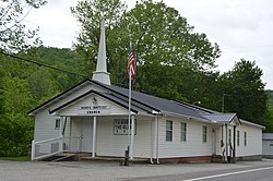
Harts (town), situated at the mouth of Big Harts Creek, is named for Stephen Hart (Heart), an early settler who once lived in the area, or his father, the latter killed by Native Americans in the vicinity. Richard Elkins was the first permanent settler, arriving in 1807 or 1815. At the time of Elkins' settlement, depending on which year is accurate, the present-day town was part of Kanawha County or Cabell County. Prominent early families who settled in the present-day town of Harts included the Elkins, Adkins, and Toney families. After 1824, the area became a part of Logan County. Prior to the Civil War, Isaac Adkins (who lived at the present-day site of the Harts Fire Department) operated a large farm at "Harts Bottom." He was one of the area's most prominent landowners; Isaac Adkins Shoals are named for him. In the 1840s, James Toney, a native of present-day Boone County, acquired land from the Elkins settlers at the mouth of Big Harts Creek, just across the Guyandotte from Harts Bottom. During the Civil War, nearly all local men served in the Confederate States Army.

In 1869, the area became part of Lincoln County. In November or December 1870, Henry S. Godby established Hearts Creek Post Office. The Hearts Creek PO was discontinued in 1872. In 1877, merchant William T. "Bill" Fowler established Hart's Creek Post Office. This post office was discontinued in 1880. In 1881, Andrew D. Robinson established the Hart Post Office. During the 1880s, the Lincoln County Feud occurred in Harts and garnered headlines in newspapers across the United States. During the 1890s, Al and Hollena Brumfield were the most prominent residents. In 1904, the C&O Railroad passed through town. In 1910, Hart PO was discontinued. In 1916, Lewis Dempsey established Harts Post Office, which continues today. Prominent merchants during this time and in subsequent decades included F.E. Adkins, Herb Adkins, P.B. "Fed" Adkins, Hollena Brumfield, Fisher B. Adkins, Watson Adkins, and L.T. Jones.

The Harts Creek community includes the Harts Creek District of Lincoln County and a portion of Chapmanville District in Logan County. It includes the following communities, many of which once had post offices which are now closed: Atenville, Bulwark, Enzelo, Ferrellsburg, Fourteen, Fry, Gill, Green Shoal, Halcyon, Harts, Leet, Rector, Sand Creek, Shively, Spottswood, Toney, Warren, and Whirlwind. The larger community includes the following watersheds: Big Harts Creek (Lincoln and Logan counties), Big Ugly Creek, Fourteen Mile Creek, a portion of Kiahs Creek, Little Harts Creek, Little Ugly Creek, Sand Creek, Dry Branch, Browns Branch, Swift Shoals Branch, Walker Branch, Fowler Branch, Douglas Branch, Green Shoal Creek, and Abbotts Branch. These various locations were populated by numerous families prior to 1840: Brumfield, Elkins, Gore, Adkins, Fry, Brown, Lucas, Spurlock, Toney, Vance, Workman, Conley, Rowe, Adams, Browning, Collins, Dingess, Dolen, Heart, Johnson, Lambert, Lilly, Perry, Tomblin, Hensley, Butcher, White, Mullins, Dalton, Thompson, Dempsey, Abbott, Blankenship, Butcher, Estep, Farley, Ferrell, Nester, Richards, Spears, Dial, Carter, and Farmer. Most early settlers were of English origin.

Related Research Articles

Logan County, West Virginia U.S. county in West Virginia

Logan County is a county in the U.S. state of West Virginia. As of the 2010 census, the population was 36,743. Its county seat is Logan. Logan County comprises the Logan, WV Micropolitan Statistical Area, which is also included in the Charleston–Huntington–Ashland, WV–OH–KY Combined Statistical Area.

Lincoln County, West Virginia County in West Virginia

Lincoln County is a county in the U.S. state of West Virginia. As of the 2010 census, the population was 21,720. Its county seat is Hamlin. The county was created in 1867 and named for Abraham Lincoln.

Alum Creek, West Virginia Census-designated place in West Virginia, United States

Alum Creek is a census-designated place (CDP) in Kanawha and Lincoln counties along the Coal River in the U.S. state of West Virginia. It includes the unincorporated communities of Alum Creek, Forks of Coal, and Priestley. The CDP had a population of 1,749 at the 2010 census, down from 1,839 at the 2000 census.

Chapmanville, West Virginia Town in West Virginia, United States

Chapmanville is a town in Logan County, West Virginia, United States. The population was 1,256 at the 2010 census. Chapmanville, originally called Chapmansville, is named for Ned Chapman, an early settler who operated a store and post office. It was incorporated in 1947.

Mallory, West Virginia Census-designated place in West Virginia, United States

Mallory is a census-designated place (CDP) in Logan County, West Virginia, United States. The population was 1,654 at the 2010 census. The CDP contains the unincorporated communities, from west to east, of Huff Junction, Mallory, Davin, Mineral City, Claypool, Combs Addition, and Gillman Bottom.

Mount Gay-Shamrock, West Virginia Census-designated place in West Virginia, United States

Mount Gay-Shamrock is a census-designated place (CDP) in Logan County, West Virginia, United States. The population was 1,779 at the 2010 census. The CDP includes the unincorporated communities of Mount Gay, Shamrock, Black Bottom, Whites Addition, Lintz Addition, Thompson Town, Hedgeview, Ridgeview, Logan Heights, Cora, and Whitman Junction.

Switzer, West Virginia Census-designated place in West Virginia, United States

Switzer is an unincorporated community and census-designated place (CDP) in Logan County, West Virginia, United States. The CDP includes the neighboring unincorporated community of Micco. The total CDP population was 595 at the 2010 census.

West Logan, West Virginia Town in West Virginia, United States

West Logan is a town along the Guyandotte River in Logan County, West Virginia, United States. The population was 424 at the 2010 census. For unknown reasons, some sources report West Logan to lay west of the county seat at Logan, attributing to this fact the name.

Guyandotte River

The Guyandotte River is a tributary of the Ohio River, approximately 166 mi (267 km) long, in southwestern West Virginia in the United States. It was named after the French term for the Wendat Native Americans. It drains an area of the unglaciated Allegheny Plateau south of the Ohio between the watersheds of the Kanawha River to the northeast and Twelvepole Creek and the Big Sandy River to the southwest. Via the Ohio River, it is part of the Mississippi River watershed.

Big Ugly Creek is a major tributary of the Guyandotte River in the Harts Creek District of Lincoln County, West Virginia, United States. The naming of this creek was due to 1) an early settler at the mouth of the creek who was unpleasing to the eye; 2) the crooked shape of the creek itself. Big Ugly Creek is a meandering stream stretching nearly 20 miles from U.S. Route 119 northeast of Chapmanville in Boone County to where it meets the Guyandotte River at Gill, an extinct railroad town north of Harts in Lincoln County. Big Ugly Creek is also at the southern end of the state's largest mountaintop removal mine, Arch Coal's Hobet 21. The mine stretches nearly 15 miles from near Julian, north of Madison in Boone County to right above the end of Fawn Hollow, which joins Big Ugly, not far from the Big Ugly Community Center.

James Edward "Ed" Haley was a blind professional American musician and composer best known for his fiddle playing.

Ferrellsburg, West Virginia Unincorporated community in West Virginia, United States

Ferrellsburg is an unincorporated community in southern Lincoln County, West Virginia, United States. It is located in Harts Creek District and is part of the Harts census-designated place.

Shively, West Virginia Unincorporated community in West Virginia, United States

Shively is an unincorporated community located on the Smokehouse Fork of Big Harts Creek in Logan County, West Virginia, United States. Shively is accessed by County Route 3. It is situated 7.2 miles from Harts and 9.3 miles from Chapmanville.

Whirlwind, West Virginia Unincorporated community in West Virginia, United States

Whirlwind is an unincorporated community on Big Harts Creek in Logan County, West Virginia, United States.

Halcyon, West Virginia Unincorporated community in West Virginia, United States

Halcyon is an unincorporated community located on the West Fork of Big Harts Creek in Logan and Lincoln counties, West Virginia, United States.

Justice Addition, West Virginia Census-designated place in West Virginia, United States

Justice Addition is an unincorporated community and census-designated place (CDP) in Logan County, West Virginia, United States. The community was first listed as a CDP prior to the 2020 census.

Atenville, West Virginia Unincorporated community in West Virginia, United States

Atenville is an unincorporated community in Lincoln County, West Virginia, United States. It is a residential community located in Harts Creek District and is part of the Harts census-designated place.

Toney, West Virginia Unincorporated community in West Virginia, United States

Toney is an unincorporated community in Lincoln County, West Virginia, United States. Its post office was established in 1904 by Brad Toney, merchant.

Gill, West Virginia Unincorporated community in West Virginia, United States

Gill is an unincorporated community and former railroad town in Lincoln County, West Virginia, United States.

Big Harts Creek

Big Harts Creek, often shortened to "Harts Creek" or "Big Hart," is a major tributary of the Guyandotte River in Lincoln and Logan counties, West Virginia.

References

  1. 1 2 3 "2020 U.S. Gazetteer Files – West Virginia". United States Census Bureau. Retrieved March 9, 2021.
  2. 1 2 "Total Population: 2010 Census DEC Summary File 1 (P1), Harts CDP, West Virginia". data.census.gov. U.S. Census Bureau. Retrieved March 9, 2021.
  3. 1 2 "U.S. Census website". United States Census Bureau . Retrieved 2008-01-31.
  4. "US Board on Geographic Names". United States Geological Survey. 2007-10-25. Retrieved 2008-01-31.
  5. "TIGERweb: Harts CDP, West Virginia". Geography Division, U.S. Census Bureau. Retrieved March 9, 2021.
  6. "U.S. Geological Survey 7.5-minute topographic map series: Ranger quadrangle". ACME Mapper. Retrieved March 9, 2021.
  7. Kenny, Hamill (1945). West Virginia Place Names: Their Origin and Meaning, Including the Nomenclature of the Streams and Mountains. Piedmont, WV: The Place Name Press. p. 666.