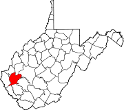
Lincoln County is a county in the U.S. state of West Virginia. As of the 2010 census, the population was 21,720. Its county seat is Hamlin. The county was created in 1867 and named for Abraham Lincoln.

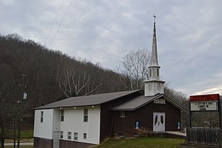
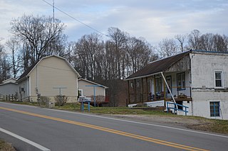
Harts is a census-designated place (CDP) at the mouth of Big Harts Creek in Lincoln County, West Virginia, United States, along the Guyandotte River. As of the 2010 census, its population was 656. Harts is a part of the Huntington-Ashland, WV-KY-OH, Metropolitan Statistical Area (MSA). The Harts CDP includes the unincorporated communities of Harts, Atenville, Ferrellsburg, and Sand Creek.

Mount Meridian is an unincorporated community in Marion Township, Putnam County, in the U.S. state of Indiana. Primarily on US 40, it is approximately 34 miles (55 km) west of Indianapolis. It is called Mount Meridian due to its being the highest place in the county and surrounding areas.

Alkol is an unincorporated community in eastern Lincoln County, West Virginia, United States. It lies along West Virginia Route 3 southeast of the town of Hamlin, the county seat of Lincoln County. Its elevation is 748 feet (228 m). Although it is unincorporated, it has a post office with the ZIP code of 25501.
Branchland is an unincorporated community in western Lincoln County, West Virginia, United States. It lies along West Virginia Route 10 southwest of the town of Hamlin, the county seat of Lincoln County. Its elevation is 597 feet (182 m). Although it is unincorporated, it has a post office, with the ZIP code of 25506. Raccoon Creek Road is one of the more popular ways of transportation through the area. Branchland Post Office serves addresses within Sheridan Magisterial District of Lincoln County as well as addresses in southern Cabell County and eastern Wayne County, West Virginia.
Griffithsville is an unincorporated community in eastern Lincoln County, West Virginia, United States. It lies along West Virginia Route 3 southeast of the town of Hamlin, the county seat of Lincoln County. Its elevation is 659 feet (201 m). Although it is unincorporated, it has a post office, with the ZIP code of 25521.
Midkiff is an unincorporated community in western Lincoln County, West Virginia, United States. It lies along West Virginia Route 10 southwest of the town of Hamlin, the county seat of Lincoln County. Its elevation is 597 feet (182 m). Although it is unincorporated, it has a post office, with the ZIP code of 25540.
Ranger is an unincorporated community in western Lincoln County, West Virginia, United States. It lies along West Virginia Route 10 southwest of the town of Hamlin, the county seat of Lincoln County. Its elevation is 614 feet (187 m). Although it is unincorporated, it has a post office, with the ZIP code of 25557. Ranger is served by the Guyan River VFD.
Sumerco is an unincorporated community in northeastern Lincoln County, West Virginia, led by William Runyon. It lies along West Virginia Route 214 east of the town of Hamlin, the county seat of Lincoln County. Its elevation is 1,211 feet (369 m). Although it is unincorporated, it has a post office, with the ZIP code of 25567; the population of the ZCTA for ZIP code 25567 was 709 at the 2000 census.

Yawkey is an unincorporated community in eastern Lincoln County, West Virginia, United States. It lies at the intersection of West Virginia Routes 3 and 214, east of the town of Hamlin, the county seat of Lincoln County. Its elevation is 738 feet (225 m). Although it is unincorporated, it had a post office, with the ZIP code of 25573.
Myra is an unincorporated community in Lincoln County, West Virginia, United States. Myra is located on the Mud River 4 miles (6.4 km) south of Hamlin. A post office was operated at Myra from September 7, 1883 until it was closed on March 19, 2011. The community was founded at the same time the post office was established.
Woodville is an unincorporated community in Lincoln County, West Virginia, United States. Woodville is 7.5 miles (12.1 km) north-northwest of Madison. Woodville had a post office, which closed on April 27, 1991.
Palermo is an unincorporated community in Lincoln County, West Virginia, United States. Palermo is located on the Mud River and County Routes 46 and 58 7.9 miles (12.7 km) south-southeast of Hamlin. Palermo had a post office, which closed on February 1, 1997.
Sias is an unincorporated community in Lincoln County, West Virginia, United States. Sias is located on the Mud River and County Routes 7 and 46 6.5 miles (10.5 km) south of Hamlin. Sias had a post office, which closed on February 1, 1997.
Sweetland is an unincorporated community in Lincoln County, West Virginia, United States. Sweetland is located on West Virginia Route 3 and the Middle Fork Mud River 3.5 miles (5.6 km) east-southeast of Hamlin. Sweetland had a post office, which closed on December 14, 1996.

Shively is an unincorporated community located on the Smokehouse Fork of Big Harts Creek in Logan County, West Virginia. Shively is accessed by County Route 3. It is situated 7.2 miles from Harts and 9.3 miles from Chapmanville.

Gill is an unincorporated community and former railroad town in Lincoln County, West Virginia.
Bradyville is an unincorporated community in Lincoln County, in the U.S. state of West Virginia.
Hager is an unincorporated community in Lincoln County, in the U.S. state of West Virginia.
Portersville is an unincorporated community in Lincoln County, in the U.S. state of West Virginia.