Green Sulphur Springs is an unincorporated community in Summers County, West Virginia, United States. It lies near Interstate 64 to the northeast of the city of Hinton, the county seat of Summers County. Its elevation is 1,552 feet. Green Sulphur Springs had a post office, with the ZIP code 25966, until it closed on February 29, 1992.

Alkol is an unincorporated community in eastern Lincoln County, West Virginia, United States. It lies along West Virginia Route 3, southeast of the town of Hamlin, the county seat of Lincoln County. Its elevation is 748 feet (228 m). Although it is unincorporated, it has a post office with the ZIP code 25501.
Branchland is an unincorporated community in western Lincoln County, West Virginia, United States. It lies along West Virginia Route 10, southwest of the town of Hamlin, the county seat of Lincoln County. Its elevation is 597 feet (182 m). It has a post office with the ZIP code 25506. Raccoon Creek Road is one of the more popular ways of transportation through the area. Branchland Post Office serves addresses within Sheridan Magisterial District of Lincoln County as well as addresses in southern Cabell County and eastern Wayne County, West Virginia.
Midkiff is an unincorporated community in western Lincoln County, West Virginia, United States. It lies along West Virginia Route 10 southwest of the town of Hamlin, the county seat of Lincoln County. Its elevation is 597 feet (182 m). It has a post office with the ZIP code 25540.
Sod is an unincorporated community in northeastern Lincoln County, West Virginia, United States. It lies along West Virginia Route 214 east of the town of Hamlin, the county seat of Lincoln County. Sod's elevation is 781 feet (238 m). It has a post office with the ZIP code 25564.
Ranger is an unincorporated community in western Lincoln County, West Virginia, United States. It lies along West Virginia Route 10 southwest of the town of Hamlin, the county seat of Lincoln County. Its elevation is 614 feet (187 m). It has a post office with the ZIP code 25557. Ranger is served by the Guyan River VFD.

Yawkey is an unincorporated community in eastern Lincoln County, West Virginia, United States. It lies at the intersection of West Virginia Routes 3 and 214, east of the town of Hamlin, the county seat of Lincoln County. Its elevation is 738 feet (225 m). Although it is unincorporated, it had a post office, with the ZIP code 25573.
Berea is an unincorporated community in southeastern Ritchie County, West Virginia, United States. It lies along West Virginia Route 74 southeast of the town of Harrisville, the county seat of Ritchie County. Its elevation is 751 feet (229 m). Although it is unincorporated nor has a post office, the ZIP code is 26327. Postal customers are serviced by the Harrisville and Auburn post offices.
Brohard is an unincorporated community in Ritchie and Wirt counties in the U.S. state of West Virginia. Its elevation is 965 feet (294 m). Brohard had a post office, which closed on November 2, 2002.
Munday is an unincorporated community in eastern Wirt County, West Virginia, United States. It lies along local roads southeast of the town of Elizabeth, the county seat of Wirt County. Its elevation is 717 feet (217 m). Munday had a post office, which closed on October 26, 2002.
Creston is an unincorporated community in southeastern Wirt County, West Virginia, United States. It lies at the confluence of the Little Kanawha River and the West Fork Little Kanawha River on West Virginia Route 5, southeast of the town of Elizabeth, the county seat of Wirt County. Its elevation is 653 feet (199 m). Creston had a post office, which closed on June 25, 2011. The community was named for a drainage divide near the town site.
Advent is an unincorporated community in southeastern Jackson County, West Virginia, United States. It lies along Advent Road southeast of the city of Ripley, the county seat of Jackson County, and near Jackson County's borders with Kanawha and Roane counties. Its elevation is 791 feet (241 m). Advent had a post office, which closed on December 25, 2010.
Arbovale is an unincorporated community in Pocahontas County, West Virginia, United States. Arbovale is 12 miles (19 km) south of Durbin. Arbovale had a post office, which closed on March 3, 2007.
Glady is an unincorporated community in Randolph County, West Virginia, United States. Glady is 11 miles (18 km) southeast of Elkins. Glady had a post office, which closed on May 14, 2011.
Ellamore is an unincorporated community in Randolph and Upshur counties, West Virginia, United States. Ellamore is located on County Route 151 along the Middle Fork River, 8 miles (13 km) southeast of Buckhannon. Ellamore had a post office, which closed on July 11, 2009.
Borderland is an unincorporated community in Mingo County, West Virginia, United States. Borderland is located along the Tug Fork and U.S. Routes 52 and 119, 3 miles (4.8 km) northwest of Williamson. Borderland had a post office, which opened on March 6, 1905, and closed on June 20, 2009.
Dothan is an unincorporated community in Fayette County, West Virginia, United States. Dothan is located on West Virginia Route 612, 4 miles (6.4 km) west of Oak Hill. Dothan had a post office, which closed on October 5, 1991, when postmaster Lewis "Jackie" Toney retired.
Colcord is an unincorporated community in Raleigh County, West Virginia, United States. Colcord is 5.5 miles (8.9 km) east-southeast of Whitesville. Colcord had a post office, which closed on November 30, 2002. The community was named after the proprietor of the Colcord Coal Company.
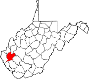
Myra is an unincorporated community in Lincoln County, West Virginia, United States. Myra is located on the Mud River, 4 miles (6.4 km) south of Hamlin.
Woodville is an unincorporated community in Lincoln County, West Virginia, United States. Woodville is 7.5 miles (12.1 km) north-northwest of Madison. Woodville had a post office, which closed on April 27, 1991.

