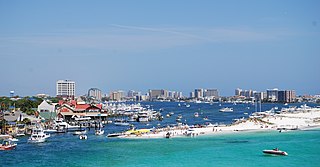
Perdido Key

Last updated • 10 min readFrom Wikipedia, The Free Encyclopedia

Johnson Beach on Perdido Key should not be confused with Johnson's Beach in Guerneville, California

Contents

Perdido Key chart.png
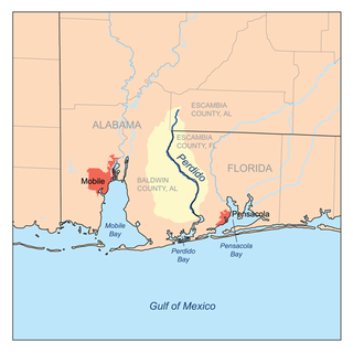
Nautical chart of Perdido Key, from Perdido Pass, Alabama (left) to Pensacola Pass, Florida, (right)

Perdido Key is a 24-kilometre-long (15 mi) barrier island on the north coast of the Gulf of Mexico. The island extends from Pensacola Pass on the east to Perdido Pass on the west. Most of the island is in Florida, with the western end of the island in Alabama. Santa Rosa Island is to the east of the island, and Alabama Point is to the west. Perdido Key was attached to the mainland until the 1940s when a canal separated it from the mainland. The eastern part of the island forms part of the Gulf Islands National Seashore, which includes the Perdido Key Historic District, the site of three shore batteries that once defended Pensacola Bay. The rest of the island, with the exception of the Perdido Key State Park, has been developed as a resort and residential community. As a barrier island, Perdidio Key is subject to changes due to wave action and longshore currents, particularly from hurricanes. The endangered Perdido Key beach mouse is endemic to the island.

Description

Perdido Key is a 24-kilometre-long (15 mi) barrier island, narrow for most of its length, with a much wider portion in the middle. The Gulf of Mexico is south of the island. Old River separates the western part of the island from Ono Island, Alabama to the north; the central and eastern parts of the island are separated from the Florida mainland by the Intracoastal Waterway and Big Lagoon, respectively. The island ends on the west at Perdido Pass and on the east at Pensacola Pass. The eastern part of the island, 11 kilometres (6.8 mi) long, is in the Gulf Islands National Seashore and is mostly undeveloped. The Perdido Key Historic District, the site of three shore batteries built between 1890 and 1945 to protect the entrance to Pensacola Bay, is at the eastern end of the island. The western part of the island is mostly developed as a resort area, although the 290 acres (120 ha) and 1.5 miles (2.4 km) of beach in the Perdido Key State Park are undeveloped, except for park facilities. Most of the island is in Florida, but the westernmost 2 miles (3.2 km) are in Alabama. The developed part of the island in Florida forms the unincorporated community of Perdido Key. The part of the island in Alabama is in the city of Orange Beach. The undeveloped part of the island has foredunes that are 4 to 5 metres (13 to 16 ft) high. Dunes behind the beach are up to 6.1 metres (20 ft) high. [1] [2] [3] [4]

Perdido Key is connected to the Florida mainland via the Theo Baars Bridge across the Intracoastal Waterway on Florida State Road 292 and to the Alabama mainland via the Perdido Pass Bridge on Alabama State Route 182. Ono Island is connected to the Alabama portion of Perdido Key by a private bridge.

Geological history

Perdido Key was part of the mainland of Florida until the middle of the 20th century. Perdido Key probably developed in place by aggradation of offshore shoals consisting of quartz sand that is likely reworked from Pleistocene delta and shallow marine deposits. Perdido Key was shorter east to west for most of the 19th century than it is now. The central part of the island was originally a peninsula that was the southern end of a ridge on the mainland. Barrier spits developed from the southern point of that peninsula, extending east and west. The easternmost part of the eastern barrier spit, adjacent to Pensacola Pass, may have been an island for much of the 19th century. It was known as Foster's Bank or Foster's Island throughout the 19th century. An intermittent inlet known as New Inlet, several miles west of Pensacola Pass, closed for the last time sometime between 1880 and 1900, attaching Foster's Bank to the spit and extending it to close to its present length. (In 2020, Hurricane Sally temporarily severed the eastern end of Perdido Key from the rest of the island). [5] [6] [7] [8] [9] [10]

Perdido Pass, the western end of Perdido Key, was about 2 miles (3.2 km) east of its present location until early in the 20th century. The barrier spit on the western (Alabama) side of the inlet, Point Ornocor, overlapped what is now Perdido Key, extending for several miles parallel to and on the north side of Perdido Key. As a result, the water passage from Perdido Pass to Perdido Bay was long, narrow and winding, passing between Perdido Key and Point Orconor, doubling the end of the point and then passing back between the point and the Florida shore on the north side. In early 1906, local residents dug a new inlet through Point Ornocor about 2 miles (3.2 km) west of the old inlet. The new inlet was widened by the 1906 Mississippi hurricane. The old inlet then silted up and closed, with the result that the portion of Point Ornocor east of the new inlet was attached to Perdido Key and the Florida mainland. The original waterway from the old Perdido Pass to Perdido Bay became known as Old River. A passage later opened from the western end of Old River to the Bayou St. John near the new Perdido Pass, separating what is now Ono Island from Perdido Key. The spit ending on the west side of Perdido Pass is now known as Alabama Point. Alabama and Florida settled the location of the state line in 1953, placing it at the location of the old Perdido Pass. In the early 1940s the Gulf Intracoastal Waterway was constructed between Perdido Key and the mainland, including the dredging of a canal through the neck of the peninsula connecting Perdido Key to the mainland, thus turning Perdido Key into an island. [2] [11] [12]

Perdido Key is shifting westward due to longshore drift. Both Pensacola Pass and Perdido Pass have historically moved westward. The westward flowing longshore current accretes sand on the up-current (eastern) sides of the passes and erodes sand from the down-current (western) sides. The site of the original Fort McRee, built in 1830 on the eastern end of Perdido Key (then known as Foster's Bank), was in the channel in the middle of Pensacola Pass by 1979. Pensacola Pass has been dredged since 1883 to maintain a channel into Pensacola Bay for United States Navy and other ships. The dredging has interrupted the natural transport of sand across the inlet from Santa Rosa Island to Perdido Key, with the result that Pensacola Pass is a net sediment sink. This has starved the eastern end of Perdido Key of sand, leading to the erosion of that part of the island. [13] [6] [14]

Much of the sand that makes up Perdido Key comes from the Gulf of Mexico floor offshore of the island. About 58,000 cubic metres (76,000 cu yd) of sand is deposited on the island from offshore each year. Part of that sand is carried west by longshore currents. Another part of the sand is carried, at infrequent intervals, across the island to and beyond the north side of the islands by washovers during hurricanes. With the reduction of sand crossing Pensacola Pass due to dredging of the inlet, most of the eastern half of the island is eroding, while the western half of the islands is accreting sand. The easternmost part of the island is receiving sand dredged from the inlet in a beach nourishment project. In the period from 1920 until 2013, the easternmost 20 kilometres (12 mi) of the island lost an average of 0.17 metres (0.56 ft) of shoreline per year. [15] [16]

Hurricanes

Perdido Key has been shaped by frequent hurricanes and tropical storms. The earliest recorded storm to affect Perdidio Key was the September 1559 hurricane which doomed the attempted Spanish colony of Ochuse on Pensacola Bay. There were at least eight major storms that struck the area in the next 200 years. Thirty hurricanes and tropical storms made landfall in the Perdido Key/Pensacola area in the century from 1889 to 1990. [17]

Perdido Key has been severely damaged by several hurricanes since the 1970s; Frederic in 1979, Erin in August 1995, Opal in October 1995, Ivan in 2004, Dennis in 2005, and Sally in 2020 damaged or destroyed foredunes and eroded beaches, causing the shoreline to retreat northward as much as 18 metres (59 ft) in each storm. Ivan brought a 14-foot (4.3 m) storm surge to the island, damaging secondary dunes as well as washing away foredunes, and causing washovers. Sally breached the eastern end of the island in three places, creating new inlets, all of which closed again within eight months. Vegetation on Perdido Key can take many years to recover from damage caused by hurricane winds. [18] [19] [20] [21]

Human history

There is scant evidence of human presence on Perdido Key prior to the 19th century. One site from the Fort Walton culture has been found on Perdido Key. There are other possible archaeological sites on the island, but repeated hurricanes have damaged or destroyed such sites. The island is unsuitable for settlement; there is no source of fresh water, no land food sources, and no land suitable for agriculture. There is no record of any European settlement on the island before 1821, when Florida was transferred from Spain to the United States. [22] [23]

Fort McRee

Construction began in 1831 on Fort McRee at the eastern end of the island, as part of the defenses for Pensacola Bay. The fort was damaged in the Civil War, and abandoned afterward. The site of the fort has since eroded away. By the early 1890s, all but one archway of the fort had fallen into the water. As of 1979, the site of the fort was believed to be in the channel in the middle of Pensacola Pass. [10] [24] [22] [25]

In 1898, construction was started on two coastal artillery installations, Battery Center and Battery Slemmer, at Fort McRee, to the west of the ruins of the mid-19th century fort on Foster's Bank (Perdido Key). The batteries were part of defenses for Pensacola Bay, which also included batteries at Fort Barrancas and Fort Pickens. The batteries were completed in 1900. Battery Slemmer was deactivated in 1918. Battery Center's guns were removed in 1920. Construction of new defenses for Pensacola Bay started in 1940. Battery 233 was built behind the ruins of Battery Slemmer on Perdido Key. Battery 233 had not yet received its intended guns when World War II ended in 1945 and Fort McRee, including the battery, was deactivated. The ruins of batteries Center, Slemmer, and 233 are preserved in the Perdido Key Historic District. [26] [25]

Parks

The Perdido Key unit of the Gulf Islands National Seashore started with the 421.3-hectare (1,041-acre) Fort McRee site at the extreme eastern end of the island, which was transferred from the US Department of Defense to the National Park Service in 1971. Rosamond Johnson Beach, just to the east of the middle of the island, was added to the national seashore in 1973. In 1977–1978, 5 miles (8.0 km) of the island between Rosamond Johnson Beach and Fort McRee were acquired and added to the Rosamund Johnson Beach Area of the national seashore. [10] [27] [28]

Ecology

Perdido Key has deep, sandy soils. In the undeveloped parts of the island, swales between dunes host a patchwork of mesic flatwoods, coastal scrub, and coastal grasslands. Those habitats may be flooded by storm surges, after which they are colonized by salt-tolerant species. Swampy areas north of the dunes are drained by creeks. Salt marshes occur along the north side of the island. [29]

A long-term survey of the Perdido Key unit of the Gulf Islands National Seashore identified 384 plant species. Four plant species on the island are of concern for conservation. Chrysopsis godfreyi (Godfrey's goldenaster) is rated "imperiled" on the NatureServe conservation status scale. Schizachyrium maritimum (gulf bluestem) and Polygonum smallianum (largeleaf jointweed) are rated "vulnerable" on the NatureServe conservation status scale. Crocanthemum arenicola (syn. Helianthemum arenicola) (gulf coast frostweed) has a limited distribution, occurring only along the north coast of the Gulf of Mexico, from Franklin County, Florida to Harrison County, Mississippi. [30] [31] [32]

Animals found on Perdido Key include the endangered Perdido Key beach mouse and two nesting shorebirds, Charadrius nivosus (snow plover) and Sternula antillarum (least tern). Loggerhead sea turtles (Caretta caretta) occasionally lay eggs in nests on the island. Ridley sea turtles (Lepidochyles spp.) have left nests on the island on rare occasions. Various shorebirds and migrating birds use the island for resting and foraging. [33]

Related Research Articles

<span class="mw-page-title-main">Destin, Florida</span> City in Florida, United States of America

Destin is a city located in Okaloosa County, Florida, United States. It is a principal city of the Crestview–Fort Walton Beach–Destin, Florida Metropolitan Statistical Area. The population was 13,931 at the 2020 census, up from 12,305 at the 2010 census.

<span class="mw-page-title-main">Fort Pickens</span> Historic United States military fort on Santa Rosa Island, Pensacola, Florida

Fort Pickens is a pentagonal historic United States military fort on Santa Rosa Island in the Pensacola, Florida, area. It is named after American Revolutionary War hero Andrew Pickens. It is the largest of four forts built to defend Pensacola Bay and its navy yard. The fort was completed in 1834 and was one of the few forts in the South that remained in Union hands throughout the American Civil War. It remained in use until 1947. Fort Pickens is included within the Gulf Islands National Seashore, and as such, is administered by the National Park Service.

<span class="mw-page-title-main">Fort McRee</span> Former fort near Pensacola, Florida

Fort McRee was a historic military fort constructed by the United States on the eastern tip of Perdido Key to defend Pensacola and its important natural harbor. In the defense of Pensacola Bay, Fort McRee was accompanied by Fort Pickens, located across Pensacola Pass on Santa Rosa Island, and Fort Barrancas, located across Pensacola Bay on the grounds of what is now Naval Air Station (NAS) Pensacola. Fort Pickens was the largest of these. Very little remains of Fort McRee today.
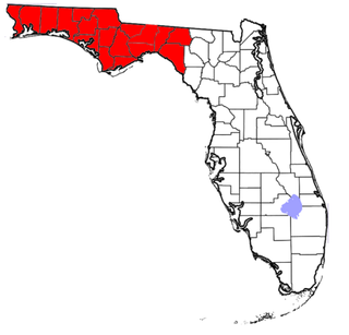
<span class="mw-page-title-main">Florida panhandle</span> Northwest region of Florida

The Florida panhandle is the northwestern part of the U.S. state of Florida. It is a salient roughly 200 miles (320 km) long, bordered by Alabama on the north and the west, Georgia on the north, and the Gulf of Mexico to the south. Its eastern boundary is arbitrarily defined. It is defined by its southern culture and rural geography relative to the rest of Florida, as well as closer cultural links to French-influenced Louisiana, Mississippi, and Alabama. Its major communities include Pensacola, Navarre, Destin, Panama City Beach, and Tallahassee.
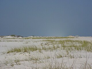
<span class="mw-page-title-main">Santa Rosa Island (Florida)</span> Island of Pensacola in Florida, United States

Santa Rosa Island is a 40-mile (64 km) barrier island located in the U.S. state of Florida, thirty miles (50 km) east of the Alabama state border. The communities of Pensacola Beach, Navarre Beach, and Okaloosa Island are located on the island. On the northern side of the island, are Pensacola Bay on the west and Choctawhatchee Bay on the east, joined through Santa Rosa Sound.

<span class="mw-page-title-main">Perdido Key State Park</span> State park in Florida, United States

Perdido Key State Park is a 247-acre (1.00 km2) Florida State Park located on a barrier island fifteen miles (24 km) southwest of Pensacola, off S.R. 292, in northwestern Florida. The address is 12301 Gulf Beach Highway.
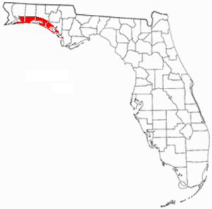
<span class="mw-page-title-main">Emerald Coast</span> Region in Florida, United States

The Emerald Coast is an unofficial name for the coastal area in the US state of Florida on the Gulf of Mexico that stretches about 100 miles (160 km) through five counties, Escambia, Santa Rosa, Okaloosa, Walton, and Bay, which include Pensacola Beach, Navarre Beach, Fort Walton Beach, Destin, and Panama City Beach. Some south Alabama communities on the coast of Baldwin County, such as Gulf Shores, Orange Beach, and Fort Morgan embrace the term as well.

<span class="mw-page-title-main">Gulf Islands National Seashore</span> 96,000 underwater acres in Mississippi and Florida (US) managed by the National Park Service

Gulf Islands National Seashore is an American National seashore that offers recreation opportunities and preserves natural and historic resources along the Gulf of Mexico barrier islands of Florida and Mississippi. In 2023, it was the fifth-most visited unit of the National Park Service.
<span class="mw-page-title-main">Fort Barrancas</span> United States historic place

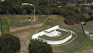
Fort Barrancas (1839) or Fort San Carlos de Barrancas is a United States military fort and National Historic Landmark in the former Warrington area of Pensacola, Florida, located physically within Naval Air Station Pensacola, which was developed later around it.

<span class="mw-page-title-main">Perdido Key, Florida</span> Unincorporated community in Florida, United States

Perdido Key is an unincorporated community located in Escambia County, Florida, United States, between the cities of Pensacola, Florida and Orange Beach, Alabama. The community is located on and named for Perdido Key, a barrier island in northwest Florida and southeast Alabama. "Perdido" means "lost" in the Spanish and Portuguese languages. The Florida district of the Gulf Islands National Seashore includes the east end of the island, as well as other Florida islands. No more than a few hundred yards wide in most places, Perdido Key stretches some 16 miles (26 km) from near Pensacola to Perdido Pass Bridge near Orange Beach.

<span class="mw-page-title-main">Ship Island</span> Island in Harrison County, Mississippi, United States of America

Ship Island is a barrier island off the Gulf Coast of Mississippi, one of the Mississippi–Alabama barrier islands. Hurricane Camille split the island into two separate islands in 1969. In early 2019, the US Army Corps of Engineers completed the first stage of a project rejoining the two islands and recreating one Ship Island. Ship Island is the site of Fort Massachusetts, as a Third System fortification. Part of the island is included in the Gulf Islands National Seashore.
<span class="mw-page-title-main">Battle of Santa Rosa Island</span> 1861 battle of the American Civil War

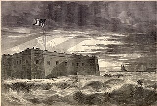
The Battle of Santa Rosa Island was an unsuccessful Confederate attempt to take Union-held Fort Pickens on Santa Rosa Island, Florida.

<span class="mw-page-title-main">Maritime history of Florida</span> History of waters in and adjacent to Florida

The maritime history of Florida describes significant past events relating to the U.S. state of Florida in areas concerning shipping, shipwrecks, and military installations and lighthouses constructed to protect or aid navigation and development of the Florida peninsula.

<span class="mw-page-title-main">Pensacola Bay</span> A bay in the northwestern part of Florida, United States, known as the Florida Panhandle

Pensacola Bay is a bay located in the northwestern part of Florida, United States, known as the Florida Panhandle.

<span class="mw-page-title-main">Perdido Pass</span>

Perdido Pass, separating Alabama Point from Florida Point, is the mouth of the Perdido River. Perdido Pass forms a water passage that connects Perdido Bay with the Gulf of Mexico to the south, in the U.S. state of Alabama, 2 miles (3 km) west of the Alabama/Florida state line. A bridge spans Perdido Pass, connecting Alabama Point with Florida Point in Alabama. At the entrance into the Gulf, the 2 rock barriers, extending from the white beaches, are the west jetty & east jetty. The surrounding area is heavily developed, with high-rise condominiums. However, there are nearby beach-front parks, with Gulf State Park on the eastern side of Perdido Pass.
<span class="mw-page-title-main">Perdido Bay</span>

Perdido Bay is a bay at the mouth of and draining the Perdido River, a designated Outstanding Florida Waters river, in Baldwin County, Alabama and Escambia County, Florida, United States. It is essentially a coastal lagoon enclosed by barrier islands, with an inlet, Perdido Pass.

<span class="mw-page-title-main">Pensacola Pass</span> Inlet on the Florida panhandle coast

Pensacola Pass is an inlet between Santa Rosa Island and Perdido Key at the western end of the Florida Panhandle. It connects the Gulf of Mexico to Pensacola Bay. The mainland around Pensacola Bay is heavily developed, with high-rise condominiums. Santa Rosa Island and the eastern part of Perdido Key adjacent to Pensacola Pass are units of the Gulf Islands National Seashore, and remain largely undeveloped.
<span class="mw-page-title-main">William Henry Chase</span> Florida planter and militia leader (1798–1870)

William Henry Chase was a Florida militia colonel during the events in early 1861 that led to the American Civil War. On January 15, 1861, on behalf of the State and Governor of Florida, Colonel Chase demanded the surrender of Fort Pickens at Pensacola, Florida and of its U.S. Army garrison. Chase had designed and constructed the fort while he was a captain in the United States Army Corps of Engineers. Lieutenant Adam J. Slemmer, commander of the fort, refused the surrender demand. An informal truce between the administration of President James Buchanan and Florida officials, including their still sitting U.S. Senators, avoided military action at Pensacola until after the Battle of Fort Sumter in April 1861.
<span class="mw-page-title-main">Mississippi–Alabama barrier islands</span> Islands in the Gulf of Mexico

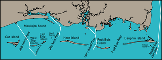
The Mississippi–Alabama barrier islands are a chain of barrier islands in the Gulf of Mexico along the coasts of Mississippi and Alabama enclosing the Mississippi Sound. The major islands are Cat Island, Ship Island, Horn Island, Petit Bois Island, and Dauphin Island; in the early 20th century the chain also included the Isle of Caprice, which has since been submerged. The islands are separated by wide inlets, several of which have been channelized to form the shipping channels for Gulf coast ports. The shapes and sizes of the islands have changed significantly since the 1800s, with the islands generally shrinking and shifting westward, especially after major tropical cyclones. Most of the islands are uninhabited. Much of the Mississippi portion of the chain is included in the Gulf Islands National Seashore.

<span class="mw-page-title-main">Little Lagoon</span> Lagoon in Gulf Shores, Alabama, USA

Little Lagoon is a shallow, brackish lagoon located in Gulf Shores, Alabama. The lagoon is approximately 10 miles long and 0.5 miles wide, with an average depth of 4-6 feet, and has a surface area of approximately 2,480 surface acres. The western shore portion of the lagoon is part of the Bon Secour National Wildlife Refuge while the remainder is private property.

References

  1. Big 2018, pp. 1, 19.
  2. 1 2 Marker 2019.
  3. Schupp 2019, pp. 1, 3.
  4. Work, Charles & Dean 1991, p. 1.
  5. Big 2018, p. 20.
  6. 1 2 NRHP 1979.
  7. Bearss 1982, p. 123.
  8. Work, Charles & Dean 1991, p. 17.
  9. Schupp 2019, pp. 69, 73.
  10. 1 2 3 Looney et al. 1993, pp. 327–328.
  11. Mullen 2020.
  12. Work, Charles & Dean 1991, p. 19.
  13. Work, Charles & Dean 1991, pp. 17, 21–22.
  14. Schupp 2019, pp. 2, 20.
  15. Work, Charles & Dean 1991, p. 27.
  16. Schupp 2019, pp. 2, 18–19, 30.
  17. Work, Charles & Dean 1991, pp. 7–8.
  18. Work, Charles & Dean 1991, p. 9.
  19. Schupp 2019, pp. 37–38.
  20. Big 2018, p. 42.
  21. Teel, Susan (March 11, 2022). "Gulf Island National Seashore to close a section of Perdido Key March 11 for Dredging Maintenance". National Park Service. Retrieved August 27, 2023.
  22. 1 2 Work, Charles & Dean 1991, p. 18.
  23. history 2018.
  24. Schupp 2019, p. 1.
  25. 1 2 "National Register of Historic Places Inventory - Nomination Form - Perdido Key Historic District" (PDF). National Park Service History. December 11, 1979. Retrieved August 20, 2023.
  26. Bearss 1982, pp. 123–139, 141–152, 293–295.
  27. "Beach Named for African American War Hero Provides Beauty, Glimpse into History". United States Navy. Retrieved 2023-08-28.
  28. NRHP 1979, p. 2.
  29. Big 2018, pp. 20, 25–26, 44–45, 53.
  30. Looney et al. 1993, p. 330.
  31. Big 2018, p. 78.
  32. "Crocanthemum arenicola - FNA". floranorthamerica.org. Retrieved 2023-08-28.
  33. Big 2018, pp. 1, 82, 91.

Sources

30°17′38″N87°27′11″W / 30.29389°N 87.45306°W / 30.29389; -87.45306