North Fork of Pound Lake | |
---|---|
Location | Wise County, Virginia, United States |
Coordinates | 37°07′29″N82°37′50″W / 37.12472°N 82.63056°W Coordinates: 37°07′29″N82°37′50″W / 37.12472°N 82.63056°W |
Type | reservoir |
Primary inflows | North Fork Pound River |
Primary outflows | North Fork Pound River |
Basin countries | United States |
Surface area | 154 acres (62 ha) [1] |
Average depth | 19 feet (6 m) [1] |
Max. depth | 55 feet (17 m) [1] |
Shore length1 | 13.5 miles (21.7 m) [1] |
Surface elevation | 1,601 feet (488 m) |
1 Shore length is not a well-defined measure. |
North Fork Pound Reservoir (also known as North Fork of Pound Lake) is a reservoir in Wise County, Virginia. It was built in 1966 as authorised by the Flood Control Act of 1960 and managed by the United States Army Corps of Engineers. [2]
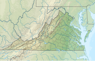
The North Fork of Pound River is a part of the upper reaches of the Big Sandy system. On its way to the Ohio River, the waters from North Fork flow northeast and meet the South Fork River to form the Pound River. The Pound River then flows into the John W. Flannagan Dam which empties into the Russell Fork River near Haysi, Virginia. The Russell Fork cuts through the Allegheny Mountain range to join the Levisa Fork then meets the Tug Fork at Louisa and forms the Big Sandy River. [3]
Construction began in 1966 by the U.S. Army Corps of Engineers under the Flood Control Act of 1960. The rock fill dam was completed in 1963 at a cost of $6.2 million. The dam is 122 feet (37 m) high and 600 feet (180 m) long. Water releases from the dam are controlled by three gates (3 feet wide, 6 feet (1.8 m) high) located in the intake structure. Lake elevation is maintained at 1,611 feet (491 m) above sea level. During the fall the lake elevation is lowered 10 feet (3.0 m) to hold water from fall and spring runoff. The lake covers 154 acres (0.62 km2) and includes 13.5 miles (21.7 km) of wooded shoreline. The U.S. Forest Service obtained ownership of the lands surrounding the lake in 1983. [3]
Detroit Dam is a gravity dam on the North Santiam River between Linn County and Marion County, Oregon. It is located in the Cascades, about 5 mi (8.0 km) west of the city of Detroit. It was constructed between 1949 and 1953 by the United States Army Corps of Engineers. The dam created 400-foot (120 m) deep Detroit Lake, more than 9 miles (14 km) long with 32 miles (51 km) of shoreline.
Big Bend Dam is a major embankment rolled-earth dam on the Missouri River in Central South Dakota, United States, creating Lake Sharpe. The dam was constructed by the U.S. Army Corps of Engineers as part of the Pick-Sloan Plan for Missouri watershed development authorized by the Flood Control Act of 1944. Construction began in 1959 and the embankment was completed in July 1963. Power generation began at the facility in 1964 and the entire complex was completed in 1966 at a total cost of $107 million. The hydroelectric plant generates 493,300 kilowatts of electricity at maximum capacity, with an annual production of 969 million kilowatt hours, and meets peak-hour demand for power within the Missouri River Basin.
Table Rock Lake, designed, built and operated by the U.S. Army Corps of Engineers, is an artificial lake or reservoir in the Ozarks of southwestern Missouri and northwestern Arkansas. The lake is impounded by Table Rock Dam, constructed from 1954 to 1958 on the White River by the U.S. Army Corps of Engineers.
Dworshak Dam is a concrete gravity dam in the western United States, on the North Fork Clearwater River in Clearwater County, Idaho. The dam is located approximately four miles (6 km) northwest of Orofino and impounds the Dworshak Reservoir for flood control and hydroelectricity generation. With a height of 717 feet (219 m), Dworshak is the third tallest dam in the United States and the tallest straight-axis concrete dam in the Western Hemisphere. Lacking fish ladders, Dworshak Dam blocks fish passage and completely extirpated anadromous fish migration into the upper reaches of the North Fork Clearwater River and its tributaries in Idaho. Construction of the dam by the U.S. Army Corps of Engineers (USACE) began in 1966 and was completed in 1973.
Wilson Lake is a reservoir in the U.S. state of Kansas, on the border of Russell County and Lincoln County. Built and managed by the U.S. Army Corps of Engineers for flood control, it is also used for wildlife management and recreation. Several parks are located along its shoreline, including Wilson State Park.
Summersville Lake is a reservoir located in the US state of West Virginia. The lake is formed by a rock-fill dam on the Gauley River, south of Summersville in Nicholas County. It is the largest lake in West Virginia, with 2,700 acres (1,100 ha) of water and over 60 miles (97 km) of shoreline at the summer pool water level. Its maximum depth is 327 feet.
The Ware River is a 35.4-mile-long (57.0 km) river in central Massachusetts. It has two forks, the longer of which begins in Hubbardston, Massachusetts. The Ware River flows southwest through the middle of the state, joins the Quaboag River at Three Rivers, Massachusetts, to form the Chicopee River on its way to the Connecticut River.
Optima Lake was built to be a reservoir in Texas County, Oklahoma. The site is located just north of Hardesty and east of Guymon in the Oklahoma Panhandle.
Benbrook Lake is a reservoir on the Clear Fork of the Trinity River in Tarrant County, Texas, USA. The lake is located approximately 10 miles (16 km) southwest of the center of Fort Worth, where the Clear Fork and the West Fork of the Trinity River join. The lake is impounded by the Benbrook Dam. The lake and dam are owned and operated by the U.S. Army Corps of Engineers, Fort Worth District.
John Redmond Reservoir is a reservoir on the Neosho River in eastern Kansas. Built and managed by the U.S. Army Corps of Engineers, it is used for flood control, recreation, water supply, and wildlife management. It borders the Flint Hills National Wildlife Refuge to the northwest.
Gathright Dam is an earthen and rolled rock-fill embankment dam on the Jackson River 19 miles (31 km) north of Covington, Virginia. The dam is 257 feet (78 m) tall and 1,310 feet (400 m) long and has a controlled spillway within the structure's southern portion. It creates Lake Moomaw, which has a normal volume of 40 billion US gallons (150,000,000 m3). The dam serves flood control and recreational purposes and is operated by the U.S. Army Corps of Engineers.
Leesville Lake is a reservoir located near Ohio State Route 212 and Leesville, Ohio. The lake is formed by Leesville Dam 40°28′6″N81°11′41″W across McGuire Creek, a tributary of Conotton Creek. The lake is named for the village of Leesville.
John W. Flannagan Dam is a flood control dam located in the Cumberland Mountains of Dickenson County, Virginia. It forms the John W. Flannagan Reservoir behind it.
Brocks Gap Dam was a never-built proposal for a water storage dam on the North Fork of the Shenandoah River at Brocks Gap in northwest Virginia. The proposal by the U.S. Army Corps of Engineers encountered opposition from local residents and was withdrawn in 1967.
Kanopolis Lake is a reservoir in Ellsworth County in the Smoky Hills of central Kansas, about 31 miles southwest of Salina and a few miles southeast of the town of Kanopolis. The lake is formed by Kanopolis Dam. Completed in 1948 as a flood control and water conservation project of the United States Army Corps of Engineers, the dam impounds the Smoky Hill River.
Council Grove Lake is a reservoir on the Neosho River in east-central Kansas. Built and managed by the U.S. Army Corps of Engineers, it is used for flood control, recreation, and water supply.
Yatesville Dam is a dam in Lawrence County, Kentucky in the far eastern part of the state, close to the town of Louisa.
The Mojave Forks Dam, most often known as the Mojave River Dam, is an earth-fill dry dam across the Mojave River in San Bernardino County, California in the United States. Completed in 1974 by the U.S. Army Corps of Engineers (USACE), the dam is located at the confluence of the West Fork Mojave River and Deep Creek, and can store approximately 179,400 acre⋅ft (221,300,000 m3) of water.
Seneca Dam was the last in a series of dams proposed on the Potomac River in the area of the Great Falls of the Potomac. Apart from small-scale dams intended to divert water for municipal use in the District of Columbia and into the Chesapeake and Ohio Canal, no version of any scheme was ever built. In most cases the proposed reservoir would have extended upriver to Harpers Ferry, West Virginia. The project was part of a program of as many as sixteen major dams in the Potomac watershed, most of which were never built.
The Potomac River basin reservoir projects were U.S. Army Corps of Engineers programs that sought to regulate the flow of the Potomac River to control flooding, to assure a reliable water supply for Washington, D.C., and to provide recreational opportunities. Beginning in 1921 the Corps studied a variety of proposals for an ambitious program of dam construction on the Potomac and its tributaries, which proposed as many as sixteen major dam and reservoir projects. The most ambitious proposals would have created a nearly continuous chain of reservoirs from tidewater to Cumberland, Maryland. The 1938 program was focused on flood control, on the heels of a major flood in 1936. The reformulated 1963 program focused on water supply and quality, mitigating upstream pollution from sewage and coal mine waste.
This Wise County, Virginia state location article is a stub. You can help Wikipedia by expanding it. |