Swannanoa River

Last updated
Swannanoa River
Tributary to French Broad River
Swannanoa-river-asheville.jpg
Swannanoa River at Asheville, North Carolina
USA North Carolina relief location map.jpg
Red pog.svg
Location of Swannanoa River mouth
Usa edcp relief location map.png
Red pog.svg
Swannanoa River (the United States)
Location
Country United States
State North Carolina
County Buncombe
City Black Mountain
Swannanoa
Asheville
Physical characteristics
Sourcedivide between Swannanoa River and Catawba River
  locationabout 0.25 miles south of Swannanoa Gap
  coordinates 35°37′11″N082°17′40″W / 35.61972°N 82.29444°W / 35.61972; -82.29444 [1]
  elevation2,790 ft (850 m) [2]
Mouth French Broad River
  location
Asheville, North Carolina
  coordinates
35°34′05″N082°33′49″W / 35.56806°N 82.56361°W / 35.56806; -82.56361 Coordinates: 35°34′05″N082°33′49″W / 35.56806°N 82.56361°W / 35.56806; -82.56361 [1]
  elevation
1,968 ft (600 m) [2]
Length24.83 mi (39.96 km) [3]
Basin size132.77 square miles (343.9 km2) [4]
Discharge 
  locationFrench Broad River
  average166.88 cu ft/s (4.726 m3/s) at mouth with French Broad River [4]
Basin features
Progression French Broad RiverTennessee RiverOhio RiverMississippi RiverGulf of Mexico
River system French Broad River
Tributaries 
  left Camp Branch
Wolfpit Branch
Stepp Branch
Gashes Creek
Christian Branch
Sweeten Creek
Ram Branch
  right Flat Creek
Tomahawk Branch
North Fork Swannanoa River
Beetree Creek
Bull Creek
Grassy Branch
Haw Creek
Ross Creek
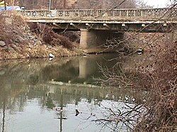
BridgesYates Avenue, Old US 70, Broadway Street, S Blue Ridge Road, I-40, US 70, Paton Hill Road, Riverwood Road, Davidson Road, Warren Wilson College Road, Tunnel Road (US 70), E Azalea Road, I-240, S Tunnel Road, Biltmore Avenue, Biltmore Estate Road

The Swannanoa River flows through the Swannanoa Valley of the region of Western North Carolina, and is a major tributary to the French Broad River. Its headwaters arise in Black Mountain, North Carolina; however, it also has a major tributary near its headwaters: Flat Creek, which begins on the slopes of Mount Mitchell. The Swannanoa River ends at its confluence with the French Broad, now within the grounds of the 8,000-acre Biltmore Estate in Asheville.

Contents

The estate encompasses numerous ancient Native American sites, including an earthwork platform mound, now known as Biltmore Mound, that is located south of the Swannanoa River. Based on evidence from excavations conducted there in the early 21st century, the mound was started by indigenous people between 400 and 550CE, with the second to last stage of the mound built about 580-600CE. It was built over a Connestee Phase habitation (built during the Pisgah phase) in the Middle Woodland period. [5]

The historic Cherokee people occupied this area, which is part of their traditional homeland in this region. The mound has been identified as an area of feasting. The Cherokee called this site near the confluence Untokiasdiyi, meaning "where they race." They used it as a meeting place and area of competitive ritual games. [6]

Under pressure from European-American settlers, the Cherokee ceded their land here in 1819. This site near the Swannanoa River was later abandoned and became overgrown. At one time there was plowing in the area, reducing the height of the mound, but it is distinguished by a much wider, oval-shaped base. The mound was rediscovered in 1984. It was first excavated in a more than two-year project by a team from Appalachian State University, beginning in 2000. [6]

The river is 22 miles or 35 kilometers long, and it flows entirely within the geographical boundaries of Buncombe County. It is a valuable resource to the county, providing drinking water to the Asheville metropolitan area, and numerous recreational opportunities. In September 2004, extremely heavy rains from the remnants of Hurricane Frances and Hurricane Ivan caused the Swannanoa to flood, causing major damage to the Biltmore Village section of Asheville, and to the other communities that it flows through.

Tributaries

(Not necessarily in order.)

Swannanoa River flooding after Hurricane Frances, September 2004 The Great Flood.JPG
Swannanoa River flooding after Hurricane Frances, September 2004

Related Research Articles

<span class="mw-page-title-main">Buncombe County, North Carolina</span> County in North Carolina, United States

Buncombe County is a county located in the U.S. state of North Carolina. It is classified within Western North Carolina. The 2020 census reported the population was 269,452. Its county seat is Asheville. Buncombe County is part of the Asheville, NC Metropolitan Statistical Area.

<span class="mw-page-title-main">Cullasaja River</span> Stream in North Carolina, USA

The Cullasaja River is a short river located entirely in Macon County, North Carolina. It is a tributary of the Little Tennessee River into which it flows near the county seat of Franklin.

<span class="mw-page-title-main">French Broad River</span> River in North Carolina and Tennessee, United States

The French Broad River is a river in the U.S. states of North Carolina and Tennessee. It flows 218 miles (351 km) from near the town of Rosman in Transylvania County, North Carolina, into Tennessee, where its confluence with the Holston River at Knoxville forms the beginning of the Tennessee River. The river flows through the counties of Transylvania, Buncombe, Henderson, and Madison in North Carolina, and Cocke, Jefferson, Sevier, and Knox in Tennessee. It drains large portions of the Pisgah National Forest and the Cherokee National Forest.

<span class="mw-page-title-main">Chickamauga Creek</span> Tributary of the Tennessee River in the United States of America

North and South Chickamauga Creek are short tributaries of the Tennessee River which join it near Chattanooga, Tennessee on the north and the south. West Chickamauga Creek is a much longer tributary of South Chickamauga Creek.

<span class="mw-page-title-main">Nottely River</span> Stream in North Carolina, USA

The Nottely River is a river in the United States. The river originates in the Blue Ridge Mountains in northern Georgia. The river flows for 51.1 miles (82.2 km) into the artificial Hiwassee Reservoir in North Carolina. The Nottely River is dammed in Georgia, creating Lake Nottely. Arkaqua Creek is a tributary.

The Roaring River is a tributary of the Yadkin River in northwestern North Carolina in the United States. Via the Yadkin it is part of the watershed of the Pee Dee River, which flows to the Atlantic Ocean. According to the Geographic Names Information System, it has also been known historically as "Roaring Creek." The river's name comes from its headwaters in the Blue Ridge Mountains, where it flows through a series of small waterfalls.

The Reddies River is a tributary of the Yadkin River in northwestern North Carolina in the United States. Via the Yadkin it is part of the watershed of the Pee Dee River, which flows to the Atlantic Ocean. According to the Geographic Names Information System, it has also been known historically as "Reddis River."

<span class="mw-page-title-main">Soque River</span>

The Soque River and its watershed are located entirely within the county boundaries of Habersham County in northeast Georgia. The Soque is a tributary of the Chattahoochee River. Portions of the river run along State Route 197.

<span class="mw-page-title-main">North Fork Feather River</span> River in California, United States

The North Fork Feather River is a watercourse of the northern Sierra Nevada and southern Cascades in the U.S. state of California. It flows generally southwards from its headwaters near Lassen Peak to Lake Oroville, a reservoir formed by Oroville Dam in the foothills of the Sierra, where it runs into the Feather River. The river drains about 2,100 square miles (5,400 km2) of the western slope of the Sierras. By discharge, it is the largest tributary of the Feather.

The Pisgah phase is an archaeological phase of the South Appalachian Mississippian culture in Southeast North America. It is associated with the Appalachian Summit area of southeastern Tennessee, Western North Carolina, and northwestern South Carolina in what is now the United States.

<span class="mw-page-title-main">Valley River</span> Stream in North Carolina, USA

The Valley River is a tributary of the Hiwassee River. It arises as a pair of springs in the Snowbird Mountains of Cherokee County, North Carolina and descends 2,960 feet (900 m) in elevation in approximately forty miles (64 km) to enter the Hiwassee embayment at present-day Murphy, North Carolina.

<span class="mw-page-title-main">South Toe River</span> River in North Carolina, United States

The South Toe River is a river in Yancey County in Western North Carolina. The name Toe is taken from its original name Estatoe, pronounced 'S - ta - toe', a native American name associated with the Estatoe trade route leading down from the NC mountains through Brevard where there is a historical plaque with information that affirms the route, on into South Carolina where a village of the same name was located.

Tenmile Creek is a stream in Washington and Greene Counties, Pennsylvania, USA. It is a tributary of the Monongahela River.

Flat Creek is a 5.39 mi (8.67 km) long 2nd order tributary to the Swannanoa River in Buncombe County, North Carolina. It is impounded at Montreat Reservoir and Lake Susan.

Tomahawk Branch is a 2.61 mi (4.20 km) long 1st order tributary to the Swannanoa River in Buncombe County, North Carolina. It has one impoundment at Lake Tomahawk.

Wolfpit Branch is a 2.55 mi (4.10 km) long 2nd order tributary to the Swannanoa River in Buncombe County, North Carolina.

North Fork Swannanoa River is a 11.23 mi (18.07 km) long 3rd order tributary to the Swannanoa River in Buncombe County, North Carolina.

Camp Branch is a 1.54 mi (2.48 km) long 2nd order tributary to the Swannanoa River in Buncombe County, North Carolina.

Beetree Creek is a 8.05 mi (12.96 km) long 2nd order tributary to the Swannanoa River in Buncombe County, North Carolina.

Stepp Branch is a 1.61 mi (2.59 km) long 1st order tributary to the Swannanoa River in Buncombe County, North Carolina.

References

  1. 1 2 "GNIS Detail - Swannanoa River". geonames.usgs.gov. US Geological Survey. Retrieved 12 October 2019.
  2. 1 2 "Swannanoa River Topo Map, Buncombe County NC (Asheville Area)". TopoZone. Locality, LLC. Retrieved 12 October 2019.
  3. "ArcGIS Web Application". epa.maps.arcgis.com. US EPA. Retrieved 12 October 2019.
  4. 1 2 "Swannanoa River Watershed Report". Waters Geoviewer. US EPA. Retrieved 12 October 2019.
  5. Kimball, Larry R; Whyte, Thomas R.; Crites, Larry D. Crites (28 Jan 2015). "The Biltmore Mound and Hopewellian Mound Use in the Southern Appalachians". Southeastern Archeology. 29 (2010, Issue 1): 44–58. doi:10.1179/sea.2010.29.1.004. S2CID   129808107 . Retrieved 9 Nov 2020.
  6. 1 2 Whitmire, Tim (9 Feb 2003). "Gilded-Age Opulence Shelters Prehistoric Tribe's Artifacts". Los Angeles Times. Retrieved 8 Nov 2020.