Swannanoa, North Carolina

Last updated

Swannanoa, North Carolina
Buncombe County North Carolina incorporated and unincorporated areas Swannanoa highlighted.svg
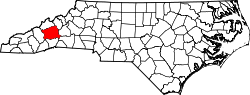
Location in Buncombe County and the state of North Carolina
Coordinates: 35°36′22″N82°22′18″W / 35.60611°N 82.37167°W / 35.60611; -82.37167
Country United States
State North Carolina
County Buncombe
Area
[1]
  Total6.41 sq mi (16.59 km2)
  Land6.38 sq mi (16.51 km2)
  Water0.03 sq mi (0.08 km2)
Elevation
[2]
2,225 ft (678 m)
Population
 (2020)
  Total5,021
  Density787.61/sq mi (304.11/km2)
Time zone UTC−5 (Eastern (EST))
  Summer (DST) UTC−4 (EDT)
ZIP Code
28778
Area code 828
FIPS code 37-66280 [3]
GNIS feature ID2402907 [2]

Swannanoa is a census-designated place (CDP) in Buncombe County, North Carolina, United States. The population 5,021 at the 2020 census [4] up from 4,576 at the 2010 census. [5] The community is named for the Swannanoa River, which flows through the settlement. It is part of the Asheville Metropolitan Statistical Area.

Contents

History

Swannanoa is located several miles west of Black Mountain just prior to Oteen and eastern Asheville. As the district continues to grow it has three fast food restaurants amongst several local based eateries. With plenty of trails and forest land it is a beautiful mountain area enriched with manufacturing history of the once great Beacon Blanket Mill. Alexander Inn was listed on the National Register of Historic Places in 1984. [6]

Geography

Swannanoa is located in eastern Buncombe County between Asheville and Black Mountain. Interstate 40 passes through the main commercial area of Swannanoa.

According to the United States Census Bureau, the CDP has a total area of 6.4 square miles (16.7 km2), of which 6.4 square miles (16.6 km2) is land and 0.04 square miles (0.1 km2), or 0.53%, is water. [5]

Demographics

Historical population
CensusPop.Note
2020 5,021
U.S. Decennial Census [7]

2020 census

Swannanoa racial composition [8]
RaceNumberPercentage
White (non-Hispanic)3,81075.88%
Black or African American (non-Hispanic)2324.62%
Native American 400.8%
Asian 280.56%
Pacific Islander 70.14%
Other/Mixed 2675.32%
Hispanic or Latino 63712.69%

As of the 2020 United States census, there were 5,021 people, 1,614 households, and 837 families residing in the CDP.

2000 census

At the 2000 census, [3] there were 4,132 people, 1,652 households and 1,113 families residing in the CDP. The population density was 649.5 inhabitants per square mile (250.8/km2). There were 1,774 housing units at an average density of 278.9 per square mile (107.7/km2). The racial makeup was 91.53% White, 5.06% African American, 0.46% Native American, 0.65% Asian, 0.02% Pacific Islander, 1.21% from other races, and 1.06% from two or more races. Hispanic or Latino of any race were 2.52% of the population.

There were 1,652 households, of which 30.0% had children under the age of 18 living with them, 50.1% were married couples living together, 12.2% had a female householder with no husband present, and 32.6% were non-families. 28.6% of all households were made up of individuals, and 11.9% had someone living alone who was 65 years of age or older. The average household size was 2.34 and the average family size was 2.86.

27.9% of the population were under the age of 18, 7.4% from 18 to 24, 28.5% from 25 to 44, 22.5% from 45 to 64, and 13.6% who were 65 years of age or older. The median age was 36 years. For every 100 females, there were 103.1 males. For every 100 females age 18 and over, there were 89.0 males.

The median household income was $31,218 and the median family income was $39,980. Males had a median income of $27,561 and females $22,939. The per capita income was $16,804. About 8.5% of families and 11.4% of the population were below the poverty line, including 17.2% of those under age 18 and 12.3% of those age 65 or over.

Government and infrastructure

The North Carolina Department of Public Safety (formerly the North Carolina Department of Corrections) operates the Swannanoa Correctional Center for Women in Swannanoa. It opened on July 7, 2008, taking women previously at the Black Mountain Correctional Center for Women. [9]

The North Carolina Department of Juvenile Justice and Delinquency Prevention formerly operated the Swannanoa Valley Youth Development Center in Swannanoa for delinquent boys, including those without sufficient English fluency. It opened in 1961. [10]

Originally growing from the Beacon Fire Brigade, Swannanoa receives fire protection from Swannanoa Fire and Rescue who holds a class 2 ISO rating providing 24/7 Full time coverage out of its main station at 103 South Avenue and out of a substation at 510 Bee Tree Rd providing fire protection, first response and, technical rescue.

Education

Warren Wilson College is located west of the Swannanoa CDP.

Charles D Owen High school provides high school education for grades 9-12 for the Swannanoa and Black Mountain Communities as well as parts of Riceville.

Buncombe Community Schools along with Art Space Charter School are also located in Swannanoa.

Brad Johnson was a graduate of Charles D. Owen High School. He went on to play in the National Football League for the Super Bowl XXXVII Champion Tampa Bay Buccaneers.

Related Research Articles

<span class="mw-page-title-main">Buncombe County, North Carolina</span> County in North Carolina, United States

Buncombe County is a county located in the U.S. state of North Carolina. It is classified within Western North Carolina. The 2020 census reported the population was 269,452. Its county seat is Asheville. Buncombe County is part of the Asheville, NC Metropolitan Statistical Area.

<span class="mw-page-title-main">Fort Pierce North, Florida</span> CDP in Florida, United States

Fort Pierce North is a census-designated place (CDP) in St. Lucie County, Florida, United States. Per the 2020 census, the population was 6,904. It is part of the Port St. Lucie Metropolitan Statistical Area.

<span class="mw-page-title-main">Avery Creek, North Carolina</span> Census-designated place in North Carolina, United States

Avery Creek is a census-designated place (CDP) in Buncombe County, North Carolina, United States. The population was 1,950 at the 2010 census. It is part of the Asheville Metropolitan Statistical Area.

<span class="mw-page-title-main">Bent Creek, Buncombe County, North Carolina</span> Census-designated place in North Carolina, United States

Bent Creek is a census-designated place (CDP) in Buncombe County, North Carolina, United States. The population was 1,287 at the 2010 census. The Bent Creek area has mountain bike trails within the Pisgah National Forest.

<span class="mw-page-title-main">Biltmore Forest, North Carolina</span> Town in North Carolina, United States

Biltmore Forest is a town in Buncombe County, North Carolina, United States. The population was 1,343 in 2010. It is part of the Asheville Metropolitan Statistical Area. Biltmore Forest is the second-wealthiest town in North Carolina by per capita income at $85,044.

<span class="mw-page-title-main">Black Mountain, North Carolina</span> Town in North Carolina

Black Mountain is a town in Buncombe County, North Carolina, United States. The population was 8,426 at the 2020 United States census. It is part of the Asheville Metropolitan Statistical Area. The town is named for the old train stop at the Black Mountain Depot and is located at the southern end of the Black Mountain range of the Blue Ridge Mountains in the Southern Appalachians.

<span class="mw-page-title-main">Fairview, Buncombe County, North Carolina</span> Census-designated place in North Carolina, United States

Fairview is a census-designated place (CDP) in Buncombe County, North Carolina, United States. The population was 2,678 at the 2010 census. It is part of the Asheville Metropolitan Statistical Area.

<span class="mw-page-title-main">Montreat, North Carolina</span> Town in North Carolina, United States

Montreat is a town in Buncombe County, North Carolina, United States. The population was 723 at the 2010 census. It is part of the Asheville Metropolitan Statistical Area. The town is best known for Montreat Conference Center and Montreat College, and for having been the home of the evangelist Billy Graham (1918-2018) and his wife Ruth Bell Graham (1920-2007).

<span class="mw-page-title-main">Royal Pines, North Carolina</span> Census-designated place in North Carolina, United States

Royal Pines is a census-designated place (CDP) in Buncombe County, North Carolina, United States. The population was 4,272 at the 2010 census. It is part of the Asheville Metropolitan Statistical Area.

<span class="mw-page-title-main">Weaverville, North Carolina</span> Town in North Carolina, United States

Weaverville is a town in Buncombe County, North Carolina, United States. The population was 4,567 at the 2020 census. It is part of the Asheville Metropolitan Statistical Area.

<span class="mw-page-title-main">Woodfin, North Carolina</span> Town in North Carolina, United States

Woodfin is a town in Buncombe County, North Carolina, United States. The population was 6,123 as of the 2010 census. It is part of the Asheville Metropolitan Statistical Area. The town is named for Nicholas Washington Woodfin, a renowned lawyer and statesman of early North Carolina, under whom Governor Zebulon Vance clerked as an attorney. Woodfin is the only municipality bearing the name Woodfin in the United States. The town was incorporated in 1971, although the community itself dates back to at least the mid-19th century.

<span class="mw-page-title-main">West Canton, North Carolina</span> Census-designated place in North Carolina, United States

West Canton is an unincorporated community and census-designated place (CDP) in Haywood County, North Carolina, United States. The population was 1,247 at the 2010 census. It is part of the Asheville Metropolitan Statistical Area.

<span class="mw-page-title-main">Balfour, North Carolina</span> Census-designated place in North Carolina, United States

Balfour is an unincorporated community and census-designated place (CDP) in Henderson County, North Carolina, United States. The population was 1,187 at the 2010 census. It is part of the Asheville Metropolitan Statistical Area.

<span class="mw-page-title-main">Barker Heights, North Carolina</span> Census-designated place in North Carolina, United States

Barker Heights is an unincorporated area and census-designated place (CDP) in Henderson County, North Carolina, United States. The population was 1,254 at the 2010 census. It is part of the Asheville Metropolitan Statistical Area.

<span class="mw-page-title-main">East Flat Rock, North Carolina</span> Census-designated place in North Carolina, United States

East Flat Rock is an unincorporated area and census-designated place (CDP) in Henderson County, North Carolina, United States. The population was 4,995 at the 2010 census, up from 4,151 at the 2000 census. It is part of the Asheville Metropolitan Statistical Area.

<span class="mw-page-title-main">Etowah, North Carolina</span> Census-designated place in Henderson County, North Carolina, USA

Etowah is an unincorporated community and census-designated place (CDP) in Henderson County, North Carolina, United States. The population was 6,944 at the 2010 census. It is part of the Asheville Metropolitan Statistical Area.

<span class="mw-page-title-main">Fletcher, North Carolina</span> Town in North Carolina, United States

Fletcher is a town in Henderson County, North Carolina, United States. The population was 7,187 at the 2010 census, and was estimated to be 8,333 in 2018.

<span class="mw-page-title-main">Mountain Home, North Carolina</span> Census-designated place in North Carolina, United States

Mountain Home is an unincorporated community and census-designated place (CDP) in Henderson County, North Carolina, United States. The population was 3,622 at the 2010 census, up from 2,169 in 2000. It is part of the Asheville Metropolitan Statistical Area.

<span class="mw-page-title-main">Valley Hill, North Carolina</span> Census-designated place in North Carolina, United States

Valley Hill is an unincorporated community and census-designated place (CDP) in Henderson County, North Carolina, United States. The population was 2,070 at the 2010 census. It is part of the Asheville Metropolitan Statistical Area.

<span class="mw-page-title-main">Asheville metropolitan area</span> Metropolitan area in North Carolina, United States

The Asheville metropolitan area is a metropolitan area centered on the principal city of Asheville, North Carolina. The U.S. Office of Management and Budget defines the Asheville, NC Metropolitan Statistical Area, a metropolitan statistical area used by the United States Census Bureau and other entities, as comprising the four counties of Buncombe, Haywood, Henderson, and Madison. The area's population was 424,858 according to the 2010 census, and 469,454 according to the 2020 census.

References

  1. "ArcGIS REST Services Directory". United States Census Bureau. Retrieved September 20, 2022.
  2. 1 2 U.S. Geological Survey Geographic Names Information System: Swannanoa, North Carolina
  3. 1 2 "U.S. Census website". United States Census Bureau . Retrieved January 31, 2008.
  4. https://data.tennessean.com/census/total-population/total-population-change/swannanoa-cdp-north-carolina/160-3766280/
  5. 1 2 "Geographic Identifiers: 2010 Demographic Profile Data (G001): Fairview CDP, North Carolina". U.S. Census Bureau, American Factfinder. Archived from the original on February 12, 2020. Retrieved February 13, 2014.
  6. "National Register Information System". National Register of Historic Places . National Park Service. July 9, 2010.
  7. "Census of Population and Housing". Census.gov. Retrieved June 4, 2016.
  8. "Explore Census Data". data.census.gov. Retrieved December 19, 2021.
  9. "Swannanoa Correctional Center for Women". North Carolina Department of Public Safety. Retrieved December 17, 2015. "Street Address 55 Lake Eden Road Black Mountain, N.C. 28711"
  10. "Swannanoa Valley YDC" (Archive). North Carolina Department of Juvenile Justice and Delinquency Prevention. April 28, 2006. Retrieved December 16, 2015.