Woodfin, North Carolina

Last updated

Woodfin, North Carolina
Woodfin, NC Town Flag.gif
Woodfin, NC Town Seal.png
Buncombe County North Carolina incorporated and unincorporated areas Woodfin highlighted.svg
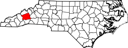
Location in Buncombe County and the state of North Carolina
Coordinates: 35°38′44″N82°35′29″W / 35.64556°N 82.59139°W / 35.64556; -82.59139
Country United States
State North Carolina
County Buncombe
Government
  Type Mayor-council [1]
  MayorJim McAllister [2]
Area
[3]
  Total9.57 sq mi (24.78 km2)
  Land9.19 sq mi (23.80 km2)
  Water0.38 sq mi (0.97 km2)
Elevation
[4]
2,123 ft (647 m)
Population
 (2020)
  Total7,936
  Density863.45/sq mi (333.39/km2)
Time zone UTC-5 (Eastern (EST))
  Summer (DST) UTC-4 (EDT)
FIPS code 37-75280 [5]
GNIS feature ID2406909 [4]
Website www.woodfin-nc.gov

Woodfin is a town in Buncombe County, North Carolina, United States. The population was 6,123 as of the 2010 census. [6] It is part of the Asheville Metropolitan Statistical Area. The town is named for Nicholas Washington Woodfin, a renowned lawyer and statesman of early North Carolina, under whom Governor Zebulon Vance clerked as an attorney. Woodfin is the only municipality bearing the name Woodfin in the United States. The town was incorporated in 1971, although the community itself dates back to at least the mid-19th century.

Contents

History

Nicholas Washington Woodfin Nicholas Washington Woodfin.png
Nicholas Washington Woodfin

The town's history is closely tied to manufacturing. Much of the remaining early housing stock is characteristic of early 20th century mill villages. Many neighborhoods within the community bear names tied to the industry, such as "Martel Village" and "Company Bottom". The decline of American industry in the 1970s and '80s brought a decline to the economy of Woodfin as well. The loss of many manufacturing jobs led to a decline in population and property values. Starting in the 1990s, however, the town has experienced new residential growth, due primarily to the influx of new residents to western North Carolina. Woodfin's economy today is a mix of large- and small-scale manufacturing, combined with a variety of residential and commercial districts. It is the 115th largest municipality in the state.

North Carolina Electrical Power Company Electric Generating Plant was listed on the National Register of Historic Places in 1999. [7]

Geography

Woodfin is located in central Buncombe County, bordering the north side of the city of Asheville.

According to the U.S. Census Bureau, the town of Woodfin has a total area of 9.2 square miles (23.8 km2), of which 8.8 square miles (22.8 km2) is land and 0.42 square miles (1.1 km2), or 4.47%, is water. [6] The French Broad River flows through the western part of the town.

Government

The town is governed by a seven-member board consisting of a mayor and six council members. The council members serve four-year terms with staggered elections of three every two years. The board meets at 5:00 PM on the third Tuesday of every month, held at the Woodfin Town Hall. [8]

Public services and utilities

Sewer services are provided by the Metropolitan Sewerage District of Buncombe County.

Water services are provided by one of three water systems that serve various parts of Woodfin: Woodfin Water District, Asheville Water Authority, and Weaverville Water Department.

Town services include police, sanitation, street maintenance and construction, planning and zoning, animal control, street lighting, parks and recreation, and administration. Fire services are provided by one of three Fire Service Districts.

Demographics

Historical population
CensusPop.Note
1980 3,260
1990 2,736−16.1%
2000 3,16215.6%
2010 6,12393.6%
2020 7,93629.6%
U.S. Decennial Census [9]

2020 census

Woodfin racial composition [10]
RaceNumberPercentage
White (non-Hispanic)6,23978.62%
Black or African American (non-Hispanic)4155.23%
Native American 290.37%
Asian 1371.73%
Pacific Islander 100.13%
Other/Mixed 3894.9%
Hispanic or Latino 7179.03%

As of the 2020 United States census, there were 7,936 people, 2,495 households, and 1,390 families residing in the town.

2000 census

As of the census [5] of 2000, there were 3,162 people, 1,394 households, and 769 families residing in the town. The population density was 905.2 inhabitants per square mile (349.5/km2). There were 1,521 housing units at an average density of 435.4 per square mile (168.1/km2). The racial makeup of the town was 92.66% White, 1.96% African American, 0.35% Native American, 0.41% Asian, 3.29% from other races, and 1.33% from two or more races. Hispanic or Latino of any race were 6.70% of the population.

There were 1,394 households, out of which 22.5% had children under the age of 18 living with them, 37.5% were married couples living together, 12.7% had a female householder with no husband present, and 44.8% were non-families. 35.2% of all households were made up of individuals, and 12.9% had someone living alone who was 65 years of age or older. The average household size was 2.19 and the average family size was 2.84.

In the town, the population was spread out, with 19.2% under the age of 18, 10.9% from 18 to 24, 30.5% from 25 to 44, 21.1% from 45 to 64, and 18.3% who were 65 years of age or older. The median age was 37 years. For every 100 females, there were 88.7 males. For every 100 females age 18 and over, there were 87.7 males.

The median income for a household in the town was $27,525, and the median income for a family was $30,909. Males had a median income of $22,351 versus $23,176 for females. The per capita income for the town was $17,408. Roughly 14.6% of families and 21.5% of the population were below the poverty line, including 37.1% of those under age 18 and 15.4% of those age 65 or over.

Related Research Articles

<span class="mw-page-title-main">Buncombe County, North Carolina</span> County in North Carolina, United States

Buncombe County is a county located in the U.S. state of North Carolina. It is classified within Western North Carolina. The 2020 census reported the population was 269,452. Its county seat is Asheville. Buncombe County is part of the Asheville, NC Metropolitan Statistical Area.

<span class="mw-page-title-main">Buncombe, Illinois</span> Village in Illinois, United States

Buncombe is a village in Johnson County, Illinois, United States. The population was 203 at the 2010 census and as of 2018, the population had declined to an estimated 173.

<span class="mw-page-title-main">Avery Creek, North Carolina</span> Census-designated place in North Carolina, United States

Avery Creek is a census-designated place (CDP) in Buncombe County, North Carolina, United States. The population was 1,950 at the 2010 census. It is part of the Asheville Metropolitan Statistical Area.

<span class="mw-page-title-main">Bent Creek, Buncombe County, North Carolina</span> Census-designated place in North Carolina, United States

Bent Creek is a census-designated place (CDP) in Buncombe County, North Carolina, United States. The population was 1,287 at the 2010 census. The Bent Creek area has mountain bike trails within the Pisgah National Forest.

<span class="mw-page-title-main">Biltmore Forest, North Carolina</span> Town in North Carolina, United States

Biltmore Forest is a town in Buncombe County, North Carolina, United States. The population was 1,343 in 2010. It is part of the Asheville Metropolitan Statistical Area. Biltmore Forest is the second-wealthiest town in North Carolina by per capita income at $85,044.

<span class="mw-page-title-main">Black Mountain, North Carolina</span> Town in North Carolina

Black Mountain is a town in Buncombe County, North Carolina, United States. The population was 8,426 at the 2020 United States census. It is part of the Asheville Metropolitan Statistical Area. The town is named for the old train stop at the Black Mountain Depot and is located at the southern end of the Black Mountain range of the Blue Ridge Mountains in the Southern Appalachians.

<span class="mw-page-title-main">Fairview, Buncombe County, North Carolina</span> Census-designated place in North Carolina, United States

Fairview is a census-designated place (CDP) in Buncombe County, North Carolina, United States. The population was 2,678 at the 2010 census. It is part of the Asheville Metropolitan Statistical Area.

<span class="mw-page-title-main">Montreat, North Carolina</span> Town in North Carolina, United States

Montreat is a town in Buncombe County, North Carolina, United States. The population was 723 at the 2010 census. It is part of the Asheville Metropolitan Statistical Area. The town is best known for Montreat Conference Center and Montreat College, and for having been the home of the evangelist Billy Graham (1918-2018) and his wife Ruth Bell Graham (1920-2007).

<span class="mw-page-title-main">Royal Pines, North Carolina</span> Census-designated place in North Carolina, United States

Royal Pines is a census-designated place (CDP) in Buncombe County, North Carolina, United States. The population was 4,272 at the 2010 census. It is part of the Asheville Metropolitan Statistical Area.

<span class="mw-page-title-main">Swannanoa, North Carolina</span> Census-designated place in North Carolina, US

Swannanoa is a census-designated place (CDP) in Buncombe County, North Carolina, United States. The population 5,021 at the 2020 census up from 4,576 at the 2010 census. The community is named for the Swannanoa River, which flows through the settlement. It is part of the Asheville Metropolitan Statistical Area.

<span class="mw-page-title-main">Weaverville, North Carolina</span> Town in North Carolina, United States

Weaverville is a town in Buncombe County, North Carolina, United States. The population was 4,567 at the 2020 census. It is part of the Asheville Metropolitan Statistical Area.

<span class="mw-page-title-main">Catawba, North Carolina</span> Town in North Carolina, United States

Catawba is a town in Catawba County, North Carolina, United States. The population was 603 at the 2010 census. It is part of the Hickory–Lenoir–Morganton Metropolitan Statistical Area. As with the county, the name recalls the Catawba people, the indigenous people who once inhabited the area.

<span class="mw-page-title-main">Stokesdale, North Carolina</span> Town in North Carolina, United States

Stokesdale is a town in Guilford County, North Carolina, United States with small parts in the counties of Rockingham, Forsyth, and Stokes. The population was 5,924 at the 2020 census. Belews Lake is located nearby, and North Carolina Highway 68 and North Carolina Highway 65 both intersect U.S. Route 158 near the town's center.

<span class="mw-page-title-main">Balfour, North Carolina</span> Census-designated place in North Carolina, United States

Balfour is an unincorporated community and census-designated place (CDP) in Henderson County, North Carolina, United States. The population was 1,187 at the 2010 census. It is part of the Asheville Metropolitan Statistical Area.

<span class="mw-page-title-main">East Flat Rock, North Carolina</span> Census-designated place in North Carolina, United States

East Flat Rock is an unincorporated area and census-designated place (CDP) in Henderson County, North Carolina, United States. The population was 4,995 at the 2010 census, up from 4,151 at the 2000 census. It is part of the Asheville Metropolitan Statistical Area.

<span class="mw-page-title-main">Fletcher, North Carolina</span> Town in North Carolina, United States

Fletcher is a town in Henderson County, North Carolina, United States. The population was 7,187 at the 2010 census, and was estimated to be 8,333 in 2018.

<span class="mw-page-title-main">Hendersonville, North Carolina</span> City in North Carolina, United States

Hendersonville is a city in Henderson County, North Carolina, United States. It is 22 miles (35 km) south of Asheville and is the county seat of Henderson County. Like the county, the city is named for 19th-century North Carolina Supreme Court Chief Justice Leonard Henderson.

<span class="mw-page-title-main">Mountain Home, North Carolina</span> Census-designated place in North Carolina, United States

Mountain Home is an unincorporated community and census-designated place (CDP) in Henderson County, North Carolina, United States. The population was 3,622 at the 2010 census, up from 2,169 in 2000. It is part of the Asheville Metropolitan Statistical Area.

<span class="mw-page-title-main">Valley Hill, North Carolina</span> Census-designated place in North Carolina, United States

Valley Hill is an unincorporated community and census-designated place (CDP) in Henderson County, North Carolina, United States. The population was 2,070 at the 2010 census. It is part of the Asheville Metropolitan Statistical Area.

<span class="mw-page-title-main">Columbus, North Carolina</span> Town in North Carolina, United States

Columbus is a town in Polk County, North Carolina, United States. The population was 999 at the 2010 census. It is the county seat of Polk County.

References

  1. "Forms of Government and Methods of Election in North Carolina Cities | UNC School of Government". www.sog.unc.edu. UNC School of Government. Retrieved January 15, 2024.
  2. "Woodfin, NC". www.woodfin-nc.gov. Retrieved January 15, 2024.
  3. "ArcGIS REST Services Directory". United States Census Bureau. Retrieved September 20, 2022.
  4. 1 2 U.S. Geological Survey Geographic Names Information System: Woodfin, North Carolina
  5. 1 2 "U.S. Census website". United States Census Bureau . Retrieved January 31, 2008.
  6. 1 2 "Geographic Identifiers: 2010 Demographic Profile Data (G001): Woodfin town, North Carolina". U.S. Census Bureau, American Factfinder. Archived from the original on February 12, 2020. Retrieved February 12, 2014.
  7. "National Register Information System". National Register of Historic Places . National Park Service. July 9, 2010.
  8. "Town of Woodfin Homepage" . Retrieved July 23, 2010.
  9. "Census of Population and Housing". Census.gov. Retrieved June 4, 2015.
  10. "Explore Census Data". data.census.gov. Retrieved December 19, 2021.