Bent Creek, Buncombe County, North Carolina

Last updated

Bent Creek, North Carolina
Buncombe County North Carolina incorporated and unincorporated areas Bent Creek highlighted.svg
Location in Buncombe County and the state of North Carolina
Coordinates: 35°30′29″N82°37′04″W / 35.50806°N 82.61778°W / 35.50806; -82.61778
Country United States
State North Carolina
County Buncombe
Area
[1]
  Total2.22 sq mi (5.74 km2)
  Land2.21 sq mi (5.72 km2)
  Water0.01 sq mi (0.02 km2)
Elevation
[2]
2,156 ft (657 m)
Population
 (2020)
  Total1,402
  Density634.39/sq mi (244.97/km2)
Time zone UTC-5 (Eastern (EST))
  Summer (DST) UTC-4 (EDT)
FIPS code 37-05049 [3]
GNIS feature ID2402683 [2]

Bent Creek is a census-designated place (CDP) in Buncombe County, North Carolina, United States. The population was 1,287 at the 2010 census. [4] The Bent Creek area has mountain bike trails within the Pisgah National Forest.

Contents

History

For its first 70 years, Bent Creek was "a self-sufficient community". From 1866 to 1887, Glencoe was an Episcopal mission, part of Ravenscroft Theological Training School and Associate Mission, started by Colonel L.M. Hatch, with a mill, a factory, a school and a church. It was named for "a Celtic hero's homeland." Col. Hatch's family sold 1383 acres for $5 an acre in 1900 to George Washington Vanderbilt II, who was adding a game preserve and hunting area to Biltmore Estate. The land later became part of Pisgah National Forest. Russell "Pinckney" Lance had a grist mill and had a "self-sufficient farm". Other farmers used methods intended to keep the farms operating for generations. Later, the area became Bent Creek Experimental Forest. [5] [6]

Geography

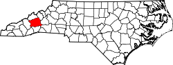
The Bent Creek CDP is located in south-central Buncombe County, southwest of downtown Asheville. It is bordered to the east by North Carolina Highway 191 (Brevard Road), to the southeast by Wesley Branch Road, to the southwest by Wolf Branch (or Wolf Creek), to the northwest by the crest of Stradley Mountain, and to the north by Boring Mill Branch. The bulk of the community centers around Bent Creek Ranch Lake on Wesley Creek. The 434-acre (176 ha) North Carolina Arboretum and Bent Creek Experimental Forest are located just outside the CDP to the south of Wesley Branch Road.

According to the United States Census Bureau, the Bent Creek CDP has a total area of 2.2 square miles (5.7 km2), of which 0.008 square miles (0.02 km2), or 0.35%, is water. [4]

Climate

Climate data for Bent Creek, Buncombe County, North Carolina, 1991–2020 normals, extremes 1949present
MonthJanFebMarAprMayJunJulAugSepOctNovDecYear
Record high °F (°C)82
(28)
81
(27)
89
(32)
90
(32)
91
(33)
98
(37)
98
(37)
100
(38)
97
(36)
89
(32)
83
(28)
76
(24)
100
(38)
Mean maximum °F (°C)65.6
(18.7)
69.2
(20.7)
77.0
(25.0)
83.4
(28.6)
86.0
(30.0)
89.1
(31.7)
90.9
(32.7)
89.9
(32.2)
87.0
(30.6)
81.5
(27.5)
73.0
(22.8)
66.8
(19.3)
91.8
(33.2)
Average high °F (°C)46.3
(7.9)
50.6
(10.3)
58.0
(14.4)
67.7
(19.8)
74.9
(23.8)
81.0
(27.2)
84.0
(28.9)
83.0
(28.3)
77.2
(25.1)
68.0
(20.0)
57.4
(14.1)
49.0
(9.4)
66.4
(19.1)
Daily mean °F (°C)35.4
(1.9)
38.4
(3.6)
45.0
(7.2)
53.8
(12.1)
62.3
(16.8)
69.4
(20.8)
72.9
(22.7)
71.8
(22.1)
65.8
(18.8)
55.2
(12.9)
44.5
(6.9)
38.1
(3.4)
54.4
(12.4)
Average low °F (°C)24.5
(−4.2)
26.1
(−3.3)
32.0
(0.0)
39.8
(4.3)
49.8
(9.9)
57.8
(14.3)
61.7
(16.5)
60.6
(15.9)
54.4
(12.4)
42.5
(5.8)
31.5
(−0.3)
27.2
(−2.7)
42.3
(5.7)
Mean minimum °F (°C)7.1
(−13.8)
12.7
(−10.7)
17.7
(−7.9)
27.0
(−2.8)
34.6
(1.4)
46.7
(8.2)
54.1
(12.3)
52.1
(11.2)
41.4
(5.2)
27.7
(−2.4)
19.0
(−7.2)
13.3
(−10.4)
4.8
(−15.1)
Record low °F (°C)−16
(−27)
−5
(−21)
−1
(−18)
17
(−8)
26
(−3)
33
(1)
40
(4)
38
(3)
29
(−2)
15
(−9)
−1
(−18)
−9
(−23)
−16
(−27)
Average precipitation inches (mm)4.50
(114)
3.57
(91)
4.64
(118)
4.46
(113)
4.12
(105)
4.75
(121)
5.19
(132)
4.13
(105)
4.74
(120)
3.64
(92)
4.07
(103)
4.20
(107)
52.01
(1,321)
Average snowfall inches (cm)1.7
(4.3)
0.4
(1.0)
1.3
(3.3)
0.0
(0.0)
0.0
(0.0)
0.0
(0.0)
0.0
(0.0)
0.0
(0.0)
0.0
(0.0)
0.0
(0.0)
0.0
(0.0)
0.6
(1.5)
4.0
(10)
Average precipitation days (≥ 0.01 in)10.29.511.810.39.913.012.612.08.66.78.19.9122.6
Average snowy days (≥ 0.1 in)0.50.60.30.10.00.00.00.00.00.00.00.31.8
Source 1: NOAA [7]
Source 2: National Weather Service [8]

Demographics

Historical population
CensusPop.Note
2020 1,402
U.S. Decennial Census [9]

As of the census [3] of 2000, there were 1,389 people, 552 households, and 418 families residing in the CDP. The population density was 627.6 inhabitants per square mile (242.3/km2). There were 583 housing units at an average density of 263.4 per square mile (101.7/km2). The racial makeup of the CDP was 97.41% White, 0.43% African American, 0.22% Native American, 1.01% Asian, 0.29% from other races, and 0.65% from two or more races. Hispanic or Latino of any race were 1.08% of the population.

There were 552 households, out of which 33.0% had children under the age of 18 living with them, 65.8% were married couples living together, 6.5% had a female householder with no husband present, and 24.1% were non-families. 19.7% of all households were made up of individuals, and 6.9% had someone living alone who was 65 years of age or older. The average household size was 2.52 and the average family size was 2.90.

In the CDP, the population was spread out, with 24.0% under the age of 18, 4.8% from 18 to 24, 29.9% from 25 to 44, 27.6% from 45 to 64, and 13.7% who were 65 years of age or older. The median age was 40 years. For every 100 females, there were 96.7 males. For every 100 females age 18 and over, there were 91.1 males.

The median income for a household in the CDP was $49,375, and the median income for a family was $57,768. Males had a median income of $36,136 versus $27,964 for females. The per capita income for the CDP was $22,138. About 6.7% of families and 9.0% of the population were below the poverty line, including 8.6% of those under age 18 and 18.6% of those age 65 or over.

Related Research Articles

<span class="mw-page-title-main">Yancey County, North Carolina</span> County in North Carolina, United States

Yancey County is a county located in the U.S. state of North Carolina. As of the 2020 census, the population was 18,470. Its county seat is Burnsville.

<span class="mw-page-title-main">Transylvania County, North Carolina</span> County in North Carolina, United States

Transylvania County is a county in the U.S. state of North Carolina. As of the 2020 census the population is 32,986. Its county seat is Brevard.

<span class="mw-page-title-main">Madison County, North Carolina</span> County in North Carolina, United States

Madison County is a county located in the U.S. state of North Carolina. As of the 2020 census, the population was 21,193. Its county seat is Marshall. Madison County is part of the Asheville, NC Metropolitan Statistical Area.

<span class="mw-page-title-main">Henderson County, North Carolina</span> County in North Carolina, United States

Henderson County is a county located in the U.S. state of North Carolina. As of the 2020 census, the population was 116,281. Its county seat is Hendersonville.

<span class="mw-page-title-main">Haywood County, North Carolina</span> County in North Carolina, United States

Haywood County is a county located in the U.S. state of North Carolina. As of the 2020 census, the population was 62,089. The county seat and its largest city is Waynesville.

<span class="mw-page-title-main">Buncombe County, North Carolina</span> County in North Carolina, United States

Buncombe County is a county located in the U.S. state of North Carolina. It is classified within Western North Carolina. The 2020 census reported the population was 269,452. Its county seat is Asheville. Buncombe County is part of the Asheville, NC Metropolitan Statistical Area.

<span class="mw-page-title-main">Avery Creek, North Carolina</span> Census-designated place in North Carolina, United States

Avery Creek is a census-designated place (CDP) in Buncombe County, North Carolina, United States. The population was 1,950 at the 2010 census. It is part of the Asheville Metropolitan Statistical Area.

<span class="mw-page-title-main">Biltmore Forest, North Carolina</span> Town in North Carolina, United States

Biltmore Forest is a town in Buncombe County, North Carolina, United States. The population was 1,343 in 2010. It is part of the Asheville Metropolitan Statistical Area. Biltmore Forest is the second-wealthiest town in North Carolina by per capita income at $85,044.

<span class="mw-page-title-main">Fairview, Buncombe County, North Carolina</span> Census-designated place in North Carolina, United States

Fairview is a census-designated place (CDP) in Buncombe County, North Carolina, United States. The population was 2,678 at the 2010 census. It is part of the Asheville Metropolitan Statistical Area.

<span class="mw-page-title-main">Royal Pines, North Carolina</span> Census-designated place in North Carolina, United States

Royal Pines is a census-designated place (CDP) in Buncombe County, North Carolina, United States. The population was 4,272 at the 2010 census. It is part of the Asheville Metropolitan Statistical Area.

<span class="mw-page-title-main">Swannanoa, North Carolina</span> Census-designated place in North Carolina, US

Swannanoa is a census-designated place (CDP) in Buncombe County, North Carolina, United States. The population 5,021 at the 2020 census up from 4,576 at the 2010 census. The community is named for the Swannanoa River, which flows through the settlement. It is part of the Asheville Metropolitan Statistical Area.

<span class="mw-page-title-main">Weaverville, North Carolina</span> Town in North Carolina, United States

Weaverville is a town in Buncombe County, North Carolina, United States. The population was 3,120 at the 2010 census. It is part of the Asheville Metropolitan Statistical Area.

<span class="mw-page-title-main">Sherrills Ford, North Carolina</span> Unincorporated community in North Carolina, United States

Sherrills Ford is an unincorporated community and former census-designated place (CDP) in Catawba County, North Carolina, United States. The population was 941 at the 2000 census. For the 2010 census it was included within the Lake Norman of Catawba CDP. It is part of the Hickory-Lenoir-Morganton Metropolitan Statistical Area.

Brices Creek is an unincorporated area and census-designated place (CDP) in Craven County, North Carolina, United States. The population was 3,073 at the 2010 census. It is part of the New Bern, North Carolina Metropolitan Statistical Area.

<span class="mw-page-title-main">Forest Oaks, North Carolina</span> Census-designated place in North Carolina, United States

Forest Oaks is a census-designated place (CDP) in Guilford County, North Carolina, United States. The population was 3,890 as of the 2010 census, up from 3,241 in 2000.

<span class="mw-page-title-main">Balfour, North Carolina</span> Census-designated place in North Carolina, United States

Balfour is an unincorporated community and census-designated place (CDP) in Henderson County, North Carolina, United States. The population was 1,187 at the 2010 census. It is part of the Asheville Metropolitan Statistical Area.

<span class="mw-page-title-main">Fletcher, North Carolina</span> Town in North Carolina, United States

Fletcher is a town in Henderson County, North Carolina, United States. The population was 7,187 at the 2010 census, and was estimated to be 8,333 in 2018.

<span class="mw-page-title-main">Mountain Home, North Carolina</span> Census-designated place in North Carolina, United States

Mountain Home is an unincorporated community and census-designated place (CDP) in Henderson County, North Carolina, United States. The population was 3,622 at the 2010 census, up from 2,169 in 2000. It is part of the Asheville Metropolitan Statistical Area.

<span class="mw-page-title-main">Hot Springs, North Carolina</span> Town in North Carolina, United States

Hot Springs is a town in Madison County, North Carolina, United States. The population was 560 at the 2010 census. It is part of the Asheville Metropolitan Statistical Area. It is a resort town, reliant on the tourist economy of its namesake springs, and being situated near the Appalachian Trail and the French Broad River.

<span class="mw-page-title-main">Asheville metropolitan area</span> Metropolitan area in North Carolina, United States

The Asheville metropolitan area is a metropolitan area centered on the principal city of Asheville, North Carolina. The U.S. Office of Management and Budget defines the Asheville, NC Metropolitan Statistical Area, a metropolitan statistical area used by the United States Census Bureau and other entities, as comprising the four counties of Buncombe, Haywood, Henderson, and Madison. The area's population was 424,858 according to the 2010 United States Census, and 469,454 according to the 2020 United States Census.

References

  1. "ArcGIS REST Services Directory". United States Census Bureau. Retrieved September 20, 2022.
  2. 1 2 U.S. Geological Survey Geographic Names Information System: Bent Creek, Buncombe County, North Carolina
  3. 1 2 "U.S. Census website". United States Census Bureau . Retrieved January 31, 2008.
  4. 1 2 "Geographic Identifiers: 2010 Demographic Profile Data (G001): Bent Creek CDP, North Carolina". U.S. Census Bureau, American Factfinder. Archived from the original on February 12, 2020. Retrieved February 13, 2014.
  5. Neufeld, Rob (January 28, 2018). "Visiting Our Past: Vanderbilt among families with toes in Bent Creek". Asheville Citizen-Times . Retrieved January 30, 2018.
  6. Neufeld, Rob (January 14, 2018). "Visiting Our Past: Pioneer Bent Creek memories reach back to the time of change". Asheville Citizen-Times. Retrieved February 1, 2018.
  7. "U.S. Climate Normals Quick Access – Station: Bent Creek, NC". National Oceanic and Atmospheric Administration. Retrieved May 11, 2023.
  8. "NOAA Online Weather Data – NWS Greenville/Spartanburg". National Weather Service. Retrieved May 11, 2023.
  9. "Census of Population and Housing". Census.gov. Retrieved June 4, 2016.