Brickell Key

Last updated
Brickell Key
Claughton Island
Brickell Key from north 20100211.jpg
Brickell Key from the northwest, February 2010
Miami neighborhoodsmap.png
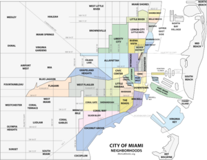
Brickell Key within the Brickell neighborhood of Miami city proper
Coordinates: 25°49′28″N80°11′27″W / 25.824385°N 80.190711°W / 25.824385; -80.190711
Country United States
State Florida
County Miami-Dade County
City Miami
Government
  City of Miami CommissionerKen Russell
  Miami-Dade CommissionerJoe Carollo
   House of Representatives Christopher Benjamin (D)
   State Senate Ileana Garcia (R)
   U.S. House María Elvira Salazar (R)
Elevation
3 ft (0.9 m)
Population
 (2010)
  Total2,189
Time zone UTC-05 (EST)
ZIP Code
33131
Area code(s) 305, 786

Brickell Key is a man-made island off the mainland Brickell neighborhood of Miami, Florida. Also called Claughton Island, the neighborhood is just east of Downtown Miami and the Miami River.

Contents

History

In 1896, Henry Flagler organized a 9-foot (2.7 m) deep channel dug from the Miami River mouth, creating two islands in the process. [1] In 1943, Edward N. Claughton, Sr. bought the Brickell Key islands and other land to combine them into a 44-acre (180,000 m2) triangle-shaped tract. [2] In the late 1970s, Swire Properties bought most of the island from Claughton. [3] Since then the island has been built out with some of the tallest buildings in Miami, and the Mandarin Oriental, Miami hotel, mainly during the condo "Manhattanization" wave of the 2000s.

Demographics

As of 2020, the population of Brickell Key had 20,558 people (excluding the demographics and population of Brickell and Mary Brickell Village). The ZIP code for Brickell is 33131. The area covers 0.162 square miles (0.42 km2). As of 2020, there were 10,412 males and 10,146 females. The median age for males was 33.9 years old, while the median age for females was 31.9 years old. The average household size had 1.7 people, while the average family size had 2.5 members. The percentage of married-couple families (among all households) was 30.6%, while the percentage of married-couple families with children (among all households) was 8.2%, and the percentage of single-mother households (among all households) was 1.4%. The percentage of never-married males 15 years old and over was 24.4%, while the percentage of never-married females 15 years old and over was 16.4%. [4]

As of 2000, people who speak English not well or not at all, made up 5.9% of the population. The percentage of residents born in Florida was 14.9%, the percentage of people born in another U.S. state was 29.1%, and the percentage of native residents but born outside the U.S. was 4.7%, while the percentage of foreign born residents was 51.3%. [4]

Related Research Articles

Miami Gardens was a census-designated place (CDP) in Broward County, Florida, United States. The population was 2,706 at the 2000 census.

<span class="mw-page-title-main">Carol City, Florida</span> Neighborhood of Miami Gardens in Miami-Dade, Florida, United States

Carol City is a neighborhood in Miami Gardens, Florida, United States. The population was 61,233 at the 2010 census. It was formerly a census-designated place.

<span class="mw-page-title-main">Fisher Island, Florida</span> Census-designated place in Florida

Fisher Island is a census-designated place in Miami-Dade County, Florida, United States, located on a barrier island of the same name. Since 2015, Fisher Island has the highest per capita income of any place in the United States. It is located in the Miami metropolitan area of South Florida. As of the 2020 census, the population was 561.

<span class="mw-page-title-main">Fontainebleau, Florida</span> Census-designated place in Florida

Fontainebleau(incorrectly spelled "Fountainebleau" in the 2000 census) is a census-designated place (CDP) in Miami-Dade County, Florida, United States. It is part of the Miami metropolitan area of South Florida. The population was 59,870 during the 2020 census.

<span class="mw-page-title-main">Golden Glades, Florida</span> Census-designated place in Florida

Golden Glades is a census-designated place (CDP) in Miami-Dade County, Florida, United States. It is part of the Miami metropolitan area of South Florida. The population was 32,499 at the 2020 US census.

<span class="mw-page-title-main">Goulds, Florida</span> Census-designated place in Florida

Goulds is an unincorporated community and census-designated place (CDP) in Miami-Dade County, Florida, United States. The area was originally populated as the result of a stop on the Florida East Coast Railroad. The railroad depot was located near the current Southwest 224th Street. The community was named after its operator, Lyman Gould, who cut trees for railroad ties. It is part of the Miami metropolitan area of South Florida. As of the 2020 US census, the population stood at 11,446, up from 10,103 in 2010 US census.

<span class="mw-page-title-main">West Perrine, Florida</span> Census-designated place in Florida

West Perrine is a census-designated place (CDP) in Miami-Dade County, Florida, United States. It is part of the Miami metropolitan area of South Florida. The population was 10,602 at the 2020 census, up from 9,460 in 2010.

<span class="mw-page-title-main">Hypoluxo, Florida</span> Town in the state of Florida, United States

Hypoluxo is a town in Palm Beach County, Florida, United States. The town was incorporated in 1955 and is part of the Miami metropolitan area of South Florida. It is home to the Hypoluxo Scrub Natural Area, which is a protected landscape. The population was 2,687 at the 2020 US Census.

<span class="mw-page-title-main">Coconut Grove</span> Neighborhood of Miami, Florida, United States

Coconut Grove, also known colloquially as The Grove, is an affluent and the oldest continuously inhabited neighborhood of Miami in Miami-Dade County, Florida. The neighborhood is roughly bounded by North Prospect Drive to the south, LeJeune Road to the west, South Dixie Highway and Rickenbacker Causeway to the north, and Biscayne Bay to the east. It is south of the neighborhoods of Brickell and The Roads and east of Coral Gables. The neighborhood's name has been sometimes spelled "Cocoanut Grove" but the definitive spelling "Coconut Grove" was established when the city was incorporated in 1919.

<span class="mw-page-title-main">Allapattah</span> Neighborhood of Miami in Miami-Dade County, Florida, United States

Allapattah is a neighborhood, located mostly in the city of Miami, Florida in metropolitan Miami. As of May 2011, the county-owned portion of Allapattah, from State Road 9 to LeJeune Road, is being annexed by the city proper.

<span class="mw-page-title-main">Little Haiti</span> Neighborhood of Miami in Miami-Dade County, Florida, United States

Little Haiti, is a neighborhood of Miami, Florida, United States. It is known historically as Lemon City, Little River and Edison. It is home to Haitian immigrant residents, as well as residents from the rest of the Caribbean.

<span class="mw-page-title-main">Liberty City (Miami)</span> Neighbourhood in Miami, Florida, US

Liberty City is a neighborhood in Miami, Florida, United States. The area is roughly bound by NW 79th Street to the north, NW 27th Avenue to the west, the Airport Expressway to the South, and Interstate 95 to the east. The neighborhood is home to one of the largest concentrations of African Americans in South Florida, as of the 2000 census. Although it was often known as "Model City" both historically and by the City of Miami government, residents more commonly call it Liberty City.

<span class="mw-page-title-main">Flagami</span> Neighborhood of Miami in Miami-Dade County, Florida, United States

Flagami is a neighborhood of Miami, Florida, United States, roughly defined as south and east of the Tamiami Canal, north of the Tamiami Trail, and west of Red Road, bisected by Flagler Street.

<span class="mw-page-title-main">Venetian Islands, Florida</span> Neighborhood of Miami in Miami-Dade County, Florida, United States

The Venetian Islands are a chain of artificial islands in Biscayne Bay in the cities of Miami and Miami Beach, Florida. The islands are, from west to east: Biscayne Island (Miami), San Marco Island (Miami), San Marino Island, Di Lido Island, Rivo Alto Island, and Belle Isle. Flagler Monument Island remains an uninhabited picnic island, originally built in 1920 as a memorial to railroad pioneer Henry Flagler. The islands are connected by bridges from the Miami mainland to Miami Beach.

<span class="mw-page-title-main">Brickell</span> Neighborhood of Miami in Miami-Dade County, Florida, United States

Brickell is a neighborhood in Miami, Florida, historically referenced at times as Southside, located directly east of Interstate 95, south of the Miami River and north of Coconut Grove. Brickell is known as the financial district of Miami, as well as South Florida.

<span class="mw-page-title-main">Greater Downtown Miami</span> Neighborhood in Miami-Dade County, Florida, United States

Downtown Miami is the urban city center of Miami, Florida, United States. The city's greater downtown region consists of the Central Business District, Brickell, the Historic District, Government Center, the Arts & Entertainment District, and Park West. It is divided by the Miami River and is bordered by Midtown Miami's Edgewater, and Wynwood sections to its north, Biscayne Bay to its east, the Health District and Overtown to its west, and Coconut Grove to its south.

<span class="mw-page-title-main">Upper Eastside</span> Neighborhood of Miami in Miami-Dade County, Florida, United States

The Upper Eastside is a neighborhood in Miami, Florida. It is north of Edgewater, east of Little Haiti, south of the village of Miami Shores, and sits on Biscayne Bay. In geographical order from south to north and east to west, it contains the subdivisions of Magnolia Park, Bay Point, Morningside, Bayside, Belle Meade, Shorecrest, and Palm Grove. The MiMo District along Biscayne Boulevard in the area is host to many art galleries, shops and restaurants.

<span class="mw-page-title-main">Edgewater (Miami)</span> Neighborhood of Miami in Miami-Dade County, Florida, United States

Edgewater is a neighborhood in Miami, Florida, located north of Downtown and the Arts & Entertainment District, and south of Midtown and the Upper Eastside. It is roughly bound by North 17th Street to the south, North 37th Street to the north, the Florida East Coast Railway and East First Avenue to the west and Biscayne Bay to the east.

<span class="mw-page-title-main">Buena Vista (Miami)</span> Neighborhood of Miami in Miami-Dade County, Florida, United States

Buena Vista is a neighborhood in Miami, Florida, United States. It is located south of Little Haiti, north of the Miami Design District.

<span class="mw-page-title-main">Coral Way</span> Neighborhood within Miami, Florida, US

Coral Way is a neighborhood within Miami, Florida that is defined by Coral Way, a road established by Coral Gables founder George E. Merrick during the 1920s. It is located in Miami-Dade County, Florida.

References

  1. "Henry Flagler Biography". Henry Morrison Flagler Museum. Retrieved 2024-02-29.
  2. Piket, Casey (2013-01-14). "Brickell Key on Claughton Island". Miami History Blog. Retrieved 2024-02-29.
  3. "Brickell Key Home Page (archived version)". February 12, 2008. Archived from the original on February 12, 2008.
  4. 1 2 "Demographics of Brickell Key Miami, FL". city-data . Retrieved 2009-08-23.

25°45′59″N80°11′07″W / 25.766288°N 80.185152°W / 25.766288; -80.185152