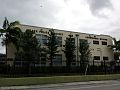
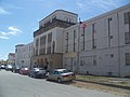
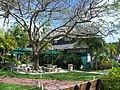
[ 3] Name on the Register [ 4] Image Date listed [ 5] Location City or town Description 1 Ace Theatre Ace Theatre June 13, 2016 (# 16000359 3664 Grand Ave. 25°43′39″N 80°15′10″W / 25.727592°N 80.252810°W / 25.727592; -80.252810 (Ace Theatre ) 2 Atlantic Gas Station Atlantic Gas Station December 29, 1988 (# 88003060 668 Northwest 5th Street 25°46′41″N 80°12′22″W / 25.778056°N 80.206111°W / 25.778056; -80.206111 (Atlantic Gas Station ) Part of the Downtown Miami MRA 3 Bacardi Complex Bacardi Complex October 16, 2018 (# 100003017 2100 Biscayne Blvd. 25°47′51″N 80°11′22″W / 25.7974°N 80.1894°W / 25.7974; -80.1894 (Bacardi Complex ) 4 Barracks and Mess Building-US Coast Guard Air Station at Dinner Key Barracks and Mess Building-US Coast Guard Air Station at Dinner Key August 10, 1995 (# 95000816 2610 Tigertail Avenue 25°43′55″N 80°14′07″W / 25.731944°N 80.235278°W / 25.731944; -80.235278 (Barracks and Mess Building-US Coast Guard Air Station at Dinner Key ) 5 Bay Shore Historic District Bay Shore Historic District October 2, 1992 (# 92001323 Roughly bounded by Northeast 55th Street, Biscayne Boulevard, Northeast 60th Street, and Biscayne Bay 25°49′46″N 80°10′57″W / 25.829319°N 80.182625°W / 25.829319; -80.182625 (Bay Shore Historic District ) 6 Brickell Mausoleum Brickell Mausoleum January 4, 1989 (# 88002977 501 Brickell Avenue 25°46′05″N 80°11′30″W / 25.768056°N 80.191667°W / 25.768056; -80.191667 (Brickell Mausoleum ) Part of the Downtown Miami MRA 7 Brickell Point Site Brickell Point Site February 5, 2002 (# 01001534 401 Brickell Ave 25°46′08″N 80°11′21″W / 25.768889°N 80.189167°W / 25.768889; -80.189167 (Brickell Point Site ) 8 William Jennings Bryan House William Jennings Bryan House January 20, 2012 (# 11001029 3115 Brickell Ave 25°44′55″N 80°12′22″W / 25.748569°N 80.206053°W / 25.748569; -80.206053 (William Jennings Bryan House ) 9 Central Baptist Church Central Baptist Church January 4, 1989 (# 88002988 500 Northeast 1st Avenue 25°46′31″N 80°11′31″W / 25.775278°N 80.191944°W / 25.775278; -80.191944 (Central Baptist Church ) Part of the Downtown Miami MRA 10 City National Bank Building City National Bank Building January 4, 1989 (# 88002975 121 Southeast 1st Street 25°46′30″N 80°11′30″W / 25.775°N 80.191667°W / 25.775; -80.191667 (City National Bank Building ) Part of the Downtown Miami MRA 11 City of Miami Cemetery City of Miami Cemetery January 4, 1989 (# 88002960 1800 Northeast 2nd Avenue 25°47′38″N 80°11′27″W / 25.793889°N 80.190833°W / 25.793889; -80.190833 (City of Miami Cemetery ) Part of the Downtown Miami MRA 12 Coconut Grove Library Coconut Grove Library May 1, 2017 (# 100000932 2875 McFarlane Rd. 25°43′36″N 80°14′26″W / 25.726641°N 80.240608°W / 25.726641; -80.240608 (Coconut Grove Library ) 13 Coconut Grove Playhouse Coconut Grove Playhouse October 19, 2018 (# 100003018 3500 Main Hwy 25°43′32″N 80°14′41″W / 25.7255°N 80.2447°W / 25.7255; -80.2447 (Coconut Grove Playhouse ) 14 Congress Building Congress Building March 14, 1985 (# 85000553 111 Northeast 2nd Avenue 25°46′31″N 80°11′24″W / 25.775278°N 80.19°W / 25.775278; -80.19 (Congress Building ) 15 Dade County Courthouse Dade County Courthouse January 4, 1989 (# 88002983 73 West Flagler Street 25°46′27″N 80°11′43″W / 25.774167°N 80.195278°W / 25.774167; -80.195278 (Dade County Courthouse ) Part of the Downtown Miami MRA 16 D. A. Dorsey House D. A. Dorsey House January 4, 1989 (# 88002966 250 Northwest 9th Street 25°46′57″N 80°11′56″W / 25.7825°N 80.198889°W / 25.7825; -80.198889 (D. A. Dorsey House ) Part of the Downtown Miami MRA 17 Marjory Stoneman Douglas House Marjory Stoneman Douglas House February 27, 2015 (# 15000312 3744 Stewart Ave. 25°42′40″N 80°15′13″W / 25.711°N 80.2535°W / 25.711; -80.2535 (Marjory Stoneman Douglas House ) Home of environmentalist and activist Marjory Stoneman Douglas 18 Downtown Miami Historic District Downtown Miami Historic District December 6, 2005 (# 05001356 Roughly bounded by Miami Ct., 3rd Street, 3rd Avenue, and 2nd Street 25°46′21″N 80°11′31″W / 25.77255°N 80.191839°W / 25.77255; -80.191839 (Downtown Miami Historic District ) 19 Alfred I. DuPont Building Alfred I. DuPont Building January 4, 1989 (# 88002984 169 East Flagler Street 25°46′28″N 80°11′26″W / 25.7745°N 80.1906°W / 25.7745; -80.1906 (Alfred I. DuPont Building ) Part of the Downtown Miami MRA 20 El Jardin El Jardin August 30, 1974 (# 74000614 3747 Main Highway 25°43′18″N 80°14′54″W / 25.721667°N 80.248333°W / 25.721667; -80.248333 (El Jardin ) 21 Fire Station No. 2 Fire Station No. 2 January 4, 1989 (# 88002971 1401 North Miami Avenue 25°47′17″N 80°11′41″W / 25.788056°N 80.194722°W / 25.788056; -80.194722 (Fire Station No. 2 ) Part of the Downtown Miami MRA 22 Fire Station No. 4 Fire Station No. 4 March 8, 1984 (# 84000836 1000 South Miami Avenue 25°45′51″N 80°11′36″W / 25.764167°N 80.193333°W / 25.764167; -80.193333 (Fire Station No. 4 ) 23 First Coconut Grove School First Coconut Grove School January 21, 1975 (# 75000547 3429 Devon Road 25°43′19″N 80°14′55″W / 25.721944°N 80.248611°W / 25.721944; -80.248611 (First Coconut Grove School ) 24 Flori-Coral Apartments Upload image April 20, 2023 (# 100008861 1250 SW 6 St. 25°46′03″N 80°12′56″W / 25.767443°N 80.215532°W / 25.767443; -80.215532 (Flori-Coral Apartments ) 25 Florida East Coast Railway Locomotive No. 153 Florida East Coast Railway Locomotive No. 153 February 21, 1985 (# 85000303 12400 Southwest 152nd Street 25°37′15″N 80°24′22″W / 25.620833°N 80.406111°W / 25.620833; -80.406111 (Florida East Coast Railway Locomotive No. 153 ) 26 Freedom Tower Freedom Tower September 10, 1979 (# 79000665 600 Biscayne Boulevard 25°46′48″N 80°11′23″W / 25.78°N 80.189722°W / 25.78; -80.189722 (Freedom Tower ) 27 Gesu Church Gesu Church July 18, 1974 (# 74000617 118 Northeast 2nd Street 25°46′32″N 80°11′31″W / 25.775556°N 80.191944°W / 25.775556; -80.191944 (Gesu Church ) 28 Greater Bethel AME Church Greater Bethel AME Church April 17, 1992 (# 88002987 245 Northwest 8th Street 25°46′54″N 80°11′57″W / 25.781667°N 80.199167°W / 25.781667; -80.199167 (Greater Bethel AME Church ) Part of the Downtown Miami MRA 29 Grove Park Historic District Upload image December 8, 2023 (# 100008869 Bounded by NW 17th Ave., FL 836, NW 14th Ct., and NW 7th St. 25°46′53″N 80°13′16″W / 25.781322°N 80.221202°W / 25.781322; -80.221202 (Grove Park Historic District ) 30 Hahn Building Hahn Building January 4, 1989 (# 88002989 140 Northeast 1st Avenue 25°46′32″N 80°11′32″W / 25.775556°N 80.192222°W / 25.775556; -80.192222 (Hahn Building ) Part of the Downtown Miami MRA 31 HALF MOON (shipwreck) HALF MOON (shipwreck) May 31, 2001 (# 01000531 Outside Bear Cut off Key Biscayne 25°43′39″N 80°08′04″W / 25.7275°N 80.134444°W / 25.7275; -80.134444 (HALF MOON (shipwreck) 32 Halissee Hall Halissee Hall October 1, 1974 (# 74000618 1700 Northwest 10th Avenue 25°47′17″N 80°12′53″W / 25.788056°N 80.214722°W / 25.788056; -80.214722 (Halissee Hall ) 33 Hampton House Motel Upload image February 7, 2022 (# 100007393 4240 NW 27th Ave. 25°48′51″N 80°14′26″W / 25.8142°N 80.2406°W / 25.8142; -80.2406 (Hampton House Motel ) 34 Huntington Building Huntington Building January 4, 1989 (# 88002976 168 Southeast 1st Street 25°46′28″N 80°11′27″W / 25.774444°N 80.190833°W / 25.774444; -80.190833 (Huntington Building ) Part of the Downtown Miami MRA 35 Ingraham Building Ingraham Building January 4, 1989 (# 88002958 25 Southeast 2nd Avenue 25°46′23″N 80°11′25″W / 25.773056°N 80.190278°W / 25.773056; -80.190278 (Ingraham Building ) Part of the Downtown Miami MRA 36 J & S Building J & S Building January 4, 1989 (# 88002967 221–233 Northwest 9th Street 25°46′55″N 80°11′53″W / 25.781944°N 80.198056°W / 25.781944; -80.198056 (J & S Building ) Part of the Downtown Miami MRA 37 Dr. James M. Jackson Office Dr. James M. Jackson Office February 24, 1975 (# 75000550 190 Southeast 12th Terrace 25°45′39″N 80°11′25″W / 25.760833°N 80.190278°W / 25.760833; -80.190278 (Dr. James M. Jackson Office ) 38 The Kampong The Kampong March 1, 1984 (# 84000837 Address Restricted 25°43′01″N 80°15′11″W / 25.716944°N 80.253056°W / 25.716944; -80.253056 (The Kampong ) 39 Kentucky Home Kentucky Home January 4, 1989 (# 88002969 1221 and 1227 Northeast 1st Avenue 25°47′10″N 80°11′31″W / 25.786111°N 80.191944°W / 25.786111; -80.191944 (Kentucky Home ) Part of the Downtown Miami MRA 40 Lincoln Memorial Park Cemetery Lincoln Memorial Park Cemetery March 29, 2018 (# 100002292 3001 NW 46th St 25°48′59″N 80°14′42″W / 25.816351°N 80.245045°W / 25.816351; -80.245045 (Lincoln Memorial Park Cemetery ) 41 Lummus Park Historic District Lummus Park Historic District October 25, 2006 (# 06000952 Roughly bounded by Northwest Second Street, Northwest Third Court, Northwest Fourth Street, and Northwest North River Drive 25°46′37″N 80°12′04″W / 25.77685°N 80.201164°W / 25.77685; -80.201164 (Lummus Park Historic District ) 42 Lyric Theater Lyric Theater January 4, 1989 (# 88002965 819 Northwest 2nd Avenue 25°46′55″N 80°11′53″W / 25.781944°N 80.198056°W / 25.781944; -80.198056 (Lyric Theater ) Part of the Downtown Miami MRA 43 Martina Apartments Martina Apartments January 4, 1989 (# 88002981 1023 South Miami Avenue 25°45′49″N 80°11′35″W / 25.763611°N 80.193056°W / 25.763611; -80.193056 (Martina Apartments ) Part of the Downtown Miami MRA 44 Meyer-Kiser Building Meyer-Kiser Building January 4, 1989 (# 88002991 139 Northeast 1st Building 25°46′30″N 80°11′29″W / 25.775°N 80.191389°W / 25.775; -80.191389 (Meyer-Kiser Building ) Part of the Downtown Miami MRA 45 Miami Black Police Precinct and Courthouse Miami Black Police Precinct and Courthouse February 5, 2020 (# 100004974 480 NW 11th St. 25°47′04″N 80°12′10″W / 25.7845°N 80.2029°W / 25.7845; -80.2029 (Miami Black Police Precinct and Courthouse ) 46 Miami City Hospital, Building No. 1 Miami City Hospital, Building No. 1 December 31, 1979 (# 79000666 1611 Northwest 12th Avenue 25°47′29″N 80°12′45″W / 25.791389°N 80.2125°W / 25.791389; -80.2125 (Miami City Hospital, Building No. 1 ) 47 Miami Edison Senior High School Miami Edison Senior High School June 5, 1986 (# 86001212 6101 Northwest Second Avenue 25°49′53″N 80°12′00″W / 25.831389°N 80.2°W / 25.831389; -80.2 (Miami Edison Senior High School ) 48 Miami Marine Stadium Miami Marine Stadium April 2, 2018 (# 100002293 3501 Rickenbacker Causeway 25°44′35″N 80°10′12″W / 25.74295°N 80.169865°W / 25.74295; -80.169865 (Miami Marine Stadium ) 49 Miami Senior High School Miami Senior High School June 18, 1990 (# 90000881 2450 Southwest First Street 25°46′17″N 80°14′10″W / 25.771389°N 80.236111°W / 25.771389; -80.236111 (Miami Senior High School ) 50 Miami Women's Club Miami Women's Club December 27, 1974 (# 74002257 1737 North Bayshore Drive 25°47′30″N 80°11′10″W / 25.791667°N 80.186111°W / 25.791667; -80.186111 (Miami Women's Club ) 51 Mount Zion Baptist Church Mount Zion Baptist Church December 29, 1988 (# 88003059 301 Northwest 9th Street 25°46′58″N 80°11′59″W / 25.782824°N 80.199822°W / 25.782824; -80.199822 (Mount Zion Baptist Church ) Part of the Downtown Miami MRA 52 Ralph M. Munroe House Ralph M. Munroe House April 11, 1973 (# 73000575 3485 Main Highway 25°43′28″N 80°14′33″W / 25.724444°N 80.2425°W / 25.724444; -80.2425 (Ralph M. Munroe House ) 53 Naval Air Station Richmond Headquarters Building Naval Air Station Richmond Headquarters Building May 1, 2017 (# 100000933 12450 SW. 152nd St. 25°37′37″N 80°23′32″W / 25.626855°N 80.392143°W / 25.626855; -80.392143 (Naval Air Station Richmond Headquarters Building ) 54 Old US Post Office and Courthouse Old US Post Office and Courthouse January 4, 1989 (# 88002962 100–118 Northeast 1st Avenue 25°46′31″N 80°11′33″W / 25.775278°N 80.1925°W / 25.775278; -80.1925 (Old US Post Office and Courthouse ) Part of the Downtown Miami MRA 55 Olympia Theater and Office Building Olympia Theater and Office Building March 8, 1984 (# 84000839 174 East Flager Street 25°46′25″N 80°11′27″W / 25.773611°N 80.190833°W / 25.773611; -80.190833 (Olympia Theater and Office Building ) 56 Palm Cottage Palm Cottage January 4, 1989 (# 88002957 60 Southeast 4th Street 25°46′14″N 80°11′33″W / 25.770556°N 80.1925°W / 25.770556; -80.1925 (Palm Cottage ) Part of the Downtown Miami MRA 57 Pan American Seaplane Base and Terminal Building Pan American Seaplane Base and Terminal Building February 20, 1975 (# 75000548 3500 Pan American Drive 25°43′40″N 80°14′03″W / 25.727778°N 80.234167°W / 25.727778; -80.234167 (Pan American Seaplane Base and Terminal Building ) 58 Plymouth Congregational Church Plymouth Congregational Church July 23, 1974 (# 74000615 3429 Devon Road 25°43′19″N 80°14′18″W / 25.721944°N 80.238333°W / 25.721944; -80.238333 (Plymouth Congregational Church ) 59 Ransom School "Pagoda" Ransom School "Pagoda" July 25, 1973 (# 73000572 3575 Main Highway 25°43′21″N 80°14′04″W / 25.7225°N 80.234444°W / 25.7225; -80.234444 (Ransom School "Pagoda" ) 60 Richmond Heights Pioneer Historic District Upload image March 25, 2019 (# 100003405 14520-14960 Monroe St. 25°37′53″N 80°22′26″W / 25.6315°N 80.3740°W / 25.6315; -80.3740 (Richmond Heights Pioneer Historic District ) 61 S & S Sandwich Shop S & S Sandwich Shop January 4, 1989 (# 88002994 1757 Northeast 2nd Street 25°47′33″N 80°11′28″W / 25.7925°N 80.191111°W / 25.7925; -80.191111 (S & S Sandwich Shop ) Part of the Downtown Miami MRA 62 St. John's Baptist Church St. John's Baptist Church April 17, 1992 (# 88002970 1328 Northwest 3rd Avenue 25°47′13″N 80°12′01″W / 25.786944°N 80.200278°W / 25.786944; -80.200278 (St. John's Baptist Church ) Part of the Downtown Miami MRA 63 Sears, Roebuck and Company Department Store Sears, Roebuck and Company Department Store August 8, 1997 (# 84003903 1300 Biscayne Boulevard 25°47′14″N 80°11′24″W / 25.787222°N 80.19°W / 25.787222; -80.19 (Sears, Roebuck and Company Department Store ) Only a tower building survives, as part of Adrienne Arsht Center for the Performing Arts 64 Security Building Security Building January 4, 1989 (# 88002990 117 Northeast 1st Avenue 25°46′31″N 80°11′31″W / 25.775278°N 80.191944°W / 25.775278; -80.191944 (Security Building ) Part of the Downtown Miami MRA 65 Shoreland Arcade Shoreland Arcade January 4, 1989 (# 88002992 120 Northeast 1st Street 25°46′28″N 80°11′29″W / 25.774444°N 80.191389°W / 25.774444; -80.191389 (Shoreland Arcade ) Part of the Downtown Miami MRA 66 South River Drive Historic District South River Drive Historic District August 10, 1987 (# 87000671 428 and 438 Southwest First Street, 437 Southwest Second Street, and 104, 109, and 118 Southwest South River Drive 25°46′20″N 80°12′06″W / 25.772222°N 80.201667°W / 25.772222; -80.201667 (South River Drive Historic District ) 67 Southside School Southside School January 4, 1989 (# 88002980 45 Southwest 13th Street 25°45′41″N 80°11′58″W / 25.761389°N 80.199444°W / 25.761389; -80.199444 (Southside School ) Part of the Downtown Miami MRA 68 Trapp Homestead Trapp Homestead November 10, 1994 (# 94001279 2521 South Bayshore Drive 25°44′01″N 80°14′17″W / 25.733611°N 80.238056°W / 25.733611; -80.238056 (Trapp Homestead ) 69 Trinity Episcopal Cathedral Trinity Episcopal Cathedral October 10, 1980 (# 80000945 464 Northeast 16th Street 25°47′24″N 80°11′12″W / 25.79°N 80.186667°W / 25.79; -80.186667 (Trinity Episcopal Cathedral ) 70 U.S. Car No. 1 U.S. Car No. 1 August 24, 1977 (# 77000401 3398 Southwest 9th Avenue 25°37′02″N 80°24′02″W / 25.617117°N 80.400647°W / 25.617117; -80.400647 (U.S. Car No. 1 ) 71 US Coast Guard Air Station Hangar at Dinner Key US Coast Guard Air Station Hangar at Dinner Key December 19, 2002 (# 02001535 2600 South Bayshore Drive 25°43′51″N 80°14′04″W / 25.730833°N 80.234444°W / 25.730833; -80.234444 (US Coast Guard Air Station Hangar at Dinner Key ) 72 US Post Office and Courthouse US Post Office and Courthouse October 14, 1983 (# 83003518 300 Northeast 1st Avenue 25°46′38″N 80°11′34″W / 25.777222°N 80.192778°W / 25.777222; -80.192778 (US Post Office and Courthouse ) 73 Vagabond Motel Vagabond Motel December 29, 2014 (# 14001086 7301 Biscayne Blvd. 25°50′34″N 80°11′02″W / 25.842891°N 80.183957°W / 25.842891; -80.183957 (Vagabond Motel ) 74 Venetian Causeway Venetian Causeway July 13, 1989 (# 89000852 Northeast 15th Street and Dade Boulevard 25°47′21″N 80°11′21″W / 25.789167°N 80.189167°W / 25.789167; -80.189167 (Venetian Causeway ) Extends into Miami Beach, elsewhere in Miami-Dade County 75 Virginia Key Beach Park Virginia Key Beach Park June 28, 2002 (# 02000681 East of Biscayne Bay and north of the Rickenbacker Causeway 25°44′02″N 80°09′43″W / 25.733889°N 80.161944°W / 25.733889; -80.161944 (Virginia Key Beach Park ) 76 Vizcaya Vizcaya September 29, 1970 (# 70000181 3251 South Miami Avenue; also roughly bounded by South Dixie Highway, Southwest 32nd Road, and South Miami Avenue 25°44′37″N 80°12′37″W / 25.743611°N 80.210278°W / 25.743611; -80.210278 (Vizcaya ) Vizcaya was added to the National Register on September 29, 1970 (refnum 70000181), with a boundary increase on November 15, 1978 (refnum 78003193). It was made a National Historic Landmark on April 19, 1994 (refnum 70000181). [ 6] 77 Walgreen Drug Store Walgreen Drug Store January 4, 1989 (# 88002982 200 East Flagler Street 25°46′29″N 80°11′25″W / 25.774722°N 80.190278°W / 25.774722; -80.190278 (Walgreen Drug Store ) Part of the Downtown Miami MRA 78 J. W. Warner House J. W. Warner House June 1, 1983 (# 83001419 111 Southwest 5th Avenue 25°46′24″N 80°12′10″W / 25.773333°N 80.202778°W / 25.773333; -80.202778 (J. W. Warner House ) 79 Woman's Club of Coconut Grove Woman's Club of Coconut Grove March 26, 1975 (# 75000549 2985 South Bayshore Drive 25°43′37″N 80°14′24″W / 25.726944°N 80.24°W / 25.726944; -80.24 (Woman's Club of Coconut Grove )