National Register of Historic Places listings in St. Johns County, Florida

Last updated

Location of St. Johns County in Florida Map of Florida highlighting St. Johns County.svg
Location of St. Johns County in Florida

This is a list of the National Register of Historic Places listings in St. Johns County, Florida.

Contents

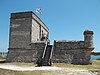
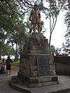
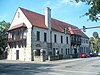
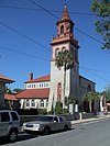
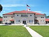
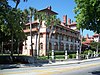
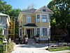
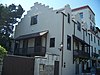
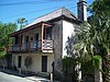
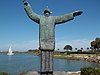
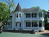
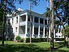
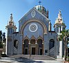
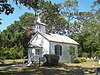
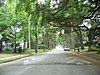
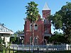
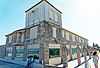
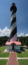
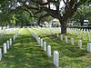
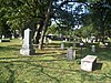
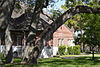
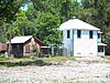
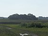
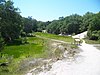
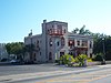
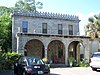
This is intended to be a complete list of the properties and districts on the National Register of Historic Places in St. Johns County, Florida, United States. The locations of National Register properties and districts for which the latitude and longitude coordinates are included below, may be seen in a map. [1]

There are 55 properties and districts listed on the National Register in the county, including 6 National Historic Landmarks.


    This National Park Service list is complete through NPS recent listings posted March 22, 2024. [2]

Contents: Counties in Florida   (non-linked contain no National Register listings)
Alachua - Baker - Bay - Bradford - Brevard - Broward - Calhoun - Charlotte - Citrus - Clay - Collier - Columbia - DeSoto - Dixie - Duval - Escambia - Flagler - Franklin - Gadsden - Gilchrist - Glades - Gulf - Hamilton - Hardee - Hendry - Hernando - Highlands - Hillsborough (Tampa) - Holmes - Indian River - Jackson - Jefferson - Lafayette - Lake - Lee - Leon - Levy - Liberty - Madison - Manatee - Marion - Martin - Miami-Dade (Miami) - Monroe - Nassau - Okaloosa - Okeechobee - Orange - Osceola - Palm Beach - Pasco - Pinellas - Polk - Putnam - St. Johns - St. Lucie - Santa Rosa - Sarasota - Seminole - Sumter - Suwannee - Taylor - Union - Volusia - Wakulla - Walton - Washington

Current listings

[3] Name on the Register [4] ImageDate listed [5] Location City or townDescription
1 Abbott Tract Historic District
Abbott Tract Historic District St Aug Abbott Tract HD house01.jpg
Abbott Tract Historic District
July 21, 1983
(#83001438)
Roughly bounded by Matanzas Bay and Pine, San Marco, and Shenandoah Aves.
29°54′04″N81°18′50″W / 29.901111°N 81.313889°W / 29.901111; -81.313889 (Abbott Tract Historic District)
St. Augustine
2 Alcazar Hotel
Alcazar Hotel St Aug Alcazar Lightner01.jpg
Alcazar Hotel
February 24, 1971
(#71001013)
79 King St.
29°53′30″N81°18′51″W / 29.891667°N 81.314167°W / 29.891667; -81.314167 (Alcazar Hotel)
St. Augustine
3 Avero House
Avero House St Aug Avero House02.jpg
Avero House
June 13, 1972
(#72001459)
39 St. George St.
29°58′44″N81°18′48″W / 29.978889°N 81.313333°W / 29.978889; -81.313333 (Avero House)
St. Augustine
4 Bridge of Lions
Bridge of Lions Lion on SA Bridge of Lions.jpg
Bridge of Lions
November 19, 1982
(#82001040)
King St.
29°53′33″N81°18′27″W / 29.8925°N 81.3075°W / 29.8925; -81.3075 (Bridge of Lions)
St. Augustine
5 Castillo de San Marcos National Monument
Castillo de San Marcos National Monument Fort2.jpg
Castillo de San Marcos National Monument
October 15, 1966
(#66000062)
1 Castillo Dr.
29°53′52″N81°18′41″W / 29.897778°N 81.311389°W / 29.897778; -81.311389 (Castillo de San Marcos National Monument)
St. Augustine A National Monument
6 Cathedral of St. Augustine
Cathedral of St. Augustine Cathedral-Basilica in St. Augustine.JPG
Cathedral of St. Augustine
April 15, 1970
(#70000844)
Cathedral St. between Charlotte and St. George Sts.
29°53′34″N81°18′45″W / 29.892778°N 81.3125°W / 29.892778; -81.3125 (Cathedral of St. Augustine)
St. Augustine
7 City of St. Augustine Miniature Golf Course
City of St. Augustine Miniature Golf Course St Aug FL Miniature Golf Course01.jpg
City of St. Augustine Miniature Golf Course
November 19, 2014
(#14000953)
111 Avenida Menendez
29°53′30″N81°18′37″W / 29.8915626°N 81.3102826°W / 29.8915626; -81.3102826 (City of St. Augustine Miniature Golf Course)
St. Augustine
8 Constitution Obelisk
Constitution Obelisk St Aug Plaza DLC const mem02.jpg
Constitution Obelisk
December 18, 2012
(#12000364)
Plaza de la Constitution
29°53′33″N81°18′45″W / 29.89245°N 81.312577°W / 29.89245; -81.312577 (Constitution Obelisk)
St. Augustine
9 Dixie Highway-Hastings, Espanola and Bunnell Road
Dixie Highway-Hastings, Espanola and Bunnell Road AndersonHighwayFlorida.jpg
Dixie Highway-Hastings, Espanola and Bunnell Road
April 20, 2005
(#05000311)
Roughly Espanola in Flagler County to County Route 204 in St. Johns County
29°34′49″N81°20′35″W / 29.580278°N 81.343056°W / 29.580278; -81.343056 (Dixie Highway-Hastings, Espanola and Bunnell Road)
Espanola Extends into Flagler County
10 Fish Island Site June 13, 1972
(#72001460)
Address Restricted
St. Augustine
11 Fort Matanzas National Monument
Fort Matanzas National Monument Fort Matanzas01.jpg
Fort Matanzas National Monument
October 15, 1966
(#66000098)
15 miles south of St. Augustine
29°42′55″N81°14′21″W / 29.715278°N 81.239167°W / 29.715278; -81.239167 (Fort Matanzas National Monument)
St. Augustine A National Monument
12 Fort Matanzas National Monument Headquarters and Visitor Center
Fort Matanzas National Monument Headquarters and Visitor Center Fort Matanzas visitor center01.jpg
Fort Matanzas National Monument Headquarters and Visitor Center
December 31, 2008
(#08001245)
8635 State Road A1A, South
29°42′42″N81°14′07″W / 29.711667°N 81.235278°W / 29.711667; -81.235278 (Fort Matanzas National Monument Headquarters and Visitor Center)
St. Augustine
13 Fountain of Youth Archeological Park
Fountain of Youth Archeological Park Fountain of Youth Archaeological Park, St. Augustine, Florida, USA5.jpg
Fountain of Youth Archeological Park
June 13, 2016
(#16000361)
11 Magnolia Ave.
29°54′26″N81°18′58″W / 29.907306°N 81.316139°W / 29.907306; -81.316139 (Fountain of Youth Archeological Park)
St. Augustine
14 Fullerwood Park Residential Historic District
Fullerwood Park Residential Historic District St Aug Fullerwood Park06.jpg
Fullerwood Park Residential Historic District
September 24, 2010
(#10000767)
Roughly bounded by San Marcos, Macaris, Hildreth & Hospital Creek
29°54′59″N81°19′14″W / 29.916389°N 81.320556°W / 29.916389; -81.320556 (Fullerwood Park Residential Historic District)
St. Augustine
15 Gonzalez-Alvarez House
Gonzalez-Alvarez House St Aug NHL Gonzalez-Alvarez01.jpg
Gonzalez-Alvarez House
April 15, 1970
(#70000845)
14 St. Francis St.
29°53′17″N81°18′36″W / 29.888056°N 81.31°W / 29.888056; -81.31 (Gonzalez-Alvarez House)
St. Augustine US National Historic Landmark
16 Government House
Government House St Aug Govt House Museum03.jpg
Government House
January 7, 2014
(#13000812)
48 King St.
29°53′32″N81°18′47″W / 29.892355°N 81.313076°W / 29.892355; -81.313076 (Government House)
St. Augustine part of the Florida's New Deal Resources MPS
17 Grace United Methodist Church
Grace United Methodist Church St Aug Grace United Methodist01.jpg
Grace United Methodist Church
November 29, 1979
(#79003132)
8 Carrera St.
29°53′42″N81°18′54″W / 29.895090°N 81.314947°W / 29.895090; -81.314947 (Grace United Methodist Church)
St. Augustine
18 Hastings High School
Hastings High School Hastings High School01.jpg
Hastings High School
June 14, 2006
(#06000502)
6195 S. Main St.
29°42′40″N81°30′18″W / 29.711111°N 81.505°W / 29.711111; -81.505 (Hastings High School)
Hastings
19 Hotel Ponce De Leon
Hotel Ponce De Leon St Aug Flagler College01.jpg
Hotel Ponce De Leon
May 6, 1975
(#75002067)
74 King St., bounded by King, Valencia, Sevilla, and Cordova Sts.
29°53′32″N81°18′54″W / 29.892222°N 81.315°W / 29.892222; -81.315 (Hotel Ponce De Leon)
St. Augustine US National Historic Landmark
20 Lincolnville Historic District
Lincolnville Historic District St Aug Lincolnville house01.jpg
Lincolnville Historic District
November 29, 1991
(#91000979)
Bounded by Cedar, Riberia, Cerro, and Washington Sts. and DeSoto Pl.
29°53′05″N81°18′52″W / 29.884722°N 81.314444°W / 29.884722; -81.314444 (Lincolnville Historic District)
St. Augustine
21 Lindsley House
Lindsley House St Aug Lindsley House01.jpg
Lindsley House
September 10, 1971
(#71001014)
214 St. George St.
29°53′30″N81°18′48″W / 29.891667°N 81.313333°W / 29.891667; -81.313333 (Lindsley House)
St. Augustine
22 Llambias House
Llambias House St Aug NHL Llambias01.jpg
Llambias House
April 15, 1970
(#70000846)
31 St. Francis St.
29°53′15″N81°18′39″W / 29.8875°N 81.310833°W / 29.8875; -81.310833 (Llambias House)
St. Augustine
23 Lodge and Hut March 20, 2024
(#100010155)
9177-9179 Old A1A Highway
29°41′50″N81°13′23″W / 29.6971°N 81.2231°W / 29.6971; -81.2231 (Lodge and Hut)
Summer Haven
24 Father Francisco Lopez Statue
Father Francisco Lopez Statue St Aug Lopez statue01.jpg
Father Francisco Lopez Statue
June 5, 2012
(#12000317)
27 Ocean Avenue
29°54′15″N81°19′00″W / 29.904204°N 81.316724°W / 29.904204; -81.316724 (Father Francisco Lopez Statue)
St. Augustine
25 Xavier Lopez House
Xavier Lopez House St Aug Xavier Lopez House01.jpg
Xavier Lopez House
July 1, 1993
(#93000579)
93½ King St.
29°53′29″N81°18′58″W / 29.891389°N 81.316111°W / 29.891389; -81.316111 (Xavier Lopez House)
St. Augustine
26 Markland
Markland St Aug Markland01.jpg
Markland
December 6, 1978
(#78003080)
102 King St.
29°53′31″N81°19′02″W / 29.891944°N 81.317222°W / 29.891944; -81.317222 (Markland)
St. Augustine
27 Menendez Encampment Site
Menendez Encampment Site Menendez Encampment Site.jpg
Menendez Encampment Site
September 27, 2016
(#16000295)
21 Magnolia Ave.
29°54′27″N81°18′59″W / 29.907574°N 81.316345°W / 29.907574; -81.316345 (Menendez Encampment Site)
St. Augustine On the grounds of the Fountain of Youth Archaeological Park.
28 Arthur Milam House
Arthur Milam House Arthur Milam House, Ponte Vedra, FL, US (12).jpg
Arthur Milam House
June 7, 2016
(#16000323)
1033 Ponte Vedra Blvd.
30°10′26″N81°21′34″W / 30.17385°N 81.35935°W / 30.17385; -81.35935 (Arthur Milam House)
Ponte Vedra Beach
29 Model Land Company Historic District
Model Land Company Historic District St Aug Mem Presby Church01.jpg
Model Land Company Historic District
August 2, 1983
(#83001439)
Roughly bounded by Ponce de Leon Boulevard and King, Cordova, and Orange Sts.
29°53′39″N81°19′06″W / 29.894167°N 81.318333°W / 29.894167; -81.318333 (Model Land Company Historic District)
St. Augustine
30 Moultrie Church
Moultrie Church St Aug Moultrie Church10.jpg
Moultrie Church
September 8, 2014
(#14000553)
480 Wildwood Dr.
29°48′55″N81°20′10″W / 29.81516°N 81.33605°W / 29.81516; -81.33605 (Moultrie Church)
St. Augustine
31 Nelmar Terrace Historic District
Nelmar Terrace Historic District St Aug Nelmar Terrace street01.jpg
Nelmar Terrace Historic District
March 28, 2011
(#11000145)
Alfred St., San Carlos Ave., San Marcos Ave., Hospital Creek
29°54′39″N81°19′06″W / 29.910833°N 81.318333°W / 29.910833; -81.318333 (Nelmar Terrace Historic District)
St. Augustine
32 North City Historic District
North City Historic District St Aug North City HD01.jpg
North City Historic District
October 1, 2009
(#09000778)
Roughly bounded by Castillo Drive, San Marcos Avenue, Old Mission Avenue, and U.S. Route 1
29°54′07″N81°19′05″W / 29.901944°N 81.318056°W / 29.901944; -81.318056 (North City Historic District)
St. Augustine
33 O'Reilly House
O'Reilly House St Aug O'Reilly House01.jpg
O'Reilly House
October 15, 1974
(#74002192)
131 Aviles St.
29°53′24″N81°18′41″W / 29.89°N 81.311389°W / 29.89; -81.311389 (O'Reilly House)
St. Augustine
34 Old St. Johns County Jail
Old St. Johns County Jail St Aug old county jail01.jpg
Old St. Johns County Jail
August 27, 1987
(#87001427)
167 San Marco Ave.
29°54′28″N81°19′08″W / 29.907778°N 81.318889°W / 29.907778; -81.318889 (Old St. Johns County Jail)
St. Augustine
35 Record Building
Record Building St Aug Record Bldg01.jpg
Record Building
April 26, 2006
(#06000315)
154 Cordova St.
29°53′20″N81°18′47″W / 29.888889°N 81.313056°W / 29.888889; -81.313056 (Record Building)
St. Augustine
36 Rodriguez-Avero-Sanchez House
Rodriguez-Avero-Sanchez House St Aug Rod-Av-San01.jpg
Rodriguez-Avero-Sanchez House
April 16, 1971
(#71001015)
52 St. George St.
29°53′46″N81°18′49″W / 29.896111°N 81.313611°W / 29.896111; -81.313611 (Rodriguez-Avero-Sanchez House)
St. Augustine
37 St. Augustine Alligator Farm Historic District
St. Augustine Alligator Farm Historic District St Aug Alligator Farm01.jpg
St. Augustine Alligator Farm Historic District
September 10, 1992
(#92001232)
999 Anastasia Boulevard
29°52′53″N81°17′18″W / 29.881389°N 81.288333°W / 29.881389; -81.288333 (St. Augustine Alligator Farm Historic District)
St. Augustine
38 St. Augustine Beach Hotel and Beachfront
St. Augustine Beach Hotel and Beachfront St. Augustine Beach Hotel, St. Augustine, FL, US.jpg
St. Augustine Beach Hotel and Beachfront
January 11, 2022
(#100007284)
370 FL A1A
29°51′24″N81°15′57″W / 29.856539°N 81.265774°W / 29.856539; -81.265774 (St. Augustine Beach Hotel and Beachfront)
St. Augustine Beach
39 St. Augustine Civic Center
St. Augustine Civic Center St Aug Civc Center01.jpg
St. Augustine Civic Center
April 21, 2005
(#05000316)
10 Castillo Dr.
29°53′55″N81°18′53″W / 29.898611°N 81.314722°W / 29.898611; -81.314722 (St. Augustine Civic Center)
St. Augustine Part of the Florida's New Deal Resources MPS
40 St. Augustine Lighthouse and Keeper's Quarters
St. Augustine Lighthouse and Keeper's Quarters St. Augustine Lighthouse 1.jpg
St. Augustine Lighthouse and Keeper's Quarters
March 19, 1981
(#81000668)
Old Beach Rd.
29°53′08″N81°17′19″W / 29.88543°N 81.28852°W / 29.88543; -81.28852 (St. Augustine Lighthouse and Keeper's Quarters)
St. Augustine
41 St. Augustine National Cemetery
St. Augustine National Cemetery St Aug Nat Cemetery02.jpg
St. Augustine National Cemetery
May 16, 2016
(#16000271)
104 Marine St.
29°53′11″N81°18′34″W / 29.886361°N 81.309572°W / 29.886361; -81.309572 (St. Augustine National Cemetery)
St. Augustine
42 St. Augustine Public Burying Ground
St. Augustine Public Burying Ground St Aug Huguenot Cem01.jpg
St. Augustine Public Burying Ground
July 23, 2021
(#100006756)
South Castillo Dr.
29°53′54″N81°18′50″W / 29.898317°N 81.313917°W / 29.898317; -81.313917 (St. Augustine Public Burying Ground)
St. Augustine
43 St. Augustine Town Plan Historic District
St. Augustine Town Plan Historic District St Aug St Francis Inn01.jpg
St. Augustine Town Plan Historic District
April 15, 1970
(#70000847)
Roughly bounded by Grove Ave., the Matanzas River, and South and Washington Sts.
29°53′36″N81°18′38″W / 29.893333°N 81.310556°W / 29.893333; -81.310556 (St. Augustine Town Plan Historic District)
St. Augustine
44 St. Augustine Water Works
St. Augustine Water Works St. Augustine Water Works.jpg
St. Augustine Water Works
February 5, 2014
(#13001134)
184 San Marco Ave.
29°54′38″N81°19′14″W / 29.9104493°N 81.3206737°W / 29.9104493; -81.3206737 (St. Augustine Water Works)
St. Augustine
45 Sanchez Homestead
Sanchez Homestead Spuds Sanchez Homestead01.jpg
Sanchez Homestead
October 12, 2001
(#01001083)
7270 Old State Road 207
29°44′16″N81°28′43″W / 29.737778°N 81.478611°W / 29.737778; -81.478611 (Sanchez Homestead)
Elkton
46 Sanchez Powder House Site
Sanchez Powder House Site St Aug Sanchez Powder Site area01.jpg
Sanchez Powder House Site
April 14, 1972
(#72001461)
Marine St.
29°52′53″N81°18′29″W / 29.881389°N 81.308056°W / 29.881389; -81.308056 (Sanchez Powder House Site)
St. Augustine
47 Second Fort Mose Site
Second Fort Mose Site St Aug Fort Mose01.jpg
Second Fort Mose Site
October 12, 1994
(#94001645)
Address Restricted
29°55′40″N81°19′31″W / 29.927778°N 81.325278°W / 29.927778; -81.325278 (Second Fort Mose Site)
St. Augustine First free African settlement in the United States [6]
48 Shell Bluff Landing (8SJ32) April 25, 1991
(#91000455)
Address Restricted
Ponte Vedra Beach
49 Solla-Carcaba Cigar Factory
Solla-Carcaba Cigar Factory St Aug Solla Carcoba01.jpg
Solla-Carcaba Cigar Factory
May 6, 1993
(#93000374)
88 Riberia St.
29°53′27″N81°19′08″W / 29.890833°N 81.318889°W / 29.890833; -81.318889 (Solla-Carcaba Cigar Factory)
St. Augustine
50 Spanish Coquina Quarries
Spanish Coquina Quarries St Aug Anastasia SP quarries03.jpg
Spanish Coquina Quarries
February 23, 1972
(#72001462)
State Road A1A in Anastasia State Park
29°52′14″N81°16′31″W / 29.870556°N 81.275278°W / 29.870556; -81.275278 (Spanish Coquina Quarries)
St. Augustine Beach
51 Stanbury Cottage
Stanbury Cottage St Aug Stanbury Cottage01.jpg
Stanbury Cottage
October 8, 2008
(#08000966)
232 St. George Street
29°53′27″N81°18′44″W / 29.8907°N 81.31235°W / 29.8907; -81.31235 (Stanbury Cottage)
St. Augustine
52 Storm Wreck October 2, 2017
(#100001671)
Address Restricted
St. Augustine vicinity
53 Villa Zorayda
Villa Zorayda St Aug Zorayda01.jpg
Villa Zorayda
September 23, 1993
(#93001002)
83 King St.
29°53′27″N81°18′53″W / 29.890833°N 81.314722°W / 29.890833; -81.314722 (Villa Zorayda)
St. Augustine
54 Horace Walker House
Horace Walker House St Aug Horace Walker01.jpg
Horace Walker House
January 30, 1998
(#98000026)
33 Old Mission Ave.
29°54′12″N81°19′14″W / 29.903333°N 81.320556°W / 29.903333; -81.320556 (Horace Walker House)
St. Augustine
55 Ximenez-Fatio House
Ximenez-Fatio House St Aug Zimenez-Fatio House01.jpg
Ximenez-Fatio House
July 25, 1973
(#73002135)
20 Aviles St.
29°53′28″N81°18′41″W / 29.89102°N 81.31152°W / 29.89102; -81.31152 (Ximenez-Fatio House)
St. Augustine

Former listing

[3] Name on the RegisterImageDate listedDate removedLocationCity or townDescription
1 Hastings Community Center
Hastings Community Center Hastings Community Center01.jpg
Hastings Community Center
February 21, 2007
(#07000057)
August 22, 2023401 N. Main St.
29°43′06″N81°30′31″W / 29.718333°N 81.508611°W / 29.718333; -81.508611 (Hastings Community Center)
Hastings

See also

Related Research Articles

<span class="mw-page-title-main">National Register of Historic Places listings in Pinellas County, Florida</span>

This is a list of the National Register of Historic Places listings in Pinellas County, Florida.

<span class="mw-page-title-main">National Register of Historic Places listings in Polk County, Florida</span>

This is a list of the National Register of Historic Places listings in Polk County, Florida.

<span class="mw-page-title-main">National Register of Historic Places listings in Monroe County, Florida</span>

This is a list of the National Register of Historic Places listings in Monroe County, Florida.

<span class="mw-page-title-main">National Register of Historic Places listings in Lake County, Florida</span>

This is a list of the National Register of Historic Places listings in Lake County, Florida.

<span class="mw-page-title-main">National Register of Historic Places listings in Marion County, Florida</span>

This is a list of the National Register of Historic Places listings in Marion County, Florida.

<span class="mw-page-title-main">National Register of Historic Places listings in Indian River County, Florida</span>

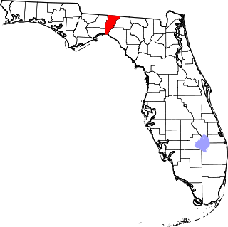
This is a list of the National Register of Historic Places listings in Indian River County, Florida.

<span class="mw-page-title-main">National Register of Historic Places listings in Jefferson County, Florida</span>

This is a list of the National Register of Historic Places listings in Jefferson County, Florida.

<span class="mw-page-title-main">National Register of Historic Places listings in Collier County, Florida</span>

This is a list of the National Register of Historic Places listings in Collier County, Florida.

<span class="mw-page-title-main">National Register of Historic Places listings in Charlotte County, Florida</span>

This is a list of the National Register of Historic Places listings in Charlotte County, Florida.

<span class="mw-page-title-main">National Register of Historic Places listings in Putnam County, Florida</span>

This is a list of the National Register of Historic Places listings in Putnam County, Florida.

<span class="mw-page-title-main">National Register of Historic Places listings in Santa Rosa County, Florida</span>

This is a list of the National Register of Historic Places listings in Santa Rosa County, Florida.

<span class="mw-page-title-main">National Register of Historic Places listings in Bradford County, Florida</span>

This is a list of the National Register of Historic Places listings in Bradford County, Florida.

<span class="mw-page-title-main">National Register of Historic Places listings in Columbia County, Florida</span>

This is a list of the National Register of Historic Places listings in Columbia County, Florida.

<span class="mw-page-title-main">National Register of Historic Places listings in Flagler County, Florida</span>

This is a list of the National Register of Historic Places listings in Flagler County, Florida.

<span class="mw-page-title-main">National Register of Historic Places listings in Hernando County, Florida</span>

This is a list of the National Register of Historic Places listings in Hernando County, Florida.

<span class="mw-page-title-main">National Register of Historic Places listings in Jackson County, Florida</span>

This is a list of the National Register of Historic Places listings in Jackson County, Florida.

<span class="mw-page-title-main">National Register of Historic Places listings in Liberty County, Florida</span>

This is a list of the National Register of Historic Places listings in Liberty County, Florida.

<span class="mw-page-title-main">National Register of Historic Places listings in Osceola County, Florida</span>

This is a list of the National Register of Historic Places listings in Osceola County, Florida.

<span class="mw-page-title-main">National Register of Historic Places listings in Pasco County, Florida</span>

This is a list of the National Register of Historic Places listings in Pasco County, Florida.

<span class="mw-page-title-main">National Register of Historic Places listings in Walton County, Florida</span>

This is a list of the National Register of Historic Places listings in Walton County, Florida.

References

  1. The latitude and longitude information provided in this table was derived originally from the National Register Information System, which has been found to be fairly accurate for about 99% of listings. Some locations in this table may have been corrected to current GPS standards.
  2. National Park Service, United States Department of the Interior, "National Register of Historic Places: Weekly List Actions", retrieved March 22, 2024.
  3. 1 2 Numbers represent an alphabetical ordering by significant words. Various colorings, defined here, differentiate National Historic Landmarks and historic districts from other NRHP buildings, structures, sites or objects.
  4. "National Register Information System". National Register of Historic Places . National Park Service. March 13, 2009.
  5. The eight-digit number below each date is the number assigned to each location in the National Register Information System database, which can be viewed by clicking the number.
  6. Griffin, Justine (January 30, 2011). "Locals hope to keep parks". St. Augustine Record . St. Augustine, Florida. Retrieved January 30, 2011.