Levy County | |
---|---|
Coordinates: 29°17′N82°47′W / 29.28°N 82.79°W | |
Country | United States |
State | Florida |
Founded | March 10, 1845 |
Named for | David Levy Yulee |
Seat | Bronson |
Largest city | Williston |
Area | |
• Total | 1,413 sq mi (3,660 km2) |
• Land | 1,118 sq mi (2,900 km2) |
• Water | 295 sq mi (760 km2) 20.9% |
Population (2020) | |
• Total | 42,915 |
• Density | 38/sq mi (15/km2) |
Time zone | UTC−5 (Eastern) |
• Summer (DST) | UTC−4 (EDT) |
Congressional district | 3rd |
Website | www |
Levy County is a county located on the Gulf coast in the northwestern part of the U.S. state of Florida. As of the 2020 census, the population was 42,915. [1] Its county seat is Bronson. [2]
Levy County was created in 1845, after the Seminole Wars, and became Florida's 27th county. It was named for David Levy Yulee, a slave owner elected in 1841 as the state's territorial delegate to the US House of Representatives, where he served two terms. [3]
Levy provided for long-term development in the state by constructing the first railroad across Florida, the Florida Railroad, linking the deep-water ports of Fernandina (Port of Fernandina) on the Atlantic Ocean and Cedar Key on the Gulf of Mexico.
The original county seat of Levy County was located in a neighborhood locally known as Sodom. This concerned the county commission so much that in April 1854 they changed the name to “Mount Pleasant”. The name was changed again in January 1856 to "Levyville". [4] An act of the State of Florida legislature ordered the county commissioners to let the county residents vote on the location of the county seat. In 1869, a vote was held to decide the location for the county seat. Bronson was selected by popular vote. County officials sited illegal votes cast in every precinct, so a new election was set to take place in 30 days. The Board of County Commissioners would later reverse their previous decision and let the vote stand. The process to build a new courthouse at Bronson began along with the removal of the courthouse at Levyville.
In 1874, the county seat was moved to Bronson, originally known as “Chunky Pond”, and was named after an early settler, Isaac Bronson. [5]
The Rosewood Massacre occurred in Levy County in the first week of January 1923. White citizens from the nearby town of Sumner, reacting to a what turned out to be a false accusation that a black man raped a white woman, burned the predominantly black town of Rosewood to the ground and brutally murdered several of Rosewood's black citizens. A film based on the incident was made in 1997, but was not filmed in Levy County. [6]
According to the U.S. Census Bureau, the county has a total area of 1,413 square miles (3,660 km2), of which 1,118 square miles (2,900 km2) is land and 295 square miles (760 km2) (20.9%) is water. [7]
Census | Pop. | Note | %± |
---|---|---|---|
1850 | 465 | — | |
1860 | 1,781 | 283.0% | |
1870 | 2,018 | 13.3% | |
1880 | 5,767 | 185.8% | |
1890 | 6,586 | 14.2% | |
1900 | 8,603 | 30.6% | |
1910 | 10,361 | 20.4% | |
1920 | 9,921 | −4.2% | |
1930 | 12,456 | 25.6% | |
1940 | 12,550 | 0.8% | |
1950 | 10,637 | −15.2% | |
1960 | 10,364 | −2.6% | |
1970 | 12,756 | 23.1% | |
1980 | 19,870 | 55.8% | |
1990 | 25,923 | 30.5% | |
2000 | 34,450 | 32.9% | |
2010 | 40,801 | 18.4% | |
2020 | 42,915 | 5.2% | |
2023 (est.) | 46,545 | [8] | 8.5% |
U.S. Decennial Census [9] 1790-1960 [10] 1900-1990 [11] 1990-2000 [12] 2010-2015 [1] 2019 [13] |
Race | Pop 2010 [16] | Pop 2020 [17] | % 2010 | % 2020 |
---|---|---|---|---|
White (NH) | 32,958 | 32,874 | 80.78% | 76.6% |
Black or African American (NH) | 3,756 | 3,597 | 9.21% | 8.38% |
Native American or Alaska Native (NH) | 129 | 122 | 0.32% | 0.28% |
Asian (NH) | 228 | 292 | 0.56% | 0.68% |
Pacific Islander (NH) | 14 | 11 | 0.03% | 0.03% |
Some Other Race (NH) | 48 | 170 | 0.12% | 0.4% |
Mixed/Multi-Racial (NH) | 621 | 1,769 | 1.52% | 4.12% |
Hispanic or Latino | 3,047 | 4,080 | 7.47% | 9.51% |
Total | 40,801 | 42,915 |
As of the 2020 United States census, there were 42,915 people, 16,971 households, and 10,747 families residing in the county.
As of the census [18] of 2000, there were 34,450 people, 13,867 households, and 9,679 families residing in the county. The population density was 31 people per square mile (12 people/km2). There were 16,570 housing units at an average density of 15 per square mile (5.8/km2). The racial makeup of the county was 85.88% White, 10.97% Black or African American, 0.47% Native American, 0.37% Asian, 0.03% Pacific Islander, 0.96% from other races, and 1.32% from two or more races. 3.89% of the population were Hispanic or Latino of any race.
There were 13,867 households, out of which 27.40% had children under the age of 18 living with them, 53.40% were married couples living together, 11.80% had a female householder with no husband present, and 30.20% were non-families. 24.90% of all households were made up of individuals, and 11.60% had someone living alone who was 65 years of age or older. The average household size was 2.44 and the average family size was 2.88.
In the county, the population was spread out, with 23.60% under the age of 18, 6.90% from 18 to 24, 25.00% from 25 to 44, 26.60% from 45 to 64, and 17.90% who were 65 years of age or older. The median age was 41 years. For every 100 females there were 94.00 males. For every 100 females age 18 and over, there were 90.80 males.
The median income for a household in the county was $26,959, and the median income for a family was $30,899. Males had a median income of $26,029 versus $20,252 for females. The per capita income for the county was $14,746. About 15.00% of families and 18.60% of the population were below the poverty line, including 25.80% of those under age 18 and 12.90% of those age 65 or over.
On April 7, 2008, Progress Energy Florida of St. Petersburg announced it had authorized Shaw and Westinghouse to purchase long-lead-time materials for up to two AP1000 nuclear reactors for its Levy County plant, a greenfield plant in Levy County, producing about 1,100 MW each.
Progress expects to apply for a Combined Construction and Operating License (COL) in the summer of 2008, according to a spokeswoman. Southern Company and SCANA, of whom each own an interest in the plant, would not reveal cost estimates, but Progress has said its plant will cost $14 billion, [19] with an additional $3 billion required for transmission infrastructure. [20]
Applying for a COL does not commit the utilities to construct the plant, but it is part of the licensing process, say officials of all the utilities. The application starts a 40-month review by the Nuclear Regulatory Commission, meaning that approval could come in August 2011.
In late July 2013 the company said it had scrapped its plan to build the plant. [21]
According to the Secretary of State's office, Republicans comprise a plurality of registered voters in Levy County.
Levy County Voter Registration and Party Enrollment as of March 22, 2019 [22] | |||||
---|---|---|---|---|---|
Political party | Total voters | Percentage | |||
Republican | 13,293 | 47.5% | |||
Democratic | 9,039 | 32.3% | |||
other party affiliation | 5,626 | 20.1% | |||
Total | 27,958 | 100% |
Year | Republican | Democratic | Third party | |||
---|---|---|---|---|---|---|
No. | % | No. | % | No. | % | |
2020 | 16,749 | 72.24% | 6,205 | 26.76% | 231 | 1.00% |
2016 | 13,775 | 70.64% | 5,101 | 26.16% | 623 | 3.20% |
2012 | 12,054 | 65.31% | 6,119 | 33.15% | 284 | 1.54% |
2008 | 11,754 | 62.56% | 6,711 | 35.72% | 324 | 1.72% |
2004 | 10,410 | 62.52% | 6,074 | 36.48% | 168 | 1.01% |
2000 | 6,863 | 53.91% | 5,398 | 42.40% | 469 | 3.68% |
1996 | 4,299 | 38.85% | 4,938 | 44.63% | 1,828 | 16.52% |
1992 | 3,796 | 34.71% | 4,330 | 39.59% | 2,810 | 25.69% |
1988 | 5,253 | 59.75% | 3,434 | 39.06% | 104 | 1.18% |
1984 | 5,561 | 64.19% | 3,103 | 35.81% | 0 | 0.00% |
1980 | 3,210 | 42.26% | 4,170 | 54.90% | 216 | 2.84% |
1976 | 1,965 | 31.87% | 4,025 | 65.28% | 176 | 2.85% |
1972 | 3,273 | 79.12% | 862 | 20.84% | 2 | 0.05% |
1968 | 745 | 18.81% | 767 | 19.36% | 2,449 | 61.83% |
1964 | 1,580 | 44.31% | 1,986 | 55.69% | 0 | 0.00% |
1960 | 996 | 33.21% | 2,003 | 66.79% | 0 | 0.00% |
1956 | 934 | 33.90% | 1,821 | 66.10% | 0 | 0.00% |
1952 | 1,066 | 34.66% | 2,010 | 65.34% | 0 | 0.00% |
1948 | 225 | 11.12% | 1,128 | 55.76% | 670 | 33.12% |
1944 | 225 | 9.65% | 2,107 | 90.35% | 0 | 0.00% |
1940 | 266 | 9.52% | 2,527 | 90.48% | 0 | 0.00% |
1936 | 183 | 8.37% | 2,003 | 91.63% | 0 | 0.00% |
1932 | 123 | 7.05% | 1,621 | 92.95% | 0 | 0.00% |
1928 | 711 | 46.23% | 797 | 51.82% | 30 | 1.95% |
1924 | 214 | 26.23% | 524 | 64.22% | 78 | 9.56% |
1920 | 377 | 29.50% | 882 | 69.01% | 19 | 1.49% |
1916 | 216 | 22.29% | 712 | 73.48% | 41 | 4.23% |
1912 | 74 | 13.91% | 375 | 70.49% | 83 | 15.60% |
1908 | 189 | 27.19% | 411 | 59.14% | 95 | 13.67% |
1904 | 151 | 24.59% | 426 | 69.38% | 37 | 6.03% |
School Board of Levy County operates public schools.
The current Levy County Library Director[ when? ] is Jeanine Turner.
The Levy County Public Library System has five branches:
600 Gilbert Street Bronson, FL 32621 Phone: (352) 486-2015
460 Second Street Cedar Key, FL 32625 Phone: (352) 543-5777
104 NE 3rd Street Chiefland, FL 32626 Phone: (352) 493-2758
10 SE 1st Street Williston, FL 32696 Phone: (352) 528-2313
11 56th Street Yankeetown, FL 34498 Phone: (352) 447-4212 [24]
Levy County Transit has public buses but doesn't have routes available online. [25] [26]
Levy County has only one railroad line running throughout the county, and only within eastern Levy along US 41. The line is a former Atlantic Coast Line Railroad line that is now used by the Florida Northern Railroad for freight to the Crystal River 3 Nuclear Power Plant in Red Level, Citrus County. Notable abandoned lines include a Seaboard Air Line Railroad line that is in proximity to the existing former ACL line, a Florida Railway and Navigation Company line running parallel to State Road 24, and a third in western and southern Levy County that spans from Fanning Springs towards the Dunnellon area running along US 19-98 until it reaches Lebanon Junction, where it runs along CR 336. The segment of that line between Fanning Springs and Chiefland is part of the Nature Coast State Trail.
# | Incorporated Community | Designation | Population |
---|---|---|---|
1 | Williston | City | 2,710 |
2 | Chiefland | City | 2,180 |
3 | Inglis | Town | 1,320 |
4 | Bronson | Town | 1,119 |
5 | Fanning Springs# | City | 1,009 |
6 | Cedar Key | City | 610 |
7 | Yankeetown | City | 495 |
8 | Otter Creek | City | 131 |
(#) Partially in Gilchrist County
# | Census-designated places | Population |
---|---|---|
1 | Williston Highlands | 2,275 |
2 | Manatee Road | 2,244 |
3 | East Bronson | 1,945 |
4 | Andrews | 798 |
5 | East Williston | 695 |
6 | Raleigh | 373 |
7 | Morriston | 164 |
Marion County is located in the northern portion of the U.S. state of Florida. As of the 2020 census, the population was 375,908. Its county seat is Ocala.
Gilchrist County is a county located in the north central part of the U.S. state of Florida. Organized in 1925 from the western part of Alachua, it is the last county to be formed in the state. As of the 2020 census, the population was 17,864. The county seat is Trenton.
Bronson is a town and the county seat of Levy County, Florida, United States. The population was 1,140 at the 2020 census.
Chiefland is a city in Levy County, Florida, United States. The population was 2,316 at the 2020 census. Chiefland calls itself "The Gem of the Suwannee Valley" and was incorporated in 1913.
Dunnellon is a city in Marion County, Florida, United States. The population was 1,928 at the 2020 census, up from 1,733 in 2010. It is part of the Ocala Metropolitan Statistical Area.
North central Florida is a region of the U.S. state of Florida which comprises the north-central part of the state and encompasses the north Florida counties of Alachua, Marion, Putnam, Bradford, Columbia, Dixie, Gilchrist, Hamilton, Lafayette, Levy, Madison, Suwannee, Taylor, and Union. The region's largest city is Gainesville, home of the University of Florida and center of the Gainesville metropolitan area, which is the largest metro area of the region. As of 2020, the region had a population of 575,622 people.
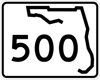
State Road 500 is a state highway running through Florida as a mostly unsigned route under several U.S. Highways. From Chiefland to Williston it is U.S. Highway 27 Alternate. From Williston to Ocala, it is US 27. From Ocala to Holopaw, it is US 441. From Kissimmee to Indialantic it is US 192.
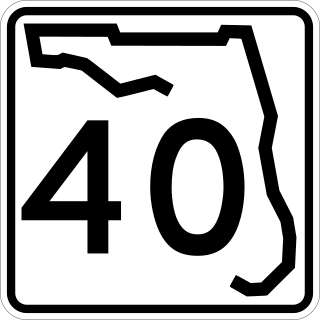
State Road 40 is a 91.8-mile-long (147.7 km) east–west highway across northern and east-central Florida, running from U.S. Highway 41 (US 41) in Rainbow Lakes Estates eastwards through Ocala over the Ocklawaha River and through the heart of the Ocala National Forest to SR A1A in Ormond Beach. Names of the road include Silver Springs Boulevard in Ocala, Fort Brooks Road from Silver Springs through Astor, Butler Road in Astor, and Granada Boulevard in Ormond Beach. Former sections in Ormond Beach are named "Old Tomoka Road" and "Old Tomoka Avenue."
State Road 345 is a north–south route in the Big Bend area of Florida, running from U.S. Route 27 Alternate east of Chiefland to County Road 332 (CR 332) southwest of Chiefland. South of CR 332, the road becomes County Road 345 as it runs towards Rosewood.
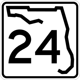
State Road 24 is an east–west state highway that runs between Cedar Key on the Gulf of Mexico and Waldo, Florida, at US 301. State Road 24 runs along a former branch of the Seaboard Air Line Railroad. This branch was originally owned by the Florida Railway and Navigation Company, and used to lead to ferries to both Pensacola, Florida and New Orleans, Louisiana. It also passes through Rosewood, site of the infamous 1923 massacre.
State Road 55 is mainly the internal or secret designation of U.S. Route 19 through Florida, although it has appeared on maps and atlases on several occasions. State Road 55 originates at the Georgia state line north of Ashville, and ends at SR 684 in Bradenton. North of Perry, it is the secret route for US 221, continuing north into Georgia as Georgia State Route 76. South of Memphis, it is a secret designation for US 41; it is also a secret designation for US 301 in the Bradenton - Palmetto area, along a segment co-signed with US 41.
State Road 26 is a 62.172-mile-long (100.056 km) east–west route across North Central Florida.
U.S. Highway 1 (US 1) in Florida runs 545 miles (877 km) along the state's east coast from Key West to its crossing of the St. Marys River into Georgia north of Boulogne and south of Folkston. US 1 was designated through Florida when the U.S. Numbered Highway System was established in 1926. With the exception of Monroe County, the highway runs through the easternmost tier of counties in the state, connecting numerous towns and cities along its route, including nine county seats. The road is maintained by the Florida Department of Transportation (FDOT).
U.S. Highway 19 (US 19) runs about 262 miles (422 km) along Florida's west coast from an interchange with US 41 in Memphis, south of Tampa, and continues to the Georgia border north of Monticello.
U.S. Highway 41 (US 41) in the state of Florida is a north–south United States Highway. It runs 479 miles (771 km) from Miami in South Florida northwest to the Georgia state line north of the Lake City area. Within the state, US 41 is paralleled by Interstate 75 (I-75) all the way from Miami to Georgia, and I-75 has largely supplanted US 41 as a major highway.
U.S. Route 98 is a major east-west thoroughfare through the U.S. state of Florida. Spanning 670.959 miles (1,079.804 km), it connects Pensacola and the Alabama/Florida state line to the west with Palm Beach and the Atlantic coast in the east. It is the longest US road in Florida, as well as the longest US road in any state east of the Mississippi River.
U.S. Route 129 (US 129) in Florida is a north–south United States Highway. It runs 88 miles (142 km) from Chiefland north to the Georgia State Line in Levy, Gilchrist, Suwannee, and Hamilton Counties.
State Road 121 is a major state highway that runs north and south in northern Florida. The road is part of a long multi-state route that also goes through Georgia and South Carolina.
State Road 49 is the state designation for US 19/98/27 Alternate(SR 55) in Chiefland, and US 27(SR 20) in Hildreth east of Branford, Florida. It also includes a county extension in Suwannee County, Florida from Hildreth to the outskirts of Live Oak, Florida.
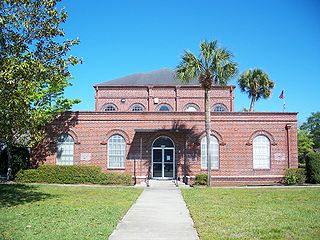
District School Board of Levy County or the School Board of Levy County (SBLC) is a school district headquartered in Bronson, Florida. It serves Levy County. Chris Cowart serves as Superintendent.