Wakulla County, Florida

Last updated

Wakulla County
Crawfordville FL new crths02.jpg
Wakulla County Courthouse
Logo of Wakulla County Florida in 2013.jpg
Map of Florida highlighting Wakulla County.svg
Location within the U.S. state of Florida
Florida in United States.svg
Florida's location within the U.S.
Coordinates: 30°09′N84°23′W / 30.15°N 84.38°W / 30.15; -84.38
CountryFlag of the United States.svg United States
StateFlag of Florida.svg  Florida
FoundedMarch 11, 1843
Named for Wakulla River
Seat Crawfordville
Largest city Sopchoppy
Area
  Total736 sq mi (1,910 km2)
  Land606 sq mi (1,570 km2)
  Water129 sq mi (330 km2)  17.6%
Population
 (2020)
  Total33,764
  Density55/sq mi (21/km2)
Time zone UTC−5 (Eastern)
  Summer (DST) UTC−4 (EDT)
Congressional district 2nd
Website www.mywakulla.com

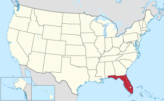
Wakulla County is a county located in the Big Bend region in the northern portion of the U.S. state of Florida. As of the 2020 census, the population was 33,764. Its county seat is Crawfordville. [1]

Contents

Wakulla County is part of the Tallahassee metropolitan area.

Wakulla County has a near-absence of any municipal population, with two small municipalities holding about 3% of the population. The county seat, Crawfordville, is one of only two unincorporated county seats among Florida's 67 counties.

History

First Spanish period

In 1528, Pánfilo de Narváez found his way to what would be Wakulla County from the future Pinellas County, Florida, camping at the confluence of the Wakulla and St. Marks rivers. Narváez determined this was a very suitable spot for a fort. In 1539, Hernando de Soto's expedition passed through La Florida with a similar route.

The Fort San Marcos de Apalache began with a wooden fort in the late 1600s. The vicinity around the fort was not settled until 1733. Spanish colonial officials began constructing a stone fort, which was unfinished in the mid-1760s when Great Britain took over.

British period

The British divided Florida into East Florida, which included present-day Wakulla County, and West Florida. The boundary was the Apalachicola River; at that time, West Florida extended all the way to the Mississippi River. Twenty years later when the Spanish returned, they kept the East and West divisions, with the administrative capitals remaining at St. Augustine and Pensacola, respectively.

Second Spanish period

The area to become Wakulla County was an active place in the early 19th century. A former British officer named William Augustus Bowles attempted to unify and lead 400 Creek Indians against the Spanish outpost of San Marcos, capturing it. This provoked Spain, and a Spanish flotilla arrived some five weeks later to restore control.

In 1818, General Andrew Jackson invaded the area, capturing Fort San Marcos. Two captive British citizens, Robert Ambrister and Alexander Arbuthnot, were tried, found guilty of inciting Indian raids, and executed under Jackson's authority – causing a diplomatic nightmare between the U.S. and Britain. The U.S. Army garrison of 200 infantry and artillery men occupied the fort for the better part of a year (1818-1819).

In 1821, Florida was ceded to the United States and Fort St. Marks, as the Americans called it, was again garrisoned by U.S. troops.

Florida's territorial period

In 1824, the fort was abandoned and turned over to the Territory of Florida.

By 1839, the fort was returned to the Federal government and a merchant marine hospital was built. The hospital provided care for seamen and area yellow fever victims.

American forts in Wakulla County

  • 1840 - Camp Lawson, northwest of Wakulla and northeast of Ivan, on the St. Marks River. A log stockade also known as Fort Lawson (2).
  • 1841-1842 - Fort Many located near Wakulla Springs.
  • 1839 - Fort Number Five (M) located near Sopchoppy.
  • 1839-1843 - Fort Stansbury was located on the Wakulla River 9 miles (14 km) from St. Marks.
  • 1841-1843 - Fort Port Leon. Abandoned after a hurricane destroyed it. Site was later used for a CSA Army artillery battery.
  • 1839 - James Island Post located on James Island. [2]

Antebellum Wakulla

Wakulla County was created from Leon County in 1843. It may (although this is disputed) be named for the Timucuan Indian word for "spring of water" or "mysterious water". This is in reference to Wakulla County's greatest natural attraction, Wakulla Springs, which is one of the world's largest freshwater springs, both in terms of depth and water flow. In 1974, the water flow was measured at 1.23 billion US gallons (4,700,000 m3) per day—the greatest recorded flow ever for a single spring.

In an 1856 book, adventurer Charles Lanman wrote of the springs:[ citation needed ]

An adequate idea of this mammoth spring could never be given by pen or pencil; but when once seen, on a bright calm day, it must ever after be a thing to dream about and love. It is the fountain-head of a river... and is of sufficient volume to float a steamboat, if such an affair had yet dared to penetrate this solemn wilderness... It wells up in the very heart of a dense cypress swamp, is nearly round in shape, measures some four hundred feet in diameter, and is in depth about one hundred and fifty feet, having at its bottom an immense horizontal chasm, with a dark portal, from one side of which looms up a limestone cliff, the summit of which is itself nearly fifty feet beneath the spectator, who gazes upon it from the sides of a tiny boat. The water is so astonishlingly clear that even a pin can be seen on the bottom in the deepest places, and of course every animate and inanimate object which it contains is fully exposed to view. The apparent color of the water from the shore is greenish, but as you look perpendicularly into it, it is colorless as air, and the sensation of floating upon it is that of being suspended in a balloon; and the water is so refractive, that when the sun shines brilliantly every object you see is enveloped in the most fascinating prismatic hues.

Another possible origin for the name Wakulla, not as widely accepted, is that it means "mist" or "misting", perhaps in reference to the Wakulla Volcano, a 19th-century phenomenon in which a column of smoke could be seen emerging from the swamp for miles.

The town of Port Leon was once a thriving cotton-shipping hub, with a railroad from Tallahassee that carried over 50,000 tons of cotton a year to be put on ships, usually for shipment direct to Europe. Port Leon was the sixth-largest town in Florida, with 1,500 residents. However, a hurricane and the accompanying storm surge wiped out the entire town. New Port (today known as Newport, Florida) was built two miles (3 km) upstream but never quite achieved the prosperity of Port Leon. [3] [4]

Civil War

During the Civil War, Wakulla County was blockaded from 1861 to 1865 by a Union Navy squadron at the mouth of the St. Marks River. Confederates took the old Spanish fort known as San Marcos de Apalache, or Fort St. Marks, and renamed it Fort Ward.

The Battle of Natural Bridge eventually stopped the Union force that intended to take Fort Ward and nearby Tallahassee, the only Confederate state capital other than Austin Texas which had not been captured. The Union was not able to land all of its forces, but they still outnumbered the Confederates, who chose to make their stand at a place where the St. Marks River goes underground: the "Natural Bridge" referred to. However, the Confederate Army had over a day to prepare its defenses, and the Union Army retreated. Most of the dead were African-American Union soldiers.

20th century and beyond

In Gloria Jahoda's book The Other Florida, she writes movingly of the extreme poverty of Wakulla County from the early 1900s to 1966 when Wakulla still had no doctor and no dentist, few stores, and a county newspaper produced just once a month on a mimeograph machine. [4]

Today, Wakulla has several doctors and dentists, several supermarkets and big-box retailers, a golf resort, and a thriving seafood business. [5]

Etymology

The name Wakulla is corrupted from Guacara. Guacara is a Spanish phonetic spelling of an original Indian name, and Wakulla is a Muskhogean pronunciation of Guacara. The Spanish "Gua" is the equivalent of the Creek "wa", and as the Creek alphabet does not exhibit an "R" sound, the second element "cara" would have been pronounced "kala" by the Creeks. The Creek voiceless "L" is always substituted for the Spanish "R". Thus the word Guacara was pronounced Wakala by the Seminoles who are Muskhogean in their origin and language.

Because Wakulla was probably a Timucuan word, it is unlikely that its meaning will ever be known. It may contain the word kala, which signified a "spring of water" in some Indian dialects. [6] . It may refer to the Whip-poor-will, known as waxkula in Creek. [7]

Geography

According to the U.S. Census Bureau, the county has a total area of 736 square miles (1,910 km2), of which 606 square miles (1,570 km2) is land and 129 square miles (330 km2) (17.6%) is water. [8]

Wakulla County was added to the Tallahassee, Florida Metropolitan Statistical Area (MSA) in 1973. The county was removed from the Tallahassee MSA in 1983. It was re-added to the MSA (for the second time) in 2003. [9]

Adjacent counties

National protected areas

State and local protected areas

Demographics

Historical population
CensusPop.Note
1850 1,955
1860 2,83945.2%
1870 2,506−11.7%
1880 2,7238.7%
1890 3,11714.5%
1900 5,14965.2%
1910 4,802−6.7%
1920 5,1296.8%
1930 5,4686.6%
1940 5,463−0.1%
1950 5,258−3.8%
1960 5,2570.0%
1970 6,30820.0%
1980 10,88772.6%
1990 14,20230.4%
2000 22,86361.0%
2010 30,77634.6%
2020 33,7649.7%
2023 (est.)36,449 [10] 8.0%
U.S. Decennial Census [11]
1790-1960 [12] 1900-1990 [13]
1990-2000 [14] 2010-2015 [15] 2019 [16]

2020 census

Wakulla County racial composition [17] [18]
(NH = Non-Hispanic) [lower-alpha 1]
RacePop 2010Pop 2020% 2010% 2020
White (NH)24,47225,98779.52%76.97%
Black or African American (NH)4,4064,20214.32%12.45%
Native American or Alaska Native (NH)1741540.57%0.46%
Asian (NH)1661980.54%0.59%
Pacific Islander (NH)17190.06%0.06%
Some Other Race (NH)291260.09%0.37%
Mixed/Multi-Racial (NH)4961,5011.61%4.45%
Hispanic or Latino 1,0161,5773.3%4.67%
Total30,77633,764

As of the 2020 United States census, there were 33,764 people, 11,382 households, and 8,362 families residing in the county.

2000 census

As of the census [21] of 2000, there were 22,863 people, 8,450 households, and 6,236 families residing in the county. The population density was 38 inhabitants per square mile (15/km2). There were 9,820 housing units at an average density of 16 per square mile (6/km2). The racial makeup of the county was 86.10% White, 11.51% Black or African American, 0.59% Native American, 0.25% Asian, 0.03% Pacific Islander, 0.29% from other races, and 1.23% from two or more races. 1.94% of the population were Hispanic or Latino of any race.

There were 8,450 households, out of which 35.60% had children under the age of 18 living with them, 57.10% were married couples living together, 12.40% had a female householder with no husband present, and 26.20% were non-families. 22.00% of all households were made up of individuals, and 7.00% had someone living alone who was 65 years of age or older. The average household size was 2.57 and the average family size was 2.99. In the county, the population was spread out, with 25.60% under the age of 18, 7.60% from 18 to 24, 31.70% from 25 to 44, 24.70% from 45 to 64, and 10.30% who were 65 years of age or older. The median age was 37 years. For every 100 females, there were 107.30 males. For every 100 females age 18 and over, there were 106.80 males.

The median income for a household in the county was $37,149, and the median income for a family was $42,222. Males had a median income of $29,845 versus $24,330 for females. The per capita income for the county was $17,678. About 9.30% of families and 11.30% of the population were below the poverty line, including 15.40% of those under age 18 and 15.10% of those age 65 or over.

Politics

United States presidential election results for Wakulla County, Florida [22]
Year Republican Democratic Third party
No.%No.%No.%
2020 12,87469.79%5,35129.01%2231.21%
2016 10,51268.07%4,34828.15%5843.78%
2012 9,29063.21%5,17535.21%2321.58%
2008 8,87761.75%5,31136.94%1881.31%
2004 6,77757.61%4,89641.62%900.77%
2000 4,51252.54%3,83844.70%2372.76%
1996 2,93340.91%3,05642.63%1,18016.46%
1992 2,58638.52%2,32034.55%1,80826.93%
1988 3,15865.72%1,60533.40%420.87%
1984 3,08867.75%1,47032.25%00.00%
1980 2,02147.26%2,08248.69%1734.05%
1976 1,58038.80%2,35357.78%1393.41%
1972 2,46682.01%53917.92%20.07%
1968 24710.49%44018.68%1,66870.83%
1964 1,27062.78%75337.22%00.00%
1960 37924.85%1,14675.15%00.00%
1956 39326.79%1,07473.21%00.00%
1952 37524.24%1,17275.76%00.00%
1948 725.22%99772.30%31022.48%
1944 736.69%1,01893.31%00.00%
1940 704.98%1,33695.02%00.00%
1936 453.08%1,41796.92%00.00%
1932 201.89%1,03698.11%00.00%
1928 6612.18%47086.72%61.11%
1924 348.74%33285.35%235.91%
1920 11917.81%53079.34%192.84%
1916 12121.49%38768.74%559.77%
1912 258.96%21577.06%3913.98%
1908 5616.28%23969.48%4914.24%
1904 3913.78%23382.33%113.89%

County representation

Wakulla County Government
PositionNameParty

CommissionerRalph ThomasRepublican
CommissionerFred Nichols IIRepublican
CommissionerMike KempRepublican
CommissionerQuincee MesserSmithRepublican
CommissionerChuck HessDemocrat
SheriffJared MillerRepublican
County JudgeBrian MillerRepublican
Clerk of the CourtGreg JamesRepublican
Property AppraiserEd BrimnerRepublican
School SuperintendentBobby PearceRepublican
Elections SupervisorJoe MorganRepublican
Tax CollectorLiza CrazeRepublican

[23]

Transportation

Roads

Although there are no Interstate highways in Wakulla County, several major routes pass through the area, including U.S. Route 98 and U.S. Route 319. Other important roads in the county include State Road 267, State Road 363 and County Road 375. [24]

Railroads

No railroads currently operate within Wakulla County.

In the past the Georgia, Florida and Alabama Railroad passed through Sopchoppy on its route between Tallahassee and Carrabelle until its abandonment in 1948; that portion of the line was referred to as the Sumatra Leaf Line, referring to a tobacco grown in the area. South of Sopchoppy the line followed H.T. Smith Road. The railroad bridge crossing the Ochlocknee River at MacIntyre still exists as pilings blocking all but a portion of the river on the south side. [25] [26] while the Tallahassee Railroad, the first railroad in Florida, was abandoned by its successor, the Seaboard Coast Line Railroad, in 1983.

Airports

The Wakulla County Airport (2J0), located south of Panacea, is a small public-use airport with a single 2,600-foot (790 m), north–south turf runway. [27] This airfield was originally constructed during World War II, as an emergency landing strip for Army Air Corps aircraft which trained and patrolled along the Gulf Coast, most of which belonged to the 3rd Army Air Corps out of Dale Mabry Field Army Air Base in Tallahassee. After the war, the air strip was turned over to the county for civilian uses.[ citation needed ]

Seaports

St. Marks is a small commercial seaport. Panacea and Ochlockonee Bay also support small fishing fleets.

Education

Wakulla County is served by the Wakulla school district with the following schools: [28]

The former Sopchoppy Elementary School now serves as the Sopchoppy Education Center, a Pre-K, adult, and second chance school.

The former Shadeville High School served African-American students from 1931 to 1967.

Library

The Wakulla County Public Library is the main library of Wakulla County and is a part of the Wilderness Coast Public Libraries. [29]

Communities

Towns

Census-designated places

Other unincorporated communities

See also

Notes

  1. Note: the US Census treats Hispanic/Latino as an ethnic category. This table excludes Latinos from the racial categories and assigns them to a separate category. Hispanics/Latinos can be of any race. [19] [20]

Related Research Articles

<span class="mw-page-title-main">Jefferson County, Florida</span> County in Florida, United States

Jefferson County is a county located in the Big Bend region in the northern part of the U.S. state of Florida. As of the 2020 census, the population was 14,510. Its county seat is Monticello.

<span class="mw-page-title-main">Leon County, Florida</span> County in Florida, United States

Leon County is a county in the Panhandle of the U.S. state of Florida. It was named after the Spanish explorer Juan Ponce de León. As of the 2020 census, the population was 292,198.

<span class="mw-page-title-main">Sopchoppy, Florida</span> City in Florida, United States

Sopchoppy is a city in Wakulla County, Florida, United States. The City of Sopchoppy is located on the Florida Panhandle in North Florida, with Ochlockonee River State Park located nearby. It is part of the Tallahassee, Florida Metropolitan Statistical Area. The population was 426 at the 2020 census.

<span class="mw-page-title-main">St. Marks, Florida</span> City in Florida, United States

St. Marks is a city in Wakulla County, Florida, United States. It is part of the Tallahassee metropolitan area. The City of St. Marks is located on the Florida Panhandle in North Florida, along the Gulf of Mexico. As of 2020, the population according to the U.S. Census Bureau is 274.

<span class="mw-page-title-main">Florida panhandle</span> Northwest region of Florida

The Florida panhandle is the northwestern part of the U.S. state of Florida. It is a salient roughly 200 miles (320 km) long, bordered by Alabama on the north and the west, Georgia on the north, and the Gulf of Mexico to the south. Its eastern boundary is arbitrarily defined. It is defined by its southern culture and rural geography relative to the rest of Florida, as well as closer cultural links to French-influenced Louisiana, Mississippi, and Alabama. Its major communities include Pensacola, Navarre, Destin, Panama City Beach, and Tallahassee.

<span class="mw-page-title-main">Florida State Road 10 (1923–1945)</span> List of roads or other routes with the same name

State Road 10 was a state highway in Florida from 1923 through 1945, when the majority of numbered highways in the state were renumbered. Today, the route is related to the following routes:

<span class="mw-page-title-main">Nature Coast</span> Region in Florida

The Nature Coast is an informal, unofficial region of the U.S. state of Florida. The broadest definition of the Nature Coast includes the eight counties that abut the Gulf of Mexico along the Big Bend Coast defined by geologists: from west to east, Wakulla, Jefferson, Taylor, Dixie, Levy, Citrus, Hernando, and Pasco counties. The name "Nature Coast" was originally devised as part of a marketing campaign to promote tourism in Levy, Citrus, Hernando, and parts of Marion and Pasco counties.

<span class="mw-page-title-main">Ochlockonee River State Park</span> Preserve in Florida, USA

Ochlockonee River State Park is a Florida State Park located in Wakulla County, Florida, south of the town of Sopchoppy in the Florida Panhandle. Located off of U.S. 319 on the Ochlockonee River, just north of the Gulf of Mexico coast, it is surrounded by the Apalachicola National Forest and the St. Marks National Wildlife Refuge and provides important habitat for the endangered red-cockaded woodpecker.

<span class="mw-page-title-main">San Marcos de Apalache Historic State Park</span> Archaeological site in Florida, United States

San Marcos de Apalache Historic State Park is a Florida State Park in Wakulla County, Florida organized around the historic site of a Spanish colonial fort, which was used by succeeding nations that controlled the area. The Spanish first built wooden buildings and a stockade in the late 17th and early 18th centuries here, which were destroyed by a hurricane.

<span class="mw-page-title-main">Newport, Florida</span> Place in Florida, United States

Newport is a small unincorporated community in Wakulla County, Florida, United States of America, situated where U.S. Highway 98 meets State Road 267.

<span class="mw-page-title-main">Tallahassee-St. Marks Historic Railroad State Trail</span> State park in Florida, United States

Tallahassee-St. Marks Historic Railroad State Trail is a rail trail and Florida State Park located on 16 miles (26 km) of the historic railbed of the Tallahassee Railroad, which ran between Tallahassee and St. Marks, Florida. The trail ends near the confluence of the St. Marks and Wakulla Rivers. The portion of the trail south of US 98 is designated as a portion of the Florida National Scenic Trail. A paved extension of the trail extends north for approximately 4 miles (6.4 km) into the City of Tallahassee.

<span class="mw-page-title-main">Fort Ward (Florida)</span>

Fort Ward was a Confederate States of America fort located in Wakulla County, Florida, at the confluence of the Wakulla River and St. Marks River and named after Colonel George T. Ward, owner of Southwood Plantation, Waverly Plantation, and Clifford Place Plantation south of Tallahassee. During the American Civil War, Confederate troops placed a battery of cannons at Fort Ward.

<span class="mw-page-title-main">St. Marks River</span> River in Florida, United States

The St. Marks River is a river in the Big Bend region of Florida. It has been classified by the Florida Department of Environmental Protection as an Outstanding Florida Water, and is the easternmost river within the Northwest Florida Water Management District.

<span class="mw-page-title-main">Forgotten Coast</span> Region in Florida

The Forgotten Coast refers to a largely untouched and uninhabited area of coastline in the panhandle of the US state of Florida. The term, also a trademark, was first used in 1992, but the Forgotten Coast's exact location is not agreed upon.

<span class="mw-page-title-main">Tallahassee metropolitan area</span> Metropolitan area in Florida, United States

The Tallahassee Metropolitan Statistical area is the metropolitan area centered on Tallahassee, Florida.

<span class="mw-page-title-main">Wakulla High School</span> Public high school in Coastal Highway, Crawfordville, Florida, US

Wakulla High School is the only public four year high school located in Wakulla County, Florida, United States. It is part of the Wakulla County Public Schools network. The Florida Department of Education has labeled Wakulla High School as a "School of Excellence" in their school accountability reports for the years 2020 and 2021.

<span class="mw-page-title-main">Big Bend (Florida)</span> Region of the state Florida, United States

The Big Bend of Florida, United States, is an informally named geographic region of North Florida where the Florida Panhandle transitions to the Florida Peninsula south and east of Tallahassee. The region is known for its vast woodlands and marshlands and its low population density relative to much of the state. The area is home to the largest single spring in the United States, the Alapaha Rise, and the longest surveyed underwater cave in the United States, the 32-mile (51 km) Wakulla-Leon Sinks cave system.

<span class="mw-page-title-main">Wakulla River</span> River in Florida, United States of America

The Wakulla River is an 11-mile-long (18 km) river in Wakulla County, Florida. It carries the outflow from Wakulla Springs, site of the Edward Ball Wakulla Springs State Park, to the St. Marks River 3 miles (5 km) north of the Gulf of Mexico. Its drainage basin extends northwest into Leon County, including Munson Slough, and may extend as far north as the Georgia border.

<span class="mw-page-title-main">Andrew Hargrett</span>

Andrew Joshua Hargrett, Sr. (1879–1932) was a pioneering African-American educator who organized Shadeville Elementary School in 1909, the first school for black people in Wakulla County, Florida. In the late 1920s, he also led the crusade to establish Shadeville High School, the county's first high school for black students. His oldest son, Andrew Hargrett II, was in the first graduating class in 1930.

References

  1. "Find a County". National Association of Counties. Archived from the original on July 12, 2012. Retrieved June 7, 2011.
  2. "Florida Forts: page 2". Archived from the original on April 26, 2005. Retrieved April 29, 2013.
  3. "Historical Places". Wakullacountytdc.com. Archived from the original on March 3, 2012. Retrieved April 29, 2013.
  4. 1 2 Jahoda, Gloria (1967). The Other Florida, Florida Classics. ISBN   978-0-912451-04-6.
  5. "Wakulla County Chamber of Commerce". Wakullacountychamber.com. Archived from the original on May 29, 2013. Retrieved April 29, 2013.
  6. Simpson, J. Clarence (1956). Mark F. Boyd (ed.). Florida Place-Names of Indian Derivation. Tallahassee, Florida: Florida Geological Survey.
  7. Gatschet, Albert S. Peet, Stephen D. (ed.). "The American Antiquarian and Oriental Journal" (PDF). Wikimedia Commons . Archived (PDF) from the original on July 28, 2021.
  8. "US Gazetteer files: 2010, 2000, and 1990". United States Census Bureau. February 12, 2011. Archived from the original on February 24, 2021. Retrieved April 23, 2011.
  9. "Metro Area History 1950–2020". U.S. Census Bureau. March 2020. Row 4179. Retrieved November 5, 2023.
  10. "Annual Estimates of the Resident Population for Counties: April 1, 2020 to July 1, 2023". United States Census Bureau. Retrieved March 31, 2024.
  11. "U.S. Decennial Census". United States Census Bureau. Archived from the original on July 1, 2021. Retrieved June 16, 2014.
  12. "Historical Census Browser". University of Virginia Library. Archived from the original on August 11, 2012. Retrieved June 16, 2014.
  13. "Population of Counties by Decennial Census: 1900 to 1990". United States Census Bureau. Archived from the original on February 20, 2014. Retrieved June 16, 2014.
  14. "Census 2000 PHC-T-4. Ranking Tables for Counties: 1990 and 2000" (PDF). United States Census Bureau. Archived (PDF) from the original on December 18, 2014. Retrieved June 16, 2014.
  15. "State & County QuickFacts". United States Census Bureau. Archived from the original on February 13, 2014. Retrieved February 15, 2014.
  16. "QuickFacts. Florida counties". Archived from the original on January 23, 2020. Retrieved May 20, 2020.
  17. "Explore Census Data". data.census.gov. Archived from the original on May 18, 2022. Retrieved May 18, 2022.
  18. "Explore Census Data". data.census.gov. Archived from the original on May 18, 2022. Retrieved May 18, 2022.
  19. Bureau, US Census. "Census.gov". Census.gov. Archived from the original on October 23, 2019. Retrieved March 17, 2023.
  20. "About the Hispanic Population and its Origin". www.census.gov. Archived from the original on May 20, 2022. Retrieved May 18, 2022.
  21. "U.S. Census website". United States Census Bureau. Archived from the original on December 27, 1996. Retrieved May 14, 2011.
  22. Leip, David. "Dave Leip's Atlas of U.S. Presidential Elections". uselectionatlas.org. Archived from the original on July 9, 2018. Retrieved June 16, 2018.
  23. "Wakulla County Supervisor of Elections". Archived from the original on December 31, 2006. Retrieved January 9, 2007.
  24. Florida Atlas & Gazetteer (7th ed.). DeLorme. 2003. ISBN   0-89933-318-4.
  25. "Georgia, Florida & Alabama Railway, 1918 map". Archived from the original on September 10, 2015. Retrieved November 27, 2016.
  26. "Donald R. Hensley, Jr.'s Taplines". The story of the Georgia Florida & Alabama RR. Archived from the original on April 4, 2019. Retrieved January 9, 2007.
  27. "AirNav, LLC". 2J0 - Wakulla County Airport. Archived from the original on September 30, 2007. Retrieved January 9, 2007.
  28. "WCSB School List". Archived from the original on May 16, 2010.
  29. "Wilderness Coast Public Libraries". wildernesscoast.org. Archived from the original on September 13, 2019. Retrieved October 11, 2019.

Sources

30°09′N84°23′W / 30.15°N 84.38°W / 30.15; -84.38