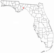
Location of Port LeonGovernment docks at Port LeonGovernment docks at Port Leon
Port Leon, Florida, was a river port town located in what is now Wakulla County, Florida (at the time, it was part of Leon County, Florida). The town existed for only about six years in the first half of the 19th century. Port Leon is classified as an "extinct city" by the State Library and Archives of Florida, and only remnants can be found today.
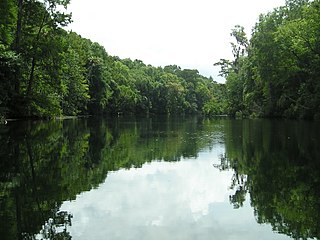
Port Leon was established in 1837, largely by former inhabitants of Magnolia. It was located approximately 3 miles (4.8km) south of St. Marks on the east bank of the St. Marks River. Similar to its neighboring towns of St. Marks and Magnolia, Port Leon served as an important port for the cotton plantations in the Red Hills Region of Florida and Georgia.
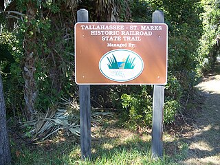
The Tallahassee Railroad reached Port Leon in 1839.[1] By that time, both freight wagons and the railroad were transporting approximately 30,000 to 40,000 bales of cotton annually to the area ports. A bridge across the St. Marks River connected the port to the railroad, facilitating the loading of cotton onto ships bound for the east coast of the United States.
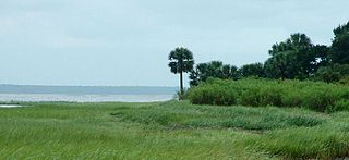
Port Leon received a post office in 1840,[2] and was incorporated in 1841. In the same year Port Leon, along with the other communities in the area, endured a severe yellow fever epidemic. On March 11, 1843, it was chosen as the seat of newly created Wakulla County. On September 13, 1843, a strong hurricane with a 10-foot (3m) storm surge hit the area and destroyed Port Leon as well as heavily damaging nearby Magnolia and St. Marks. Port Leon was abandoned and many of its residents moved inland to the new town of Newport.[3]
Port Leon had several hundred citizens at its peak with 8 to 10 businesses, some wharves, warehouses, a hotel, two taverns, a newspaper and an annual fair. One of the successful citizens was Daniel Ladd who had married into the Hamlin family from Maine that established the town of Magnolia.
Franklin County is a county along the Gulf of Mexico in the panhandle of the U.S. state of Florida. As of the 2020 census, the population was 12,451, making it the third-least populous county in Florida. The county seat is Apalachicola.
Jefferson County is a county located in the Big Bend region in the northern part of the U.S. state of Florida. As of the 2020 census, the population was 14,510. Its county seat is Monticello.
Leon County is a county in the Panhandle of the U.S. state of Florida. It was named after the Spanish explorer Juan Ponce de León. As of the 2020 census, the population was 292,198.
Wakulla County is a county located in the Big Bend region in the northern portion of the U.S. state of Florida. As of the 2020 census, the population was 33,764. Its county seat is Crawfordville.
St. Marks is a city in Wakulla County, Florida, United States. It is part of the Tallahassee, Florida Metropolitan Statistical Area. St. Marks is located on the Florida Panhandle in North Florida, along the Gulf of Mexico. The population at the 2020 census was 274, down from 293 at the 2010 census.
The Florida panhandle is the northwestern part of the U.S. state of Florida. It is a salient roughly 200 miles (320 km) long, bordered by Alabama on the north and the west, Georgia on the north, and the Gulf of Mexico to the south. Its eastern boundary is arbitrarily defined. It is defined by its southern culture and rural geography relative to the rest of Florida, as well as closer cultural links to French-influenced Louisiana, Mississippi, and Alabama. Its major communities include Pensacola, Navarre, Destin, Panama City Beach, and Tallahassee.
San Marcos de Apalache Historic State Park is a Florida State Park in Wakulla County, Florida organized around the historic site of a Spanish colonial fort, which was used by succeeding nations that controlled the area. The Spanish first built wooden buildings and a stockade in the late 17th and early 18th centuries here, which were destroyed by a hurricane.
St. Joseph was a boomtown founded in 1835 on the shores of St. Joseph Bay that briefly became the largest community in Florida before being abandoned after less than eight years. A yellow fever epidemic in 1841 ended its brief period of prosperity and the abandoned remnants of the town were destroyed by a storm surge in 1844. The town site is in Gulf County, Florida, near the city of Port St. Joe.
Newport is a small unincorporated community in Wakulla County, Florida, United States of America, situated where U.S. Highway 98 meets State Road 267.
Tallahassee-St. Marks Historic Railroad State Trail is a rail trail and Florida State Park located on 16 miles (26 km) of the historic railbed of the Tallahassee Railroad, which ran between Tallahassee and St. Marks, Florida. The trail ends near the confluence of the St. Marks and Wakulla Rivers. The portion of the trail south of US 98 is designated as a portion of the Florida National Scenic Trail. A paved extension of the trail extends north for approximately 4 miles (6.4 km) into the City of Tallahassee.
St. Marks National Wildlife Refuge, in Wakulla County, Florida, is one of the oldest wildlife refuges in the United States. Established in 1931 as a wintering ground for migratory birds, it encompasses more than 83,000 acres spread between Wakulla, Jefferson, and Taylor Counties in the state of Florida.
The Tallahassee Railroad, headquartered in Tallahassee, Florida, was one of the first two railroads in Florida, starting operations in 1836 or 1837. It did not successfully use steam locomotives until 1855, with trains being pulled by mules for more than 20 years. The principal source of traffic on the railroad for many years was carrying cotton bales from Tallahassee to seaports on the St. Marks River.
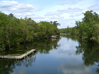
The St. Marks River is a river in the Big Bend region of Florida. It has been classified by the Florida Department of Environmental Protection as an Outstanding Florida Water, and is the easternmost river within the Northwest Florida Water Management District.
The Tallahassee Metropolitan Area is the metropolitan area centered on Tallahassee, the capital of the U.S. state of Florida, located in Leon County the center of North Florida in the Florida panhandle.
Magnolia, Florida was a thriving river port town in southern Wakulla County, Florida, established in the 1820s and is classified as an "extinct city" by the State Library and Archives of Florida. All that remains of the city is the cemetery; the last known burial was in 1883 James French a C.S.A privatethat was born in Magnolia town in 1843." The cemetery is on land now owned by the St. Joe Paper Company. The town was located near the small city of St. Marks, Florida.
The Big Bend of Florida, United States, is an informally named geographic region of North Florida where the Florida Panhandle transitions to the Florida Peninsula south and east of Tallahassee. The region is known for its vast woodlands and marshlands and its low population density relative to much of the state. The area is home to the largest single spring in the United States, the Alapaha Rise, and the longest surveyed underwater cave in the United States, the 32-mile (51 km) Wakulla-Leon Sinks cave system.
The Wakulla River is an 11-mile-long (18 km) river in Wakulla County, Florida. It carries the outflow from Wakulla Springs, site of the Edward Ball Wakulla Springs State Park, to the St. Marks River 3 miles (5 km) north of the Gulf of Mexico. Its drainage basin extends northwest into Leon County, including Munson Slough, and may extend as far north as the Georgia border.
Daniel Ladd was born in Augusta, Maine and was an exporter, cotton broker and merchant in early Florida and active as a member of the Secession Convention of Florida.
Augustus Steele was a Florida entrepreneur, a Florida state legislator, and helped found Hillsborough County.
This page is based on this Wikipedia article Text is available under the CC BY-SA 4.0 license; additional terms may apply. Images, videos and audio are available under their respective licenses.