The U.S. state of Florida has a total of 4,510 islands that are ten acres or larger. [1] This is the second-highest number of islands of any state of the United States; only Alaska has more. [1]
Major island chains include the Florida Keys, the Ten Thousand Islands, the Sea Islands, and the barrier islands of the Atlantic coast, the Panhandle Gulf of Mexico coast, and the Tampa Bay Area and Southwest Florida Gulf coast.
| Island | Image | Size | County | Notes |
|---|---|---|---|---|
| Adams Key |  | Miami-Dade | In Biscayne National Park. Home to the former Cocolobo Cay Club owned by Carl Fisher. | |
| Allison Island |  | Miami-Dade | ||
| Amelia Island |  | 18 square miles (47 km2) [2] | Nassau | One of the Sea Islands |
| Anastasia Island | | 14 square miles (36 km2) [3] | St. Johns | Barrier island |
| Anna Maria Island |  | 7 square miles (18 km2) | Manatee | Barrier island |
| Archer Key | 24.7 ha; 61.1 acres | Monroe | One of the Mule Keys in the lower Florida Keys | |
| Arsenicker Keys | Miami-Dade | In Biscayne National Park | ||
| Atsena Otie Key |  | Levy | One of the Cedar Keys | |
| Bahia Honda Key | 524 acres (212 ha) | Monroe | In the lower Florida Keys | |
| Ballast Key |  | 4.68 ha; 11.6 acres | Monroe | One of the Mule Keys in the lower Florida Keys |
| Barracouta Key | 47.2 ha; 117 acres | Monroe | One of the Mule Keys in the lower Florida Keys | |
| Belle Isle |  | Miami-Dade | Artificial island in the Venetian Islands in Biscayne Bay | |
| Big Coppitt Key |  | Monroe | In the lower Florida Keys | |
| Big Mullet Key | 8.72 ha; 21.6 acres | Monroe | One of the Mule Keys in the lower Florida Keys | |
| Big Pine Key | 9.8 square miles (25 km2) | Monroe | In the lower Florida Keys | |
| Big Talbot Island | Duval | One of the Sea Islands | ||
| Big Torch Key |  | Monroe | In the lower Florida Keys | |
| Bird Key | 1.2 square miles (3.1 km2) | Sarasota | Barrier island | |
| Bird Key | Miami-Dade | in Biscayne Bay | ||
| Biscayne Island | Miami-Dade | Artificial island in the Venetian Island in Biscayne Bay | ||
| Black Hammock Island | Duval | In a marsh | ||
| Blount Island |  | 2,000 acres (810 ha) | Duval | In the St. Johns River |
| Boca Chica Key | Monroe | In the lower Florida Keys | ||
| Boca Chita Key | | Miami-Dade | In Biscayne National Park | |
| Boca Grande | 3 square miles (7.8 km2) [4] | Monroe | One of the Mule Keys in the lower Florida Keys | |
| Boot Key |  | Monroe | In the middle Florida Keys | |
| Brickell Key |  | 1.19 square miles (3.1 km2) | Miami-Dade | Artificial island in Biscayne Bay |
| Caesar's Rock | Miami-Dade | In Biscayne National Park | ||
| Caladesi Island |  | 3 square miles (7.8 km2) | Pinellas | Barrier island |
| Cape St. George Island | Franklin | Barrier island | ||
| Casey Key | Sarasota | Barrier island | ||
| Captiva Island |  | 4 square miles (10 km2) | Lee | Barrier island |
| Cayo Costa | 2,506 acres (1,014 ha) | Lee | Barrier island | |
| Cedar Key | Levy | One of the Cedar Keys | ||
| Chokoloskee Island |  | 0.23 square miles (0.60 km2) | Collier | In the Ten Thousand Islands |
| City Island |  | 0.7 square miles (1.8 km2) | Volusia | In the Intracoastal Waterway |
| Clearwater Beach Island |  | Pinellas | Barrier island | |
| Coconut Island | Collier | Small barrier island | ||
| Conch Key |  | Monroe | In the middle Florida Keys | |
| Cottrell Key | 53.4 acres (21.6 ha) | Monroe | One of the Mule Keys in the lower Florida Keys | |
| Craig Key | Monroe | In the upper Florida Keys | ||
| Crawfish Key | 4.23 acres (1.71 ha) | Monroe | One of the Mule Keys in the lower Florida Keys | |
| Crawl Key |  | Monroe | In the middle Florida Keys | |
| Cudjoe Key |  | Monroe | In the lower Florida Keys | |
| Davis Islands | Hillsborough | Two artificial islands in Tampa Bay | ||
| Deerfield Beach Island | Broward (part) Palm Beach (part) | Barrier island | ||
| Demere Key | Lee | In Pine Island Sound | ||
| Di Lido Island | Miami-Dade | In the Venetian Islands | ||
| Dildo Key |  | 0.12 square miles (0.3 km2) | Monroe | In Everglades National Park |
| Discovery Island |  | 12 acres (4.9 ha) | Orange | Island formerly used as an attraction at Walt Disney World Resort |
| Dismal Key | Monroe | In the Ten Thousand Islands | ||
| Dog Island | 1,842 acres (745 ha) | Franklin | Barrier island | |
| Don Pedro Island | Charlotte County | Barrier island | ||
| Drayton Island |  | 1,700 acres (690 ha) | Putnam | In Lake George |
| Dry Tortugas | Monroe | In Dry Tortugas National Park | ||
| Duck Key |  | Monroe | In the middle Florida Keys | |
| East Rockland Key | Monroe | In the lower Florida Keys | ||
| Egmont Key | 328 acres (133 ha) | Hillsborough | Barrier island | |
| Elliott Key | Miami-Dade | Largest island in Biscayne National Park | ||
| Estero Island | Lee | Barrier island | ||
| Fat Deer Key | Monroe | In the middle Florida Keys | ||
| Fiesta Key |  | Monroe | In the upper Florida Keys | |
| Fisher Island |  | 222 acres (90 ha) | Miami-Dade | Barrier island |
| Flagler Monument Island |  | 4 acres (1.6 ha) | Miami-Dade | Artificial island in Biscayne Bay |
| Fleming Key | Monroe | In the lower Florida Keys | ||
| Fort George Island | Duval | One of the Sea Islands | ||
| Galt Island | Lee | In Pine Island Sound | ||
| Gasparilla Island | 7 square miles (18 km2) | Charlotte and Lee counties | Barrier island | |
| Geiger Key |  | Monroe | In the lower Florida Keys | |
| Grassy Key |  | Monroe | In the middle Florida Keys | |
| Grove Isle | 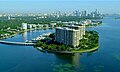 | 20 acres (8.1 ha) | Miami-Dade | Artificial island in Biscayne Bay |
| Hibiscus Island |  | Miami-Dade | Artificial island in Biscayne Bay | |
| Honeymoon Island | 385 acres (156 ha) | Pinellas | Barrier island | |
| Hontoon Island |  | 1,648 acres (667 ha) | Volusia | In St. Johns River |
| Hutchinson Island | 23.86 square miles (61.8 km2) | Martin (part) St. Lucie (part) | Barrier island | |
| Hypoluxo Island [5] | 2.7 square miles (7.0 km2) | Palm Beach | An island in Lake Worth Lagoon | |
| Indian Key |  | 12 acres (4.9 ha) [6] | Monroe | In the Florida Keys |
| Joe Ingram Key | 1.00 ha; 2.47 acres | Monroe | One of the Mule Keys in the lower Florida Keys | |
| Jupiter Island | 3.56 square miles (9.2 km2) | Martin (part) Palm Beach (part) | Barrier island | |
| Keywaydin Island | Collier | Barrier island | ||
| Key Biscayne |  | 5 square miles (13 km2) | Miami-Dade | Barrier island |
| Key Largo |  | Monroe | In the upper Florida Keys | |
| Key Marco | Collier | In the Ten Thousand Islands | ||
| Key Vaca | Monroe | In the middle Florida Keys | ||
| Key West |  | 5.27 square miles (13.6 km2) | Monroe | In the lower Florida Keys |
| Knights Key |  | Monroe | In the middle Florida Keys | |
| Knockemdown Key | Monroe | In the lower Florida Keys | ||
| Kreamer Island | Palm Beach | In Lake Okeechobee | ||
| Lido Key |  | 530 acres (210 ha) | Sarasota | Barrier island |
| Lignumvitae Key |  | 300 acres (120 ha) [7] | Monroe | In the upper Florida Keys |
| Little Conch Key | Monroe | In the middle Florida Keys | ||
| Little Crawl Key | Monroe | In the middle Florida Keys | ||
| Little Duck Key |  | Monroe | In the lower Florida Keys | |
| Little Gasparilla Island | Charlotte | Barrier island | ||
| Little Mullet Key | 5.86 ha; 14.5 acres | Monroe | One of the Mule Keys in the lower Florida Keys | |
| Little Talbot Island | 3.9 square miles (10 km2) | Duval | One of the Sea Islands | |
| Little Torch Key |  | Monroe | In the lower Florida Keys | |
| Loggerhead Key |  | 49 acres (20 ha) | Monroe | In the Dry Tortugas |
| Lois Key | Monroe | In the lower Florida Keys | ||
| Long Key | Monroe | In the middle Florida Keys | ||
| Longboat Key |  | 16 square miles (41 km2) | Sarasota (part) Manatee (part) | Barrier island |
| Long Point Key | Monroe | In the middle Florida Keys | ||
| Lovers Key | Lee | Barrier island | ||
| Lower Matecumbe Key | Monroe | In the upper Florida Keys | ||
| Makinson Island | Osceola | In Lake Tohopekaliga | ||
| Man Key | 35.9 ha; 88.7 acres | Monroe | One of the Mule Keys in the lower Florida Keys | |
| Manasota Key | 3.089 square miles (8.00 km2) | Charlotte (part) Sarasota (part) | Barrier island | |
| Marco Island | 12.1 square miles (31 km2) | Collier | Barrier island | |
| Marquesas Keys |  | 2.541 square miles (6.58 km2) | Monroe | In the lower Florida Keys |
| Meig's Key |  | Monroe | In Biscayne National Park | |
| Melody Key | 6 acres (2.4 ha) [8] | Monroe | In the lower Florida Keys | |
| Merritt Island | 46.16 square miles (119.6 km2) | Brevard | Barrier island | |
| Miami Beach | | Miami-Dade | Barrier island | |
| Middle Torch Key | Monroe | In the Florida Keys | ||
| Missouri Key | Monroe | In the lower Florida Keys | ||
| Molasses Keys | Monroe | In the lower Florida Keys | ||
| Money Key | Monroe | In the lower Florida Keys | ||
| Mule Key | 5.22 ha; 12.9 acres | Monroe | One of the Mule Keys in the lower Florida Keys | |
| Mule Keys | 263 ha; 649 acres | Monroe | In the lower Florida Keys | |
| Mullet Key |  | Citrus | Island in the Gulf of Mexico | |
| Munyon Island | Palm Beach | In Lake Worth Lagoon | ||
| No Name Key | Monroe | In the lower Florida Keys | ||
| North Captiva Island | 4 square miles (10 km2) | Lee County | Barrier island | |
| North Hutchinson Island/ Orchid Island | 23.86 square miles (61.8 km2) | Indian River (part) St. Lucie (part) | Barrier island | |
| Ohio Key | Monroe | In the lower Florida Keys | ||
| Old Rhodes Key | Miami-Dade | In the upper Florida Keys | ||
| Palm Beach Island |  | 8.12 square miles (21.0 km2) | Palm Beach | Barrier island |
| Palm Island |  | Miami-Dade | Artificial island in Biscayne Bay | |
| Palm Key | Monroe | In Florida Bay | ||
| Paradise Island | Osceola | In Lake Tohopekaliga | ||
| Park Key |  | 70 acres (28 ha) | Monroe | In the lower Florida Keys |
| Peanut Island | 0.32 square kilometres (0.12 sq mi) | Palm Beach | Artificial island in Lake Worth Lagoon | |
| Pelican Island | 3 acres (1.2 ha) | St. Lucie | In the Indian River | |
| Perdido Key |  | Escambia | Barrier island | |
| Perico Island | Manatee | In Tampa Bay | ||
| Picnic Islands | Miami-Dade | Small group of artificial islands in Biscayne Bay | ||
| Pigeon Key | 5 acres (2.0 ha) | Monroe | In the middle Florida Keys | |
| Pine Island | 18 square miles (47 km2) | Lee | Largest island in Florida | |
| Plantation Key | | Monroe | In the upper Florida Keys | |
| Porgy Key | Miami-Dade | In Biscayne National Park | ||
| Ragged Keys | Miami-Dade | In Biscayne National Park | ||
| Ramrod Key | Monroe | In the lower Florida Keys | ||
| Rattlesnake Key | Manatee | In Tampa Bay | ||
| Reid Key | Miami-Dade | In Biscayne National Park | ||
| Ritta Island | 5 square miles (13 km2) | Palm Beach | In Lake Okeechobee | |
| Rivo Alto Island | Miami-Dade | Artificial island in the Venetian Islands in Biscayne Bay | ||
| Rockland Key |  | Monroe | In the lower Florida Keys | |
| Rubicon Keys |  | Miami-Dade | In Biscayne National Park | |
| Saddlebunch Keys | Monroe | In the lower Florida Keys | ||
| Sand Key | 95 acres (38 ha) | Pinellas | Barrier island | |
| Sands Key | Miami-Dade | In Biscayne National Park | ||
| Sandspur Island | 15 acres (6.1 ha) | Miami-Dade | Artificial island in Biscayne Bay | |
| Sanibel Island |  | 33.25 square miles (86.1 km2) | Lee | Barrier island |
| San Marco Island | Miami-Dade | Artificial island in the Venetian Islands in Biscayne Bay | ||
| San Marino Island | Miami-Dade | Artificial island in the Venetian Islands in Biscayne Bay | ||
| Santa Rosa Island | Escambia (part) Santa Rosa (part) Okaloosa (part) | Barrier island | ||
| Scout Key |  | Monroe | In the lower Florida Keys | |
| Shark Key |  | Monroe | In the lower Florida Keys | |
| Shell Key | Pinellas | Barrier island | ||
| Siesta Key | 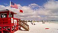 | 8 square miles (21 km2) [9] | Sarasota | Barrier Island |
| Sigsbee Park (Dredgers Key) | Monroe | Artificial island in the lower Florida Keys | ||
| Singer Island | Palm Beach | Barrier peninsula | ||
| Snead Island | 0.75 square miles (1.9 km2) [10] | Manatee | ||
| Soldier Key | Miami-Dade | In Biscayne National Park | ||
| Spanish Harbor Key | Monroe | In the lower Florida Keys | ||
| St. Armands Key | 83.6 acres (33.8 ha) | Sarasota | In Sarasota Bay | |
| St. George Island | 28 square miles (73 km2) | Franklin | Barrier island | |
| St. James Island | Franklin | Separated from the mainland by the Crooked River | ||
| St. Vincent Island | Franklin | Barrier island | ||
| Star Island | | 0.4 square miles (1.0 km2) | Miami-Dade | Artificial island in Biscayne Bay |
| Stock Island |  | Monroe | In the lower Florida Keys | |
| Sugarloaf Key | Monroe | In the lower Florida Keys | ||
| Summerland Key |  | Monroe | In the lower Florida Keys | |
| Sunset Key |  | 27 acres (11 ha) | Monroe | In the lower Florida Keys |
| Tea Table Key | Monroe | In the Florida Keys | ||
| Ten Thousand Islands | Collier (part) Monroe (part) | Chain of islands | ||
| Thousand Islands | Brevard | Group in the Banana River | ||
| Three Rooker Island | Pinellas | Barrier island | ||
| Torch Keys (Big, Little, and Middle Torch Keys) | Monroe | In the lower Florida Keys | ||
| Totten Key | Miami-Dade | In Biscayne National Park | ||
| Treasure Island | Pinellas | Barrier island | ||
| Upper Matecumbe Key | Monroe | In the upper Florida Keys | ||
| Useppa Island | 1 square mile (2.6 km2) | Lee | In Pine Island Sound | |
| Venetian Islands | | Miami-Dade | Group of artificial islands in Biscayne Bay | |
| Venice Island | 16.81 square miles (43.5 km2) | Sarasota | Barrier island | |
| Virginia Key |  | 863 acres (349 ha) | Miami-Dade | Barrier island |
| Watson Island | | 179 acres (72 ha) | Miami-Dade | Artificial island in Biscayne Bay |
| Windley Key | Monroe | In the upper Florida Keys | ||
| Wisteria Island | 10.6 ha; 26.3 acres | Monroe | In the lower Florida Keys | |
| Woman Key | 31.8 ha; 78.5 acres | Monroe | In the lower Florida Keys | |