
Marathon is a city in the middle of the Florida Keys, in Monroe County, Florida, United States. As of the 2020 census, the city had a population of 9,689, up from 8,297 in 2010.

The Florida Keys are a coral cay archipelago off the southern coast of Florida, forming the southernmost part of the continental United States. They begin at the southeastern coast of the Florida peninsula, about 15 miles (24 km) south of Miami, and extend in a gentle arc south-southwest and then westward to Key West, the westernmost of the inhabited islands, and on to the uninhabited Dry Tortugas. The islands lie along the Florida Straits, dividing the Atlantic Ocean to the east from the Gulf of Mexico to the northwest, and defining one edge of Florida Bay. At the nearest point, the southern part of Key West is just 93 miles (150 km) from Cuba. The Keys are between about 24.3 and 25.5 degrees North latitude.

Scout Key is an island in the lower Florida Keys. It was previously known as West Summerland Key until 2010. U.S. 1 crosses the key at approximately mile markers 34–35, between Spanish Harbor Key and Big Pine Key.

Duck Key is an island in Monroe County, Florida, United States, in the middle Florida Keys. It is part of the Duck Key, Florida census-designated place. The CDP also includes the neighboring island of Conch Key.

The Seven Mile Bridge is a bridge in the Florida Keys, in Monroe County, Florida, United States. It connects Knight's Key in the Middle Keys to Little Duck Key in the Lower Keys. Among the longest bridges in existence when it was built, it is part of the Overseas Highway in the Keys, which is part of the 2,369-mile (3,813 km) U.S. Route 1.

The Overseas Highway is a 113-mile (181.9 km) highway carrying U.S. Route 1 (US 1) through the Florida Keys to Key West. Large parts of it were built on the former right-of-way of the Overseas Railroad, the Key West Extension of the Florida East Coast Railway. Completed in 1912, the Overseas Railroad was heavily damaged and partially destroyed in the 1935 Labor Day hurricane. The Florida East Coast Railway was financially unable to rebuild the destroyed sections, so the roadbed and remaining bridges were sold to the state of Florida for $640,000.

Little Torch Key is an island in the lower Florida Keys.
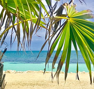
Key Vaca is an island in the middle Florida Keys, located entirely within the borders of the city of Marathon, Florida.

No Name Key is an island in the lower Florida Keys in the United States. It is 3 miles (4.8 km) from US 1 and sparsely populated, with only 43 homes. It is only about 1,140 acres in comparison to its larger neighbor, Big Pine Key, which lies about half a mile (800 m) to its west. It is accessible by a concrete bridge from Big Pine Key and was the terminus of a car ferry that existed before the present Overseas Highway was built on the remains of Flagler's Overseas Railroad.

Card Sound Bridge is a high-rise toll causeway connecting southern Miami-Dade County and northern Monroe County. It is one of only two ways that motorists can leave or enter the Florida Keys. The toll for two-axle automobiles is USD $1.50 if paid via SunPass. The prior toll plaza was demolished during hurricane Matthew and has been replaced with a toll-by-plate plaza. The toll fee will be charged by plate automatically and sent via the mail to the address on the vehicle registration. The cashless all-electronic tolling system replaced the previous staffed toll booth on October 20, 2018. The toll fee is waived upon evacuating the Keys for hurricanes or in instances in which US 1 is impassable.

Sugarloaf Key is a single island in the lower Florida Keys that forms a loop on the Atlantic Ocean side giving the illusion of separate islands. Although frequently referred to simply and with technical accuracy as "Sugarloaf Key", this island contains two distinct island communities, known as Lower Sugarloaf Key and Upper Sugarloaf Key.
U.S. Highway 1 (US 1) in Florida runs 545 miles (877 km) along the state's east coast from Key West to its crossing of the St. Marys River into Georgia north of Boulogne and south of Folkston. US 1 was designated through Florida when the U.S. Numbered Highway System was established in 1926. With the exception of Monroe County, the highway runs through the easternmost tier of counties in the state, connecting numerous towns and cities along its route, including nine county seats. The road is maintained by the Florida Department of Transportation (FDOT).

US 1 crosses the Ohio Key at approximately mile marker 39, between Missouri Key and Bahia Honda Key. Today it is also known as Sunshine Key, after a camping resort located there. The portion of the island south of U.S. Route 1 is protected as the Ohio Key National Wildlife Refuge.
Bahia Honda is an island in the lower Florida Keys.

Missouri Key is a small island in the lower Florida Keys.

Conch Key is an island and unincorporated community in Monroe County, Florida, United States, located in the middle Florida Keys. U.S. 1 crosses the key at approximately mile markers 62–63, between Long and Duck Keys. It is part of the census-designated place of Duck Key.
Money Key is a small island in Monroe County in the unincorporated, Lower Florida Keys. It is located in the Atlantic Ocean between Little Duck Key and Pigeon Key.
Pigeon Key is a small island containing the historic district of Pigeon Key, Florida. The 5-acre (2.0-hectare) island is home to 8 buildings on the National Register of Historic Places, some of which remain from its earliest incarnation as a work camp for the Florida East Coast Railway. Today these buildings serve a variety of purposes, ranging from housing for educational groups to administrative offices for the non-profit Pigeon Key Foundation. The former Assistant Bridge Tender's House has been converted into a small museum featuring artifacts and images from Pigeon Key's colorful past. It is located off the old Seven Mile Bridge, at approximately mile marker 45, west of Knight's Key, and just east of Moser Channel, which is the deepest section of the 7-mile (11 km) span.
Little Conch Key is an island in Monroe County, Florida, United States. It is located in the middle Florida Keys. U.S. 1 crosses the key at approximately mile marker 62.2, between Duck Key and Conch Key. It is part of the census-designated place of Duck Key.

Grassy Key, Florida, is an island in the middle Florida Keys. It is located on U.S. 1, near mile markers 57—60, below the Conch Keys. It has an area of 3.65 km², with a population of 974 as of the census 2000.


