The East Coast of the United States, also known as the Eastern Seaboard, the Atlantic Coast, and the Atlantic Seaboard, is the coastline along which the Eastern United States meets the North Atlantic Ocean. The eastern seaboard contains the coastal states and areas east of the Appalachian Mountains that have shoreline on the Atlantic Ocean, namely, Maine, New Hampshire, Massachusetts, Rhode Island, Connecticut, New York, New Jersey, Delaware, Maryland, Virginia, North Carolina, South Carolina, Georgia, and Florida.

Key Biscayne is an island town in Miami-Dade County, Florida. The population was 12,344 at the 2010 census.

Key Colony Beach is a municipality in the middle of the Florida Keys, Monroe County, Florida, United States. The population was 797 at the 2010 census. As of 2018, the population estimated by the U.S. Census Bureau was 814.

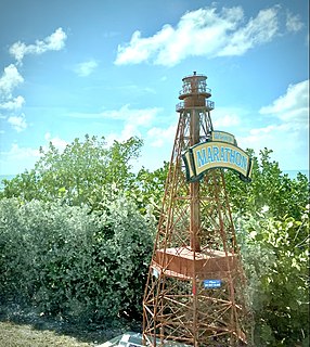
Marathon is a city spread over Knight's Key, Boot Key, Key Vaca, Fat Deer Key, Long Point Key, Crawl Key and Grassy Key islands in the middle of the Florida Keys, in Monroe County, Florida, United States. As of the 2010 census, the city had a total population of 8,297. As of 2019, the population estimated by the U.S. Census Bureau was 8,581.

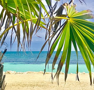
The Florida Keys are a coral cay archipelago located off the southern coast of Florida, forming the southernmost part of the continental United States. They begin at the southeastern coast of the Florida peninsula, about 15 miles (24 km) south of Miami, and extend in a gentle arc south-southwest and then westward to Key West, the westernmost of the inhabited islands, and on to the uninhabited Dry Tortugas. The islands lie along the Florida Straits, dividing the Atlantic Ocean to the east from the Gulf of Mexico to the northwest, and defining one edge of Florida Bay. At the nearest point, the southern part of Key West is just 93 miles (150 km) from Cuba. The Florida Keys are between about 24.3 and 25.5 degrees North latitude.

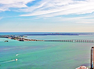
Key Biscayne is an island located in Miami-Dade County, Florida, located between the Atlantic Ocean and Biscayne Bay. It is the southernmost of the barrier islands along the Atlantic coast of Florida, and lies south of Miami Beach and southeast of Miami. The key is connected to Miami via the Rickenbacker Causeway, originally built in 1947.

Boot Key is an island in the middle Florida Keys located adjacent to Key Vaca. Boot Key is within the city limits of Marathon, Florida, United States. The island is largely undeveloped. A draw bridge that once connected the island to Marathon is no longer in service and is now closed to pedestrian and vehicular traffic.
Key Vaca is an island in the middle Florida Keys, located entirely within the borders of the city of Marathon, Florida.

Egmont Key State Park and National Wildlife Refuge is a Florida State Park located on the island of Egmont Key, at the mouth of Tampa Bay. Egmont Key lies southwest of Fort De Soto Park and can only be reached by boat or ferry. Located within Egmont Key State Park are the 1858 Egmont Key Lighthouse, maintained by the U.S. Coast Guard, and the ruins of Fort Dade, a Spanish–American War era fort that housed 300 residents. Egmont Key is located in Hillsborough County Florida on a narrow strip of the county that extends along the Tampa Port Shipping Channel.

The Rickenbacker Causeway is a causeway that connects Miami, Florida to the barrier islands of Virginia Key and Key Biscayne across Biscayne Bay.

U.S. Highway 1 (US 1) in Florida runs 545 miles (877 km) along the state's east coast from Key West to its crossing of the St. Marys River into Georgia north of Boulogne and south of Folkston. US 1 was designated through Florida when the U.S. Numbered Highway System was established in 1926. The road is maintained by the Florida Department of Transportation (FDOT).

Bahia Honda is an island in the lower Florida Keys.

Knights Key is an island in the middle Florida Keys, located entirely within the borders of the city of Marathon, Florida.
Long Point Key is an island in the middle Florida Keys.

Crawl Key is an island in the middle Florida Keys.

The following is an alphabetical list of articles related to the U.S. state of Florida.

Delray Beach is a city in Palm Beach County, Florida, United States. The population of Delray Beach as of April 1, 2020 was 66,846 according to the 2020 United States Census. Located 52 miles north of Miami, Delray Beach is in the Miami metropolitan area.

Grassy Key, Florida, is an island in the middle Florida Keys. It is located on U.S. 1, near mile markers 57—60, below the Conch Keys. It has an area of 3.65 km², with a population of 974 as of the census 2000.
Cabana Colony is a census-designated place in Palm Beach County, Florida, United States. Its population was 2,460 as of the 2020 census. Cabana Colony is located on the east side of State Road 811 and borders Palm Beach Gardens on three sides.
Little Crawl Key is an island in the middle Florida Keys. It lies adjacent to Crawl Key, and the two islands are separated by a cove.


