
Key West is an island in the Straits of Florida, within the U.S. state of Florida. Together with all or parts of the separate islands of Dredgers Key, Fleming Key, Sunset Key, and the northern part of Stock Island, it constitutes the City of Key West.
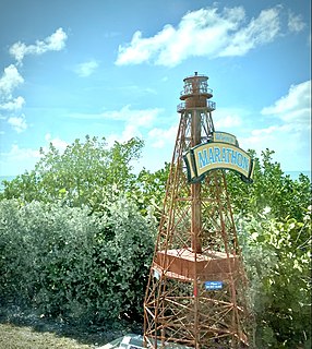
Marathon is a city spread over Knight's Key, Boot Key, Key Vaca, Fat Deer Key, Long Point Key, Crawl Key and Grassy Key islands in the middle of the Florida Keys, in Monroe County, Florida, United States. As of the 2010 census, the city had a total population of 8,297. As of 2019, the population estimated by the U.S. Census Bureau was 8,581.

The Florida Keys are a coral cay archipelago located off the southern coast of Florida, forming the southernmost part of the continental United States. They begin at the southeastern coast of the Florida peninsula, about 15 miles (24 km) south of Miami, and extend in a gentle arc south-southwest and then westward to Key West, the westernmost of the inhabited islands, and on to the uninhabited Dry Tortugas. The islands lie along the Florida Straits, dividing the Atlantic Ocean to the east from the Gulf of Mexico to the northwest, and defining one edge of Florida Bay. At the nearest point, the southern part of Key West is just 93 miles (150 km) from Cuba. The Florida Keys are between about 24.3 and 25.5 degrees North latitude.

Key Largo is an island in the upper Florida Keys archipelago and is the largest section of the Keys, at 33 miles (53 km) long. It is one of the northernmost of the Florida Keys in Monroe County, and the northernmost of the Keys connected by U.S. Highway 1. Three census-designated places are on the island of Key Largo: North Key Largo, near the Card Sound Bridge, Key Largo, eight or nine miles from the southern end of the island, and Tavernier, at the southern end of the island. As of 2010, the three places have a combined population of 13,850. None of Key Largo is an incorporated municipality, so it is governed at the local level by Monroe County.

Duck Key is an island in Monroe County, Florida, United States, in the middle Florida Keys. It is part of the Duck Key, Florida census-designated place. The CDP also includes the neighboring island of Conch Key.

The Overseas Highway is a 113-mile (181.9 km) highway carrying U.S. Route 1 (US 1) through the Florida Keys to Key West. Large parts of it were built on the former right-of-way of the Overseas Railroad, the Key West Extension of the Florida East Coast Railway. Completed in 1912, the Overseas Railroad was heavily damaged and partially destroyed in the 1935 Labor Day hurricane. The Florida East Coast Railway was financially unable to rebuild the destroyed sections, so the roadbed and remaining bridges were sold to the state of Florida for $640,000.

Little Torch Key is an island in the lower Florida Keys.

Boot Key is an island in the middle Florida Keys located adjacent to Key Vaca. Boot Key is within the city limits of Marathon, Florida, United States. The island is largely undeveloped. A draw bridge that once connected the island to Marathon is no longer in service and is now closed to pedestrian and vehicular traffic.
Key Vaca is an island in the middle Florida Keys, located entirely within the borders of the city of Marathon, Florida.

US 1 crosses the Ohio Key at approximately mile marker 39, between Missouri Key and Bahia Honda Key. Today it is also known as Sunshine Key, after a camping resort located there. The portion of the island south of U.S. Route 1 is protected as the Ohio Key National Wildlife Refuge.

Missouri Key is a small island in the lower Florida Keys.

Little Duck Key is a small island in the lower Florida Keys.

Knights Key is an island in the middle Florida Keys, located entirely within the borders of the city of Marathon, Florida.
Fat Deer Key is an island in the middle Florida Keys.
Long Point Key is an island in the middle Florida Keys.
Middle Torch Key is an island in the lower Florida Keys.

Loggerhead Key is an uninhabited tropical island within the Dry Tortugas group of islands in the Gulf of Mexico. At approximately 49 acres in size, it is the largest island of the Dry Tortugas. Despite being uninhabited, the island receives visitors, such as day visitors and campers. The island only has a few built structures, including the Dry Tortugas Light and a lightkeeper's house that was constructed in the 1920s. The island has drinking water derived using desalination technology and solar power. The Carnegie Marine Biological Laboratory operated on Loggerhead Key from 1904 to 1939.

Grassy Key, Florida, is an island in the middle Florida Keys. It is located on U.S. 1, near mile markers 57—60, below the Conch Keys. It has an area of 3.65 km², with a population of 974 as of the census 2000.
Little Crawl Key is an island in the middle Florida Keys. It lies adjacent to Crawl Key, and the two islands are separated by a cove.


