Big Pine Key, Florida

Last updated

Big Pine Key, Florida
Monroe County Florida Incorporated and Unincorporated areas Big Pine Key Highlighted.svg
Location in Monroe County and the state of Florida
Big Pine Key.png
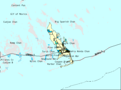
U.S. Census Bureau map showing CDP boundaries
Coordinates: 24°40′12″N81°21′14″W / 24.67000°N 81.35389°W / 24.67000; -81.35389 [1]
Country United States
State Florida
County Monroe
Area
[2]
  Total10.31 sq mi (26.70 km2)
  Land10.20 sq mi (26.43 km2)
  Water0.11 sq mi (0.28 km2)
Elevation
[1]
3 ft (1 m)
Population
 (2020) [3]
  Total4,521
  Density443.06/sq mi (171.07/km2)
Time zone UTC-5 (Eastern (EST))
  Summer (DST) UTC-4 (EDT)
ZIP code
33043
Area code 305
FIPS code 12-06425 [4]

Big Pine Key is a census-designated place and unincorporated community in Monroe County, Florida, United States, on an island of the same name in the Florida Keys. As of the 2020 census, the town had a total population of 4,521. [3]

Contents

Geography

View of west side of the island from the Overseas Highway Big Pine Key westside.jpg
View of west side of the island from the Overseas Highway

U.S. 1 (the Overseas Highway) crosses the key at mile markers 29.5–33, one of the few places on the keys where the road orients north–south (along the eastern edge of the Key). The highway leads west-southwest 29 miles (47 km) to Key West and east-northeast 21 miles (34 km) to Marathon.

Big Pine Key was the location of one of the stations of the Overseas Railroad.

According to the United States Census Bureau, the CDP has a total area of 10.3 square miles (27 km2), of which 0.1 square miles (0.3 km2), or 1.04%, is covered by water. [2]

Demographics

Historical population
CensusPop.Note
1980 2,350
1990 4,20679.0%
2000 5,03219.6%
2010 4,252−15.5%
2020 4,5216.3%
U.S. Decennial Census [5]

2020 census

As of the 2020 United States census, there were 4,521 people, 2,065 households, and 1,180 families residing in the CDP.

Big Pine Key racial composition [6]
RaceNumberPercentage
White (non-Hispanic)3,61279.89%
Black or African American (non-Hispanic)491.08%
Native American 90.2%
Asian 461.02%
Pacific Islander 20.04%
Other/Mixed 1824.03%
Hispanic or Latino 62113.74%

2000 census

As of the census [4] of 2000, 5,032 people, 2,247 households, and 1,420 families resided in the CDP. The population density was 198.9/km2 (515.3/mi2). The 3,153 housing units averaged 124.6/km2 (322.9/mi2). The racial makeup of the CDP was 94.83% White, 1.09% African American, 0.50% Native American, 0.58% Asian, 0.02% Pacific Islander, 1.19% from other races, and 1.79% from two or more races. Hispanics or Latinos of any race were 6.72% of the population.

Of the 2,247 households, 41.4% had children under the age of 18 living with them, 43.8% were married couples living together, 5.7% had a female householder with no husband present, and 6.8% were not families. About 26.0% of all households were made up of individuals, and 7.8% had someone living alone who was 65 years of age or older. The average household size was 2.21 and the average family size was 2.63.

In the CDP, the population was distributed as 16.8% under the age of 18, 4.3% from 18 to 24, 30.3% from 25 to 44, 33.7% from 45 to 64, and 14.9% who were 65 years of age or older. The median age was 44 years. For every 100 females, there were 110.4 males. For every 100 females age 18 and over, there were 111.6 males.

The median income for a household in the CDP was $44,514, and for a family was $47,639. Males had a median income of $31,552 versus $28,021 for females. The per capita income for the CDP was $23,169. About 5.6% of families and 9.5% of the population were below the poverty line, including 17.4% of those under age 18 and 7.0% of those aged 65 or over.

The Blue Hole

The Blue Hole is the only freshwater lake in the Florida Keys. Blue Hole Big Pine Key.jpg
The Blue Hole is the only freshwater lake in the Florida Keys.
A green iguana in front of the Blue Hole sign Blue Hole Big Pine Key sign.jpg
A green iguana in front of the Blue Hole sign

The Blue Hole is an abandoned rock quarry that was used for nearby road fills and Henry Flagler's Overseas Railroad. [7] The water it contains is mostly fresh and is used by various wildlife in the area, such as birds, snakes, alligators and invasive green iguanas. It is part of the National Key Deer Refuge. [8]

Business and commerce

The primary grocery store is located in a shopping center just north of US 1. This shopping center contains several restaurants, an outlet store, electronics store, the visitor center for the National Key Deer Refuge, and a branch of the Monroe County Library (with WiFi internet access). Pharmacies are located along US 1, as well as a shoe store, a tropical decor store, and a bait and tackle shop. A small hardware store in the same area sells typical paint, hardware, tools, other goods needed to build/repair items around the home, and a limited selection of parts for boat repair.

Several bars and restaurants are along the US 1 corridor. The nearest city of note is Marathon about 23 miles (37 km) "north" on US 1. Key West, a major shopping and cultural hub for the area, is about 30 miles (48 km) "south" on US 1.

Accommodation is limited, though RV/camping and a small number of motel-style units are available on the far southeast side of the island.

Key deer

Key deer (buck) KeyDeerLick.jpg
Key deer (buck)

The island of Big Pine Key is home to the National Key Deer Refuge. The majority of the Key deer population are found on this island.

The Key deer is the smallest subspecies of white-tailed deer. The largest bucks are less than a yard high at the shoulders and weigh approximately 80 pounds. The does are 24 to 28 inches at the shoulders and weigh approximately 65 pounds. They have many habitats in the Florida Keys including pine rocklands, hardwood hammocks, mangroves, and freshwater wetlands. Key deer are only found from Big Pine Key to Sugarloaf Key. [9]

As Key deer are endangered, many precautions have been taken to preserve as much Key deer habitat as possible:

Big Pine Key from west.jpg
View of a portion of the west side of the island as seen from the Overseas Highway.

Related Research Articles

<span class="mw-page-title-main">Pine Island Ridge, Florida</span> Neighborhood in Broward, Florida, United States

Pine Island Ridge was a census-designated place (CDP) in Broward County, Florida, United States. The population was 5,199 at the 2000 census. Formerly a part of unincorporated Broward County, Pine Island Ridge was annexed into the town of Davie, Florida on 15 September 2006, and is now a neighborhood of that town.

<span class="mw-page-title-main">Washington Park, Florida</span> CDP in Florida, United States

Washington Park is a census-designated place (CDP) in Broward County, Florida, United States. Its population was 1,948 at the 2020 census. It is home to the African-American Research Library and Cultural Center.

<span class="mw-page-title-main">Stock Island, Florida</span> Census-designated place in Florida, United States

Stock Island is a census-designated place (CDP) and unincorporated community on the island of the same name in Monroe County, Florida, United States. The population of the CDP was 4,722 at the 2020 census, up from 3,919 in 2010. It is located on the portion of the island south of US 1. It is supposedly named for the herds of livestock formerly kept there. Alternatively, some local historians suggest that it may be named for an early settler.

<span class="mw-page-title-main">Tavernier, Florida</span> Census-designated place in Florida, United States

Tavernier is a census-designated place (CDP) and unincorporated community in Monroe County, Florida, United States on Key Largo, the largest island in the upper Florida Keys. Tavernier's population was 2,530 at the 2020 census, up from 2,136 in 2010.

<span class="mw-page-title-main">Fairview Shores, Florida</span> Census-designated place in Florida, United States

Fairview Shores is a census-designated place and an unincorporated area in Orange County, Florida, United States. The population was 10,239 at the 2010 census. It is part of the Orlando–Kissimmee–Sanford, Florida Metropolitan Statistical Area.

<span class="mw-page-title-main">Lockhart, Florida</span> Census-designated place in Florida, United States

Lockhart is a census-designated place in Orange County, Florida, United States. The population was 13,060 at the 2010 census. It is part of the Orlando–Kissimmee–Sanford, Florida Metropolitan Statistical Area. The community is named for David Lockhart.

<span class="mw-page-title-main">Oak Ridge, Florida</span> Census-designated place in Florida, United States

Oak Ridge is a census-designated place and unincorporated area in Orange County, Florida, United States. The population was 22,685 at the 2010 census. It is part of the Orlando–Kissimmee–Sanford, Florida Metropolitan Statistical Area.

<span class="mw-page-title-main">Orlo Vista, Florida</span> Census-designated place & Unincorporated community in Florida, United States

Orlo Vista is an unincorporated community and census-designated place in Orange County, Florida, United States. While the spelling "Orlo Vista" is used by the U.S. Postal Service, the community is shown as Orlovista on federal maps. The population of the Orlovista census-designated place was 6,123 at the 2010 census. It is part of the Orlando–Kissimmee Metropolitan Statistical Area. The boundaries of the Orlovista CDP are West Colonial Drive on the north, Pine Hills Road on the east, Old Winter Garden Road and Carter Street at the Orlando city limits on the south, and Hiawassee Road on the west.

<span class="mw-page-title-main">Pine Castle, Florida</span> Census-designated place in Florida, United States

Pine Castle is a census-designated place and unincorporated area in Orange County, Florida, United States. It is part of the Orlando–Kissimmee–Sanford, Florida Metropolitan Statistical Area.

<span class="mw-page-title-main">Sky Lake, Florida</span> Census-designated place in Florida, United States

Sky Lake is a census-designated place (CDP) and an unincorporated area in Orange County, Florida, United States. The population was 6,153 at the 2010 census. It is part of the Orlando-Kissimmee, Florida Metropolitan Statistical Area.

<span class="mw-page-title-main">South Apopka, Florida</span> Census-designated place in Florida, United States

South Apopka is a census-designated place and an unincorporated area in Orange County, Florida, United States. Per the 2020 census, the population was 6,803. It is part of the Orlando–Kissimmee Metropolitan Statistical Area.

<span class="mw-page-title-main">Southchase, Florida</span> Census-designated place in Florida, United States

Southchase is a census-designated place and an unincorporated area in Orange County, Florida, United States. The population was 15,921 at the 2010 census. It is part of the Orlando–Kissimmee–Sanford, Florida Metropolitan Statistical Area.

<span class="mw-page-title-main">Taft, Florida</span> Census-designated place in Florida, United States

Taft is a census-designated place and an unincorporated area in Orange County, Florida, United States. The population was 2,205 at the 2010 census. It is part of the Orlando–Kissimmee Metropolitan Statistical Area.

<span class="mw-page-title-main">Union Park, Florida</span> Census-designated place in Florida, United States

Union Park is a census-designated place (CDP) in Orange County, Florida, United States. The population was 10,452 at the 2020 census. It is part of the Orlando–Kissimmee Metropolitan Statistical Area. The ZIP codes for Union Park are 32817 and 32825. The community is southwest of the University of Central Florida.

Stacy Street is a residential street and surrounding census-designated place (CDP) in Palm Beach County, Florida, United States. In the 2010 and 2020 US Census, the CDP is misspelled as Stacey Street. It is part of the Miami metropolitan area of South Florida. The population was 978 at the 2020 US census.

<span class="mw-page-title-main">Bay Pines, Florida</span> Census-designated place in Florida, United States

Bay Pines is a census-designated place (CDP) in Pinellas County, Florida, United States. The population was 2,931 at the 2010 census. The community is home to Bay Pines Veterans Hospital and Bay Pines National Cemetery.

<span class="mw-page-title-main">South Highpoint, Florida</span> Census-designated place in Florida, United States

South Highpoint is a census-designated place (CDP) in Pinellas County, Florida, United States. The population was 5,195 at the 2010 census.

<span class="mw-page-title-main">Samsula-Spruce Creek, Florida</span> CDP in Florida, United States

Samsula-Spruce Creek is a census-designated place (CDP) in Volusia County, Florida, United States. The population was 5,047 at the 2010 census. While many households reside here, it is principally an agricultural area west of the cities of Port Orange and New Smyrna Beach.

<span class="mw-page-title-main">Yarmouth Port, Massachusetts</span> Census-designated place in Massachusetts, United States

Yarmouth Port is a census-designated place (CDP) in the town of Yarmouth in Barnstable County, Massachusetts, United States. The population was 5,320 at the 2010 census.

<span class="mw-page-title-main">Ayer (CDP), Massachusetts</span> Census-designated place in Massachusetts, United States

Ayer is a census-designated place (CDP) and the primary settlement in the town of Ayer in Middlesex County, Massachusetts, United States. The population of the CDP was 2,986 at the 2020 census, out of 8,479 in the entire town.

References

  1. 1 2 U.S. Geological Survey Geographic Names Information System: Big Pine Key, Florida
  2. 1 2 "2022 U.S. Gazetteer Files: Florida". United States Census Bureau. Retrieved January 18, 2023.
  3. 1 2 "P1. Race – Big Pine Key CDP, Florida: 2020 DEC Redistricting Data (PL 94-171)". U.S. Census Bureau. Retrieved January 18, 2023.
  4. 1 2 "U.S. Census website". United States Census Bureau . Retrieved January 31, 2008.
  5. "Census of Population and Housing". Census.gov. Retrieved June 4, 2016.
  6. "Explore Census Data". data.census.gov. Retrieved January 4, 2022.
  7. "The Florida Keys:Lower Keys". Archived from the original on December 5, 2008. Retrieved June 27, 2008.
  8. History of Big Pine Key; Big Pine Key Information Archived 2008-06-27 at the Wayback Machine
  9. "Land Mammals - Key Deer". Florida Fish and Wildlife Conservation Commission. Archived from the original on February 24, 2023. Retrieved February 16, 2024.