
Bonita Springs is a city in Lee County, Florida, United States. The population was 53,644 at the 2020 census. It is part of the Cape Coral-Fort Myers, Florida Metropolitan Statistical Area, on the state's southwest coast.

Key Colony Beach is a municipality in the middle of the Florida Keys, Monroe County, Florida, United States. The population was 790 at the 2020 census.

Key West is an island in the Straits of Florida, within the U.S. state of Florida. Together with all or parts of the separate islands of Dredgers Key, Fleming Key, Sunset Key, and the northern part of Stock Island, it constitutes the City of Key West.
An islet is a very small, often unnamed island. Most definitions are not precise, but some suggest that an islet has little or no vegetation and cannot support human habitation. It may be made of rock, sand and/or hard coral; may be permanent or tidal ; and may exist in the sea, lakes, rivers or any other sizeable bodies of water.

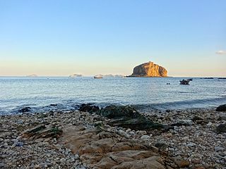
The Florida Keys are a coral cay archipelago off the southern coast of Florida, forming the southernmost part of the continental United States. They begin at the southeastern coast of the Florida peninsula, about 15 miles (24 km) south of Miami, and extend in a gentle arc south-southwest and then westward to Key West, the westernmost of the inhabited islands, and on to the uninhabited Dry Tortugas. The islands lie along the Florida Straits, dividing the Atlantic Ocean to the east from the Gulf of Mexico to the northwest, and defining one edge of Florida Bay. At the nearest point, the southern part of Key West is just 93 miles (150 km) from Cuba. The Keys are between about 24.3 and 25.5 degrees North latitude.

Biscayne Bay is a lagoon with characteristics of an estuary located on the Atlantic coast of South Florida. The northern end of the lagoon is surrounded by the densely developed heart of the Miami metropolitan area while the southern end is largely undeveloped with a large portion of the lagoon included in Biscayne National Park.

Dry Tortugas National Park is an American national park located about 68 miles (109 km) west of Key West in the Gulf of Mexico, in the United States. The park preserves Fort Jefferson and the several Dry Tortugas islands, the westernmost and most isolated of the Florida Keys. The archipelago's coral reefs are the least disturbed of the Florida Keys reefs.

The Seven Mile Bridge is a bridge in the Florida Keys, in Monroe County, Florida, United States. It connects Knight's Key in the Middle Keys to Little Duck Key in the Lower Keys. Among the longest bridges in existence when it was built, it is part of the Overseas Highway in the Keys, which is part of the 2,369-mile (3,813 km) U.S. Route 1.

The Overseas Highway is a 113-mile (181.9 km) highway carrying U.S. Route 1 (US 1) through the Florida Keys to Key West. Large parts of it were built on the former right-of-way of the Overseas Railroad, the Key West Extension of the Florida East Coast Railway. Completed in 1912, the Overseas Railroad was heavily damaged and partially destroyed in the 1935 Labor Day hurricane. The Florida East Coast Railway was financially unable to rebuild the destroyed sections, so the roadbed and remaining bridges were sold to the state of Florida for $640,000.

Little Torch Key is an island in the lower Florida Keys.

The Marquesas Keys form an uninhabited island group about 20 miles (32 km) west of Key West, four miles (6 km) in diameter, and largely covered by mangrove forest. They are an unincorporated area of Monroe County, Florida and belong to the Lower Keys Census County Division. They are protected as part of the Key West National Wildlife Refuge. The Marquesas were used for target practice by the military as recently as 1980.

Little Talbot Island State Park is a Florida State Park located on Little Talbot Island, 17 miles (27 km) northeast of Jacksonville on State Road A1A. The park covers the entire 2,500-acre (10 km2) island. Big Talbot Island State Park lies to the immediate north. The park contains maritime forests, dunes, and salt marshes on the western side of the island. Wild life includes river otters, marsh rabbits, bobcats, and a variety of native and migrating birds. Activities include camping, fishing, hiking, swimming, canoeing, nature watching and surfing. Erosion on Big Talbot Island, coupled with sand deposition on Little Talbot, have resulted in Little Talbot Island becoming the larger of the two Talbot Islands. The largest continuous section of the Machaba Balu Preserve lies just to the west of Little Talbot Island.

Lovers Key State Park is a 712-acre (2.88 km2) Florida State Park located on Lover's Key and three other barrier islands—Black Island, Inner and Long Key. It is at 8700 Estero Blvd., Fort Myers Beach, between Big Carlos Pass and New Pass and 10.5 miles (16.9 km) west of Interstate 75 on exit 116. The park lies within the city limits of Bonita Springs and is just north of Bonita Beach. The park uses a Fort Myers Beach zip code for address purposes.

US 1 crosses the Ohio Key at approximately mile marker 39, between Missouri Key and Bahia Honda Key. Today it is also known as Sunshine Key, after a camping resort located there. The portion of the island south of U.S. Route 1 is protected as the Ohio Key National Wildlife Refuge.
Bahia Honda is an island in the lower Florida Keys.

Little Duck Key is a small island in the lower Florida Keys.

Geiger Key is an island in the lower Florida Keys about 5 miles (8 km) east of Key West. It is located to the south of, and bridged to, Big Coppitt Key via Boca Chica Road at about mile marker 11 on U.S. 1. It has the small trailer park community of Tamarac, Geiger Key Pub & Grill and Geiger Key Marina. It is part of the census-designated place of Big Coppitt Key, Florida.
Soldier Key is an island in Biscayne National Park in Miami-Dade County, Florida. It is located between Biscayne Bay and the Atlantic Ocean, about three miles north of the Ragged Keys, five miles south of Cape Florida on Key Biscayne, seven-and-a-half miles east of the mainland and three miles west of Fowey Rocks. It lies on the Safety Valve, a sand bar that separates Biscayne Bay from the Atlantic Ocean and moderates storm surges into the bay.
Pigeon Key is a small island containing the historic district of Pigeon Key, Florida. The 5-acre (2.0-hectare) island is home to 8 buildings on the National Register of Historic Places, some of which remain from its earliest incarnation as a work camp for the Florida East Coast Railway. Today these buildings serve a variety of purposes, ranging from housing for educational groups to administrative offices for the non-profit Pigeon Key Foundation. The former Assistant Bridge Tender's House has been converted into a small museum featuring artifacts and images from Pigeon Key's colorful past. It is located off the old Seven Mile Bridge, at approximately mile marker 45, west of Knight's Key, and just east of Moser Channel, which is the deepest section of the 7-mile (11 km) span.

Poinciana was a planned community that was to be located along the Lostmans River in Monroe County, Florida. Poinciana has been described as the Everglades's "most spectacular commercial enterprise" and "the prototype of all Florida scams".


