
Islamorada is an incorporated village in Monroe County, Florida, United States. It is located directly between Miami and Key West on five islands—Tea Table Key, Lower Matecumbe Key, Upper Matecumbe Key, Windley Key and Plantation Key—in the Florida Keys. As of the 2020 census, the village had a population of 7,107, up from 6,119 in 2010.

Duck Key is a census-designated place and unincorporated community in Monroe County, Florida, United States, on an island of the same name in the middle Florida Keys. The CDP also includes the neighboring island of Conch Key. As of the 2020 census, the CDP had a population of 727, up from 621 in 2010.

Tavernier is a census-designated place (CDP) and unincorporated community in Monroe County, Florida, United States on Key Largo, the largest island in the upper Florida Keys. Tavernier's population was 2,530 at the 2020 census, up from 2,136 in 2010.
The Florida Keys are a coral cay archipelago off the southern coast of Florida, forming the southernmost part of the continental United States. They begin at the southeastern coast of the Florida peninsula, about 15 miles (24 km) south of Miami and extend in a gentle arc south-southwest and then westward to Key West, the westernmost of the inhabited islands, and on to the uninhabited Dry Tortugas. The islands lie along the Florida Straits, dividing the Atlantic Ocean to the east from the Gulf of Mexico to the northwest, and defining one edge of Florida Bay. The southern part of Key West is 93 miles (150 km) from Cuba. The Keys are located between about 24.3 and 25.5 degrees North latitude.

The 1935 Labor Day Hurricane was an extremely powerful and devastating Atlantic hurricane that struck the southeastern United States in early September 1935. For several decades it was: the most intense Atlantic hurricane on record in terms of barometric pressure, until surpassed by Hurricane Gilbert in 1988; the strongest Atlantic hurricane on record in terms of 1-minute sustained winds, until surpassed by Hurricane Allen in 1980; and the strongest at landfall by 1-minute sustained winds, until it was tied by Hurricane Dorian in 2019. The fourth tropical cyclone, third tropical storm, second hurricane, and second major hurricane of the 1935 Atlantic hurricane season, it is one of four Category 5 hurricanes on record to strike the contiguous United States, along with Hurricane Camille (1969), Hurricane Andrew (1992), and Hurricane Michael (2018).

Long Key is an island in the middle Florida Keys. Long Key was called Cayo Víbora by early Spanish explorers, a reference to the shape of the island, which resembles a snake with its jaws open, rather than to its denizens. The city of Layton is located on Long Key. The 965-acre (3.9 km2) state park (3.9 km2) was dedicated October 1, 1969.

The Overseas Highway is a 113-mile (181.9 km) highway carrying U.S. Route 1 (US 1) through the Florida Keys to Key West. Large parts of it were built on the former right-of-way of the Overseas Railroad, the Key West Extension of the Florida East Coast Railway. Completed in 1912, the Overseas Railroad was heavily damaged and partially destroyed in the 1935 Labor Day hurricane. The Florida East Coast Railway was financially unable to rebuild the destroyed sections, so the roadbed and remaining bridges were sold to the state of Florida for $640,000.

Sea Base, formerly known as Florida National High Adventure Sea Base, is a high adventure program base run by the Boy Scouts of America (BSA) in the Florida Keys. Its counterparts are the Philmont Scout Ranch in northern New Mexico, the Northern Tier National High Adventure Bases in Ely, Minnesota as well as Manitoba and Ontario in Canada, and The Summit Bechtel Family National Scout Reserve near the New River Gorge National Park in southern West Virginia.
Lignumvitae Key Botanical State Park is a Florida State Park consisting of Lignumvitae Key, Shell Key, surrounding submerged lands, and a parcel at the northern end of Lower Matecumbe Key. The islands are located one mile west of U.S. 1 at mile marker 78.5, and can be reached only by private boat or tour boat.

Lower Matecumbe Key is an island in the upper Florida Keys, United States, located on U.S. 1 between mile markers 75–78.

Plantation Key is an island in Monroe County, Florida, United States. It is located in the upper Florida Keys on U.S. 1, between Key Largo and Windley Key.
Plantation Key, Florida is a former census-designated place on Plantation Key in the Florida Keys, in Monroe County, Florida, United States. It is located just South of the Tavernier bridge and North of the Snake Creek bridge and was reported to have a population of 4,405 in 1990. It became part of the Village of Islamorada when the latter incorporated in 1997.
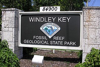
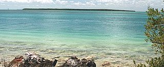
Windley Key is an island in the upper Florida Keys in Monroe County, Florida, United States. U.S. 1 crosses it at approximately mile markers 84–85.5, between Plantation Key and Upper Matecumbe Key. All of the key is within the Village of Islamorada as of November 4, 1997, when it was incorporated.
The San Felipe is a historic shipwreck near Islamorada, Florida, United States. It is located east of Lower Matecumbe Key and south of the wreck of the San Pedro. On August 11, 1994, it was added to the U.S. National Register of Historic Places.
The LaBranche Fishing Camp is a historic site in Islamorada, Florida, United States. On May 9, 1997, it was added to the U.S. National Register of Historic Places.

Monroe County School District is a public school district serving the residents of Monroe County, Florida. The district's administrative offices are headquartered in Key West, Florida, United States, with school sites located throughout the Florida Keys from Key West to Key Largo. The district provides educational services for students enrolled in Pre-Kindergarten through 12th grade and educational opportunities for adult learners enrolled through adult education programs.
Lower Matecumbe Beach is a neighborhood within the village of Islamorada in Monroe County, Florida, United States. It is located in the upper Florida Keys on the southwestern half of Lower Matecumbe Key.
Matecumbe is a neighborhood within the village of Islamorada in Monroe County, Florida, United States. It is located in the upper Florida Keys on the island of Upper Matecumbe Key.
Tea Table Key also known as "Terra's Key" is an island in the upper Florida Keys.


