
Sea Base, formerly known as Florida National High Adventure Sea Base, is a high adventure program base run by the Boy Scouts of America (BSA) in the Florida Keys. Its counterparts are the Philmont Scout Ranch in northern New Mexico, the Northern Tier National High Adventure Bases in Ely, Minnesota as well as Manitoba and Ontario in Canada, and The Summit Bechtel Family National Scout Reserve near the New River Gorge National Park in southern West Virginia.

The Key West Tropical Forest & Botanical Garden is a frost-free arboretum and botanical garden containing a collection of trees, shrubs, and palms, including several "champion tree" specimens. It is located on Stock Island in the municipality of Key West, Florida, United States. It is open daily. There is a nominal fee for admission, with free admission for locals on the first Sunday of every month.
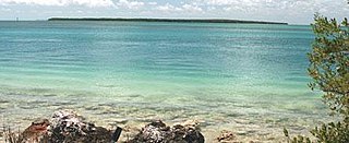
Lignumvitae Key Botanical State Park is a Florida State Park consisting of Lignumvitae Key, Shell Key, surrounding submerged lands, and a parcel at the northern end of Lower Matecumbe Key. The islands are located one mile west of U.S. 1 at mile marker 78.5, and can be reached only by private boat or tour boat.

Key Marco was an archaeological site (8CR48) consisting of a large shell works island next to Marco Island, Florida. A small pond on Key Marco, now known as the "Court of the Pile Dwellers" (8CR49), was excavated in 1896 by the Smithsonian Institution's Pepper-Hearst Expedition, led by Frank Hamilton Cushing. Cushing recovered more than 1,000 wooden artifacts from the pond, the largest number of wooden artifacts from any prehistoric archaeological site in the eastern United States. These artifacts are described as some of the finest prehistoric Native American art in North America. The Key Marco materials are principally divided between the University of Pennsylvania Museum of Archaeology and Anthropology, University of Pennsylvania; the Department of Anthropology, National Museum of Natural History, Smithsonian Institution; and the Florida Museum of Natural History, University of Florida. The original pond was completely excavated and refilled. It is now covered by a housing subdivision. Excavations of small parts of the site were also conducted in 1965 and 1995.

Horr's Island is a significant Archaic period archaeological site located on an island in Southwest Florida formerly known as Horr's Island. Horr's Island is on the south side of Marco Island in Collier County, Florida. The site includes four mounds and a shell ring. It has one of the oldest known mound burials in the eastern United States, dating to about 3400 radiocarbon years Before Present (BP). One of the mounds has been dated to as early as 6700 BP. It was the largest known community in the southeastern United States to have been permanently occupied during the Archaic period.
The Belle Glade culture, or Okeechobee culture, is an archaeological culture that existed from as early as 1000 BCE until about 1700 CE in the area surrounding Lake Okeechobee and in the Kissimmee River valley in the Florida Peninsula.
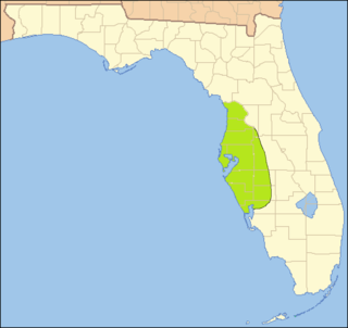
The Glades culture is an archaeological culture in southernmost Florida that lasted from about 500 BCE until shortly after European contact. Its area included the Everglades, the Florida Keys, the Atlantic coast of Florida north through present-day Martin County and the Gulf coast north to Marco Island in Collier County. It did not include the area around Lake Okeechobee, which was part of the Belle Glade culture.
Robert S. Carr is an American archaeologist and the current executive director of The Archaeological and Historical Conservancy, Inc. He specializes in Southeastern archaeology, with particular emphasis on archaeology in Florida. He has also conducted fieldwork in the Bahamas.
Mound Key Archaeological State Park is a Florida State Park, located in Estero Bay, near the mouth of the Estero River. One hundred and thirteen of the island's one hundred and twenty-five acres are managed by the park system. It is a complex of mounds and accumulated shell, fish bone, and pottery middens that rises more than 30 feet above the waters of the bay.
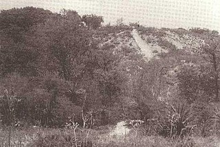
The Big Mound Key-Boggess Ridge Archeological District is a historic site near Placida, Florida. It is located southeast of Placida, on Big Mound Key. On December 3, 1990, it was added to the U.S. National Register of Historic Places.

Mount Royal (8PU35) is a U.S. archaeological site close to where the St. Johns River exits from Lake George in Putnam County, Florida. It is located three miles (5 km) south of Welaka, in the Mount Royal Airpark, off County Road 309 on the eastern bank of the St. Johns River. The site consists of a large sand mound and several nearby middens.

The St. Johns culture was an archaeological culture in northeastern Florida, USA that lasted from about 500 BCE until shortly after European contact in the 17th century. The St. Johns culture was present along the St. Johns River and its tributaries (including the Oklawaha River, and along the Atlantic coast of Florida from the mouth of the St. Johns River south to a point east of the head of the St. Johns River, near present-day Cocoa Beach, Florida. At the time of first European contact, the St. Johns culture area was inhabited by speakers of the Mocama, Agua Fresca and Acuera dialects of the Timucua language and by the Mayacas.
The indigenous people of the Everglades region arrived in the Florida peninsula of what is now the United States approximately 14,000 to 15,000 years ago, probably following large game. The Paleo-Indians found an arid landscape that supported plants and animals adapted to prairie and xeric scrub conditions. Large animals became extinct in Florida around 11,000 years ago.
John Mann Goggin was a cultural anthropologist in the southwest, southeast, Mexico, and Caribbean, primarily focusing on the ethnology, cultural history, and typology of artifacts from archaeological sites.
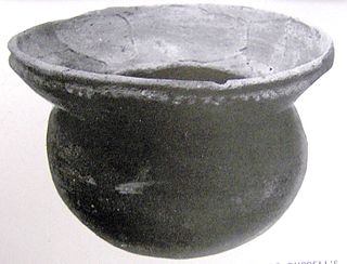
The Safety Harbor culture was an archaeological culture practiced by Native Americans living on the central Gulf coast of the Florida peninsula, from about 900 CE until after 1700. The Safety Harbor culture is defined by the presence of Safety Harbor ceramics in burial mounds. The culture is named after the Safety Harbor site, located close to the center of the culture area. The Safety Harbor site is the probable location of the chief town of the Tocobaga, the best known of the groups practicing the Safety Harbor culture.
Bussell Island, formerly Lenoir Island, is an island located at the mouth of the Little Tennessee River, at its confluence with the Tennessee River in Loudon County, near the U.S. city of Lenoir City, Tennessee. The island was inhabited by various Native American cultures for thousands of years before the arrival of early European explorers. The Tellico Dam and a recreational area occupy part of the island. Part of the island was added in 1978 to the National Register of Historic Places for its archaeological potential.
Fort Center is an archaeological site in Glades County, Florida, United States, a few miles northwest of Lake Okeechobee. It was occupied for more than 2,000 years, from 450 BCE until about 1700 CE. The inhabitants of Fort Center may have been cultivating maize centuries before it appeared anywhere else in Florida.

Shell works are large and complex assemblages of shell found in southwest Florida. Shell works include mounds and other deposits, with features described as borrow pits, canals, causeways, cisterns, crescents, sunken plazas, ponds, ramps, raised platforms, ridges, rings, walls, and "water courts". The largest shell works were constructed during the Woodland period in southwest Florida, from Charlotte Harbor to the Ten Thousand Islands, including Estero Bay.
Cayo Pelau Archaeological Site is a multi-period aboriginal archaeological site in Charlotte Harbor on the west peninsular Gulf coast of the United States. The island is 3.5 miles directly south of the Big Mound Key-Boggess Ridge Archeological District. It is the only site that lies within two counties, Lee County in the south and Charlotte County, Florida to the north. Neither county has taken responsibility for identifying, protecting or preserving the prehistoric and historical cultural resources on the island.
The Ortona Prehistoric Village is an archaeological site adjacent to the community of Ortona in northeastern Glades County, Florida, north of the Caloosahatchee River and west of Lake Okeechobee, consisting of mounds, canals and other features. Part of the site is currently in the Glades County-owned Ortona Indian Mound Park, but much remains in private hands. The site has been extensively modified by 20th-century activities, including the construction of a county road and a cemetery, sand mining operations, and improvements to pasture land.


