Kreamer Island

Last updated

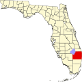
Kreamer Island is a small island in the south-easternmost part of Lake Okeechobee, located in Palm Beach County, Florida just north of Torry Island.

Kreamer Island is accessible only by airboat during the wet season and by recreational vehicles during dry season/droughts. A small canal separates Kreamer Island and Torry Island.

Kreamer Island was a settlement in Palm Beach County, Florida. The settlement was situated 4 miles (6.4 km) north-west of Belle Glade. The island was first settled in the 19th century as a fishing and agricultural settlement. Kreamer Island suffered numerous casualties over the years from hurricanes, including one in the 1920s, in which about 1000 people around the lake perished. The area became generally flooded after the dike around the lake was raised from 6 feet to 20 feet. Kreamer Island is now considered a ghost town. [1]

In the beginning of the 2007 winter the Palm Beach County Board of Commissioners started an archaeological dig on Kreamer Island after drought conditions revealed artifacts on the bottom of Lake Okeechobee.
Related Research Articles

<span class="mw-page-title-main">Hendry County, Florida</span> County in Florida, United States

Hendry County is a county in the Florida Heartland region of the U.S. state of Florida. As of the 2020 census, the population was 39,619, down from 42,022 at the 2010 census. Its county seat is LaBelle.

<span class="mw-page-title-main">Palm Beach County, Florida</span> County in Florida, United States

Palm Beach County is a county in the southeastern part of Florida, located in the Miami metropolitan area. It is Florida's third-most populous county after Miami-Dade County and Broward County and the 26th-most populous in the United States, with 1,492,191 residents as of the 2020 census. Its county seat and largest city is West Palm Beach, which had a population of 117,415 as of 2020. Named after one of its oldest settlements, Palm Beach, the county was established in 1909, after being split from Dade County. The county's modern-day boundaries were established in 1963.

<span class="mw-page-title-main">Canal Point, Florida</span> CDP in Florida, United States

Canal Point is a census-designated place (CDP) and unincorporated community in Palm Beach County, Florida, United States. It is part of the Miami metropolitan area of South Florida despite its local culture and location being way more similar to the Florida Heartland. Canal Point has a population of 344 people counted in the 2020 US census.

<span class="mw-page-title-main">Lake Okeechobee</span> Natural freshwater lake in Florida, United States

Lake Okeechobee is the largest freshwater lake in the U.S. state of Florida. It is the tenth largest natural freshwater lake among the 50 states of the United States and the second-largest natural freshwater lake contained entirely within the contiguous 48 states, after Lake Michigan.

<span class="mw-page-title-main">1928 Okeechobee hurricane</span> Category 5 Atlantic hurricane

The Okeechobee hurricane of 1928, also known as the San Felipe Segundo hurricane, was one of the deadliest hurricanes in the recorded history of the North Atlantic basin, and the fourth deadliest hurricane in the United States, only behind the 1900 Galveston hurricane, 1899 San Ciriaco hurricane, and Hurricane Maria. The hurricane killed an estimated 2,500 people in the United States; most of the fatalities occurred in the state of Florida, particularly in Lake Okeechobee. It was the fourth tropical cyclone, third hurricane, and only major hurricane of the 1928 Atlantic hurricane season. It developed off the west coast of Africa on September 6 as a tropical depression, but it strengthened into a tropical storm later that day, shortly before passing south of the Cape Verde islands. Further intensification was slow and halted late on September 7. About 48 hours later, the storm strengthened and became a Category 1 hurricane on the Saffir–Simpson hurricane wind scale. Still moving westward, the system reached Category 4 intensity before striking Guadeloupe on September 12, where it brought great destruction and resulted in 1,200 deaths. The islands of Martinique, Montserrat, and Nevis also reported damage and fatalities, but not nearly as severe as in Guadeloupe.

<span class="mw-page-title-main">Port Mayaca, Florida</span>

Port Mayaca is a sparsely populated place located in western Martin County, Florida, United States, on the eastern side of Lake Okeechobee.

<span class="mw-page-title-main">Hillsboro Canal</span> Canal in Florida, United States

The Hillsboro Canal is located in the southeastern portion of Florida within the South Florida Water Management District, and for much of its length forms the border between Broward and Palm Beach counties; however, its western end was entirely in Palm Beach County, until being recently annexed to Broward County-Parkland, FL. It begins at Lake Okeechobee at the S-2 water control structure in South Bay west of Belle Glade, Florida. It passes within the southern border of the Loxahatchee National Wildlife Refuge and flows southeast from there along Loxahatchee Road in a rural, lightly populated area. When it reaches the more heavily built-up region further east, it bends to head due eastward, forming the county line. Near its eastern end at the Intracoastal Waterway, with Boca Raton to the north and Deerfield Beach to the south, it departs from its straight course to go around several curves, but the county boundary continues to follow it at this point. 10 miles of the canal is navigable, and it is popular for recreational boating and fishing.

<span class="mw-page-title-main">Herbert Hoover Dike</span>

The Herbert Hoover Dike is a dike around the waters of Lake Okeechobee in Florida.

<span class="mw-page-title-main">Lake Worth Lagoon</span> Lagoon in Florida, US

The Lake Worth Lagoon is a lagoon located in Palm Beach County, Florida. It runs parallel to the coast, and is separated from the Atlantic Ocean by barrier beaches, including Palm Beach Island. The lagoon is connected to the Atlantic Ocean by two permanent, man-made inlets.

<span class="mw-page-title-main">Lake Worth Inlet</span> Ocean inlet in Florida, US

The Palm Beach Inlet, also known as the Lake Worth Inlet is an artificial cut through a barrier island connecting the northern part of the Lake Worth Lagoon in Palm Beach County, Florida with the Atlantic Ocean. It is bordered by the town of Palm Beach on the south, and by the town of Palm Beach Shores to the north. The inlet is also the entrance channel for the Port of Palm Beach. Its coordinates are 26°46′20″N80°02′14″W.

The Belle Glade culture, or Okeechobee culture, is an archaeological culture that existed from as early as 1000 BCE until about 1700 CE in the area surrounding Lake Okeechobee and in the Kissimmee River valley in the Florida Peninsula.

<span class="mw-page-title-main">Florida State Road 717</span>

State Road 717 (SR 717) is a 1.7-mile-long (2.7 km) northwest-southeast road in Belle Glade, Palm Beach County, Florida also known as Canal Street.

<span class="mw-page-title-main">Fort Drum, Florida</span>

Fort Drum was a town in Okeechobee County, Florida, United States, located on US 441, between Yeehaw Junction and Okeechobee. A service plaza on Florida's Turnpike is named after the town. The Fort Drum Wildlife Management Area consists of nearly 21,000 acres in southwestern Indian River County and is named for its proximity to the town and is known as the birthplace of the St. John's River. Fort Drum is the only known locale for crystal bearing fossil shells. There is a cemetery in the middle of the town on almost eight acres, in which many of the first settlers of Fort Drum were buried and still remain. It is currently owned and maintained by Okeechobee County.

<span class="mw-page-title-main">Florida's 20th congressional district</span> U.S. House district for Florida

Florida's 20th congressional district is a U.S. congressional district in Southeast Florida. It is currently held by Democrat Sheila Cherfilus-McCormick, who was elected in a January 2022 special election, following the death of Alcee Hastings on April 6, 2021. With a Cook Partisan Voting Index (CPVI) rating of D+25, it is one of the most Democratic districts in Florida.

<span class="mw-page-title-main">1949 Florida hurricane</span> Category 4 Atlantic hurricane in 1949

The 1949 Florida hurricane, also known as the Delray Beach hurricane, caused significant damage in the southern portions of the state late in the month of August. The second recorded tropical cyclone of the annual hurricane season, the system originated from a tropical wave near the northern Leeward Islands on August 23. Already a tropical storm upon initial observations, the cyclone curved west-northwestward and intensified, becoming a hurricane on August 25. Rapid intensification ensued as the storm approached the central Bahamas early on August 26, with the storm reaching Category 4 hurricane strength later that day and peaking with maximum sustained winds of 130 mph (210 km/h) shortly after striking Andros. Late on August 26, the storm made landfall near Lake Worth, Florida, at the same intensity. The cyclone initially weakened quickly after moving inland, falling to Category 1 status early the next day. Shortly thereafter, the system curved northward over the Nature Coast and entered Georgia on August 28, where it weakened to a tropical storm. The storm then accelerated northeastward and became extratropical over New England by August 29. The remnants traversed Atlantic Canada and much of the Atlantic Ocean before dissipating near Ireland on September 1.

Okeelanta is an unincorporated community in Palm Beach County, Florida, United States, located approximately 4 miles (7 km) south of South Bay on U.S. Route 27 at County Road 827. It was originally developed as a planned community in the 1910s, but had effectively disappeared by the end of the 1920s. The name is a portmanteau of Lake Okeechobee and Atlantic Ocean.

<span class="mw-page-title-main">1933 Treasure Coast hurricane</span> Category 4 Atlantic hurricane in 1933

The 1933 Treasure Coast hurricane was the second-most intense tropical cyclone to strike the United States during the active 1933 Atlantic hurricane season. The eleventh tropical storm, fifth hurricane, and the third major hurricane of the season, it formed east-northeast of the Leeward Islands on August 31. The tropical storm moved rapidly west-northwestward, steadily intensifying to a hurricane. It acquired peak winds of 140 mph (220 km/h) and passed over portions of the Bahamas on September 3, including Eleuthera and Harbour Island, causing severe damage to crops, buildings, and infrastructure. Winds over 100 mph (160 km/h) affected many islands in its path, especially those that encountered its center, and many wharves were ruined.

<span class="mw-page-title-main">Ritta Island, Florida</span> Former human settlement in Palm Beach County

Ritta Island is an island in Lake Okeechobee, Florida, near its southern shore. It was once inhabited. The settlement was situated in Palm Beach County, 5 miles (8.0 km) east of Clewiston.

<span class="mw-page-title-main">Effects of the 1928 Okeechobee hurricane in Florida</span> At least 2,500 fatalities in the state of Florida

The effects of the 1928 Okeechobee hurricane in Florida included at least 2,500 fatalities in the state, making this the second deadliest tropical cyclone on record in the contiguous United States, behind only the 1900 Galveston hurricane, as well as the deadliest weather event on the East Coast of the United States. The storm originated from a tropical depression that developed near Senegal on September 6. Traversing westward across the Atlantic Ocean, the cyclone struck the Lesser Antilles, Puerto Rico, and the Bahamas as a powerful hurricane. Early on September 17, the storm made landfall near Palm Beach, Florida, as a Category 4 hurricane on the modern-day Saffir–Simpson scale. After initially moving northwestward across Florida, the cyclone curved north-northeastward near the Tampa Bay area. The hurricane briefly re-emerged into the Atlantic prior to striking South Carolina on September 18 and becoming extratropical over North Carolina on the next day, before the remnants lost their identity over Ontario on September 21.

The Lake Okeechobee Scenic Trail (LOST) is a 109-mile multi-use path around Lake Okeechobee, the seventh largest lake in the United States and the largest in the state of Florida. The trail began as the Okeechobee Segment of the Florida National Scenic Trail (FNST), a 1,000 mile trail that runs from Miami to Pensacola. The USDA and National Forest Service dedicated the Okeechobee Segment as part of the FNST in 1993. Most of the trail is atop the 35-feet tall Herbert Hoover Dike. The trail crosses five counties, Hendry, Glades, Okeechobee, Martin and Palm Beach. Many stretches run along state and county highways, including Florida State Road 78.

References

26°45′24″N80°44′00″W / 26.75667°N 80.73333°W / 26.75667; -80.73333