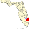
Whisper Walk, Florida | |
---|---|
Location of Whisper Walk, Florida | |
Coordinates: 26°23′56″N80°10′57″W / 26.39889°N 80.18250°W Coordinates: 26°23′56″N80°10′57″W / 26.39889°N 80.18250°W | |
Country | United States |
State | Florida |
County | Palm Beach |
Area | |
• Total | 1.0 sq mi (2.6 km2) |
• Land | 1.0 sq mi (2.6 km2) |
• Water | 0.0 sq mi (0.0 km2) |
Elevation | 16 ft (5 m) |
Population (2000) | |
• Total | 5,135 |
• Density | 5,123.7/sq mi (1,978.3/km2) |
Time zone | UTC-5 (Eastern (EST)) |
• Summer (DST) | UTC-4 (EDT) |
FIPS code | 12-77216 [1] |
GNIS feature ID | 1867235 [2] |
Whisper Walk was a census-designated place (CDP) located in an unincorporated area northwest of Boca Raton in Palm Beach County, Florida, United States. The population was 5,135 at the 2000 census. While it is not in the city of Boca Raton, Boca Raton is its postal address, and the community is frequently classified under its umbrella term.
Whisper Walk is located at 26°23′56″N80°10′57″W / 26.39889°N 80.18250°W (26.398866, -80.182492). [3]
According to the United States Census Bureau, the CDP has a total area of 2.6 km2 (1.0 mi2), all land.
Whisper Walk is an active adult community. By deed restriction, at least one member of the household must be age fifty-five or higher. The majority of residents are seasonal, retired Jewish couples from the New York metropolitan area, and other Northeastern areas.
As of the census [1] of 2000, there were 5,135 people, 2,418 households, and 1,716 families residing in the CDP. The population density was 1,982.6/km2 (5,123.7/mi2). There were 2,637 housing units at an average density of 1,018.2/km2 (2,631.2/mi2). The racial makeup of the CDP was 93.67% White (89% were Non-Hispanic White,) [4] 2.06% African American, 0.04% Native American, 2.77% Asian, 0.53% from other races, and 0.93% from two or more races. Hispanic or Latino of any race were 5.63% of the population.
There were 2,418 households, out of which 16.6% had children under the age of 18 living with them, 65.3% were married couples living together, 3.7% had a female householder with no husband present, and 29.0% were non-families. 26.7% of all households were made up of individuals, and 22.4% had someone living alone who was 65 years of age or older. The average household size was 2.12 and the average family size was 2.53.
In the CDP, the population was spread out, with 14.9% under the age of 18, 2.3% from 18 to 24, 16.4% from 25 to 44, 15.0% from 45 to 64, and 51.4% who were 65 years of age or older. The median age was 66 years. For every 100 females, there were 84.6 males. For every 100 females age 18 and over, there were 82.0 males.
The median income for a household in the CDP was $42,368, and the median income for a family was $51,308. Males had a median income of $51,422 versus $34,844 for females. The per capita income for the CDP was $26,098. About 3.4% of families and 4.7% of the population were below the poverty line, including 5.7% of those under age 18 and 5.3% of those age 65 or over.
As of 2000, English was the first language for 91.60% of all residents, while Spanish accounted for 5.48%, Italian for 1.18%, Yiddish made up 1.07%, and Hebrew was the mother tongue for 0.64% of the population. [5]
Saybrook Manor is a community and census-designated place (CDP) in Old Saybrook, a town in Middlesex County, Connecticut, United States. The population was 1,133 at the 2000 census. The Saybrook Manor section is generally the area south of U.S. Route 1 between the Westbrook town line and the Oyster River.
Boulevard Gardens is a census-designated place (CDP) in Broward County, Florida, United States. The population was 1,274 at the 2010 census.
Tildenville is a census-designated place (CDP) and an unincorporated area in Orange County, Florida, United States. The population was 511 at the 2010 census. It is part of the Orlando–Kissimmee Metropolitan Statistical Area. Generally speaking, Tildenville is a narrow area alongside Orange County Road 545, south of Florida State Road 50 and north of the Stoneybrook West planned unit development. Residents utilize Winter Garden, Florida for mail delivery.
Boca Del Mar was a census-designated place (CDP) in an unincorporated area near Boca Raton in Palm Beach County, Florida, United States. The population was 21,832 at the 2000 census. While it is not officially in the City of Boca Raton, the community is often classified under its umbrella term.
Boca Pointe was a census-designated place (CDP) located in an unincorporated area near Boca Raton in Palm Beach County, Florida, United States. The population was 3,302 at the 2000 census. The CDP was not included in the 2010 census. While it is not officially in the City of Boca Raton, the community is frequently classified under its umbrella term.
Hamptons at Boca Raton was a census-designated place (CDP) located in an unincorporated area near Boca Raton in Palm Beach County, Florida, United States. The population was 11,306 at the 2000 census. While it is not officially in the City of Boca Raton, the community is frequently classified under its umbrella term.
Mission Bay is a census-designated place (CDP) located in an unincorporated area in west Boca Raton in Palm Beach County, Florida, United States. The population was 2,926 at the 2000 census.
Sandalfoot Cove was a census-designated place (CDP) located in an unincorporated area near Boca Raton in Palm Beach County, Florida, United States. The population was 16,582 at the 2000 census. While it is not officially in the City of Boca Raton, the community is frequently classified under its umbrella term.
Venetian Village is a census-designated place (CDP) in Lake County, Illinois, United States. The population was 2,826 at the 2010 census.
Yarmouth Port is a census-designated place (CDP) in the town of Yarmouth in Barnstable County, Massachusetts, United States. The population was 5,320 at the 2010 census.
Four Corners is a census-designated place (CDP) in Gallatin County, Montana, United States. The population was 3,146 at the 2010 census, up from 1,828 in 2000. It is part of the Bozeman, MT Micropolitan Statistical Area.
Rocky Point is a census-designated place (CDP) in Lake County, Montana, United States. The population was 97 at the 2010 census.
Maplewood Park is a census-designated place (CDP) in Trumbull County, Ohio, United States. The population was 321 at the 2000 census. It is part of the Youngstown–Warren–Boardman, OH-PA Metropolitan Statistical Area.
Imperial-Enlow was a census-designated place (CDP) in Allegheny County, Pennsylvania, United States, for the 2000 census. The population at the time was 3,514. The 2010 census recognized two separate census-designated places, Imperial and Enlow.
Newtown Grant is a census-designated place (CDP) in Bucks County, Pennsylvania, United States. The population was 3,620 at the 2010 census.
Cecil-Bishop is a census-designated place (CDP) in Washington County, Pennsylvania, United States. The population was 2,476 at the 2010 census. The CDP is a merger of two unincorporated communities: larger Cecil in the east and smaller Bishop in the west.
McGovern is a census-designated place (CDP) in Washington County, Pennsylvania, United States. The population was 2,742 at the 2010 census.
Woodfield is a census-designated place (CDP) in Richland County, South Carolina, United States. The population was 9,303 at the 2010 census. It is part of the Columbia, South Carolina Metropolitan Statistical Area.
Moses Lake North is a census-designated place (CDP) in Grant County, Washington, United States. The population was 4,418 at the 2010 census, up from 4,232 at the 2000 census.
Seymour is a census-designated place (CDP) in Eau Claire County, Wisconsin, United States. The population was 1,418 at the 2010 census. It is located within the town of Seymour and is part of the Eau Claire urban area.