Westgate, Florida

Last updated

Westgate, Florida
FLMap-doton-Westgate-BelvedereHomes.PNG
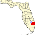
Location of Westgate, Florida
Coordinates: 26°41′57″N80°5′40″W / 26.69917°N 80.09444°W / 26.69917; -80.09444
Country Flag of the United States.svg  United States
State Flag of Florida.svg  Florida
County   Palm Beach
Area
[1]
  Total1.52 sq mi (3.93 km2)
  Land1.52 sq mi (3.93 km2)
  Water0.00 sq mi (0.00 km2)
Population
 (2020)
  Total8,435
  Density5,553.00/sq mi (2,144.13/km2)
Time zone UTC-5 (Eastern (EST))
  Summer (DST) UTC-4 (EDT)
ZIP code
33409 [2]
Area code 561
FIPS code 12-76305 [3]

Westgate is an unincorporated census-designated place (CDP) in Palm Beach County, Florida, United States. The population was 8,435 at the 2020 census. [4] Prior to the 2010 census, it was listed as the Westgate-Belvedere Homes CDP.

Contents

Geography

Westgate is located at 26°41′57″N80°5′40″W / 26.69917°N 80.09444°W / 26.69917; -80.09444 (26.699243, -80.094468). [5]

According to the United States Census Bureau, the community has a total area of 1.5 square miles (3.9 km2), all land. [4]

Demographics

Historical population
CensusPop.Note
1990 6,880
2000 8,13418.2%
2010 7,975−2.0%
2020 8,4355.8%
As Westgate-Belvedere Homes (1990-2000); [6]
As Westgate (2010) [4]

As of the census [3] of 2000, there were 8,134 people, 2,774 households, and 1,908 families residing in the community. The population density was 1,524.5/km2 (3,944.7/mi2). There were 3,110 housing units at an average density of 582.9/km2 (1,508.3/mi2). The racial makeup of the community was 62.10% White (41.2% were Non-Hispanic White,) [7] 24.05% African American, 0.61% Native American, 0.90% Asian, 0.07% Pacific Islander, 8.11% from other races, and 4.16% from two or more races. Hispanic or Latino of any race were 32.37% of the population.

There were 2,774 households, out of which 37.4% had children under the age of 18 living with them, 41.4% were married couples living together, 19.6% had a female householder with no husband present, and 31.2% were non-families. 22.8% of all households were made up of individuals, and 7.1% had someone living alone who was 65 years of age or older. The average household size was 2.93 and the average family size was 3.42.

The population was spread out, with 30.8% under the age of 18, 10.8% from 18 to 24, 31.5% from 25 to 44, 18.0% from 45 to 64, and 8.8% who were 65 years of age or older. The median age was 30 years. For every 100 females, there were 101.6 males. For every 100 females age 18 and over, there were 102.0 males.

The median income for a household in the community was $29,659, and the median income for a family was $33,836. Males had a median income of $24,517 versus $19,477 for females. The per capita income for the community was $12,382. About 16.4% of families and 20.8% of the population were below the poverty line, including 26.6% of those under age 18 and 10.8% of those age 65 or over.

As of 2000, English was the first language for 61.25% of all residents, while Spanish accounted for 31.26%, French Creole made up 6.23%, and French was the mother tongue for 1.24% of the population. [8]

Related Research Articles

<span class="mw-page-title-main">Golden Gate, Florida</span> Census-designated place in Florida

Golden Gate is a community and census-designated place (CDP) in Collier County, Florida, United States. Golden Gate's boundaries coincide with a 2 by 2 miles square of significantly higher density development than surrounding areas. The population was 23,961 as recorded in the 2010 census. It is part of the Naples–Marco Island Metropolitan Statistical Area.

<span class="mw-page-title-main">Brent, Florida</span> Census-designated place in Florida, United States

Brent is a census-designated place (CDP) in Escambia County, Florida. It is considered to be a community within Pensacola. The population was 21,804 at the 2010 census. It is a principal area of the Pensacola-Ferry Pass-Brent Metropolitan Statistical Area. The community is named after Francis Celestino Brent, who played an integral role in the development of Pensacola.

<span class="mw-page-title-main">Okahumpka, Florida</span> Census-designated place in Florida

Okahumpka is an unincorporated community and census-designated place (CDP) in Lake County, Florida, United States. The population was 267 at the 2010 census. It is part of the Orlando–Kissimmee Metropolitan Statistical Area.

<span class="mw-page-title-main">Fort Myers Shores, Florida</span> Census-designated place in Florida, United States

Fort Myers Shores is an unincorporated community and census-designated place (CDP) in Lee County, Florida, United States. The population was 5,774 at the 2020 census. It is part of the Cape Coral-Fort Myers, Florida Metropolitan Statistical Area.

<span class="mw-page-title-main">Tice, Florida</span> Census-designated place in Florida, United States

Tice is an unincorporated community and census-designated place (CDP) in Lee County, Florida, United States. As of the 2020 census, the CDP population was 4,853. It is part of the Cape Coral-Fort Myers, Florida Metropolitan Statistical Area.

<span class="mw-page-title-main">Leisure City, Florida</span> Census-designated place in Florida, United States

Leisure City is an unincorporated community and census-designated place (CDP) in Miami-Dade County, Florida, United States, that includes the smaller, older community of Modello in its northwestern section. The population was 26,324 at the 2020 census, up from 22,655 in 2010. It is most notable for the Coral Castle Museum, located in the Modello area.

<span class="mw-page-title-main">Three Lakes, Florida</span> Census-designated place in Florida, United States

Three Lakes is a census-designated place (CDP) in Miami-Dade County, Florida, United States. The population was 16,540 at the 2020 census, up from 15,047 in 2010. Its name comes from the planned community of Three Lakes, which is located inside Three Lakes CDP boundaries.

<span class="mw-page-title-main">Tavernier, Florida</span> Census-designated place in Florida, United States

Tavernier is a census-designated place (CDP) and unincorporated community in Monroe County, Florida, United States on Key Largo, the largest island in the upper Florida Keys. Tavernier's population was 2,530 at the 2020 census, up from 2,136 in 2010.

High Point was a census-designated place (CDP) in Palm Beach County, Florida, United States. The population was 2,191 at the 2000 census. The CDP was removed from the 2010 census. Although it is still unincorporated, it is within Delray Beach's "future annexation area."

Lake Belvedere Estates is a census-designated place (CDP) in Palm Beach County, Florida, United States. The population was 2,091 at the 2020 census.

<span class="mw-page-title-main">Sandalfoot Cove, Florida</span> Unincorporated place in Florida, United States

Sandalfoot Cove was a census-designated place (CDP) located in an unincorporated area near Boca Raton in Palm Beach County, Florida, United States. The population was 16,582 at the 2000 census. While it is not officially in the City of Boca Raton, the community is frequently classified under its umbrella term.

Stacy Street is a street and surrounding census-designated place (CDP) in Palm Beach County, Florida, United States. The population was 978 at the 2020 census, which misspelled it as Stacey Street.

<span class="mw-page-title-main">Belvedere Park, Georgia</span> Census-designated place in Georgia, United States

Belvedere Park is a census-designated place (CDP) in DeKalb County, Georgia, United States. The population was 15,113 at the 2020 census.

<span class="mw-page-title-main">Fairmount, Maryland</span> CDP in Maryland, United States

Fairmount is a census-designated place (CDP) in Somerset County, Maryland, United States. The population was 537 at the 2000 census. It is included in the Salisbury, Maryland-Delaware Metropolitan Statistical Area.

<span class="mw-page-title-main">Girdletree, Maryland</span> CDP in Maryland, United States

Girdletree is a census-designated place in Worcester County, Maryland, United States. The population was 149 at the 2010 census. It is part of the Salisbury, Maryland-Delaware Metropolitan Statistical Area.

<span class="mw-page-title-main">Glenmoor, Ohio</span> Census-designated place in Ohio, United States

Glenmoor is an unincorporated community and census-designated place in southwestern St. Clair Township, Columbiana County, Ohio, United States. The population was 1,829 at the 2020 census. Glenmoor is located in the Salem micropolitan area and the greater Youngstown–Warren area.

<span class="mw-page-title-main">La Croft, Ohio</span> Census-designated place in Ohio, United States

La Croft is an unincorporated community and census-designated place (CDP) in Liverpool Township, Columbiana County, Ohio, United States. The population was 1,078 at the 2020 census. La Croft is located in the Salem micropolitan area and the greater Youngstown–Warren area.

<span class="mw-page-title-main">Fairdale, Pennsylvania</span> Census-designated place in Pennsylvania, United States

Fairdale is a community and census-designated place (CDP) in Greene County, Pennsylvania, United States. The population was 2,059 at the 2010 census.

<span class="mw-page-title-main">Belvedere, South Carolina</span> Census-designated place in South Carolina, United States of America

Belvedere is a census-designated place (CDP) and suburb of North Augusta in Aiken County, South Carolina, United States. It is part of the Augusta, Georgia metropolitan area. The population was 5,792 at the 2010 census.

<span class="mw-page-title-main">Marshfield (CDP), Massachusetts</span> Census-designated place in Massachusetts, United States

Marshfield is a census-designated place (CDP) in the town of Marshfield in Plymouth County, Massachusetts, United States. The population was 4,335 at the 2010 census.

References

  1. "2020 U.S. Gazetteer Files". United States Census Bureau. Retrieved December 2, 2021.
  2. "Westgate FL ZIP Code". zipdatamaps.com. 2023. Retrieved January 26, 2023.
  3. 1 2 "U.S. Census website". United States Census Bureau . Retrieved January 31, 2008.
  4. 1 2 3 "Geographic Identifiers: 2010 Demographic Profile Data (G001): Westgate CDP, Florida". U.S. Census Bureau, American Factfinder. Archived from the original on February 12, 2020. Retrieved November 8, 2012.
  5. "US Gazetteer files: 2010, 2000, and 1990". United States Census Bureau. February 12, 2011. Retrieved April 23, 2011.
  6. "CENSUS OF POPULATION AND HOUSING (1790-2000)". U.S. Census Bureau . Retrieved July 31, 2010.
  7. "Demographics of Westgate-Belvedere Homes, FL". MuniNetGuide.com. Retrieved December 14, 2007.
  8. "MLA Data Center Results for Westgate-Belvedere Homes, Florida". Modern Language Association . Retrieved December 14, 2007.