Gun Club Estates, Florida

Last updated

Gun Club Estates, Florida
CDP
Coordinates: 26°40′31″N80°6′32″W / 26.67528°N 80.10889°W / 26.67528; -80.10889
Country Flag of the United States.svg  United States
State Flag of Florida.svg  Florida
County Flag of Palm Beach County, Florida.png Palm Beach
Area
[1]
  Total0.13 sq mi (0.33 km2)
  Land0.12 sq mi (0.31 km2)
  Water0.01 sq mi (0.02 km2)
Elevation
13 ft (4 m)
Population
 (2020)
  Total816
  Density6,857.14/sq mi (2,637.75/km2)
Time zone UTC-5 (Eastern (EST))
  Summer (DST) UTC-4 (EDT)
ZIP code
33406 [2]
Area code 561
FIPS code 12-28305 [3]
GNIS feature ID1853256 [4]

Gun Club Estates is a census-designated place (CDP) in Palm Beach County, Florida, United States. It is part of the Miami metropolitan area of South Florida. The population was 816 at the 2020 US census.

Contents

History

The CDP and Gun Club Road are both named after the Palm Beach Gun Club, a skeet and target shooting range that originally opened in the town of Palm Beach in 1911 and remained there until relocating to the modern-day Gun Club Estates area prior to the Korean War. A biography on Arthur Jackson dating to approximately 1952 notes that during the war, military personnel stationed at PBI (then known as the Palm Beach Air Force Base) used the gun ranges for training. By the mid-1950s, however, the owners of the club relocated it to just north of the intersection of Jog Road and Lake Worth Road (State Road 802) as homes for Gun Club Estates were being constructed. [5]

Geography

Gun Club Estates is located at 26°40′31″N80°06′32″W / 26.675393°N 80.108789°W / 26.675393; -80.108789 . [6]

According to the United States Census Bureau, the CDP has a total area of 0.3 km2 (0.1 mi2), all land.

The CDP is located in an unincorporated area near the southwest corner of the Palm Beach International Airport (PBI) and is bounded by West Palm Beach Canal on the north, Kirk Road on the east, Gun Club Road on the south, and Military Trail (State Road 809) on the west. [7]

Demographics

Historical population
CensusPop.Note
2000 711
2010 7769.1%
2020 8165.2%
U.S. Decennial Census [8]

2020 census

Gun Club Estates racial composition
(Hispanics excluded from racial categories)
(NH = Non-Hispanic) [9]
RaceNumberPercentage
White (NH)11313.85%
Black or African American (NH)759.19%
Native American or Alaska Native (NH)00.00%
Asian (NH)50.61%
Pacific Islander or Native Hawaiian (NH)00.00%
Some Other Race (NH)00.00%
Mixed/Multiracial (NH)101.23%
Hispanic or Latino 61375.12%
Total816100%

As of the 2020 United States census, there were 816 people, 342 households, and 134 families residing in the CDP. [10]

2010 census

Gun Club Estates racial composition
(Hispanics excluded from racial categories)
(NH = Non-Hispanic) [11]
RaceNumberPercentage
White (NH)23029.64%
Black or African American (NH)506.44%
Native American or Alaska Native (NH)00.00%
Asian (NH)81.03%
Pacific Islander or Native Hawaiian (NH)00.00%
Some Other Race (NH)20.26%
Mixed/Multiracial (NH)00.00%
Hispanic or Latino 48662.63%
Total776100%

As of the 2010 United States census, there were 776 people, 275 households, and 227 families residing in the CDP. [12]

2000 census

At the 2000 census, [3] there were 711 people, 250 households and 182 families living in the CDP. The population density was 2,287.7/km2 (6,010.7/mi2). There were 268 housing units at an average density of 862.3/km2 (2,265.7/mi2). The racial makeup of the CDP was 87.34% White (55.8% were Non-Hispanic White), [13] 2.25% African American, 0.14% Native American, 0.14% Asian, 3.52% from other races, and 6.61% from two or more races. Hispanic or Latino of any race were 39.80% of the population.

There were 250 households, of which 34.8% had children under the age of 18 living with them, 45.2% were married couples living together, 17.2% had a female householder with no husband present, and 26.8% were non-families. 17.2% of all households were made up of individuals, and 5.2% had someone living alone who was 65 years of age or older. The average household size was 2.84 and the average family size was 3.09.

26.2% of the population were under the age of 18, 9.3% from 18 to 24, 36.0% from 25 to 44, 21.2% from 45 to 64, and 7.3% who were 65 years of age or older. The median age was 34 years. For every 100 females, there were 108.5 males. For every 100 females age 18 and over, there were 105.9 males.

The median household income was $33,380, and the median family income was $28,375. Males had a median income of $19,943 compared with $21,372 for females. The per capita income for the CDP was $12,560. None of the families and 3.7% of the population were living below the poverty line, including no under eighteens and none of those over 64.

In 2000, English was the first language for 53.50% of all residents, while Spanish was the mother tongue for 46.49% of the population. [14]

Related Research Articles

<span class="mw-page-title-main">Mojave Ranch Estates, Arizona</span> CDP in Mohave County, Arizona

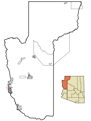
Mojave Ranch Estates is an unincorporated community and census-designated place (CDP) in Mohave County, Arizona, United States. The population was 53 as of the 2020 census.

Palm Aire, Florida was an unincorporated census-designated place in Broward County, Florida consisting of residential property, commercial businesses, and four golf courses. Palm Aire describes both Palm Aire Village, a collection of single-family houses, and Palm Aire Country Club, a 5,000-acre (20 km2) property with condominiums, villas, estate homes, and four golf courses. It is now part of the cities of Fort Lauderdale and Pompano Beach.

<span class="mw-page-title-main">Palm City, Florida</span> Census-designated place in Florida, United States

Palm City is an unincorporated area and census-designated place (CDP) in Martin County, Florida, United States. The population was 25,883 at the 2020 census. It is part of the Port St. Lucie Metropolitan Statistical Area.

<span class="mw-page-title-main">Palm Springs North, Florida</span> Census-designated place in Florida, United States

Palm Springs North is an unincorporated community and census-designated place (CDP) in Miami-Dade County, Florida, United States. The population was 5,030 at the 2020 census.

<span class="mw-page-title-main">Canal Point, Florida</span> CDP in Florida, United States

Canal Point is a census-designated place (CDP) and unincorporated community in Palm Beach County, Florida, United States. It is part of the Miami metropolitan area of South Florida despite its local culture and location being way more similar to the Florida Heartland. Canal Point has a population of 344 people counted in the 2020 US census.

Dunes Road is a former census-designated place (CDP) and current unincorporated place in Palm Beach County, Florida, United States. The population was 391 at the 2000 census.

Juno Ridge is a census-designated place (CDP) in Palm Beach County, Florida, United States. It is part of the Miami metropolitan area of South Florida. The population was 1,186 at the 2020 US census.

Lake Belvedere Estates is a census-designated place (CDP) in Palm Beach County, Florida, United States. The population was 2,091 at the 2020 census.

Limestone Creek is a census-designated place (CDP) in Palm Beach County, Florida, United States. The population was 1,316 at the 2020 census.

Plantation Mobile Home Park is a census-designated place (CDP) in Palm Beach County, Florida, United States. The population was 1,462 at the 2020 census.

Royal Palm Estates is a census-designated place (CDP) in Palm Beach County, Florida, United States. The population was 1,974 at the 2020 census.
<span class="mw-page-title-main">Sandalfoot Cove, Florida</span> Unincorporated place in Florida, United States

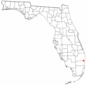
Sandalfoot Cove was a former census-designated place (CDP) and current unincorporated place near Boca Raton in Palm Beach County, Florida, United States. The population was 16,582 at the 2000 census. While it is not officially in the City of Boca Raton, the community is frequently classified under its umbrella term.

Schall Circle is a census-designated place (CDP) in Palm Beach County, Florida, United States. The population was 792 at the 2020 census.

Seminole Manor is a census-designated place (CDP) in Palm Beach County, Florida, United States. The population was 2,562 at the 2020 census. The neighborhood was developed in the late 1950s, with the majority of houses built in 1958 and 1959.

Stacy Street is a street and surrounding census-designated place (CDP) in Palm Beach County, Florida, United States. The population was 978 at the 2020 census, which misspelled it as Stacey Street.

<span class="mw-page-title-main">North Falmouth, Massachusetts</span> Census-designated place in Massachusetts, United States

North Falmouth is a census-designated place (CDP) in the town of Falmouth in Barnstable County, Massachusetts, United States. The population was 3,084 at the 2010 census.
<span class="mw-page-title-main">Lake Worth Corridor, Florida</span> Unincorporated place in Florida, United States

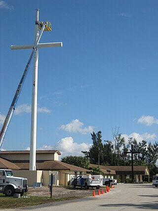
Lake Worth Corridor was a former census-designated place (CDP) and now a current unincorporated place in Palm Beach County, Florida, United States, approximately 3 miles (4.8 km) west of the city of Lake Worth Beach. The population was 18,663 at the 2000 census. The CDP was not included in the 2010 census.

<span class="mw-page-title-main">Lakehills, Texas</span> CDP in Texas, United States

Lakehills is a census-designated place (CDP) in Bandera County, Texas, United States. The population was 5,150 at the 2010 census, making it the most populous place in Bandera county. It is part of the San Antonio Metropolitan Statistical Area.

<span class="mw-page-title-main">Lake Kiowa, Texas</span> Census-designated place in Texas, United States

Lake Kiowa is a census-designated place (CDP) in Cooke County, Texas, United States, the majority of which consists of the gated community of the same name.

Cabana Colony is a census-designated place (CDP) in Palm Beach County, Florida, United States. The CDP is part of the Miami metropolitan area of South Florida. Its population was 2,460 as of the 2020 census.

References

  1. "2020 U.S. Gazetteer Files". United States Census Bureau. Retrieved October 31, 2021.
  2. "Gun Club Estates, FL ZIP Code". zipdatamaps.com. 2023. Retrieved February 19, 2023.
  3. 1 2 "U.S. Census website". United States Census Bureau . Retrieved January 31, 2008.
  4. "US Board on Geographic Names". United States Geological Survey. October 25, 2007. Retrieved January 31, 2008.
  5. Eliot Kleinberg (March 19, 2008). "Gun club, military post shared range". The Palm Beach Post. p. 14O. Retrieved November 1, 2021 via Newspapers.com. Lock-green.svg
  6. "US Gazetteer files: 2010, 2000, and 1990". United States Census Bureau. February 12, 2011. Retrieved April 23, 2011.
  7. "2020 Census Census Tract Reference Map: Palm Beach County, FL" (PDF). United States Census Bureau. Retrieved November 1, 2021.
  8. "Census of Population and Housing". Census.gov. Retrieved June 4, 2016.
  9. "HISPANIC OR LATINO, AND NOT HISPANIC OR LATINO BY RACE: 2020". data.census.gov. Retrieved July 19, 2023.
  10. "HOUSEHOLDS AND FAMILIES:2020". data.census.gov. Retrieved July 19, 2023.
  11. "HISPANIC OR LATINO, AND NOT HISPANIC OR LATINO BY RACE: 2010". data.census.gov. Retrieved July 19, 2023.
  12. "HOUSEHOLDS AND FAMILIES: 2010". data.census.gov. Retrieved July 19, 2023.
  13. "Demographics of Gun Club Estates, FL". MuniNetGuide.com. Retrieved December 9, 2007.
  14. "MLA Data Center Results for Gun Club Estates, Florida". Modern Language Association . Retrieved December 9, 2007.