Atlantis, Florida

Last updated

Atlantis, Florida
City of Atlantis
Atlantis, FL Seal.png
Palm Beach County Florida Incorporated and Unincorporated areas Atlantis Highlighted 1202500.svg
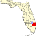
Location of Atlantis in Palm Beach County, Florida.
Coordinates: 26°35′36″N80°6′16″W / 26.59333°N 80.10444°W / 26.59333; -80.10444
Country United States
State Florida
County Palm Beach
Incorporated June 19, 1959 (1959-06-19) [1]
Government
  Type Mayor-Council
   Mayor Allan Kaulbach
   Vice Mayor Keller Lanahan
   Councilors Guy Motzer,
Michael LaCoursiere, and
Derek Cooper
   City Manager Brian R. Moree
   City Clerk Kristen Puhalainen
Area
[2]
  Total1.40 sq mi (3.63 km2)
  Land1.36 sq mi (3.53 km2)
  Water0.04 sq mi (0.10 km2)
Elevation
[3]
13 ft (4 m)
Population
 (2020)
  Total2,142
  Density1,572.69/sq mi (607.01/km2)
Time zone UTC-5 (Eastern (EST))
  Summer (DST) UTC-4 (EDT)
ZIP code
33462
Area code(s) 561, 728
FIPS code 12-02500 [4]
GNIS feature ID0302714 [3]
Website https://www.atlantisfl.gov/

Atlantis is a city in Palm Beach County, Florida, United States. It is part of the Miami metropolitan area of South Florida. As of the 2020 census, the city had a population of 2,142.

Contents

History

The modern history of what became known as the city of Atlantis originates in a ranch called Mulberry Farms, owned by Philip D. Lewis, a former Florida state senator. [1] Lewis's Mission Company raised Brahman cattle on the land. In 1958, real estate developers Nathan Hunt and Paul Kintz purchased the land, and began the construction of what became a gated golf and country club community. The residential development, combined with a small amount of adjacent land for commercial use, was incorporated on June 19, 1959. [1] Its first council was appointed, consisting of James Kintz as mayor, Nathan Hunt as vice mayor, and councilmen Paul Kintz, Marjorie Hunt and William Blakeslee. [1]

Geography

According to the United States Census Bureau, the city has a total area of 1.4 square miles (3.6 km2), of which 1.4 square miles (3.6 km2) is land and 0.04 square miles (0.10 km2) (2.84%) is water. It 834 acres (338 ha) borders the Lake Worth Drainage (L-14) Canal on the north, Lantana Road to the south, Military Trail to the west and Congress Avenue to the east. [1]

Demographics

Historical population
CensusPop.Note
1960 2
1970 42521,150.0%
1980 1,325211.8%
1990 1,65324.8%
2000 2,00521.3%
2010 2,0050.0%
2020 2,1426.8%
U.S. Decennial Census [5]

2020 census

Atlantis racial composition
(Hispanics excluded from racial categories)
(NH = Non-Hispanic) [6]
RaceNumberPercentage
White (NH)1,76682.45%
Black or African American (NH)472.19%
Native American or Alaska Native (NH)00.00%
Asian (NH)572.66%
Pacific Islander or Native Hawaiian (NH)00.00%
Some other race (NH)150.70%
Two or more races/Multiracial (NH)472.19%
Hispanic or Latino (any race)2109.80%
Total2,142

As of the 2020 United States census, there were 2,142 people, 845 households, and 517 families residing in the city. [7]

2010 census

Atlantis Demographics
2010 Census AtlantisPalm Beach CountyFlorida
Total population2,0051,320,13418,801,310
Population, percent change, 2000 to 20100.0%+16.7%+17.6%
Population density1,442.4/sq mi670.2/sq mi350.6/sq mi
White or Caucasian (including White Hispanic)95.3%73.5%75.0%
(Non-Hispanic White or Caucasian)88.3%60.1%57.9%
Black or African-American 1.2%17.3%16.0%
Hispanic or Latino (of any race) 7.4%19.0%22.5%
Asian 2.4%2.4%2.4%
Native American or Native Alaskan 0.1%0.5%0.4%
Pacific Islander or Native Hawaiian 0.0%0.1%0.1%
Two or more races (Multiracial) 0.6%2.3%2.5%
Some Other Race 0.0%3.9%3.6%

As of the 2010 United States census, there were 2,005 people, 898 households, and 576 families residing in the city. [8]

2000 census

As of the census of 2000, there were 2,005 people, 1,024 households, and 677 families residing in the city. The population density was 565.1/km² (1,462.9/mi²). There were 1,140 housing units at an average density of 321.3/km² (831.8/mi²). The racial makeup of the city was 97.11% White (94.6% were Non-Hispanic), [9] 0.50% African American, 2.00% Asian, 0.20% from other races, and 0.20% from two or more races. Hispanic or Latino of any race were 2.59% of the population.

As of 2000, there were 1,024 households out of which 8.8% had children under the age of 18 living with them, 61.8% were married couples living together, 3.7% had a female householder with no husband present, and 33.8% were non-families. 29.7% of all households were made up of individuals and 23.0% had someone living alone who was 65 years of age or older. The average household size was 1.96 and the average family size was 2.36.

In 2000, in the city the population was spread out with 8.6% under the age of 18, 2.4% from 18 to 24, 10.8% from 25 to 44, 27.0% from 45 to 64, and 51.2% who were 65 years of age or older. The median age was 66 years. For every 100 females there were 86.7 males. For every 100 females age 18 and over, there were 86.1 males.

In 2000, the median income for a household in the city was $71,019, and the median income for a family was $82,807. Males had a median income of $38,906 versus $47,188 for females. The per capita income for the city was $47,614. About 4.8% of families and 4.0% of the population were below the poverty line, including none of those under age 18 and 3.8% of those age 65 or over.

As of 2000, speakers of English as a first language accounted for 97.94% of all residents, while Spanish was the mother tongue of 2.05% of the population. [10]

As of 2000, Atlantis had the 126th highest percentage of Cuban residents in the US, with 1.70% of the populace. [11] It had the sixteenth highest percentage of Syrian residents in the US, at 1.20% of the city's population, [12] and the tenth highest percentage of Australian residents in the US, at 1.10% of its population (tied with Mad River, Ohio, Lebanon, Maine and Gilmer, Illinois). [13]

Economy

Atlantis is home to JFK Medical Center, site of the first reported case that turned out to be part of the 2001 anthrax attacks. [14] [15] It is the largest employer in Atlantis.[ citation needed ]

Related Research Articles

<span class="mw-page-title-main">Cooper City, Florida</span> City in Florida

Cooper City is a city in Broward County, Florida, United States. The city is named for Morris Cooper, who founded the community in 1959. It's part of the Miami metropolitan area of South Florida. The city's population was 34,401 at the 2020 census.

<span class="mw-page-title-main">Lauderdale Lakes, Florida</span> City in Florida

Lauderdale Lakes is a city in Broward County, Florida, United States. It is part of the Miami metropolitan area of South Florida. As of the 2020 United States Census, the city's population was 35,954.

<span class="mw-page-title-main">Margate, Florida</span> City in Florida

Margate is a city in Broward County, Florida, United States. The city of Margate is part of the Miami metropolitan area. As of the 2020 census, the city had a population of 58,712.

<span class="mw-page-title-main">Pembroke Park, Florida</span> Town in the state of Florida, United States

Pembroke Park is a town in Broward County, Florida, United States. The town took its name from its location along Pembroke Road. It is part of the South Florida metropolitan area. Almost one-half of its residents live in mobile homes. As of the 2020 census, the population was 6,260.

<span class="mw-page-title-main">North Fort Myers, Florida</span> Census-designated place in Florida, United States

North Fort Myers is an unincorporated area and census-designated place (CDP) in Lee County, Florida, United States. It is part of the Cape Coral-Fort Myers, Florida Metropolitan Statistical Area. The population was 42,719 at the 2020 census.

<span class="mw-page-title-main">Golden Glades, Florida</span> Census-designated place in Florida

Golden Glades is a census-designated place (CDP) in Miami-Dade County, Florida, United States. It is part of the Miami metropolitan area of South Florida. The population was 32,499 at the 2020 US census.

<span class="mw-page-title-main">Goulds, Florida</span> Census-designated place in Florida

Goulds is an unincorporated community and census-designated place (CDP) in Miami-Dade County, Florida, United States. The area was originally populated as the result of a stop on the Florida East Coast Railroad. The railroad depot was located near the current Southwest 224th Street. The community was named after its operator, Lyman Gould, who cut trees for railroad ties. It is part of the Miami metropolitan area of South Florida. As of the 2020 US census, the population stood at 11,446, up from 10,103 in 2010 US census.

<span class="mw-page-title-main">Homestead Base, Florida</span> Census-designated place in Florida

Homestead Base is a census-designated place (CDP) in Miami-Dade County, Florida, United States. The CDP comprises the extent of Homestead Air Reserve Base plus some surrounding land. It is part of the Miami metropolitan area of South Florida. The population was 999 at the 2020 census.

<span class="mw-page-title-main">Naranja, Florida</span> Census-designated place in Florida

Naranja is an unincorporated community and census-designated place (CDP) in Miami-Dade County, Florida, United States. Many orange groves were once located in this area, so the community name came from the Spanish word for orange, naranja, though the pronunciation among the local residents is "Na-Ran-Jah". Naranja was also a stop for the Florida East Coast Railroad that once ran through this area. It is part of the Miami metropolitan area of South Florida. The population was 13,509 at the 2020 census, up from 8,303 in 2010.

<span class="mw-page-title-main">Palm Springs North, Florida</span> Census-designated place in Florida

Palm Springs North is an unincorporated community and census-designated place (CDP) in Miami-Dade County, Florida, United States. It is part of the Miami metropolitan area of South Florida. The population was 5,030 at the 2020 census.

<span class="mw-page-title-main">Richmond West, Florida</span> Census-designated place in Florida

Richmond West is a census-designated place (CDP) in Miami-Dade County, Florida, United States. It is part of the Miami metropolitan area of South Florida. The population was 35,884 at the 2020 census, up from 31,973 at the 2010 census.

<span class="mw-page-title-main">Westview, Florida</span> Census-designated place in Florida

Westview is a census-designated place (CDP) in Miami-Dade County, Florida, United States. It is part of the Miami metropolitan area of South Florida. The population was 9,923 at the 2020 census.

<span class="mw-page-title-main">Westwood Lakes, Florida</span> Census-designated place in Florida

Westwood Lakes is a census-designated place and unincorporated community of Miami-Dade County, Florida, United States. It is part of the Miami metropolitan area of South Florida. The population was 11,373 at the 2020 census.

<span class="mw-page-title-main">Haverhill, Florida</span> Town in the state of Florida, United States

Haverhill is a town in Palm Beach County, Florida, United States. It is a part of the Miami metropolitan area of South Florida. Haverhill became a town on May 3, 1950, and was named after the city of Haverhill, Massachusetts. The town is located in east-central Palm Beach County near the western periphery of the Palm Beach International Airport, and is also small geographically, encompassing just 0.63 square miles (1.6 km2). The population of the town was 2,187 as of the 2020 US Census.

<span class="mw-page-title-main">Highland Beach, Florida</span> Town in the state of Florida, United States

Highland Beach is a town in Palm Beach County, Florida, United States. It is part of the Miami metropolitan area of South Florida, and situated 50 miles north of Miami and 28 miles south of Palm Beach. As of the 2020 US census, the population was 4,295.

<span class="mw-page-title-main">Hypoluxo, Florida</span> Town in the state of Florida, United States

Hypoluxo is a town in Palm Beach County, Florida, United States. The town was incorporated in 1955 and is part of the Miami metropolitan area of South Florida. It is home to the Hypoluxo Scrub Natural Area, which is a protected landscape. The population was 2,687 at the 2020 US Census.

<span class="mw-page-title-main">Lake Park, Florida</span> Town in the state of Florida, United States

Lake Park is a town in Palm Beach County, Florida, United States. Lake Park is part of the Miami Metropolitan Area of South Florida. The population was 9,047 at the 2020 US census.

<span class="mw-page-title-main">Mangonia Park, Florida</span> Town in the state of Florida, United States

Mangonia Park is a town in Palm Beach County, Florida, United States. It is a part of the Miami metropolitan area of South Florida as well as Uptown West Palm, which includes the cities of Riviera Beach and West Palm Beach. As of 2020, the population recorded by the U.S. Census Bureau was 2,142.

<span class="mw-page-title-main">Palm Beach Shores, Florida</span> Town in the state of Florida, United States

Palm Beach Shores is a town in Palm Beach County, Florida, United States. The town is part of the Miami metropolitan area of South Florida. The population was 1,330 at the 2020 US census.

<span class="mw-page-title-main">South Miami Heights, Florida</span> Census-designated place in Florida

South Miami Heights is a census-designated place (CDP), originally known as Eureka, in Miami-Dade County, Florida. It is part of the Miami metropolitan area of South Florida. The population was 36,770 as of the 2020 census.

References

  1. 1 2 3 4 5 History of the City of Atlantis Archived 2014-05-08 at the Wayback Machine from the city's official website. Retrieved2012-06-10.
  2. "2020 U.S. Gazetteer Files". United States Census Bureau. Retrieved October 31, 2021.
  3. 1 2 U.S. Geological Survey Geographic Names Information System: Atlantis, Florida
  4. "U.S. Census website". United States Census Bureau . Retrieved January 31, 2008.
  5. "Census of Population and Housing". Census.gov. Retrieved June 4, 2015.
  6. "Explore Census Data". data.census.gov. Retrieved February 11, 2022.
  7. "S1101 HOUSEHOLDS AND FAMILIES - 2020: Atlantis city, Florida". United States Census Bureau .
  8. "S1101 HOUSEHOLDS AND FAMILIES - 2010: Atlantis city, Florida". United States Census Bureau .
  9. "Demographics of Atlantis, FL". MuniNetGuide.com. Retrieved November 20, 2007.
  10. "MLA Data Center Results for Atlantis, Florida". Modern Language Association . Retrieved November 20, 2007.
  11. "Ancestry Map of Cuban Communities". Epodunk.com. Archived from the original on November 7, 2007. Retrieved November 20, 2007.
  12. "Ancestry Map of Syrian Communities". Epodunk.com. Archived from the original on December 11, 2007. Retrieved November 20, 2007.
  13. "Ancestry Map of Australian Communities". Epodunk.com. Archived from the original on November 7, 2007. Retrieved November 20, 2007.
  14. McKenna, Maryn. "20 Years After the Anthrax Attacks, We're Still Unprepared". Wired. ISSN   1059-1028 . Retrieved November 13, 2023.
  15. "What Ever Happened To Anthrax?". Esquire. January 29, 2007. Retrieved November 13, 2023.