Cabana Colony, Florida | |
---|---|
Coordinates: 26°51′20″N80°05′12″W / 26.85556°N 80.08667°W | |
Country | United States |
State | Florida |
County | Palm Beach |
Area | |
• Total | 0.43 sq mi (1.11 km2) |
• Land | 0.43 sq mi (1.11 km2) |
• Water | 0.00 sq mi (0.00 km2) |
Elevation | 13 ft (4 m) |
Population (2020) | |
• Total | 2,460 |
• Density | 5,734.27/sq mi (2,214.95/km2) |
Time zone | UTC-5 (Eastern (EST)) |
• Summer (DST) | UTC-4 (EDT) |
ZIP Code | 33410 [2] |
Area code(s) | 561, 728 |
GNIS feature ID | 2628519 [3] |
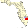
Cabana Colony is a census-designated place (CDP) in Palm Beach County, Florida, United States. The CDP is part of the Miami metropolitan area of South Florida. Its population was 2,460 as of the 2020 census.
Cabana Colony is located on the east side of Dixie Highway and borders Palm Beach Gardens on three sides.
Census | Pop. | Note | %± |
---|---|---|---|
2010 | 2,391 | — | |
2020 | 2,460 | 2.9% | |
U.S. Decennial Census [4] |
Race | Number | Percentage |
---|---|---|
White (NH) | 1,450 | 58.95% |
Black or African American (NH) | 276 | 11.22% |
Native American or Alaska Native (NH) | 2 | 0.08% |
Asian (NH) | 129 | 5.24% |
Pacific Islander or Native Hawaiian (NH) | 0 | 0.00% |
Some Other Race (NH) | 20 | 0.81% |
Mixed/Multiracial (NH) | 82 | 3.33% |
Hispanic or Latino (any race) | 501 | 20.37% |
Total | 2,460 | 100.00% |
As of the 2020 United States census, there were 2,460 people, 973 households, and 613 families residing in the CDP. [6]
Race | Number | Percentage |
---|---|---|
White (NH) | 1,692 | 70.77% |
Black or African American (NH) | 222 | 9.28% |
Native American or Alaska Native (NH) | 10 | 0.42% |
Asian (NH) | 98 | 4.10% |
Pacific Islander or Native Hawaiian (NH) | 1 | 0.04% |
Some Other Race (NH) | 11 | 0.46% |
Mixed/Multiracial (NH) | 44 | 1.84% |
Hispanic or Latino (any race) | 313 | 13.09% |
Total | 2,391 | 100.00% |
As of the 2010 United States census, there were 2,391 people, 797 households, and 526 families residing in the CDP. [8]
The 2010 U.S. Census depicts 42.2% of the population in Cabana Colony is male and the other 57.8% is female with a median age of 42.1 years old.
In 2010, the estimated median house or condo value in Cabana Colony during 2016 was $269,600, whereas the estimated median for Florida as a whole was $197,700. The median gross in rent in Cabana Colony in 2016 was $1,332.
In 2010, 71.2% of people over 25 years old have received their high school diplomas, while 15.7% received a higher degree and 13.1% have received no high school diploma.
Country Club is a census-designated place and a suburban unincorporated community located in northwest Miami-Dade County, Florida, United States. It is located in the Miami metropolitan area of South Florida. The CDP is named after the Country Club of Miami, which was established in 1961 in what was then an unpopulated and undeveloped section of the county. The population was 49,967 at the 2020 census, up from 3,408 in 1990.
Ives Estates is a census-designated place (CDP) in Miami-Dade County, Florida. It is part of the Miami metropolitan area of South Florida. The population was 25,005 at the 2020 census, up from 19,525 in 2010.
Palm Springs North is an unincorporated community and census-designated place (CDP) in Miami-Dade County, Florida, United States. It is part of the Miami metropolitan area of South Florida. The population was 5,030 at the 2020 census.
Westwood Lakes is a census-designated place and unincorporated community of Miami-Dade County, Florida, United States. It is part of the Miami metropolitan area of South Florida. The population was 11,373 at the 2020 census.
Canal Point is a census-designated place (CDP) and unincorporated community in Palm Beach County, Florida, United States. It is part of the Miami metropolitan area of South Florida despite its local culture and location being way more similar to the Florida Heartland. Canal Point has a population of 344 people counted in the 2020 US census.
Gun Club Estates is a census-designated place (CDP) in Palm Beach County, Florida, United States. It is part of the Miami metropolitan area of South Florida. The population was 816 at the 2020 US census.
Juno Ridge is a census-designated place (CDP) in Palm Beach County, Florida, United States. It is part of the Miami metropolitan area of South Florida. The population was 1,186 at the 2020 US census.
Lake Belvedere Estates is a census-designated place (CDP) in Palm Beach County, Florida, United States. It is part of the Miami metropolitan area of South Florida. The population was 2,091 at the 2020 US census.
Lake Harbor is a census-designated place (CDP) in Palm Beach County, Florida, United States. It is part of the Miami metropolitan area of South Florida despite being physically and culturally closer to the Florida Heartland. The population was 49 at the 2020 US census.
Limestone Creek is a census-designated place (CDP) in Palm Beach County, Florida, United States. It is part of the Miami metropolitan area of South Florida. The population was 1,316 at the 2020 US census.
Plantation Mobile Home Park is a census-designated place (CDP) in Palm Beach County, Florida, United States. It is part of the Miami metropolitan area of South Florida. The population was 1,462 at the 2020 US census.
Royal Palm Estates is a census-designated place (CDP) in Palm Beach County, Florida, United States. It is part of the Miami metropolitan area of South Florida. The population was 1,974 at the 2020 census.
Schall Circle is a census-designated place (CDP) in Palm Beach County, Florida, United States. It is part of the Miami metropolitan area of South Florida. The population was 792 at the 2020 US census.
Seminole Manor is a census-designated place (CDP) in Palm Beach County, Florida, United States. The CDP was developed in the late 1950s, with the majority of houses built in 1958 and 1959. It is part of the Miami metropolitan area of South Florida. The population was 2,562 at the 2020 US census.
Stacy Street is a residential street and surrounding census-designated place (CDP) in Palm Beach County, Florida, United States. In the 2010 and 2020 US Census, the CDP is misspelled as Stacey Street. It is part of the Miami metropolitan area of South Florida. The population was 978 at the 2020 US census.
Westgate is an unincorporated census-designated place (CDP) in Palm Beach County, Florida, United States. Prior to the 2010 US census, the CDP was listed as Westgate-Belvedere Homes. It is part of the Miami metropolitan area of South Florida. The population was 8,435 at the 2020 census.
The Acreage is a census-designated place (CDP) located in Palm Beach County, Florida, United States. It is part of the Miami metropolitan area of South Florida. The population of the CDP had 41,654 residents in the 2020 US census.
Jupiter Farms is a census-designated place (CDP) and an agriculture residential community in Palm Beach County, Florida, United States. Locally known as "The Farms", it is located west of Florida's Turnpike on Indiantown Road, the major highway through the community. "The Farms" is composed of roughly 15 square miles (39 km2) of land, and is part of the Miami metropolitan area of South Florida. As of the 2020 US census, the CDP's population had 12,572 residents.
San Castle is a census-designated place in Palm Beach County, Florida, United States. It is part of the Miami metropolitan area of South Florida. The population was 3,755 as of the 2020 census.
Acacia Villas is a census-designated place (CDP) in Palm Beach County, Florida, United States. It is part of the Miami metropolitan area of South Florida. The population was 398 as of the 2020 census.