Canal Point, Florida

Last updated

Canal Point, Florida
CDP
Canal Point Florida Sugarcane from Air 1968.jpg
Nickname: 
CP
Coordinates: 26°51′43″N80°37′50″W / 26.86194°N 80.63056°W / 26.86194; -80.63056
Country Flag of the United States.svg  United States
State Flag of Florida.svg  Florida
County Flag of Palm Beach County, Florida.png Palm Beach
Area
[1]
  Total1.39 sq mi (3.60 km2)
  Land1.39 sq mi (3.60 km2)
  Water0.00 sq mi (0.00 km2)
Elevation
13 ft (4 m)
Population
 (2020)
  Total344
  Density247.13/sq mi (95.42/km2)
Time zone UTC-5 (Eastern (EST))
  Summer (DST) UTC-4 (EDT)
ZIP code
33438 [2]
Area code(s) 561, 728
FIPS code 12-10100 [3]
GNIS feature ID0279964 [4]

Canal Point is a census-designated place (CDP) and unincorporated community in Palm Beach County, Florida, United States. It is part of the Miami metropolitan area of South Florida despite its local culture and location being way more similar to the Florida Heartland. Canal Point has a population of 344 people counted in the 2020 US census.

Contents

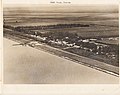
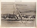
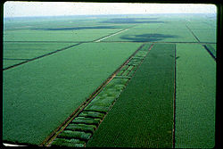
The land was originally inhabited by the Calusa tribe until 1650 CE. White settlers began occupying the area in 1909, establishing an agrarian community that currently still relies heavily on agriculture, especially sugar from sugarcane crops. The completion of the West Palm Beach Canal in 1917 allowed crops to be shipped by boat to West Palm Beach and then to other areas of the country, while construction of Conners Highway in 1924 resulted in crops being transported by motor vehicle. The CDP is very small with very little infrastructure.

Geography

Canal Point is located at 26°51′43″N80°37′50″W / 26.86194°N 80.63056°W / 26.86194; -80.63056 (26.862060, -80.630543). [5]

According to the United States Census Bureau, the CDP has a total area of 1.5 square miles (3.9 km2), all land.

Canal Point is located along the eastern shore of Lake Okeechobee, to the northeast of Pahokee and to the northwest of Bryant.

Climate

Climate data for Canal Point, Florida, 1991–2020 normals, extremes 1953–present
MonthJanFebMarAprMayJunJulAugSepOctNovDecYear
Record high °F (°C)90
(32)
90
(32)
94
(34)
97
(36)
99
(37)
98
(37)
100
(38)
99
(37)
98
(37)
96
(36)
93
(34)
94
(34)
100
(38)
Mean maximum °F (°C)85.1
(29.5)
85.7
(29.8)
88.5
(31.4)
91.5
(33.1)
93.5
(34.2)
94.9
(34.9)
95.7
(35.4)
95.6
(35.3)
94.4
(34.7)
91.7
(33.2)
87.8
(31.0)
85.9
(29.9)
96.5
(35.8)
Average high °F (°C)74.2
(23.4)
77.4
(25.2)
80.2
(26.8)
85.2
(29.6)
88.7
(31.5)
91.0
(32.8)
92.2
(33.4)
92.2
(33.4)
90.5
(32.5)
86.8
(30.4)
80.9
(27.2)
76.8
(24.9)
84.7
(29.3)
Daily mean °F (°C)65.6
(18.7)
68.3
(20.2)
71.1
(21.7)
75.5
(24.2)
79.3
(26.3)
83.0
(28.3)
84.0
(28.9)
84.2
(29.0)
83.0
(28.3)
79.3
(26.3)
73.1
(22.8)
68.7
(20.4)
76.3
(24.6)
Average low °F (°C)57.1
(13.9)
59.2
(15.1)
62.0
(16.7)
65.8
(18.8)
69.8
(21.0)
75.0
(23.9)
75.7
(24.3)
76.2
(24.6)
75.5
(24.2)
71.7
(22.1)
65.3
(18.5)
60.5
(15.8)
67.8
(19.9)
Mean minimum °F (°C)40.6
(4.8)
43.3
(6.3)
49.0
(9.4)
54.1
(12.3)
61.1
(16.2)
68.0
(20.0)
70.4
(21.3)
70.7
(21.5)
69.5
(20.8)
61.1
(16.2)
51.5
(10.8)
45.5
(7.5)
38.5
(3.6)
Record low °F (°C)25
(−4)
29
(−2)
31
(−1)
41
(5)
48
(9)
53
(12)
62
(17)
61
(16)
60
(16)
42
(6)
38
(3)
25
(−4)
25
(−4)
Average precipitation inches (mm)2.37
(60)
1.94
(49)
2.86
(73)
4.25
(108)
3.91
(99)
8.38
(213)
6.53
(166)
9.19
(233)
8.06
(205)
3.73
(95)
2.18
(55)
2.06
(52)
55.46
(1,408)
Average precipitation days (≥ 0.01 in)6.25.55.75.66.913.812.914.313.48.25.25.6103.3
Source: NOAA [6] [7]

History

Archaeological evidence from Big Mound City, located roughly 10 mi (16 km) of Canal Point, suggests that the Calusa tribe inhabited the area between about 500 BCE and 1650 CE. [8] In 1909, Canal Point became the first White settlement on the eastern shore of Lake Okeechobee. The Southern States Land and Timber Company began planting sugarcane in the area in 1917. Around that time, the West Palm Beach Canal was completed. The canal connected Lake Okeechobee at Canal Point to West Palm Beach, allowing farms to sell crops to West Palm Beach or elsewhere in the United States via the Florida East Coast Railway. Transportation of crops by motor vehicle from the area to other destinations began in 1924 with the completion of Conners Highway, which mostly followed the path of the West Palm Beach Canal. [9]

Unlike other communities along the southeastern and eastern shores of Lake Okeechobee, Canal Point was relatively unscathed by the 1928 hurricane. The community was likely inundated with 1.5 to 2.5 ft (0.46 to 0.76 m) of water and one death occurred. [10] However, the local economy suffered greatly and never recovered after construction of the Herbert Hoover Dike limited boat traffic in the 1930s. Residents saved the historic Canal Point School from demolition and hoped to convert it into an agricultural museum, but the building was destroyed by a fire in 2008. About three years earlier, Hurricane Wilma wrecked several other historic buildings in the community. [9]

Demographics

Historical population
CensusPop.Note
2000 525
2010 367−30.1%
2020 344−6.3%
U.S. Decennial Census [11]

2020 census

Cabana Colony racial composition
(Hispanics excluded from racial categories)
(NH = Non-Hispanic) [12]
RaceNumberPercentage
White (NH)10731.10%
Black or African American (NH)5014.53%
Native American or Alaska Native (NH)00.00%
Asian (NH)10.29%
Pacific Islander or Native Hawaiian (NH)00.00%
Some Other Race (NH)00.00%
Mixed/Multiracial (NH)30.87%
Hispanic or Latino 18353.19%
Total344

As of the 2020 United States census, there were 344 people, 107 households, and 81 families residing in the CDP. [13]

2010 census

Cabana Colony racial composition
(Hispanics excluded from racial categories)
(NH = Non-Hispanic) [14]
RaceNumberPercentage
White (NH)17748.23%
Black or African American (NH)7420.16%
Native American or Alaska Native (NH)10.27%
Asian (NH)00.00%
Pacific Islander or Native Hawaiian (NH)00.00%
Some Other Race (NH)61.63%
Mixed/Multiracial (NH)00.00%
Hispanic or Latino 10929.70%
Total367

As of the 2010 United States census, there were 367 people, 91 households, and 35 families residing in the CDP. [15]

2000 census

As of the census [3] of 2000, there were 525 people, 197 households, and 127 families residing in the CDP. The population density was 339.3 inhabitants per square mile (131.0/km2). There were 227 housing units at an average density of 146.7 per square mile (56.6/km2). The racial makeup of the CDP was 55.05% White (43.1% were Non-Hispanic White), [16] 17.52% African American, 0.38% Native American, 0.57% Asian, 0.19% Pacific Islander, 21.14% from other races, and 5.14% from two or more races. Hispanic or Latino of any race were 35.05% of the population.

As of 2000, there were 197 households, out of which 34.5% had children under the age of 18 living with them, 45.2% were [married couples living together, 13.7% had a female householder with no husband present, and 35.5% were non-families. 29.4% of all households were made up of individuals, and 9.1% had someone living alone who was 65 years of age or older. The average household size was 2.66 and the average family size was 3.38.

In 2000, in the CDP, the population was spread out, with 30.5% under the age of 18, 7.6% from 18 to 24, 29.1% from 25 to 44, 23.0% from 45 to 64, and 9.7% who were 65 years of age or older. The median age was 34 years. For every 100 females, there were 95.9 males. For every 100 females age 18 and over, there were 108.6 males.

In 2000, the median income for a household in the CDP was $37,813, and the median income for a family was $29,792. Males had a median income of $32,232 versus $12,283 for females. The per capita income for the CDP was $18,625. About 19.5% of families and 14.4% of the population were below the poverty line, including 11.8% of those under age 18 and 7.8% of those age 65 or over.

As of 2000, English as a first language accounted for 65.00% of all residents, while Spanish is the first language of 35.00% of the population. [17]

Living

Almost the entirety of Canal Point's populace is involved in agriculture. Most are independent farmers or employees of one of the large local sugar co-operatives, the largest three being the US Sugar Corporation, Osceola Farms, and Fanjul Sugar. The town has an access point to the Lake Okeechobee Scenic Trail.

Transportation

The Palm Tran Route 47 connects Canal Point to Pahokee, Belle Glade, and South Bay, as well as to Route 40, [18] which links Belle Glade to Wellington. [19] State Road 15 and US routes 98 and 441 move jointly northeastward through Canal Point, generally parallel to the shore of Lake Okeechobee, with the road locally referred to as E. Main Street. The road is adjoined by the northwest-southeast moving State Road 700, locally known as W. Main Street and Conners Highway, just south of the West Palm Beach Canal. State Road 700 moves southeastward and rejoins State Road 15 and US routes 98 and 441 near Twentymile Bend. [20]

Education

View of Canal Point Elementary School, circa July 1953. This building burned down on June 17, 2008. Canal Point elementary school, 1953.jpg
View of Canal Point Elementary School, circa July 1953. This building burned down on June 17, 2008.

There are no colleges or universities in Canal Point. However, Palm Beach State College has campuses in Belle Glade and Loxahatchee Groves. [25]

Notable people

Images

Related Research Articles

<span class="mw-page-title-main">Glades County, Florida</span> County in Florida, United States

Glades County is a county located in the Florida Heartland region of the U.S. state of Florida. As of the 2020 census, the population was 12,126, making it the fourth-least populous county in Florida. Its county seat is Moore Haven.

<span class="mw-page-title-main">Hendry County, Florida</span> County in Florida, United States

Hendry County is a county in the Florida Heartland region of the U.S. state of Florida. As of the 2020 census, the population was 39,619, down from 42,022 at the 2010 census. Its county seat is LaBelle.

<span class="mw-page-title-main">Highlands County, Florida</span> County in Florida, United States

Highlands County is a county located in the Florida Heartland region of the U.S. state of Florida. As of the 2020 census, the population was 101,235. Its county seat is Sebring.

<span class="mw-page-title-main">Martin County, Florida</span> County in Florida, United States

Martin County is a county located in the southeastern part of the state of Florida, in the United States. As of the 2020 census, the population was 158,431. Its county seat is Stuart. Martin County is in the Port St. Lucie, FL Metropolitan Statistical Area.

<span class="mw-page-title-main">Okeechobee County, Florida</span> County in Florida, United States

Okeechobee County is a county located in the Florida Heartland region of the state of Florida. As of the 2020 census, the population was 39,644. The county seat is Okeechobee.

<span class="mw-page-title-main">Palm Beach County, Florida</span> County in Florida, United States

Palm Beach County is a county in the southeastern part of Florida, located in the Miami metropolitan area. It is Florida's third-most populous county after Miami-Dade County and Broward County and the 26th-most populous in the United States, with 1,492,191 residents as of the 2020 census. Its county seat and largest city is West Palm Beach, which had a population of 117,415 as of 2020. Named after one of its oldest settlements, Palm Beach, the county was established in 1909, after being split from Dade County. The county's modern-day boundaries were established in 1963.

<span class="mw-page-title-main">Belle Glade, Florida</span> City in Florida, United States

Belle Glade is a city in south-central Florida and it is the far western part of Palm Beach County, Florida, United States, on the southeastern shore of Lake Okeechobee. It is part of the Miami metropolitan area of South Florida. According to the 2020 U.S. Census, the city had a population of 16,698, down from 17,467 in the 2010 census.

Gun Club Estates is a census-designated place (CDP) in Palm Beach County, Florida, United States. It is part of the Miami metropolitan area of South Florida. The population was 816 at the 2020 US census.

<span class="mw-page-title-main">Lake Harbor, Florida</span> CDP in Florida, United States

Lake Harbor is a census-designated place (CDP) in Palm Beach County, Florida, United States. It is part of the Miami metropolitan area of South Florida despite being physically and culturally closer to the Florida Heartland. The population was 49 at the 2020 US census.

<span class="mw-page-title-main">Pahokee, Florida</span> City in Florida, United States

Pahokee is a city located on the shore of Lake Okeechobee in Palm Beach County, Florida, United States. It is part of the Miami metropolitan area of South Florida. The population was 5,524 in the 2020 census.

<span class="mw-page-title-main">Miami metropolitan area</span> Metropolis in the U.S. state of Florida

The Miami metropolitan area, also known as South Florida, SoFlo, SoFla, the Gold Coast, the Tri-County Area, or Greater Miami, and officially known as the Miami–Fort Lauderdale–West Palm Beach Metropolitan Statistical Area, is a coastal metropolitan area in southeastern Florida. It is the ninth-largest metropolitan statistical area (MSA) in the United States, the fifth-largest metropolitan area in the Southern United States, and the largest metropolitan area in Florida. With a population of 6.14 million, its population exceeds 31 of the nation's 50 states as of 2022. It comprises the three most populated counties in the state, Miami-Dade County, Broward County, and Palm Beach County, which rank as the first, second, and third-most populous counties in the state, respectively. Miami-Dade County, with 2,716,940 people in 2019, is the seventh-most populous county in the United States.

<span class="mw-page-title-main">South Central Florida Express</span> Shortline railroad in Florida

The South Central Florida Express, Inc. is a common carrier shortline railroad in southern Florida run by U.S. Sugar Corporation. Its trains operate from Sebring to Fort Pierce via Clewiston around the southern perimeter of Lake Okeechobee, and serves customers at 26 locations. With 171 miles (275 km) of track, the SCXF is the largest private agricultural railroad in the U.S.

<span class="mw-page-title-main">Port Mayaca, Florida</span>

Port Mayaca is a sparsely populated place located in western Martin County, Florida, United States, on the eastern side of Lake Okeechobee.

Palm Beach County Glades Airport, also known as Pahokee Airport, is a county-owned, public-use airport in Palm Beach County, Florida, United States. It is located three nautical miles (6 km) southwest of the central business district of Pahokee, Florida. The airport is owned by Palm Beach County and operated by the Palm Beach County Airports Department. It is included in the National Plan of Integrated Airport Systems for 2011–2015, which categorized it as a general aviation facility.

<span class="mw-page-title-main">Florida State Road 715</span>

State Road 715 (SR 715) is a 12-mile-long (19 km) north–south route serving two cities on and near the southeastern shore of Lake Okeechobee in southern Florida. It is known locally as Southwest 16th Street, Northwest 16th Street, and Bacom Point Road, The southern terminus is an intersection with Palm Beach Road in Palm Beach County just south of Belle Glade; the northern terminus is an intersection with Lake Avenue in downtown Pahokee.

<span class="mw-page-title-main">Florida State Road 717</span>

State Road 717 (SR 717) is a 1.7-mile-long (2.7 km) northwest-southeast road in Belle Glade, Palm Beach County, Florida also known as Canal Street.

<span class="mw-page-title-main">Loxahatchee Groves, Florida</span> Town in the state of Florida, United States

Loxahatchee Groves is a town in Palm Beach County, Florida, United States. The town was incorporated November 1, 2006, as the 38th municipality in Palm Beach County. The first election for town council members was held on March 13, 2007. The area had been settled since 1917, although Loxahatchee Groves did not become a municipality until 2006. The town bills itself as "Florida's Last Frontier". It was incorporated primarily in order to protect the area from the encroaching urbanization of South Florida, as nearby cities continued to develop and to preserve the area's rural character. The town is part of the Miami metropolitan area. As of the 2020 US census, the town had a population of 3,355.

<span class="mw-page-title-main">Florida Heartland</span> Region in Florida

The Florida Heartland is a region of Florida located to the north and west of Lake Okeechobee, composed of six inland, non-metropolitan counties—DeSoto, Glades, Hardee, Hendry, Highlands, and Okeechobee. In 2000, The US Census Bureau recorded the population of the region at 229,509. In 2010, The US Census Bureau recorded the population of the region at 253,399, a growth rate of 11.0%. The most populous county in the region is Highlands County, and the region's largest cities are Avon Park and Sebring, both with slightly more than 10,000 people. Unlike the coastal areas to the east and west, the rural nature of the Florida Heartland is culturally closer to the Deep South than the rest of South Florida and has traditionally been inhabited by Americans of predominantly English ancestry. While located in Palm Beach County, the nearby rural cities of South Bay, Belle Glade and Pahokee as well as the census-designated place of Lake Harbor, located on the southeastern shore of Lake Okeechobee, are more associated with the Florida Heartland than the remainder of South Florida. The same could also apply to the Collier County communities of Immokalee, Ave Maria and Harker as well as to the Martin County community of Port Mayaca. Occasionally included are the southern Polk County communities of Fort Meade, Frostproof and River Ranch as well as Yeehaw Junction in Osceola County.

Cabana Colony is a census-designated place (CDP) in Palm Beach County, Florida, United States. The CDP is part of the Miami metropolitan area of South Florida. Its population was 2,460 as of the 2020 census.

The Lake Okeechobee Scenic Trail (LOST) is a 109-mile multi-use path around Lake Okeechobee, the seventh largest lake in the United States and the largest in the state of Florida. The trail began as the Okeechobee Segment of the Florida National Scenic Trail (FNST), a 1,000 mile trail that runs from Miami to Pensacola. The USDA and National Forest Service dedicated the Okeechobee Segment as part of the FNST in 1993. Most of the trail is atop the 35-feet tall Herbert Hoover Dike. The trail crosses five counties, Hendry, Glades, Okeechobee, Martin and Palm Beach. Many stretches run along state and county highways, including Florida State Road 78.

References

  1. "2020 U.S. Gazetteer Files". United States Census Bureau. Retrieved October 31, 2021.
  2. "Canal Point, FL ZIP Code". zipdatamaps.com. 2023. Retrieved July 19, 2023.
  3. 1 2 "U.S. Census website". United States Census Bureau . Retrieved January 31, 2008.
  4. "US Board on Geographic Names". United States Geological Survey. October 25, 2007. Retrieved January 31, 2008.
  5. "US Gazetteer files: 2010, 2000, and 1990". United States Census Bureau. February 12, 2011. Retrieved April 23, 2011.
  6. "NOWData - NOAA Online Weather Data". National Oceanic and Atmospheric Administration . Retrieved May 14, 2021.
  7. "Summary of Monthly Normals 1991–2020 – Station: Canal PT USDA, FL". National Oceanic and Atmospheric Administration . Retrieved May 14, 2021.
  8. "Archaeology in Palm Beach County". Historical Society of Palm Beach County. Archived from the original on April 9, 2023. Retrieved October 16, 2023.
  9. 1 2 "Canal Point". Historical Society of Palm Beach County. Archived from the original on April 4, 2023. Retrieved October 16, 2023.
  10. Eliot Kleinberg (2003). Black Cloud: The Great Florida Storm of 1928. Carroll & Graf Publishers. p. 99. ISBN   978-0-7867-1146-8.
  11. "Census of Population and Housing". Census.gov. Retrieved June 4, 2016.
  12. "HISPANIC OR LATINO, AND NOT HISPANIC OR LATINO BY RACE: 2020". data.census.gov. Retrieved July 19, 2023.
  13. "HOUSEHOLDS AND FAMILIES:2020". data.census.gov. Retrieved July 19, 2023.
  14. "HISPANIC OR LATINO, AND NOT HISPANIC OR LATINO BY RACE: 2010". data.census.gov. Retrieved July 19, 2023.
  15. "HOUSEHOLDS AND FAMILIES: 2010". data.census.gov. Retrieved July 19, 2023.
  16. "Demographics of Canal Point, FL". MuniNetGuide.com. Retrieved December 6, 2007.
  17. "MLA Data Center Results for Canal Point, Florida". Modern Language Association . Retrieved December 6, 2007.
  18. "Central County Route 47" (PDF). Palm Beach County Government. May 2019. Retrieved September 19, 2019.
  19. "Central County Route 40" (PDF). Palm Beach County Government. May 2019. Retrieved September 19, 2019.
  20. "Straight-Line Diagram of Road Inventory, Roadway: 93140000 Conners Highway: CR-880-Martin". Florida Department of Transportation . Retrieved September 19, 2019.
  21. "Fire in Canal Point Elementary School". Palm Beach County Fire Rescue. Archived from the original on September 8, 2018. Retrieved September 7, 2018.
  22. Dean Jones (July 20, 1990). "Honor sought for principal". The Palm Beach Post. p. 3B. Retrieved September 19, 2019 via Newspapers.com. Lock-green.svg
  23. "Middle School Attendance Boundaries SY2018–19" (PDF). School District of Palm Beach County. 2018. Retrieved September 19, 2019.
  24. "High School Attendance Boundaries SY2018–19" (PDF). School District of Palm Beach County. 2018. Retrieved September 19, 2019.
  25. Scott Travis (February 24, 2017). "Palm Beach State opens long-awaited western campus". Sun-Sentinel. Retrieved July 15, 2018.
  26. "Anquan Boldin". Pro-Football-Reference.com. Retrieved September 19, 2019.
  27. Robert Preston Jr. (March 18, 2014). "The Mystique of Glades Central High School". Game High School Sports Magazine. p. 12. Retrieved September 19, 2019.
  28. Kleinberg, Elliot (September 3, 2015). "POST TIME: Upthegrove Beach named for family that saw prestige, shame" . Retrieved May 23, 2016.