Sea Islands

Last updated
Sea Islands
Sea Islands map.svg
Map of the Sea islands
Usa edcp location map.svg
Red pog.svg
Sea Islands
Geography
LocationAtlantic Ocean
Total islandsOver 100
Administration
United States

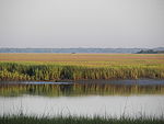
The Sea Islands are a chain of over a hundred tidal and barrier islands on the Atlantic Ocean coast of the Southeastern United States, between the mouths of the Santee and St. Johns rivers along South Carolina, Georgia and Florida. The largest is Johns Island, South Carolina. Sapelo Island is home to the Gullah people. All of the islands are acutely threatened by sea level rise due to climate change. [1]

Contents

History

Settled by indigenous cultures thousands of years ago, the islands were selected by Spanish colonists as sites for founding of colonial missions. Historically the Spanish influenced the Guale and Mocama chiefdoms by establishing Christian missions in their major settlements, from St. Catherine's Island south to Fort George Island (at present-day Jacksonville, Florida). [2] The area was home to multiple plantations; in 1863 Fanny Kemble published Journal of a Residence on a Georgian Plantation in 1838–1839 about her experience on her husband's plantations in St. Simon's Island and Butler Island. [3]

The Sea Islands were known historically for the production of Sea Island cotton.

After President Abraham Lincoln's Emancipation Proclamation became effective on January 1, 1863, more than 5,000 slaves on Union-occupied islands obtained their freedom. [4]

In 1893, a deadly major hurricane struck the Sea Islands.

List

South Carolina

Charleston County

Colleton County

Beaufort County

Georgia

Chatham County

Liberty County

McIntosh County

Glynn County

Camden County

Florida

Nassau County

Duval County

See also

Related Research Articles

<span class="mw-page-title-main">St. Simons, Georgia</span> Place in Georgia, United States

St. Simons Island is a barrier island and census-designated place (CDP) located on St. Simons Island in Glynn County, Georgia, United States. The names of the community and the island are interchangeable, known simply as "St. Simons Island" or "SSI", or locally as "The Island". St. Simons is part of the Brunswick metropolitan statistical area, and according to the 2020 U.S. census, the CDP had a population of 14,982. Located on the southeast Georgia coast, midway between Savannah and Jacksonville, St. Simons Island is both a seaside resort and residential community. It is the largest of Georgia's renowned Golden Isles. Visitors are drawn to the Island for its warm climate, beaches, variety of outdoor activities, shops and restaurants, historical sites, and natural environment.

<span class="mw-page-title-main">Gullah</span> African American ethnic group in south United States

The Gullah are a subgroup of the African American ethnic group, who predominantly live in the Lowcountry region of the U.S. states of South Carolina, North Carolina, Georgia, and Florida within the coastal plain and the Sea Islands. Their language and culture have preserved a significant influence of Africanisms as a result of their historical geographic isolation and the community's relation to their shared history and identity.

<span class="mw-page-title-main">Saint Helena Island (South Carolina)</span> Island in South Carolina, United States

St. Helena Island is a Sea Island in Beaufort County, South Carolina, United States. The island is connected to Beaufort by U.S. Highway 21. The island has a land area of about 64 sq mi (170 km2) and a population of 8,763 as of the 2010 census. It is included as part of the Hilton Head Island-Beaufort Micropolitan Area. The island is renowned for its rural Lowcountry character and being a major center of African-American Gullah culture and language. It is considered to be the geographic influence behind the children's television program Gullah Gullah Island.

<span class="mw-page-title-main">Daufuskie Island</span> Census-designated place in South Carolina, United States

Daufuskie Island, located between Hilton Head Island and Savannah, is the southernmost inhabited sea island in South Carolina. It is 5 miles (8 km) long by almost 2.5 miles (4.0 km) wide – approximate surface area of 8 square miles (21 km2). With over 3 miles (5 km) of beachfront, Daufuskie is surrounded by the waters of Calibogue Sound, the Intracoastal Waterway and the Atlantic Ocean. It was listed as a census-designated place in the 2020 census with a population of 557.

<span class="mw-page-title-main">Sapelo Island</span> Island in Georgia, United States

Sapelo Island is a state-protected barrier island located in McIntosh County, Georgia. The island is accessible only by boat; the primary ferry comes from the Sapelo Island Visitors Center in McIntosh County, Georgia, a seven-mile (11 km), twenty-minute trip. It is the site of Hog Hammock, the last known Gullah community. It is illegal to visit the island without a permit issued by state tourism authorities.

<span class="mw-page-title-main">St. Catherines Island</span> United States historic place

St. Catherines Island is a sea island on the coast of the U.S. state of Georgia, 42 miles (80 km) south of Savannah in Liberty County. The island, located between St. Catherine's Sound and Sapelo Sound, is ten miles (16 km) long and from one to three miles (5 km) wide. It covers approximately 22,265 acres, with about half of the acreage being salt marsh, while the remaining acreage is wooded. There are fine beaches on the northeast and south sides. The island is owned by the Saint Catherines Island Foundation and is not open to the public, apart from the beach below the mean high water line.

<span class="mw-page-title-main">Golden Isles of Georgia</span> Place in Georgia, United States

The Golden Isles of Georgia consist of barrier islands, and the mainland port cities of Brunswick and Darien on the 100-mile-long coast of the U.S. state of Georgia on the Atlantic Ocean. They include St. Simons Island, Sea Island, Jekyll Island, Little St. Simons Island, Sapelo Island, and Blackbeard Island. The islands are part of a long chain of barrier islands known as the "Sea Islands", located along the coasts of South Carolina, Georgia and northern Florida.

<span class="mw-page-title-main">Timucuan Ecological and Historic Preserve</span> Wetlands in Florida (US) managed by the National Park Service

The Timucuan Ecological and Historic Preserve is a U.S. National Preserve in Jacksonville, Florida. It comprises 46,000 acres (19,000 ha) of wetlands, waterways, and other habitats in northeastern Duval County. Managed by the National Park Service in cooperation with the City of Jacksonville and Florida State Parks, it includes natural and historic areas such as the Fort Caroline National Memorial and the Kingsley Plantation.

<span class="mw-page-title-main">Little St. Simons Island</span> Barrier island on the coast of Georgia in the United States

Virtually untouched for centuries, Little St. Simons Island is a barrier island located on the coast of the US state of Georgia, and is one of the least developed of Georgia's Golden Isles. The island covers an area of 10,000 acres (40 km2) and boasts 7 miles (11 km) of beaches. Little St. Simons Island is located slightly east and north of St. Simons Island and Sea Island. It is separated from these islands by the Hampton River and from the marshes of the mainland by Buttermilk Sound. The mouth of the Altamaha River opens directly north of the island. The island's continuous growth can be attributed to sediment deposited by the undammed Altamaha.

<span class="mw-page-title-main">1st South Carolina Volunteer Infantry Regiment (Colored)</span> Military unit

The 1st South Carolina Volunteer Infantry Regiment (Colored) was a Union Army regiment during the American Civil War, formed by General Rufus Saxton. It was composed of escaped slaves from South Carolina and Florida. The 1st SC Volunteer Infantry black regiment was formed in 1862 and became the 33rd United States Colored Troops Regiment in February of 1864. It has the distinction of being the first black regiment to fight in the Civil War at the Skirmish at Spaulding's on the Sapelo River GA. It was one of the first black regiments in the Union Army.

Thomas Spalding was a United States representative from Georgia. He was born in Frederica, Georgia, St. Simons Island, Glynn County, Georgia. He studied law and was admitted to the bar in 1795, but did not practice. He engaged extensively in agricultural pursuits and is widely known for owning slaves

Guale was a historic Native American chiefdom of Mississippian culture peoples located along the coast of present-day Georgia and the Sea Islands. Spanish Florida established its Roman Catholic missionary system in the chiefdom in the late 16th century.

<span class="mw-page-title-main">Spanish missions in Georgia</span> Catholic religious outposts

The Spanish missions in Georgia comprised a series of religious outposts established by Spanish Catholics in order to spread the Christian doctrine among the Guale and various Timucua peoples in southeastern Georgia.

<span class="mw-page-title-main">Fort King George</span> United States historic place

Fort King George State Historic Site is a fort located in the U.S. state of Georgia in McIntosh County, adjacent to Darien. The fort was built in 1721 along what is now known as the Darien River and served as the southernmost outpost of the British Empire in the Americas until 1727. The fort was constructed in what was then considered part of the colony of South Carolina, but was territory later settled as Georgia. It was part of a defensive line intended to encourage settlement along the colony's southern frontier, from the Savannah River to the Altamaha River. Great Britain, France, and Spain were competing to control the American Southeast, especially the Savannah-Altamaha River region.

Santa Catalina de Guale (1602-1702) was a Spanish Franciscan mission and town in Spanish Florida. Part of Spain's effort to convert the Native Americans to Catholicism, Santa Catalina served as the provincial headquarters of the Guale mission province. It also served various non-religious functions, such as providing food and labor for the colonial capital of St. Augustine. The mission was located on St. Catherines Island from 1602 to 1680, then on Sapelo Island from 1680 to 1684, and finally on Amelia Island from 1684 to 1702.

<span class="mw-page-title-main">Tabby concrete</span> A type of concrete using lime from burnt shell

Tabby is a type of concrete made by burning oyster shells to create lime, then mixing it with water, sand, ash and broken oyster shells. Tabby was used by early Spanish settlers in present-day Florida, then by British colonists primarily in coastal South Carolina and Georgia. It is a man-made analogue of coquina, a naturally-occurring sedimentary rock derived from shells and also used for building.

<span class="mw-page-title-main">Gullah-Geechee Cultural Heritage Corridor</span> Federal National Heritage Area in the United States

The Gullah-Geechee Cultural Heritage Corridor is a federal National Heritage Area in the United States. The intent of the designation is to help preserve and interpret the traditional cultural practices, sites, and resources associated with Gullah-Geechee people. Gullah-Geechee Cultural Heritage Corridor, and the federal Gullah-Geechee Cultural Heritage Corridor Commission established to oversee it, were designated by an act of Congress on October 12, 2006 through the National Heritage Areas Act of 2006.

<span class="mw-page-title-main">Hog Hammock, Georgia</span> United States historic place

Hog Hammock is an African-American community on Sapelo Island, a barrier island of the U.S. state of Georgia.

<span class="mw-page-title-main">Representations of Gullah culture in art and media</span> Representations and portrayals of Gullah Geechee culture in art and media

The Gullah are African Americans who live in the Lowcountry region of the U.S. states of Georgia, Florida, South Carolina, and North Carolina, in both the coastal plain and the Sea Islands. They developed a creole language, also called Gullah, and a culture with some African influence.

References

  1. "Rising seas threaten the Gullah Geechee culture. Here's how they're fighting back". National Geographic Society . 27 July 2022. Archived from the original on 25 October 2022. Retrieved 25 October 2022.
  2. "Mission Santa Catalina de Guale" Archived 2011-06-06 at the Wayback Machine , New Georgia Encyclopedia, 2008, accessed 13 May 2010
  3. "Journal of a Residence on a Georgian Plantation in 1838–1839". Encyclopedia.com . Archived from the original on 2022-07-05. Retrieved 2022-07-05.
  4. William Klingaman, Abraham Lincoln and the Road to Emancipation, 1861-1865 (NY: Viking Press, 2001), p. 234
  5. "University of South Carolina Beaufort - Pritchards Island". www.uscb.edu. Archived from the original on 2 September 2006. Retrieved 12 January 2022.

Further reading