Mitchell County, Georgia | |
|---|---|
| Mitchell County Courthouse (Built 1936), Camilla | |
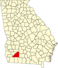
| Location within the U.S. state of Georgia | |
| Coordinates: 31°13′N84°11′W / 31.22°N 84.19°W | |
| Country | |
| State | |
| Founded | 1857 |
| Seat | Camilla |
| Largest city | Camilla |
| Area | |
• Total | 514 sq mi (1,330 km2) |
| • Land | 512 sq mi (1,330 km2) |
| • Water | 1.7 sq mi (4.4 km2) 0.3% |
| Population (2020) | |
• Total | 21,755 |
| • Density | 42/sq mi (16/km2) |
| Time zone | UTC−5 (Eastern) |
| • Summer (DST) | UTC−4 (EDT) |
| Congressional district | 2nd |
| Website | www |
Mitchell County is a county in the U.S. state of Georgia. As of the 2020 census, the population was 21,755. [1] The county seat is Camilla. [2] Mitchell County was created on December 21, 1857. [3]
Sources conflict as to whether Mitchell County was named for David Brydie Mitchell, the 27th Governor of Georgia, or for Henry Mitchell, a general in the Revolutionary War. [4] However, it is most likely that the county was named for General Henry Mitchell, as a marker outside of the Mitchell County Courthouse says, "However, the Georgia Laws of 1857 (pages 38-40), creating Mitchell County, say the county was named in honor of Gen. Henry Mitchell...." [5]
Mitchell County was created out of Baker County on December 21, 1857. It is the state's 123rd county. [6]
According to the U.S. Census Bureau, the county has a total area of 514 square miles (1,330 km2), of which 512 square miles (1,330 km2) is land and 1.7 square miles (4.4 km2) (0.3%) is water. [7]
The bulk of Mitchell County is located in the Lower Flint River sub-basin of the ACF River Basin (Apalachicola-Chattahoochee-Flint River Basin). The county's southeastern corner, bordered by a line from Sale City southwest through Pelham, is located in the Lower Ochlockonee River sub-basin of the same Ochlockonee River basin. [8]
| Census | Pop. | Note | %± |
|---|---|---|---|
| 1860 | 4,308 | — | |
| 1870 | 6,633 | 54.0% | |
| 1880 | 9,392 | 41.6% | |
| 1890 | 10,906 | 16.1% | |
| 1900 | 14,767 | 35.4% | |
| 1910 | 22,114 | 49.8% | |
| 1920 | 25,588 | 15.7% | |
| 1930 | 23,620 | −7.7% | |
| 1940 | 23,261 | −1.5% | |
| 1950 | 22,528 | −3.2% | |
| 1960 | 19,652 | −12.8% | |
| 1970 | 18,956 | −3.5% | |
| 1980 | 21,114 | 11.4% | |
| 1990 | 20,275 | −4.0% | |
| 2000 | 23,932 | 18.0% | |
| 2010 | 23,498 | −1.8% | |
| 2020 | 21,755 | −7.4% | |
| 2024 (est.) | 20,329 | [9] | −6.6% |
| U.S. Decennial Census [10] 1790-1880 [11] 1890-1910 [12] 1920-1930 [13] 1930-1940 [14] 1940-1950 [15] 1960-1980 [16] 1980-2000 [17] 2010 [18] | |||
| Race / Ethnicity (NH = Non-Hispanic) | Pop 2000 [19] | Pop 2010 [20] | Pop 2020 [21] | % 2000 | % 2010 | % 2020 |
|---|---|---|---|---|---|---|
| White alone (NH) | 11,746 | 10,894 | 10,106 | 49.08% | 46.36% | 46.45% |
| Black or African American alone (NH) | 11,423 | 11,185 | 10,054 | 47.73% | 47.60% | 46.21% |
| Native American or Alaska Native alone (NH) | 41 | 60 | 37 | 0.17% | 0.26% | 0.17% |
| Asian alone (NH) | 61 | 120 | 108 | 0.25% | 0.51% | 0.50% |
| Pacific Islander alone (NH) | 8 | 4 | 0 | 0.03% | 0.02% | 0.00% |
| Other race alone (NH) | 8 | 18 | 41 | 0.03% | 0.08% | 0.19% |
| Mixed race or Multiracial (NH) | 154 | 189 | 445 | 0.64% | 0.80% | 2.05% |
| Hispanic or Latino (any race) | 491 | 1,028 | 964 | 2.05% | 4.37% | 4.43% |
| Total | 23,932 | 23,498 | 21,755 | 100.00% | 100.00% | 100.00% |
As of the 2020 census, there were 21,755 people, 8,156 households, and 5,454 families residing in the county. The median age was 42.3 years, with 21.6% of residents under the age of 18 and 19.0% of residents aged 65 years or older. [22] [23]
For every 100 females there were 103.0 males, and for every 100 females age 18 and over there were 103.2 males. 24.2% of residents lived in urban areas, while 75.8% lived in rural areas. [23]
The racial makeup of the county was 47.2% White, 46.5% Black or African American, 0.2% American Indian and Alaska Native, 0.5% Asian, 0.0% Native Hawaiian and Pacific Islander, 2.8% from some other race, and 2.7% from two or more races. Hispanic or Latino residents of any race comprised 4.4% of the population. [24]
Among the 8,156 households in the county, 28.9% had children under the age of 18 living with them and 36.7% had a female householder with no spouse or partner present. About 29.3% of all households were made up of individuals and 13.5% had someone living alone who was 65 years of age or older. [22]
There were 9,036 housing units, of which 9.7% were vacant. Among occupied housing units, 63.5% were owner-occupied and 36.5% were renter-occupied. The homeowner vacancy rate was 1.3% and the rental vacancy rate was 8.0%. [22]
The Mitchell County School District operates public schools in the majority of the county, although Pelham City School District includes the city limits of Pelham. [25]
Andersonville Theological Seminary has its headquarters based in Camilla. The seminary's headquarters consists of two administrative buildings. Most of the seminary's students take online classes to complete their degree programs, but in January 2020 the school started to provide on-site courses at their location in Camilla. [26]
As of the 2020s, Mitchell County is a Republican stronghold, voting 58% for Donald Trump in 2024. For elections to the United States House of Representatives, Mitchell County is part of Georgia's 2nd congressional district, currently represented by Sanford Bishop. For elections to the Georgia State Senate, Mitchell County is part of District 12. [27] For elections to the Georgia House of Representatives, Mitchell County is part of District 171. [28]
| Year | Republican | Democratic | Third party(ies) | |||
|---|---|---|---|---|---|---|
| № | % | № | % | № | % | |
| 1912 | 150 | 12.54% | 1,046 | 87.46% | 0 | 0.00% |
| 1916 | 96 | 9.07% | 921 | 87.05% | 41 | 3.88% |
| 1920 | 144 | 13.41% | 930 | 86.59% | 0 | 0.00% |
| 1924 | 51 | 6.09% | 736 | 87.83% | 51 | 6.09% |
| 1928 | 143 | 9.53% | 1,358 | 90.47% | 0 | 0.00% |
| 1932 | 15 | 0.71% | 2,097 | 99.06% | 5 | 0.24% |
| 1936 | 79 | 3.32% | 2,297 | 96.47% | 5 | 0.21% |
| 1940 | 155 | 6.78% | 2,131 | 93.22% | 0 | 0.00% |
| 1944 | 226 | 9.40% | 2,179 | 90.60% | 0 | 0.00% |
| 1948 | 152 | 7.35% | 1,453 | 70.30% | 462 | 22.35% |
| 1952 | 601 | 16.44% | 3,054 | 83.56% | 0 | 0.00% |
| 1956 | 382 | 12.26% | 2,735 | 87.74% | 0 | 0.00% |
| 1960 | 430 | 11.64% | 3,264 | 88.36% | 0 | 0.00% |
| 1964 | 3,265 | 73.17% | 1,197 | 26.83% | 0 | 0.00% |
| 1968 | 731 | 12.97% | 1,256 | 22.29% | 3,647 | 64.73% |
| 1972 | 2,400 | 68.18% | 1,120 | 31.82% | 0 | 0.00% |
| 1976 | 1,572 | 25.91% | 4,495 | 74.09% | 0 | 0.00% |
| 1980 | 2,231 | 38.10% | 3,566 | 60.89% | 59 | 1.01% |
| 1984 | 2,737 | 49.51% | 2,791 | 50.49% | 0 | 0.00% |
| 1988 | 2,590 | 53.29% | 2,260 | 46.50% | 10 | 0.21% |
| 1992 | 1,917 | 33.08% | 3,052 | 52.67% | 826 | 14.25% |
| 1996 | 2,033 | 36.39% | 3,165 | 56.66% | 388 | 6.95% |
| 2000 | 2,790 | 48.11% | 2,971 | 51.23% | 38 | 0.66% |
| 2004 | 3,885 | 53.42% | 3,360 | 46.20% | 27 | 0.37% |
| 2008 | 4,201 | 51.66% | 3,872 | 47.61% | 59 | 0.73% |
| 2012 | 4,155 | 50.18% | 4,081 | 49.28% | 45 | 0.54% |
| 2016 | 4,279 | 54.30% | 3,493 | 44.33% | 108 | 1.37% |
| 2020 | 4,935 | 55.06% | 3,993 | 44.55% | 35 | 0.39% |
| 2024 | 5,150 | 58.02% | 3,701 | 41.69% | 26 | 0.29% |
It was named either for Henry Mitchell, a general in the Revolutionary War (1775-83), or for David B. Mitchell, who served twice as Georgia's governor in the early 1800s; historical sources differ.
Some historians say that the county was named for David B. Mitchell, Governor of Georgia in 1809-13 and again in 1815-17, and that Camilla was named for daughter. However, the Georgia Laws of 1857 (pages 38-40), creating Mitchell County, say the county was named in honor of Gen. Henry Mitchell, who was born in 1760 and died in 1839