Chattahoochee County, Georgia | |
|---|---|
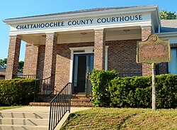
| Chattahoochee County Courthouse in Cusseta | |
| Location within the U.S. state of Georgia | |
| Coordinates: 32°21′N84°47′W / 32.35°N 84.79°W | |
| Country | |
| State | |
| Founded | 1854 |
| Named after | Chattahoochee River |
| Seat | Cusseta |
| Largest city | Cusseta |
| Area | |
• Total | 251 sq mi (650 km2) |
| • Land | 249 sq mi (640 km2) |
| • Water | 2.4 sq mi (6.2 km2) 1.0% |
| Population (2020) | |
• Total | 9,565 |
• Estimate (2024) | 8,548 |
| • Density | 38.4/sq mi (14.8/km2) |
| Time zone | UTC−5 (Eastern) |
| • Summer (DST) | UTC−4 (EDT) |
| Congressional district | 2nd |
| Website | ugoccc.com |
Chattahoochee County, also known as Cusseta-Chattahoochee County, [1] is a county located on the western border in central Georgia. As of the 2020 census, the population was 9,565. [2] The county seat is Cusseta, [3] with which the county shares a consolidated city-county government. The city of Cusseta remains a geographically distinct municipality within Chattahoochee County. [1] [4] The county was created on February 13, 1854. Chattahoochee County is included in the Columbus, Georgia metropolitan area.
This section needs additional citations for verification .(December 2025) |
This area was occupied by the historic Muscogee people (also known as the Creek) at the time of European encounter. They had a large confederacy in the Southeast. They were among the Five Civilized Tribes who were forcibly removed to Indian Territory in the 1830s during the administration of President Andrew Jackson. European Americans moved into their former areas, in some cases acquiring land through lotteries run by the state.
The Georgia General Assembly created Chattahoochee County on February 13, 1854, from portions of Muscogee and Marion counties. It is named for the Chattahoochee River that forms its western boundary. [5] The county seat was named Cusseta to commemorate the historic Creek Indian town of that name that long existed nearby. In 2004–2005, the U.S. Census Bureau reported a 6.2% population decline, making this county at the top of those nationally with shrinking populations.
The original courthouse, built in 1854 by enslaved African Americans, is preserved at the tourist attraction of Westville in Columbus, Georgia.
Since 1918, most of the land in Chattahoochee County has been part of the Fort Benning military reservation. [6]
According to the U.S. Census Bureau, the county has a total area of 251 square miles (650 km2), of which 249 square miles (640 km2) is land and 2.4 square miles (6.2 km2) (1.0%) is water. [7]
The vast majority of Chattahoochee County is located in the Middle Chattahoochee River-Walter F. George Lake subbasin of the ACF River Basin (Apalachicola-Chattahoochee-Flint River Basin). The very small southeastern corner of the county is located in the Kinchafoonee-Muckalee subbasin of the same larger ACF Basin. [8] The county forms part of the West Georgia region.
| Census | Pop. | Note | %± |
|---|---|---|---|
| 1860 | 5,797 | — | |
| 1870 | 6,059 | 4.5% | |
| 1880 | 5,670 | −6.4% | |
| 1890 | 4,902 | −13.5% | |
| 1900 | 5,790 | 18.1% | |
| 1910 | 5,586 | −3.5% | |
| 1920 | 5,266 | −5.7% | |
| 1930 | 8,894 | 68.9% | |
| 1940 | 15,138 | 70.2% | |
| 1950 | 12,149 | −19.7% | |
| 1960 | 13,011 | 7.1% | |
| 1970 | 25,813 | 98.4% | |
| 1980 | 21,732 | −15.8% | |
| 1990 | 16,934 | −22.1% | |
| 2000 | 14,882 | −12.1% | |
| 2010 | 11,267 | −24.3% | |
| 2020 | 9,565 | −15.1% | |
| 2024 (est.) | 8,548 | [9] | −10.6% |
| U.S. Decennial Census [10] 1790-1880 [11] 1890-1910 [12] 1920-1930 [13] 1930-1940 [14] 1940-1950 [15] 1960-1980 [16] 1980-2000 [17] 2010 [18] | |||
| Race | Num. | Perc. |
|---|---|---|
| White | 5,403 | 56.49% |
| Black or African American | 1,463 | 15.3% |
| Native American | 35 | 0.37% |
| Asian | 304 | 3.18% |
| Pacific Islander | 104 | 1.09% |
| Other/Mixed | 646 | 6.75% |
| Hispanic or Latino | 1,610 | 16.83% |
As of the 2020 census, the county had a population of 9,565, with 2,625 households and 1,886 families residing in the county. Of the residents, 24.7% were under the age of 18 and 4.8% were 65 years of age or older; the median age was 23.8 years. For every 100 females there were 155.7 males, and for every 100 females age 18 and over there were 180.8 males. 59.9% of residents lived in urban areas and 40.1% lived in rural areas. [20] [21] [22]
The racial makeup of the county was 62.4% White, 15.8% Black or African American, 0.5% American Indian and Alaska Native, 3.2% Asian, 1.2% Native Hawaiian and Pacific Islander, 6.1% from some other race, and 10.9% from two or more races. Hispanic or Latino residents of any race comprised 16.8% of the population. [22]
Among these households, 49.8% had children under the age of 18 living with them and 16.8% had a female householder with no spouse or partner present. About 21.2% of all households were made up of individuals and 4.6% had someone living alone who was 65 years of age or older. [21]
There were 3,242 housing units, of which 19.0% were vacant. Among occupied housing units, 27.0% were owner-occupied and 73.0% were renter-occupied. The homeowner vacancy rate was 3.3% and the rental vacancy rate was 13.1%. [21]
The Chattahoochee County School District holds pre-school to grade twelve, and consists of one elementary school, a middle school, and a high school. [23] The district has 85 full-time teachers and over 1000 students. [24]
All parts of the county except Fort Benning are zoned to county schools for all grades. Fort Benning children are zoned to Department of Defense Education Activity (DoDEA) schools for grades K-8. [25] However Fort Benning high school students attend the public high schools in the respective counties they are located in. [26]
As of the 2020s, Chattahoochee County is a Republican stronghold, voting 58% for Donald Trump in 2024. For elections to the United States House of Representatives, Chattahoochee County is part of Georgia's 2nd congressional district, currently represented by Sanford Bishop. For elections to the Georgia State Senate, Chattahoochee County is part of District 15. [27] For elections to the Georgia House of Representatives, Chattahoochee County is part of District 151. [28]
| Year | Republican | Democratic | Third party(ies) | |||
|---|---|---|---|---|---|---|
| № | % | № | % | № | % | |
| 1912 | 11 | 7.38% | 137 | 91.95% | 1 | 0.67% |
| 1916 | 4 | 2.42% | 156 | 94.55% | 5 | 3.03% |
| 1920 | 5 | 5.43% | 87 | 94.57% | 0 | 0.00% |
| 1924 | 14 | 6.17% | 208 | 91.63% | 5 | 2.20% |
| 1928 | 18 | 11.32% | 141 | 88.68% | 0 | 0.00% |
| 1932 | 1 | 0.53% | 186 | 99.47% | 0 | 0.00% |
| 1936 | 20 | 8.85% | 206 | 91.15% | 0 | 0.00% |
| 1940 | 20 | 8.93% | 204 | 91.07% | 0 | 0.00% |
| 1944 | 19 | 15.97% | 100 | 84.03% | 0 | 0.00% |
| 1948 | 1 | 0.86% | 46 | 39.66% | 69 | 59.48% |
| 1952 | 73 | 38.62% | 116 | 61.38% | 0 | 0.00% |
| 1956 | 43 | 28.67% | 107 | 71.33% | 0 | 0.00% |
| 1960 | 66 | 25.78% | 190 | 74.22% | 0 | 0.00% |
| 1964 | 246 | 56.29% | 191 | 43.71% | 0 | 0.00% |
| 1968 | 70 | 13.44% | 148 | 28.41% | 303 | 58.16% |
| 1972 | 345 | 74.03% | 121 | 25.97% | 0 | 0.00% |
| 1976 | 178 | 26.02% | 506 | 73.98% | 0 | 0.00% |
| 1980 | 256 | 34.04% | 476 | 63.30% | 20 | 2.66% |
| 1984 | 459 | 51.75% | 428 | 48.25% | 0 | 0.00% |
| 1988 | 454 | 55.57% | 362 | 44.31% | 1 | 0.12% |
| 1992 | 413 | 34.47% | 604 | 50.42% | 181 | 15.11% |
| 1996 | 398 | 36.78% | 565 | 52.22% | 119 | 11.00% |
| 2000 | 590 | 48.88% | 600 | 49.71% | 17 | 1.41% |
| 2004 | 905 | 53.55% | 773 | 45.74% | 12 | 0.71% |
| 2008 | 811 | 48.97% | 830 | 50.12% | 15 | 0.91% |
| 2012 | 735 | 49.23% | 729 | 48.83% | 29 | 1.94% |
| 2016 | 751 | 54.03% | 594 | 42.73% | 45 | 3.24% |
| 2020 | 880 | 55.63% | 667 | 42.16% | 35 | 2.21% |
| 2024 | 982 | 57.97% | 703 | 41.50% | 9 | 0.53% |