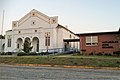
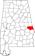
Notasulga, Alabama

Last updated

Notasulga
Notasulga1.JPG
Notasulga in 2007
Lee County and Macon County Alabama Incorporated and Unincorporated areas Notasulga Highlighted 0155440.svg
Macon County, Alabama
Coordinates: 32°33′39″N85°40′3″W / 32.56083°N 85.66750°W / 32.56083; -85.66750
Country United States
State Alabama
Counties Macon, Lee
Government
  MayorTommy Miller [1]
Area
[2]
  Total
14.12 sq mi (36.57 km2)
  Land13.97 sq mi (36.17 km2)
  Water0.15 sq mi (0.40 km2)
Elevation
512 ft (156 m)
Population
 (2020) [3]
  Total
914
  Density65.4/sq mi (25.27/km2)
Time zone UTC-6 (CST)
  Summer (DST) UTC-5 (CDT)
ZIP code
36866
Area code 334
FIPS code 01-55440
GNIS feature ID0152715
Website Notasulga

Notasulga is a town in Macon and Lee counties in the U.S. state of Alabama. As of the 2020 census, the population of the town was 914. [3] The portion in Lee County is part of the Auburn Metropolitan Area. According to the 1910 U.S. Census, it incorporated in 1893. [4] Author Zora Neale Hurston was born in Notasulga in 1891. The town name comes from the Creek words noti sulgi, which means "many teeth". [5]

Contents

Geography

Notasulga is located in northern Macon County at 32°33′39″N85°40′3″W / 32.56083°N 85.66750°W / 32.56083; -85.66750 (32.560821, -85.667631). [6] The town extends northeast into the western part of Lee County.

According to the U.S. Census Bureau, the town has a total area of 14.1 square miles (36.6 km2), of which 14.0 square miles (36.2 km2) are land and 0.2 square miles (0.4 km2), or 1.09%, are water. [2] The center of town is on a height of land, draining north to Sougahatchee Creek, a west-flowing tributary of the Tallapoosa River, and south to Red Creek, a tributary of Uphapee Creek, which also flows west to the Tallapoosa.

Demographics

Historical population
CensusPop.Note
1880 236
1890 33240.7%
1910 512
1920 61920.9%
1930 75622.1%
1940 86314.2%
1950 816−5.4%
1960 8848.3%
1970 833−5.8%
1980 8765.2%
1990 97911.8%
2000 916−6.4%
2010 9655.3%
2020 914−5.3%
U.S. Decennial Census [7]
2013 Estimate [8]

As of the census [9] of 2000, there were 916 people, 393 households, and 260 families residing in the town. The population density was 65.9 inhabitants per square mile (25.4/km2). There were 446 housing units at an average density of 32.1 per square mile (12.4/km2). The racial makeup of the town was 66.27% White, 32.42% Black or African American, 0.22% Native American, 0.55% from other races, and 0.55% from two or more races. 0.76% of the population were Hispanic or Latino of any race.

There were 393 households, out of which 26.2% had children under the age of 18 living with them, 48.6% were married couples living together, 14.0% had a female householder with no husband present, and 33.6% were non-families. 29.5% of all households were made up of individuals, and 11.5% had someone living alone who was 65 years of age or older. The average household size was 2.33 and the average family size was 2.87.

In the town, the population was spread out, with 23.4% under the age of 18, 7.8% from 18 to 24, 24.8% from 25 to 44, 28.2% from 45 to 64, and 15.9% who were 65 years of age or older. The median age was 40 years. For every 100 females, there were 86.6 males. For every 100 females age 18 and over, there were 81.9 males.

The median income for a household in the town was $31,307, and the median income for a family was $34,479. Males had a median income of $27,500 versus $18,684 for females. The per capita income for the town was $17,115. About 10.7% of families and 17.8% of the population were below the poverty line, including 20.8% of those under age 18 and 11.2% of those age 65 or over.

Government

Notasulga elects a mayor and five city council members every four years.

2017 Mayor and Council: [10]

Notable people

References

  1. Ly, My (April 21, 2022). "Five East Alabama mayors endorse Ivey for reelection". The Plainsman. Retrieved April 25, 2022.
  2. 1 2 "2020 U.S. Gazetteer Files". United States Census Bureau. Retrieved October 29, 2021.
  3. 1 2 "Notasulga town, Alabama: 2020 DEC Redistricting Data (PL 94-171)". U.S. Census Bureau. Retrieved March 31, 2022.
  4. "Thirteenth Census of the United States Taken in the Year 1910: Statistics for Alabama Containing Statistics of Population, Agriculture, Manufactures, and Mining for the State, Counties, Cities, and Other Divisions". 1913.
  5. William A. Read (1994). "Southeastern Indian Place Names in what is now Alabama" (PDF). Indian Place Names in Alabama. Alabama Department of Archives and History. Archived from the original (PDF) on January 29, 2010. Retrieved January 22, 2023.
  6. "US Gazetteer files: 2010, 2000, and 1990". United States Census Bureau. February 12, 2011. Retrieved April 23, 2011.
  7. "U.S. Decennial Census". Census.gov. Retrieved June 6, 2013.
  8. "Annual Estimates of the Resident Population: April 1, 2010 to July 1, 2013" . Retrieved June 3, 2014.
  9. "U.S. Census website". United States Census Bureau . Retrieved January 31, 2008.
  10. "Notasulga, Alabama: Elected Officials" . Retrieved February 6, 2022.
  11. Valerie Boyd (October 4, 2011). Wrapped in Rainbows: The Life of Zora Neale Hurston. Simon and Schuster. p. 19. ISBN   978-1-4391-2541-0.

32°33′39″N85°40′03″W / 32.560821°N 85.667631°W / 32.560821; -85.667631