This article needs additional citations for verification .(July 2009) |
West Point, Georgia | |
---|---|
City | |
Coordinates: 32°52′35″N85°10′26″W / 32.87639°N 85.17389°W | |
Country | United States |
State | Georgia |
Counties | Troup, Harris |
Government | |
• Mayor | Steve Tramell |
Area | |
• Total | 11.85 sq mi (30.69 km2) |
• Land | 11.70 sq mi (30.29 km2) |
• Water | 0.15 sq mi (0.40 km2) |
Elevation | 568 ft (173 m) |
Population (2020) | |
• Total | 3,719 |
• Density | 318.00/sq mi (122.78/km2) |
Time zone | UTC-5 (Eastern (EST)) |
• Summer (DST) | UTC-4 (EDT) |
ZIP code | 31833 |
Area code | Area code 706 |
FIPS code | 13-82132 [2] |
GNIS feature ID | 0333394 [3] |
Website | cityofwestpointga.com |
West Point is a city in Troup and Harris counties in the U.S. state of Georgia. It is located approximately halfway between Montgomery, Alabama and Atlanta along Interstate 85. As of 2020, its population was 3,719. Most of the city is in Troup County, which is part of the LaGrange micropolitan statistical area, and hence part of the Atlanta-Athens-Clarke County-Sandy Springs, GA combined statistical area.[ citation needed ] A sliver in the south is in Harris County, which is part of the Columbus metropolitan statistical area.
The city's present name comes from its being near the westernmost point of the Chattahoochee River, where the river turns from its southwesterly flow from the Appalachian Mountains to due south – for all practical purposes – and forms the boundary with Alabama. The large nearby reservoir, West Point Lake, was created by the Army Corps of Engineers by the building of the West Point Dam, for water storage and hydroelectric power generation. The reservoir stores water which can be released during dry seasons, in order to maintain the water level of the navigable inland waterway from Columbus, Georgia, south to the Gulf of Mexico.
During the late spring of 2003, there was a flood caused by extremely heavy rainfall and thunderstorms upstream of the West Point Dam; the weather caused the water level in the reservoir to come close to overflowing the top of the dam. There were allegations of poor forecasting by the Corps of Engineers of the reservoir's water levels.[ citation needed ] The flood water would have overflowed the dam had a large amount of water not been released through the spillway of the dam. Whereas this prevented the catastrophic failure of the West Point Dam, the city endured a flood much more severe than any other in the time since the dam had been built.
In the mid-19th century, the Atlanta & LaGrange Railroad was established and soon renamed the Atlanta & West Point Railroad, using the name of West Point; the city of East Point, Fulton County, Georgia, received its name for being at the northeastern end of this railroad line. The rail line linked metropolitan Atlanta with the lower reaches of the Chattahoochee River, with Columbus, and with Montgomery, Alabama, via the Montgomery & West Point Railroad.
Passenger service between Atlanta and Montgomery continued, on the "West Point Route", until approximately the beginning of the Amtrak era, or more than 100 years (circa 1855–circa 1970). The Montgomery-to-West Point rail line was completed in 1851, three years before the West Point-to-Atlanta segment. Rail operations were seriously disrupted during the Civil War (1861–65), as Southern rail lines were subject to Union Army attacks.
Toward the end of the war, West Point was the scene of the Battle of West Point (April 16, 1865, seven days after Lee's surrender at Appomattox).
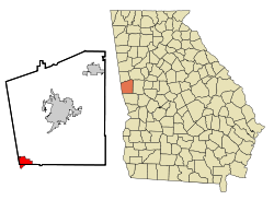
West Point is located primarily in the southwest corner of Troup County, with a portion extending south into the northwest corner of Harris County. It is bordered to the northeast by the city of LaGrange, the Troup County seat. The city is bordered to the west by the Chattahoochee River, across which are the cities of Lanett and Valley, Alabama. According to the United States Census Bureau, the city has a total area of 11.3 square miles (29.2 km2), of which 11.2 square miles (28.9 km2) are land and 0.1 square miles (0.3 km2), or 1.11%, are water. [4]
Interstate 85 runs northeast to southwest through the city, leading northeast 81 miles (130 km) to Atlanta and southwest 81 miles (130 km) to Montgomery, Alabama. Other highways that run through the city include U.S. Route 29, Georgia State Route 18, and Georgia State Route 103.
Climate data for West Point, Georgia, 1991–2020 normals, extremes 1891–2015 | |||||||||||||
---|---|---|---|---|---|---|---|---|---|---|---|---|---|
Month | Jan | Feb | Mar | Apr | May | Jun | Jul | Aug | Sep | Oct | Nov | Dec | Year |
Record high °F (°C) | 80 (27) | 84 (29) | 95 (35) | 94 (34) | 100 (38) | 104 (40) | 106 (41) | 106 (41) | 106 (41) | 99 (37) | 93 (34) | 80 (27) | 106 (41) |
Mean maximum °F (°C) | 71.4 (21.9) | 74.9 (23.8) | 81.8 (27.7) | 86.0 (30.0) | 90.6 (32.6) | 95.3 (35.2) | 97.2 (36.2) | 96.6 (35.9) | 92.6 (33.7) | 86.2 (30.1) | 79.2 (26.2) | 72.9 (22.7) | 98.5 (36.9) |
Mean daily maximum °F (°C) | 55.6 (13.1) | 59.5 (15.3) | 67.0 (19.4) | 74.6 (23.7) | 81.8 (27.7) | 87.6 (30.9) | 90.4 (32.4) | 89.4 (31.9) | 84.2 (29.0) | 75.1 (23.9) | 65.8 (18.8) | 57.9 (14.4) | 74.1 (23.4) |
Daily mean °F (°C) | 43.8 (6.6) | 47.1 (8.4) | 53.9 (12.2) | 61.0 (16.1) | 69.4 (20.8) | 76.4 (24.7) | 79.7 (26.5) | 78.9 (26.1) | 73.5 (23.1) | 62.7 (17.1) | 53.0 (11.7) | 46.3 (7.9) | 62.1 (16.8) |
Mean daily minimum °F (°C) | 32.0 (0.0) | 34.8 (1.6) | 40.8 (4.9) | 47.5 (8.6) | 57.1 (13.9) | 65.3 (18.5) | 69.1 (20.6) | 68.4 (20.2) | 62.8 (17.1) | 50.2 (10.1) | 40.3 (4.6) | 34.7 (1.5) | 50.3 (10.1) |
Mean minimum °F (°C) | 16.4 (−8.7) | 20.7 (−6.3) | 26.7 (−2.9) | 33.7 (0.9) | 44.3 (6.8) | 56.0 (13.3) | 62.7 (17.1) | 62.0 (16.7) | 49.7 (9.8) | 35.6 (2.0) | 28.0 (−2.2) | 20.0 (−6.7) | 13.4 (−10.3) |
Record low °F (°C) | −8 (−22) | 5 (−15) | 11 (−12) | 26 (−3) | 35 (2) | 43 (6) | 53 (12) | 52 (11) | 35 (2) | 24 (−4) | 8 (−13) | 1 (−17) | −8 (−22) |
Average precipitation inches (mm) | 4.88 (124) | 4.71 (120) | 5.31 (135) | 4.59 (117) | 3.89 (99) | 3.90 (99) | 4.70 (119) | 3.98 (101) | 3.67 (93) | 3.12 (79) | 4.37 (111) | 5.42 (138) | 52.54 (1,335) |
Average snowfall inches (cm) | 0.0 (0.0) | 0.0 (0.0) | 0.0 (0.0) | 0.0 (0.0) | 0.0 (0.0) | 0.0 (0.0) | 0.0 (0.0) | 0.0 (0.0) | 0.0 (0.0) | 0.0 (0.0) | 0.0 (0.0) | 0.1 (0.25) | 0.1 (0.25) |
Average precipitation days (≥ 0.01 in) | 8.8 | 8.4 | 7.6 | 7.1 | 7.0 | 9.5 | 9.0 | 8.2 | 6.8 | 5.7 | 6.8 | 8.7 | 93.6 |
Average snowy days (≥ 0.1 in) | 0.0 | 0.0 | 0.0 | 0.0 | 0.0 | 0.0 | 0.0 | 0.0 | 0.0 | 0.0 | 0.0 | 0.1 | 0.1 |
Source 1: NOAA [5] | |||||||||||||
Source 2: National Weather Service (mean maxima/minima 1981–2010) [6] |
Census | Pop. | Note | %± |
---|---|---|---|
1870 | 1,405 | — | |
1880 | 1,178 | −16.2% | |
1890 | 1,254 | 6.5% | |
1900 | 1,797 | 43.3% | |
1910 | 1,906 | 6.1% | |
1920 | 2,138 | 12.2% | |
1930 | 2,145 | 0.3% | |
1940 | 3,591 | 67.4% | |
1950 | 4,076 | 13.5% | |
1960 | 4,610 | 13.1% | |
1970 | 4,232 | −8.2% | |
1980 | 4,305 | 1.7% | |
1990 | 3,571 | −17.0% | |
2000 | 3,382 | −5.3% | |
2010 | 3,474 | 2.7% | |
2020 | 3,719 | 7.1% | |
U.S. Decennial Census [7] 1850-1870 [8] 1870-1880 [9] 1890-1910 [10] 1920-1930 [11] 1940 [12] 1950 [13] 1960 [14] 1970 [15] 1980 [16] 1990 [17] 2000 [18] 2010 [19] |
Race | Num. | Perc. |
---|---|---|
White (non-Hispanic) | 1,387 | 37.29% |
Black or African American (non-Hispanic) | 2,041 | 54.88% |
Native American | 12 | 0.32% |
Asian | 66 | 1.77% |
Pacific Islander | 1 | 0.03% |
Other/Mixed | 126 | 3.39% |
Hispanic or Latino | 86 | 2.31% |
As of the 2020 United States census, there were 3,719 people, 1,579 households, and 970 families residing in the city.
Kia Motors opened an automobile factory in West Point in 2009. Since 2011, the West Point auto factory has been manufacturing models of the Kia K5, Kia Sorento, Kia Sportage, and Kia Telluride. The Kia Motors Manufacturing Georgia also manufactures the Kia Sorento's sibling, the Hyundai Santa Fe to get more Sonatas in Alabama. [21]
Batson-Cook Construction was founded in West Point in 1913. It continues to be headquartered in West Point.
West Point Iron Works was founded in West Point three years after the Civil War ended. The company started off as a supplier of individual components, such as pulleys and gears, to nearby textile mills. In the 1930s the company was renamed West Point Foundry and Machine Co. In the 2000s, having been negatively impacted by imports (cloth) the company turned to SEETAC to seek assistance to use the firm's engineering and production expertise to provide products to the U.S. military. The firm also changed its name to West Point Industries to emphasize its broader client base. West Point now also makes component parts for manufacturers in a wide range of industries.
Troup County High School and Long Cane Middle School, located in LaGrange, serve the children of West Point and the surrounding area.
Point University, formerly Atlanta Christian College, a private Christian university in East Point, moved their campus to West Point in 2012. [22]
Troup County is a county in the West Central region of the U.S. state of Georgia. As of the 2020 census, the population was 69,426. The county seat is LaGrange. Troup County comprises the LaGrange micropolitan statistical area along with Chambers County, AL. It is included in the Atlanta-Athens-Clarke County-Sandy Springs combined statistical area.
Stewart County is a county located in the west central portion of the U.S. state of Georgia. As of the 2020 census, the population was 5,314. The county seat is Lumpkin. The county was created on December 23, 1830.
Quitman County is a county located in the southwestern part of the U.S. state of Georgia. As of the 2020 census, the population was 2,235, making it the second-least populous county in Georgia. The county seat is Georgetown. The county was created on December 10, 1858, and named after General John A. Quitman, leader in the Mexican–American War, and once Governor of Mississippi. In November 2006, residents voted to consolidate the city government of Georgetown and the county government of Quitman into a consolidated city-county.
Muscogee County is a county located on the central western border of the U.S. state of Georgia named after the Muscogee that originally inhabited the land with its western border with the state of Alabama that is formed by the Chattahoochee River. As of the 2020 census, the population was 206,922. Its county seat and only city is Columbus, with which it has been a consolidated city-county since the beginning of 1971.
Meriwether County is a county in the West Central region of the U.S. state of Georgia. As of the 2020 census, the population was 20,613. The county seat is Greenville, home of the Meriwether County Courthouse. The county was formed on December 14, 1827, as the 73rd county in Georgia. It was named for David Meriwether, a general in the American Revolutionary War and member of Congress from Georgia.
Lumpkin County is a county in the Northeast region of the U.S. state of Georgia. As of the 2020 census, the population was 33,488. Its county seat is Dahlonega. Lumpkin County is included in the Atlanta-Sandy Springs-Roswell, Georgia metropolitan statistical area.
Heard County is a county located in the west central portion of the U.S. state of Georgia. At the 2020 census, the population was 11,412, down from 11,834 in 2010. The county seat is Franklin. The county was created on December 22, 1830.
Harris County is a county located in the west-central portion of the U.S. state of Georgia; its western border with the state of Alabama is formed by the Chattahoochee River. As of the 2020 census, the population was 34,668. The county seat is Hamilton. The largest city in the county is Pine Mountain, a resort town that is home to the Franklin D. Roosevelt State Park. Harris County was created on December 14, 1827, and named for Charles Harris, a Georgia judge and attorney. Harris County is part of the Columbus, GA-AL metropolitan area and has become a popular suburban and exurban destination of residence for families relocating from Columbus. Because of this, Harris has become the sixth-wealthiest county in Georgia in terms of per capita income and the wealthiest in the state outside of Metro Atlanta.
Coweta County is a county in the West Central region of the U.S. state of Georgia. It is part of Metro Atlanta. As of the 2020 census, the population was 146,158. The county seat is Newnan.
Chattahoochee County, also known as Cusseta-Chattahoochee County, is a county located on the western border in central Georgia. As of the 2020 census, the population was 9,565. The county seat is Cusseta, with which the county shares a consolidated city-county government. The city of Cusseta remains a geographically distinct municipality within Chattahoochee County. The county was created on February 13, 1854.
Carroll County is a county in the West Central region of the State of Georgia. As of the 2020 census, its population was 119,148. Its county seat is the city of Carrollton. Carroll County is included in the Atlanta–Sandy Springs–Roswell metropolitan statistical area and is also adjacent to Alabama on its western border.
Eufaula is the largest city in Barbour County, Alabama, United States. As of the 2010 census the city's population was 13,137.
Valley is a city in Chambers County, Alabama, United States. Valley was incorporated in 1980 combining the four textile mill villages of Fairfax, Langdale, River View, and Shawmut. As of the 2020 census it had a population of 10,529. The city lies on the western bank of the Chattahoochee River, the state border between Alabama and Georgia. Valley is a pilot city for the Alabama Communities of Excellence program, a non-profit that partners with governments, businesses, and universities to prepare participating communities for a more vibrant future. It is included in the LaGrange, Georgia Micropolitan Statistical Area, which is included in the Greater Atlanta Combined Statistical Area.
Greenville is a city and the county seat of Meriwether County, Georgia, United States. The population was 794 at the 2020 census, down from 876 in 2010. The city is located 60 miles (97 km) southwest of Atlanta and is part of the Atlanta metropolitan area.
Columbus is a consolidated city-county located on the west-central border of the U.S. state of Georgia. Columbus lies on the Chattahoochee River directly across from Phenix City, Alabama. It is the county seat of Muscogee County, with which it officially merged in 1970; the original merger excluded Bibb City, which joined in 2000 after dissolving its own city charter.
Georgetown is a city in Quitman County, Georgia, United States. It is on the Alabama-Georgia state line next to Walter F. George Lake and across the Chattahoochee River from Eufaula, Alabama. Per the 2020 census, the population was 2,235. In 2006, Georgetown and Quitman County voted to consolidate their governments, becoming the smallest such consolidated entity in the Lower 48 states.
LaGrange is a city in and the county seat of Troup County, Georgia, United States. The population of the city was estimated to be 30,858 in 2020 by the U.S. Census Bureau. It is the principal city of the LaGrange, Georgia Micropolitan Statistical Area, which is included in the Atlanta-Sandy Springs-Gainesville, Georgia-Alabama (part) combined statistical area. It is about 60 miles (97 km) southwest of Atlanta and located in the foothills of the Georgia Piedmont.
The Chattahoochee River is a river in the Southeastern United States. It forms the southern half of the Alabama and Georgia border, as well as a portion of the Florida and Georgia border. It is a tributary of the Apalachicola River, a relatively short river formed by the confluence of the Chattahoochee and Flint rivers and emptying from Florida into Apalachicola Bay in the Gulf of Mexico. The Chattahoochee River is about 430 miles (690 km) long. The Chattahoochee, Flint, and Apalachicola rivers together make up the Apalachicola–Chattahoochee–Flint River Basin. The Chattahoochee makes up the largest part of the ACF's drainage basin.
The tri-state water dispute is a 21st-century water-use conflict among the U.S. states of Georgia, Alabama, and Florida over flows in the Apalachicola-Chattahoochee-Flint River Basin and the Alabama-Coosa-Tallapoosa River Basin. The U.S. Army Corps of Engineers has regulated water flow for the entire Chattahoochee River, from Lake Lanier in Forsyth County, Georgia, to Alabama and Florida.
West Point Lake is a man-made reservoir located mostly in west-central Georgia on the Chattahoochee River and maintained by the U.S. Army Corps of Engineers (USACE). The Chattahoochee river flows in from the north, before flowing through the West Point Dam, which impounds the lake, and continuing to Columbus, Georgia. Of the four major USACE lakes in the ACF River Basin, West Point Lake is the smallest by area containing 25,864 acres (10,467 ha) of water, and has the second shortest shoreline at 604 mi (972 km). The purposes of the reservoir are to provide flood control, hydroelectric power, and water storage to aid the navigation of the lower Chattahoochee.