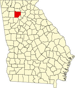
Cherokee County, Georgia

Last updated

Cherokee County
Cherokee County Superior Court - panoramio.jpg
Cherokee County Justice Center
Flag of Cherokee County, Georgia.png
Seal of Cherokee County, Georgia.png
Map of Georgia highlighting Cherokee County.svg
Location within the U.S. state of Georgia
Georgia in United States.svg
Georgia's location within the U.S.
Coordinates: 34°14′N84°28′W / 34.24°N 84.47°W / 34.24; -84.47
CountryFlag of the United States.svg United States
StateFlag of Georgia (U.S. state).svg  Georgia
Founded1831;193 years ago (1831)
Named for Cherokee people
Seat Canton
Largest city Woodstock
Area
  Total434 sq mi (1,120 km2)
  Land421 sq mi (1,090 km2)
  Water13 sq mi (30 km2)  2.9%
Population
 (2020)
  Total266,620 [1]
Time zone UTC−5 (Eastern)
  Summer (DST) UTC−4 (EDT)
Congressional districts 6th, 11th
Website www.cherokeega.com

Cherokee County is located in the US state of Georgia. As of the 2020 Census, the population was 266,620. [2] [1] The county seat is Canton. [3] The county Board of Commissioners is the governing body, with members elected to office. Cherokee County is included in the Atlanta Metropolitan Area.

Contents

History

Original territory

An 1822 map of Cherokee lands in Georgia Cherokee1822.jpg
An 1822 map of Cherokee lands in Georgia

Cherokee County was created by an act of the Georgia General Assembly on December 26, 1831, covering a vast area northwest of the Chattahoochee River and Chestatee River (except for Carroll County). It was named after the Cherokee people who lived in the area at that time. [4]

The discovery of gold in local streams accelerated the push of European Americans to expel the Cherokee from their land.

In 1832, the State of Georgia implemented the Cherokee Land Lottery, which gave deeds of land that had previously belonged to the Cherokee people to white male citizens. [5] The forcible removal of the Cherokee people to Indian Territory west of the Mississippi River began during this year.

Partition

An 1834 map of counties created from Cherokee land Cherokee1834.jpg
An 1834 map of counties created from Cherokee land

The General Assembly passed a law on December 3, 1832, which created the counties of Forsyth, Lumpkin, Union, Cobb, Gilmer, Murray, Cass (now Bartow), Floyd, and Paulding from area that had previously been part of Cherokee County. [6]

Etowah was declared the county seat in 1833. Its name was later changed to Canton, which is still the county seat today.

In 1857, part of the southeastern corner of the county was ceded by the General Assembly to form Milton County (now the cities of Milton, Alpharetta, Roswell, and parts of Sandy Springs, within north Fulton County).

Development

In the 1890s, The Atlanta & Knoxville Railroad (later renamed the Marietta & North Georgia Railroad when it could not be completed to Knoxville) built a branch line through the middle of the county. When this line was bought by the Louisville & Nashville Railroad in the following decade, the L&N Railroad built stations at Woodstock and Holly Springs.

Cherokee County began to see rapid population growth following the construction of Interstate 575, the first phase of which opened in 1979. The freeway bisects the county and serves as its primary thoroughfare, running from Kennesaw north through Woodstock, Holly Springs, Canton, and Ball Ground. Today, the county is most densely populated in its southern areas, which are closest to the City of Atlanta.

Geography

According to the U.S. Census Bureau, the county has a total area of 434 square miles (1,120 km2), of which 422 square miles (1,090 km2) are land and 13 square miles (34 km2) (2.9%) are covered by water. [7] Much of the water is in Lake Allatoona in the southwest. The lake is fed by the Etowah and Little Rivers (the county's primary waterways), and other large streams such as Noonday Creek. Much of the northern part of the county begins to rise toward the foothills of the north Georgia mountains.

The vast majority of Cherokee County is located in the [Etowah River] sub-basin of the Coosa-Tallapoosa River Basin, with only a small northwesterly corner of the county located in the Coosawattee River sub-basin of the same basin. [8]

Mountains

Pine Log Mountain (left) and Bear Mountain (right) Pine Log Mountain and Bear Mountain, Cherokee County, Georgia.jpg
Pine Log Mountain (left) and Bear Mountain (right)

Nine summits are listed by the United States Geological Survey Geographic Names Information System as being in the county. From tallest to lowest, they are:

  • Bear Mountain – 2,297 feet (700 m)
  • Pine Log Mountain – 2,260 feet (689 m)
  • Oakey Mountain – 1,686 feet (514 m)
  • Dry Pond Mountain – 1,644 feet (501 m)
  • Hickory Log Mountain – 1,545 feet (471 m)
  • Polecat Mountain – 1,503 feet (458 m)
  • Byrd Mountain – 1,358 feet (414 m)
  • Garland Mountain – 1,348 feet (411 m)
  • Posey Mountain – 1,306 feet (398 m)

Adjacent counties

Government, politics, and policing

United States presidential election results for Cherokee County, Georgia [9]
Year Republican Democratic Third party
No.%No.%No.%
2020 99,58568.75%42,77929.53%2,4951.72%
2016 80,64971.51%25,23122.37%6,9046.12%
2012 76,51477.73%19,84120.16%2,0842.12%
2008 70,27974.79%22,35023.78%1,3441.43%
2004 58,23878.99%14,82420.11%6650.90%
2000 38,03372.65%12,29523.49%2,0203.86%
1996 24,52763.41%10,80227.93%3,3488.66%
1992 16,05454.95%8,11327.77%5,04717.28%
1988 14,59376.45%4,37822.94%1170.61%
1984 11,14676.11%3,49923.89%00.00%
1980 5,25044.96%6,02051.55%4083.49%
1976 2,60928.52%6,53971.48%00.00%
1972 5,50982.62%1,15917.38%00.00%
1968 2,67535.85%1,43619.24%3,35144.91%
1964 3,39851.59%3,18948.41%00.00%
1960 2,34143.21%3,07756.79%00.00%
1956 1,82946.43%2,11053.57%00.00%
1952 1,61839.75%2,45260.25%00.00%
1948 63129.31%1,26758.85%25511.84%
1944 1,05944.00%1,34856.00%00.00%
1940 1,01739.39%1,55260.11%130.50%
1936 84240.87%1,21158.79%70.34%
1932 31415.25%1,72783.88%180.87%
1928 1,67974.29%58125.71%00.00%
1924 60139.99%84856.42%543.59%
1920 1,13867.66%54432.34%00.00%
1916 29218.16%85553.17%46128.67%
1912 211.57%60345.20%71053.22%
1908 66559.80%32629.32%12110.88%
1904 24620.08%62250.78%35729.14%
1900 55048.12%53546.81%585.07%
1896 70247.24%71247.91%724.85%
1892 38218.16%92744.06%79537.79%
1888 45922.36%1,57576.72%190.93%
1884 14013.93%86586.07%00.00%
1880 1256.45%1,81393.55%00.00%

Government

The five-member board of commissioners is elected from four districts, with an at-large county commission chair. Thus, members are elected as residents of geographic districts, but the commission chair must receive the majority vote of the county in total. Each is elected to a four-year term.

Cherokee County sheriff and municipal police

The county is under the jurisdiction of the Cherokee County Sheriff's Office, which is headed by Sheriff Frank Reynolds. The cities within of Woodstock, Canton, Holly Springs, and Ball Ground have independent municipal police departments.

Politics

As of 2021, all state, county, and municipal elected officials representing Cherokee County are members of the Republican Party (with the exception of officials who hold officially non-partisan offices). [10] [11]

Cherokee County had voting patterns similar to most Solid South and Georgia counties prior to 1964 in presidential elections, though Democratic Party candidates did not win by as wide margins as they did in the rest of the state and the Deep South. In fact, the county backed Republican candidates four times between 1900 and 1960. From 1964 on, the county has swung strongly toward the Republicans, only failing to vote for the Republican in presidential elections since then in 1968 when segregationist George Wallace appealed to anti-Civil Rights Act sentiment and in the two elections Georgian Jimmy Carter was on the ballot. In addition, unlike the inner suburban counties of the Atlanta metropolitan area, Cherokee County has continued to vote for Republicans by landslide margins, although the margins have decreased slightly in the most recent elections with the growth of the metropolitan area. In the Presidential election of 2020, the majority of votes from all of the 42 county election precincts were cast for incumbent President Donald Trump. [12]

Demographics

Historical population
CensusPop.Note
1840 5,895
1850 12,800117.1%
1860 11,291−11.8%
1870 10,399−7.9%
1880 14,32537.8%
1890 15,4127.6%
1900 15,243−1.1%
1910 16,6619.3%
1920 18,56911.5%
1930 20,0037.7%
1940 20,1260.6%
1950 20,7503.1%
1960 23,00110.8%
1970 31,05935.0%
1980 51,69966.5%
1990 90,20474.5%
2000 141,90357.3%
2010 214,34651.1%
2020 266,62024.4%
2023 (est.)286,602 [13] 7.5%
U.S. Decennial Census [14]
1790-1880 [15] 1890-1910 [16]
1920-1930 [17] 1930-1940 [18]
1940-1950 [19] 1960-1980 [20]
1980-2000 [21] 2010 [22] 2020 [23]

2020 census

Cherokee County, Georgia – Racial and ethnic composition
(NH = Non-Hispanic)
Note: the US Census treats Hispanic/Latino as an ethnic category. This table excludes Latinos from the racial categories and assigns them to a separate category. Hispanics/Latinos may be of any race.
Race / EthnicityPop 2000 [24] Pop 2010 [22] Pop 2020 [23] % 2000% 2010% 2020
White alone (NH)127,618174,243197,86789.93%81.29%74.21%
Black or African American alone (NH)3,48311,63317,3262.45%5.43%6.50%
Native American or Alaska Native alone (NH)4205365020.30%0.25%0.19%
Asian alone (NH)1,1273,4845,4290.79%1.63%2.04%
Pacific Islander alone (NH)32841000.02%0.04%0.04%
Other race alone (NH)1234871,5440.09%0.23%0.58%
Mixed race or Multiracial (NH)1,4053,31311,7410.99%1.55%4.40%
Hispanic or Latino (any race)7,69520,56632,1115.42%9.59%12.04%
Total141,903214,346266,620100.00%100.00%100.00%

As of the 2020 United States census, there were 266,620 people, 93,441 households, and 69,257 families residing in the county.

2010 census

As of the 2010 United States Census, 214,346 people, 75,936 households, and 57,876 families were living in the county. [25] The population density was 508.3 inhabitants per square mile (196.3/km2). The 82,360 housing units averaged 195.3 per square mile (75.4/km2). [26] The racial makeup of the county was 86.6% White, 5.65% Black or African American, 1.65% Asian, 0.4% American Indian, 0.1% Pacific Islander, 3.6% from other races, and 2.1% from two or more races. Those of Hispanic or Latino origin of any race made up 9.6% of the population. [25] In terms of ancestry, 16.2% were Irish, 16.1% were German, 14.1% were English, 10.7% were American, and 5.7% were Italian. [27]

Of the 75,936 households, 41.4% had children under the age of 18 living with them, 61.9% were married couples living together, 10.1% had a female householder with no husband present, 23.8% were not families, and 18.8% of all households were made up of individuals. The average household size was 2.80 and the average family size was 3.20. The median age was 36.3 years. [25]

The median income for a household in the county was $66,320 and for a family was $77,190. Males had a median income of $53,773 versus $40,153 for females. The per capita income for the county was $30,217. About 5.5% of families and 7.4% of the population were below the poverty line, including 8.4% of those under age 18 and 7.7% of those age 65 or over. [28]

2000 census

As of the census [29] of 2000, 141,903 people, 49,495 households, and 39,200 families resided in the county. The population density was 335 inhabitants per square mile (129/km2).

Of the 49,495 households, 41.40% had children under the age of 18 living with them, 67.20% were married couples living together, 8.30% had a female householder with no husband present, and 20.80% were not families. About 16.00% of all households were made up of individuals, and 4.10% had someone living alone who was 65 years of age or older. The average household size was 2.85 and the average family size was 3.18.

In the county, the population was distributed as 28.30% under the age of 18, 7.70% from 18 to 24, 35.80% from 25 to 44, 21.70% from 45 to 64, and 6.60% who were 65 years of age or older. The median age was 34 years. For every 100 females, there were 100.70 males. For every 100 females age 18 and over, there were 98.90 males.

The median income for a household in the county was $60,896, and for a family was $66,419. Males had a median income of $44,374 versus $31,036 for females. The per capita income for the county was $24,871. About 3.50% of families and 5.30% of the population were below the poverty line, including 5.50% of those under age 18 and 9.80% of those age 65 or over.

Education

Public schools

Private schools

Private schools in Cherokee County include:

Higher education

Chattahoochee Technical College has campuses in Woodstock and Canton in Cherokee County.

Transportation

Major highways


Airport

The Cherokee County Airport (FAA LOC ID: CNI) is located adjacent to I-575 about six miles (9.7 km) northeast of downtown Canton.

A redevelopment project recently completed a 10,000-square-foot (930 m2) terminal, the lengthening of the runway from 3,414 to 5,000 feet (1,041 to 1,524 m), a new parallel taxiway, instrument landing equipment, and new hangars. The new facilities will accommodate 200 corporate aircraft in hangars and provide 100 tie-downs for smaller aircraft.

Public transportation

The Cherokee Area Transit Service serves all of the Cherokee County area, rural and suburban.

Communities

Cities

Unincorporated communities

Notable residents

See also

Related Research Articles

<span class="mw-page-title-main">Calhoun County, Alabama</span> County in Alabama, United States

Calhoun County is a county in the east central part of the U.S. state of Alabama. As of the 2020 census, the population was 116,441. Its county seat is Anniston. It is named in honor of John C. Calhoun, a US Senator from South Carolina.

<span class="mw-page-title-main">Cherokee County, Alabama</span> County in Alabama, United States

Cherokee County, Alabama is a county located in the northeastern part of the U.S. state of Alabama. As of the 2020 census, the population was 24,971. Its county seat is Centre. The county is named for the Cherokee tribe.

<span class="mw-page-title-main">Etowah County, Alabama</span> County in Alabama, United States

Etowah County is a county located in the northeastern part of the U.S. state of Alabama. As of the 2020 census the population was 103,436. Its county seat is Gadsden. Its name is from a Cherokee word meaning "edible tree". In total area, it is the smallest county in Alabama, but one of the most densely populated. Etowah County comprises the Gadsden Metropolitan Statistical Area.

<span class="mw-page-title-main">DeKalb County, Alabama</span> County in Alabama, United States

DeKalb County is a county located in the northeastern part of the U.S. state of Alabama. As of the 2020 census, the population was 71,608. Its county seat is Fort Payne, and it is named after Major General Baron Johan DeKalb. DeKalb County is part of the Huntsville-Decatur-Albertville, AL Combined Statistical Area.

<span class="mw-page-title-main">Rabun County, Georgia</span> County in Georgia, United States

Rabun County is the north-easternmost county in the U.S. state of Georgia. As of the 2020 census, the population was 16,883, up from 16,276 in 2010. The county seat is Clayton. With an average annual rainfall of over 70 inches (1,800 mm), Rabun County has the title of the rainiest county in Georgia and is one of the rainiest counties east of the Cascades. The year 2018 was the wettest on record in the county's history. The National Weather Service cooperative observation station in northwest Rabun's Germany Valley measured 116.48 inches of rain during the year. During 2020, the Germany Valley NWS station reported a yearly precipitation total of 100.19 inches.

<span class="mw-page-title-main">Polk County, Georgia</span> County in Georgia, United States

Polk County is a county located in the northwestern part of the U.S. state of Georgia. As of the 2020 census, the population was 42,853. The county seat is Cedartown. The county was created on December 20, 1851, by an act of the Georgia General Assembly and named after James K. Polk, the eleventh President of the United States.

<span class="mw-page-title-main">Pickens County, Georgia</span> County in Georgia, United States

Pickens County is a county located in the north-central portion of the U.S. state of Georgia. As of the 2020 census, the population was 33,216. The county seat is Jasper. Pickens County is part of the Atlanta-Sandy Springs-Roswell, Georgia metropolitan statistical area.

<span class="mw-page-title-main">Paulding County, Georgia</span> County in Georgia, United States

Paulding County is a county located in the northwestern part of the U.S. state of Georgia. Part of the Atlanta metropolitan area, it had an estimated population of 168,661 in 2020. The county seat is Dallas.

<span class="mw-page-title-main">Murray County, Georgia</span> County in Georgia, United States

Murray County is a county located in the northwestern part of the U.S. state of Georgia. As of the 2020 census, the population was 39,973. The county seat is Chatsworth.

<span class="mw-page-title-main">Lumpkin County, Georgia</span> County in Georgia, United States

Lumpkin County is a county located in the north central portion of the U.S. state of Georgia. As of the 2020 census, the population was 33,488. Its county seat is Dahlonega. Lumpkin County is included in the Atlanta-Sandy Springs-Roswell, Georgia Metropolitan Statistical Area.

<span class="mw-page-title-main">Habersham County, Georgia</span> County in Georgia, United States

Habersham County is a county located in the northeastern part of the U.S. state of Georgia. As of the 2020 census, the population was 46,031. The county seat is Clarkesville. The county was created on December 15, 1818, and named for Colonel Joseph Habersham of the Continental Army in the Revolutionary War.

<span class="mw-page-title-main">Floyd County, Georgia</span> County in Georgia, United States

Floyd County is a county located in the northwestern part of the U.S. state of Georgia. As of the 2020 United States Census, the population was 98,584. The county seat is Rome.

<span class="mw-page-title-main">Fannin County, Georgia</span> County in Georgia, United States

Fannin County is a county located in the north central portion of the U.S. state of Georgia. As of the 2020 census, the population was 25,319. It is one of the most rural counties in Georgia due its location in the Appalachian Mountain Range, with about 90% of the population of Fannin County living in unincorporated lands. The county seat and largest city is Blue Ridge. The county was created on January 21, 1854, and is named after James Fannin, a veteran who fought in the Texas Revolution.

<span class="mw-page-title-main">Dawson County, Georgia</span> County in Georgia, United States

Dawson County is a county located in the Northeast portion of the U.S. state of Georgia. As of the 2020 census, the population was 26,798 up from 22,330 in 2010. The county seat is Dawsonville.

<span class="mw-page-title-main">Cobb County, Georgia</span> County in Georgia, United States

Cobb County is a county in the U.S. state of Georgia, located in the Atlanta metropolitan area in the north central portion of the state. As of 2020 Census, the population was 766,149. It is the state's third most populous county, after Fulton and Gwinnett counties. Its county seat is Marietta; its largest city is Mableton.

<span class="mw-page-title-main">Chattooga County, Georgia</span> County in Georgia, United States

Chattooga County is a county located in the northwestern part of the U.S. state of Georgia. As of the 2020 census, the population was 24,965. The county seat is Summerville. The county was created on December 28, 1838.

<span class="mw-page-title-main">Catoosa County, Georgia</span> County in Georgia, United States

Catoosa County is a county located in the northwestern part of the U.S. state of Georgia. As of the 2020 census, the population was 67,872. The county seat is Ringgold. The county was created on December 5, 1853. The meaning of the Cherokee language name "Catoosa" is obscure: "Catoosa" may come from the Cherokee words gatusi or gatu'gitse.

<span class="mw-page-title-main">Bartow County, Georgia</span> County in Georgia, United States

Bartow County is located in the northwestern part of the U.S. state of Georgia. As of the 2020 census, the population was 108,901, up from 100,157 in 2010. The county seat is Cartersville.

<span class="mw-page-title-main">Canton, Georgia</span> City in Georgia, United States

Canton is a city in and the county seat of Cherokee County, Georgia, United States. As of the 2010 census, the city had a population of 22,958, up from 7,709 in 2000.

<span class="mw-page-title-main">Holly Springs, Georgia</span> City in Georgia, United States

Holly Springs is a city in Cherokee County, Georgia, United States. The population was 9,189 as of the 2010 census, up from 3,195 in 2000.

References

  1. 1 2 US 2020 Census Bureau report, Cherokee County, Georgia
  2. "2019 County Metro Population Estimates". United States Census Bureau. Retrieved March 26, 2020.
  3. "Find a County". National Association of Counties. Archived from the original on May 3, 2015. Retrieved June 7, 2011.
  4. Krakow, Kenneth K. (1975). Georgia Place-Names: Their History and Origins (PDF). Macon, GA: Winship Press. p. 41. ISBN   0-915430-00-2. Archived (PDF) from the original on July 10, 2003.
  5. "GeorgiaInfo has moved :: Carl Vinson Institute of Government". Cviog.uga.edu. Archived from the original on May 11, 2008. Retrieved July 22, 2010.
  6. "GeorgiaInfo has moved :: Carl Vinson Institute of Government". Cviog.uga.edu. Archived from the original on February 18, 2008. Retrieved July 22, 2010.
  7. "US Gazetteer files: 2010, 2000, and 1990". United States Census Bureau. February 12, 2011. Retrieved April 23, 2011.
  8. "Georgia Soil and Water Conservation Commission Interactive Mapping Experience". Georgia Soil and Water Conservation Commission. Archived from the original on October 3, 2018. Retrieved November 19, 2015.
  9. Leip, David. "Dave Leip's Atlas of U.S. Presidential Elections". uselectionatlas.org. Retrieved March 19, 2018.
  10. "Elected Official Directory" (PDF). Cherokee Chamber. Archived (PDF) from the original on January 22, 2021. Retrieved August 18, 2021.
  11. "Elected Officials Listing" (PDF). Cherokee Elections and Voter Registration. Archived (PDF) from the original on August 18, 2021. Retrieved August 18, 2021.
  12. "Election Results by Precinct" (PDF). Cherokee County Elections and Voter Registration. November 9, 2020. Archived (PDF) from the original on January 2, 2021. Retrieved August 18, 2021.
  13. "Annual Estimates of the Resident Population for Counties: April 1, 2020 to July 1, 2023". United States Census Bureau. Retrieved March 31, 2024.
  14. "Decennial Census of Population and Housing by Decades". United States Census Bureau.
  15. "1880 Census Population by Counties 1790-1800" (PDF). United States Census Bureau. 1880.
  16. "1910 Census of Population - Georgia" (PDF). United States Census Bureau. 1910.
  17. "1930 Census of Population - Georgia" (PDF). United States Census Bureau. 1930.
  18. "1940 Census of Population - Georgia" (PDF). United States Census Bureau. 1940.
  19. "1950 Census of Population - Georgia -" (PDF). United States Census Bureau. 1950.
  20. "1980 Census of Population - Number of Inhabitants - Georgia" (PDF). United States Census Bureau. 1980.
  21. "2000 Census of Population - Population and Housing Unit Counts - Georgia" (PDF). United States Census Bureau. 2000.
  22. 1 2 "P2: Hispanic or Latino, and Not Hispanic or Latino by Race – 2010: DEC Redistricting Data (PL 94-171) – Cherokee County, Georgia". United States Census Bureau.
  23. 1 2 "P2: Hispanic or Latino, and Not Hispanic or Latino by Race – 2020: DEC Redistricting Data (PL 94-171) – Cherokee County, Georgia". United States Census Bureau.
  24. "P004 HISPANIC OR LATINO, AND NOT HISPANIC OR LATINO BY RACE – 2000: DEC Summary File 1 – Cherokee County, Georgia". United States Census Bureau.
  25. 1 2 3 "DP-1 Profile of General Population and Housing Characteristics: 2010 Demographic Profile Data". United States Census Bureau. Archived from the original on February 13, 2020. Retrieved December 27, 2015.
  26. "Population, Housing Units, Area, and Density: 2010 – County". United States Census Bureau. Archived from the original on February 13, 2020. Retrieved December 27, 2015.
  27. "DP02 SELECTED SOCIAL CHARACTERISTICS IN THE UNITED STATES – 2006–2010 American Community Survey 5-Year Estimates". United States Census Bureau. Archived from the original on February 13, 2020. Retrieved December 27, 2015.
  28. "DP03 SELECTED ECONOMIC CHARACTERISTICS – 2006–2010 American Community Survey 5-Year Estimates". United States Census Bureau. Archived from the original on February 13, 2020. Retrieved December 27, 2015.
  29. "U.S. Census website". United States Census Bureau . Retrieved May 14, 2011.

Local newspapers

34°14′N84°28′W / 34.24°N 84.47°W / 34.24; -84.47