Union City, Georgia | |
|---|---|
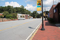 Downtown Union City | |
 Flag  Seal Logo | |
| Nickname: The Progressive City | |
    | |
| Coordinates: 33°36′18″N84°29′37″W / 33.60500°N 84.49361°W [1] | |
| Country | United States |
| State | Georgia |
| County | Fulton |
| Area | |
• Total | 19.83 sq mi (51.37 km2) |
| • Land | 19.68 sq mi (50.96 km2) |
| • Water | 0.16 sq mi (0.41 km2) |
| Elevation | 971 ft (296 m) |
| Population (2020) | |
• Total | 26,830 |
| • Density | 1,363.7/sq mi (526.51/km2) |
| Time zone | UTC-5 (Eastern (EST)) |
| • Summer (DST) | UTC-4 (EDT) |
| ZIP code | 30291 |
| Area code | 770 |
| FIPS code | 13-78324 [3] |
| GNIS feature ID | 2405627 [1] |
| Website | unioncityga.org |

Union City is a city in Fulton County, Georgia, United States. The population was 26,830 at the 2020 census. [4]


