Belvedere Park, Georgia

Last updated

Belvedere Park, Georgia
GA 154 @ Columbia Drive, Belvedere Park, Georgia.jpg
Intersection in Belvedere Park, Georgia
DeKalb County Georgia Incorporated and Unincorporated areas Belvedere Park Highlighted.svg
Location in DeKalb County and the state of Georgia
Metro atlanta.jpg
Red pog.svg
Belvedere Park
Location in Metro Atlanta
Coordinates: 33°44′56″N84°15′35″W / 33.74889°N 84.25972°W / 33.74889; -84.25972
CountryUnited States
State Georgia
County DeKalb
Area
[1]
  Total4.90 sq mi (12.69 km2)
  Land4.90 sq mi (12.68 km2)
  Water0.00 sq mi (0.01 km2)
Elevation
997 ft (304 m)
Population
 (2020)
  Total15,113
  Density3,085.55/sq mi (1,191.44/km2)
Time zone UTC-5 (Eastern (EST))
  Summer (DST) UTC-4 (EDT)
FIPS code 13-06884 [2]
GNIS feature ID0331129 [3]

Belvedere Park is an unincorporated community and census-designated place (CDP) in DeKalb County, Georgia, United States. The population was 15,113 at the 2020 census.

Contents

Geography

Belvedere Park is located at 33°44′56″N84°15′35″W / 33.74889°N 84.25972°W / 33.74889; -84.25972 (33.748855, -84.259617). [4] It is bordered by:

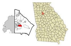
According to the United States Census Bureau, Belvedere Park has a total area of 5.0 square miles (13 km2), all land.

History

Belvedere Park emerged beginning in 1952 as a planned community with schools, parks, and a shopping center. It continued to grow and expand throughout the decade. [5]

Housing tracts

In 1958, the Atlanta Journal advertised houses in Belvedere Park for between $11,000 and $14,800. One ad proclaimed:

“Buy a Home in Belvedere Park with a 100% GI Loan - A Complete Established Community of Distinction and Quality Convenient to Everything.”

A majority of homes in Belvedere Park are one-story and while some are traditional red brick ranch homes, contemporary style houses were also built. Homes were built by the Embry Brothers. Adair Realty and Loan, a powerful real estate company in Atlanta during the early to mid 20th century, represented Belvedere Park. [5]

Belvedere Motel

The Belvedere Motel, operated by the renowned Dinkler Hotel Corporation, opened with telephones and large screen televisions in every room. The motel claimed to be “dedicated to your traveling comfort” — additional amenities included a playground and a shuffleboard court. [5]

Opening of Rich's

In 1959, the second branch of Rich's Department Store was opened in the Belvedere Shopping Center (the first branch was opened at Lenox Square Mall). Rich's added an air of metropolitan living to the suburbs. [5]

In 1963, Towers High School was opened and is still in operation today. Midway Park on Midway Road is a popular recreational center. It has several fields for baseball and football and a public swimming pool. [5]

Former wig and beeper store in Belvedere Plaza Wig and beeper store belvedere plaza.jpg
Former wig and beeper store in Belvedere Plaza

Demographics

Historical population
CensusPop.Note
1980 17,766
1990 18,0891.8%
2000 18,9454.7%
2010 15,152−20.0%
2020 15,113−0.3%
U.S. Decennial Census [6]
1850-1870 [7] 1870-1880 [8]
1890-1910 [9] 1920-1930 [10]
1940 [11] 1950 [12] 1960 [13]
1970 [14] 1980 [15] 1990 [16]
2000 [17] 2010 [18] 2020 [19]

Belvedere Park first appeared as a census designated place in the 1980 U.S. census. [15]

Belvedere Park, Georgia – Racial and ethnic composition
Note: the US Census treats Hispanic/Latino as an ethnic category. This table excludes Latinos from the racial categories and assigns them to a separate category. Hispanics/Latinos may be of any race.
Race / Ethnicity (NH = Non-Hispanic)Pop 2000 [20] Pop 2010 [21] Pop 2020 [19] % 2000% 2010% 2020
White alone (NH)2,2862,7444,07212.07%18.11%26.94%
Black or African American alone (NH)15,54211,4549,30982.04%75.59%61.60%
Native American or Alaska Native alone (NH)2536240.13%0.24%0.16%
Asian alone (NH)1731202170.91%0.79%1.44%
Pacific Islander alone (NH)4370.02%0.02%0.05%
Other race alone (NH)2832850.15%0.21%0.56%
Mixed race or Multiracial (NH)2272406191.20%1.58%4.10%
Hispanic or Latino (any race)6605237803.48%3.45%5.16%
Total18,94515,15215,113100.00%100.00%100.00%

As of the 2020 United States census, there were 15,113 people, 6,086 households, and 3,251 families residing in the CDP.

Education

It is within the DeKalb County School District. [22]

Economy

Wig store at Belvedere Plaza, circa 2011 Wig-only store Belvedere Park.jpg
Wig store at Belvedere Plaza, circa 2011

The community's economy contains Belvedere Plaza, which had the second suburban Rich's department store (after Lenox Square in Atlanta), currently a market for Afro-centric sales products.

Related Research Articles

<span class="mw-page-title-main">Rockdale County, Georgia</span> County in Georgia, United States

Rockdale County is a county located in the North Central portion in the U.S. state of Georgia. As of the 2020 census, the population was 93,570 up from 85,215 in 2010. The county seat is Conyers.

<span class="mw-page-title-main">Henry County, Georgia</span> County in Georgia, United States

Henry County is located in the north central portion of the U.S. state of Georgia. According to the 2020 census, the population of Henry County was 240,712, up from 203,922 in 2010. The seat of government is McDonough. The county was named for Patrick Henry.

<span class="mw-page-title-main">DeKalb County, Georgia</span> County in Georgia, United states

DeKalb County is located in the north central portion of the U.S. state of Georgia. As of the 2020 census, the population was 764,382, making it Georgia's fourth-most populous county. Its county seat is Decatur.

<span class="mw-page-title-main">Conley, Georgia</span> Place in Georgia, United States

Conley is an unincorporated community and census-designated place (CDP) in Clayton County, Georgia, United States. It is at Atlanta's southeast corner, 7.98 miles from downtown. The population was 6,680 at the 2020 census. It is part of the Atlanta metropolitan area.

<span class="mw-page-title-main">Forest Park, Georgia</span> City in Georgia, United States

Forest Park is a city in Clayton County, Georgia, United States. It is located approximately nine miles (14 km) south of Atlanta and is part of the Atlanta–Sandy Springs–Marietta metropolitan statistical area. As of the 2020 census, the city had a population of 19,932.

<span class="mw-page-title-main">Irondale, Georgia</span> Place in Georgia, United States

Irondale is an unincorporated community and census-designated place (CDP) in Clayton County, Georgia, United States. The population was 8,740 at the 2020 census.

<span class="mw-page-title-main">Vinings, Georgia</span> Place in Georgia, United States

Vinings is an unincorporated community and census-designated place (CDP) in Cobb County, Georgia, United States that runs along the Chattahoochee River bank across from Buckhead. As of the 2020 census, the CDP had a total population of 12,581. Located next to the affluent Paces section of Buckhead in northwest Atlanta, Vinings is known for its historic sites, shopping districts, proximity to local freeways and The Battery, and nearby nature areas. The United States Postal Service assigns "Atlanta" to the ZIP Code (30339) that includes Vinings.

<span class="mw-page-title-main">Candler-McAfee, Georgia</span> Place in Georgia, United States

Candler-McAfee is an unincorporated community and census-designated place (CDP) in DeKalb County, Georgia, United States. It is located east of Atlanta approximately 10 miles (16 km) east of Downtown Atlanta and to the south of Decatur, Georgia The population was 22,468 in 2020.

<span class="mw-page-title-main">Druid Hills, Georgia</span> Neighborhood of Atlanta, Georgia, United States

Druid Hills is a community which includes both a census-designated place (CDP) in unincorporated DeKalb County, Georgia, United States, as well as a neighborhood of the city of Atlanta. The CDP's population was 14,568 at the 2010 census. The CDP formerly contained the main campus of Emory University and the Centers for Disease Control and Prevention (CDC); however, they were annexed by Atlanta in 2018. The Atlanta-city section of Druid Hills is one of Atlanta's most affluent neighborhoods with a mean household income in excess of $238,500.

<span class="mw-page-title-main">Gresham Park, Georgia</span> Place in Georgia, United States

Gresham Park is an unincorporated community and census-designated place (CDP) in DeKalb County, Georgia, United States. The population was 7,700 at the 2020 census.

<span class="mw-page-title-main">North Decatur, Georgia</span> Place in Georgia, United States

North Decatur is an unincorporated community and census-designated place (CDP) in DeKalb County, Georgia, United States. The population was 18,511 in 2020.

<span class="mw-page-title-main">North Druid Hills, Georgia</span> Place in Georgia, United States

North Druid Hills, also known as Briarcliff or Toco Hills, is an unincorporated community and census-designated place in DeKalb County, Georgia, United States. The population was 20,385 in 2020. The commercial center of the area is the Toco Hill Shopping Center, located near the intersection of North Druid Hills Road and LaVista Road.

<span class="mw-page-title-main">Panthersville, Georgia</span> Place in Georgia, United States

Panthersville is an unincorporated community and census-designated place (CDP) in DeKalb County, Georgia, United States. The population was 11,237 in 2020, up from 9,749 in 2010.

<span class="mw-page-title-main">Redan, Georgia</span> Place in Georgia, United States

Redan is an unincorporated community and census-designated place (CDP) in DeKalb County, Georgia, United States. As of the 2020 census, the CDP had a total population of 31,749. It is a predominantly African American community in eastern DeKalb County, and is a suburb of Atlanta.

<span class="mw-page-title-main">Scottdale, Georgia</span> Place in Georgia, United States

Scottdale is an unincorporated community and census-designated place (CDP) in DeKalb County, Georgia, United States. The population was 10,698 in 2020.

<span class="mw-page-title-main">Tucker, Georgia</span> City in Georgia, United States

Tucker is a city located in DeKalb County, Georgia, United States, located near Atlanta and was originally settled in the 1820s, and later developed as a railroad community in 1892. According to the 2016 United States Census Bureau annual estimate of resident population, it has a population of 35,322. In a November 2015 referendum, by a 3:1 margin (73.94%), voters approved incorporating Tucker into a city. In March 2016, Tucker residents elected the city's first mayor and city council.

<span class="mw-page-title-main">Lithia Springs, Georgia</span> Place in Georgia, United States

Lithia Springs is an unincorporated community and census-designated place, formerly incorporated as a city, located in northeastern Douglas County, Georgia, United States. As of the 2020 census, the community had a population of 16,644. The area is named for its historic lithia mineral water springs.

<span class="mw-page-title-main">Experiment, Georgia</span> Place in Georgia, United States

Experiment is an unincorporated community and census-designated place (CDP) in Spalding County, Georgia, United States. The population was 3,328 in 2020.

Cataula is an unincorporated community and census-designated place (CDP) in Harris County, Georgia, United States.

<span class="mw-page-title-main">Brookhaven, Georgia</span> City in Georgia, United States and the inspiration for the Roblox game of the same name

Brookhaven, formerly North Atlanta, is a city in the northeastern suburbs of Atlanta that is located in western DeKalb County, Georgia, United States, directly northeast of Atlanta. On July 31, 2012, Brookhaven was approved in a referendum to become DeKalb County's 11th city. Incorporation officially took place on December 17, 2012, on which date municipal operations commenced. With a population of around 55,366 as of 2021, it is the largest city in DeKalb County. The new city stretches over 12 square miles (31 km2).

References

  1. "2020 U.S. Gazetteer Files". United States Census Bureau. Retrieved December 18, 2021.
  2. "U.S. Census website". United States Census Bureau . Retrieved January 31, 2008.
  3. "US Board on Geographic Names". United States Geological Survey. October 25, 2007. Retrieved January 31, 2008.
  4. "US Gazetteer files: 2010, 2000, and 1990". United States Census Bureau. February 12, 2011. Retrieved April 23, 2011.
  5. 1 2 3 4 5 '"The Ranch House in DeKalb County", Times of DeKalb, DeKalb History Center
  6. "Decennial Census of Population and Housing by Decade". United States Census Bureau.
  7. "1870 Census of Population - Georgia - Population of Civil Divisions less than Counties" (PDF). United States Census Bureau. 1870.
  8. "1880 Census of Population - Georgia - Population of Civil Divisions less than Counties" (PDF). United States Census Bureau. 1880.
  9. "1910 Census of Population - Georgia" (PDF). United States Census Bureau. 1910.
  10. "1930 Census of Population - Georgia" (PDF). United States Census Bureau. 1930. pp. 251–256.
  11. "1940 Census of Population - Georgia" (PDF). United States Census Bureau. 1940.
  12. "1950 Census of Population - Georgia" (PDF). United States Census Bureau. 1950.
  13. "1960 Census of Population - Population of County Subdivisions - Georgia" (PDF). United States Census Bureau. 1960.
  14. "1970 Census of Population - Population of County Subdivisions - Georgia" (PDF). United States Census Bureau. 1970.
  15. 1 2 "1980 Census of Population - Number of Inhabitants - Georgia" (PDF). United States Census Bureau. 1980.
  16. "1990 Census of Population - Summary Social, Economic, and Housing Characteristics - Georgia" (PDF). United States Census Bureau. 1990.
  17. "2000 Census of Population - General Population Characteristics - Georgia" (PDF). United States Census Bureau. 2000.
  18. "2010 Census of Population - General Population Characteristics - Georgia" (PDF). United States Census Bureau. 2010.
  19. 1 2 "P2: Hispanic or Latino, and Not Hispanic or Latino by Race – 2020: DEC Redistricting Data (PL 94-171) – Belvedere Park CDP, Georgia". United States Census Bureau . Retrieved January 26, 2024.
  20. "P004 Hispanic or Latino, and Not Hispanic or Latino by Race – 2000: DEC Summary File 1 – Belvedere Park CDP, Georgia". United States Census Bureau . Retrieved January 26, 2024.
  21. "P2: Hispanic or Latino, and Not Hispanic or Latino by Race – 2010: DEC Redistricting Data (PL 94-171) – Belvedere Park CDP, Georgia". United States Census Bureau . Retrieved January 26, 2024.
  22. "2010 CENSUS - CENSUS BLOCK MAP: Belvedere Park CDP, GA" (PDF). U.S. Census Bureau . Retrieved May 7, 2020. - Compare with school boundary maps.
  23. "Elementary School Attendance Areas 2016 - 2017 School Year." DeKalb County School System. Retrieved on June 1, 2017.
  24. "Middle School Attendance Areas 2016 - 2017 School Year." DeKalb County School System. Retrieved on June 1, 2017.
  25. "High School Attendance Areas 2016 - 2017 School Year." DeKalb County School System. Retrieved on June 1, 2017.