Embry Hills, Georgia

Last updated
Embry Hills, Georgia
Embry Circle, Embry Hills, Georgia June 2017.jpg
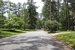
A neighborhood in Embry Hills
USA Georgia location map.svg
Red pog.svg
Embry Hills
Location within the state of Georgia
Usa edcp location map.svg
Red pog.svg
Embry Hills
Embry Hills (the United States)
Coordinates: 33°52′53″N84°15′21″W / 33.88139°N 84.25583°W / 33.88139; -84.25583 Coordinates: 33°52′53″N84°15′21″W / 33.88139°N 84.25583°W / 33.88139; -84.25583
Country United States
State Georgia
County DeKalb
Elevation
906 ft (276 m)
Time zone UTC-5 (Eastern (EST))
  Summer (DST) UTC-4 (EDT)
ZIP codes
30341

Embry Hills is a neighborhood in northern unincorporated DeKalb County, Georgia, United States, near the intersection of I-85 and I-285. The neighborhood has a mix of middle-class young families and retirees, with houses priced from the mid-$200,000s to the upper-$300,000s. [1] Embry Hills is located south of Doraville, east of Chamblee, and north of Tucker, but is not considered part of any of the three cities, although many area businesses and residences use a Chamblee address.

Contents

History

In the mid-1950s, three sibling developers (Jack, James and Neal Embry, for whom the neighborhood is named) purchased 600 acres of farmland west of what is now I-85. Starting in 1957, the Embrys built the 700-800 homes in the neighborhood. They also built several apartment complexes on the acreage. [2] The Embry Hills Club was built in 1958. [3] The land was bisected by I-285 in the 1960s. In 1963, the first phase of the Embry Hills retail district was built. [1] The Embry National Bank (now United Community Bank) soon followed. DeKalb County Public Library recently constructed the new Embry Hills Library, replacing the neighborhood branch that opened in 1990. [4]


Transportation

Public transportation is available at the Doraville MARTA station. Interstate access from I-85 and I-285 is through the Pleasantdale Road and Chamblee Tucker Road exits, respectively. Surface street access is through Chamblee Tucker and Henderson Mill Roads. [1]

Related Research Articles

DeKalb County, Georgia County in Georgia, United states

DeKalb County is located in the north central portion of the U.S. state of Georgia. As of the 2020 census, the population was 764,382, making it Georgia's fourth-most populous county. Its county seat is Decatur.

Chamblee, Georgia City in Georgia, United States

Chamblee is a city in northern DeKalb County, Georgia, United States, northeast of Atlanta. The population was 30,164 as of the 2020 census.

Doraville, Georgia City in Georgia, United States

Doraville is a city in DeKalb County, Georgia, United States northeast of Atlanta. As of the 2020 census, the city had a population of 10,623.

Dunwoody, Georgia City in Georgia, United States

Dunwoody is a city located in DeKalb County, Georgia, United States. As a northern suburb of Atlanta, Dunwoody is part of the Atlanta metropolitan area. It was incorporated as a city on December 1, 2008 but its area establishment dates back to the early 1830s. As of 2019, the city has a population of 49,356, up from 46,267 in the 2010 Census.

North Decatur, Georgia CDP in Georgia, United States

North Decatur is a census-designated place (CDP) in DeKalb County, Georgia, United States. The population was 16,698 at the 2010 census.

Tucker, Georgia City in Georgia, United States

Tucker is a city located in DeKalb County, Georgia, located near Atlanta and was originally settled in the 1820s, and later developed as a railroad community in 1892. According to the 2016 United States Census Bureau annual estimate of resident population, it has a population of 35,322. In a November 2015 referendum, by a 3:1 margin (73.94%), voters approved incorporating Tucker into a city. In March 2016, Tucker residents elected the city's first mayor and city council.

Georgia State Route 141 Highway in Georgia

State Route 141 (SR 141) is a 34.1-mile-long (54.9 km) state highway that runs southwest-to-northeast in the northwest part of the U.S. state of Georgia. It connects the Buckhead area of Atlanta with Cumming. Its routing exists within portions of Fulton, DeKalb, Gwinnett, Forsyth counties.

Tom Moreland Interchange

Tom Moreland Interchange, colloquially known as Spaghetti Junction, is the interchange of Interstate 85 (I-85) and I-285, along with several access roads, in northern DeKalb County, Georgia, northeast of Atlanta and just to the south of Norcross in Gwinnett County. It is named for Tom Moreland, a former commissioner of the Georgia Department of Transportation (GDOT) from 1975 to 1987.

Peachtree Creek

Peachtree Creek is a major stream in Atlanta. It flows for 7.5 miles (12.1 km) almost due west into the Chattahoochee River just south of Vinings.

Brookhaven, Georgia City in Georgia, United States

Brookhaven is a city in the northeastern suburbs of Atlanta that is located in western DeKalb County, Georgia, United States, directly northeast of Atlanta. On July 31, 2012, Brookhaven was approved in a referendum to become DeKalb County's 11th city. Incorporation officially took place on December 17, 2012, on which date municipal operations commenced. With a population of around 55,554 as of 2019, it is the largest city in DeKalb County. The new city stretches over 12 square miles (31 km2).

Georgia State Route 13 State highway in northeastern Georgia

State Route 13 (SR 13) is a 49.5-mile-long (79.7 km) state highway in the north-central part of the U.S. state of Georgia, that travels through portions of Fulton, DeKalb, Gwinnett, and Hall counties.

Chamblee station MARTA rail station

Chamblee is a train station in Chamblee, Georgia, serving the Gold Line of the Metropolitan Atlanta Rapid Transit Authority (MARTA) rail system. The station is bounded by New Peachtree Road on the East, Peachtree Road on the West and Chamblee Tucker road to the South. Chamblee Dunwoody Road is approximately ¼ mile to the north. A multi use trail has been completed between Keswick Park and Chamblee Tucker Road; this trail crosses under Peachtree Industrial Boulevard at Clairmont Road and ends at the Wal-Mart Shopping Center just southeast of the station. Chamblee has plans to connect this multi use trail at Keswick Park to an existing PATH trail that runs near Ashford Dunwoody Road between Blackburn Park and Murphey Candler Park. This station provides access to DeKalb-Peachtree Airport, Interactive College of Technology, Chamblee City Hall, and connecting bus service to Northlake Mall, Georgia State University, Peachford Hospital, Mercer University, Strayer University, the Georgia Vocational Rehabilitation Agency, North DeKalb Health Center, and the Veterans Administration Hospital.

The DeKalb County School District (DCSD) is a school district headquartered at 1701 Mountain Industrial Boulevard in unincorporated DeKalb County, Georgia, United States, near Stone Mountain and in the Atlanta metropolitan area. DCSD operates public schools in areas of DeKalb County that are not within the city limits of Atlanta and Decatur. It will serve a portion of Atlanta annexed by that city in 2018 until 2024, when that portion will be re-assigned to Atlanta Public Schools (APS).

The transportation system of Georgia is a cooperation of complex systems of infrastructure comprising over 1,200 miles (1,900 km) of interstates and more than 120 airports and airbases serving a regional population of 59,425 people.

Murphey Candler Park Park in Brookhaven, Georgia, United States

Murphey Candler Park is a 135-acre multi-use park located in Brookhaven, Georgia, United States. The park is owned and operated by the City of Brookhaven. Park amenities include multi-use fields, tennis courts, a swimming pool, a playground, picnic areas, a lake, and trails. Youth sports are offered through baseball, softball, and football programs that operate through the park. The lake at Murphey Candler Park offers fishing, and it is home to largemouth bass, bluegill, redear sunfish, and channel catfish. The lake is also home to Canada Geese, Mallards, other ducks and beavers.

Northlake, Georgia Unincorporated community

Northlake is an unincorporated community in northeastern metro Atlanta, Georgia, United States, in DeKalb County. Although not formally an edge city, Northlake is home to a large amount of office space, retail options, and residential housing. Similar to its edge city neighbor north of Atlanta, Perimeter Center, Northlake's history began with the construction of a shopping mall, Northlake Mall, in 1971. Both the area and mall are named after North Lake, an actual lake within the community. Northlake is located northeast of Atlanta, south of the junction of I-285 and I-85. The area is served by the arterial roads of LaVista Road, Briarcliff Road, and Henderson Mill Road.

Buford Highway Place in Georgia, United States

Buford Highway, a.k.a. the DeKalb International Corridor, and in the 1990-2000's as the DeKalb County International Village district, is a community northeast of the city of Atlanta, celebrated for its ethnic diversity and spanning multiple counties including Fulton, DeKalb, and Gwinnett counties in the U.S. state of Georgia. The area generally spans along and on either side of a stretch of Georgia State Route 13 (SR 13) in DeKalb County. It begins just north of Midtown Atlanta, continues northeast through the towns of Brookhaven, Chamblee, Doraville, and Norcross. The name of the corridor originates from the name of the highway which connects to the city of Buford. Creative Loafing's Atlanta edition named Buford Highway Atlanta's "best neighborhood for diversity" in their March 2012 Neighborhood Guide. The population exceeds 50,000.

Cross Keys High School is a public high school in Georgia, United States which opened in 1958. It is located at 1626 North Druid Hills Road NE in the city of Brookhaven, near Atlanta, on the western edge of DeKalb County. It serves students from the Buford Highway Corridor in Brookhaven, Chamblee, and Doraville in the DeKalb County School System.

The Northwoods Historic District in DeKalb County, Georgia consists of five adjoining residential neighborhoods, including Northwoods, Fleetwood Hills, Gordon Hills, Gordon Heights and Sequoyah Woods. The Northwoods, Gordon Hills and Gordon Heights neighborhoods are all located within the city limits of Doraville, Georgia, and Sequoyah Woods and Fleetwood Hills are located in unincorporated DeKalb County. The district was developed in the 1950s and 60's and consists of approximately 530 acres with a total of 922 historic/contributing resources.

The Peachtree Creek Greenway trail is a multi-use trail under construction along the North Fork Peachtree Creek in and near Atlanta, Georgia, United States, which will traverse the cities of Atlanta, Brookhaven, Chamblee, Doraville and parts of Unincorporated Dekalb County. Once complete, it will connect 12 miles from the Atlanta Beltline trails and Path 400 northward up to I-285. Some landmarks along the route will include Silverback stadium, Mercer University, CHOA & Emory and multiple schools and libraries.

References

  1. 1 2 3 "Embry Hills Population Demographics, Embry Hills Maps, Embry Hills School Information- ajchomefinder". Archived from the original on 2011-07-07. Retrieved 2011-01-18.
  2. "2009 Winter Newsletter" (PDF). DeKalb History Center.
  3. "Swim and Tennis Club in Embry Hills. Having fun here since 1958". Embryhillsclub.com. Retrieved 11 July 2018.
  4. "DeKalb County Public Library - Embry Hills Library". Archived from the original on 2011-07-25. Retrieved 2011-01-18.