Snapfinger, Georgia

Last updated
Snapfinger, Georgia
USA Georgia location map.svg
Red pog.svg
Snapfinger
Location within the state of Georgia
Usa edcp location map.svg
Red pog.svg
Snapfinger
Snapfinger (the United States)
Coordinates: 33°41′13″N84°12′6″W / 33.68694°N 84.20167°W / 33.68694; -84.20167 Coordinates: 33°41′13″N84°12′6″W / 33.68694°N 84.20167°W / 33.68694; -84.20167
Country United States
State Georgia
County DeKalb
Elevation
279 ft (85 m)
Time zone UTC-5 (Eastern (EST))
  Summer (DST) UTC-4 (EDT)
GNIS feature ID333078 [1]

Snapfinger is an unincorporated community in DeKalb County, Georgia, United States.

History

A post office called Snapfinger was established in 1881, and remained in operation until 1901. [2] The community takes its name from nearby Snapfinger Creek. [3]

Related Research Articles

DeKalb County, Georgia County in Georgia, United states

DeKalb County is located in the north central portion of the U.S. state of Georgia. As of the 2020 census, the population was 764,382, making it Georgia's fourth-most populous county. Its county seat is Decatur.

Belvedere Park, Georgia Census-designated place in Georgia, United States

Belvedere Park is a census-designated place (CDP) in DeKalb County, Georgia, United States. The population was 15,152 at the 2010 census.

Pine Lake, Georgia City in Georgia, United States

Pine Lake is the smallest city in DeKalb County, Georgia, United States. The population was 730 at the 2010 census.
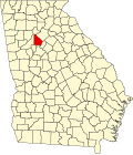
White Oak is an unincorporated community in Camden County, Georgia, United States.

Martin Luther King Jr. High School (Georgia) Public secondary school in Lithonia, Georgia, United States

Martin Luther King Jr. High School is a public high school located in unincorporated DeKalb County, Georgia, United States, with a Lithonia postal address. It opened in August 2001 as the newest high school in the DeKalb County School System, and was named after the late civil rights leader Martin Luther King Jr.

Musella, Georgia Unincorporated community in Georgia, United States

Musella is an unincorporated community in Crawford County, Georgia, United States.

Georgia, Indiana Unincorporated community in Indiana, United States

Georgia is an unincorporated community in Spice Valley Township, Lawrence County, Indiana.

Durand, Georgia Unincorporated community in Georgia, United States

Durand is an unincorporated community in Meriwether County, Georgia, United States.

Snapfinger may refer to:

Dry Branch, Georgia Unincorporated community in Georgia, United States

Dry Branch is an unincorporated community located in Twiggs and Bibb counties, Georgia, United States. Its ZIP code is 31020. The area covered by the ZIP code has a population of 3,198 and contains 100.81 square miles of land and is 0.4% water.

Whitesville is an unincorporated community in Harris County, Georgia, United States.

Cisco, Georgia Unincorporated community in Georgia, United States

Cisco is an unincorporated community in Murray County, Georgia, United States. The community is located at the intersection of U.S. Route 411, Georgia State Route 2, and Georgia State Route 61, 13 miles (21 km) north of Chatsworth. Cisco has a post office with ZIP code 30708.

Murrayville, Georgia Unincorporated community in Georgia, United States

Murrayville is an unincorporated community in Hall County, Georgia, United States. The community is located along Georgia State Route 60, 9.6 miles (15.4 km) north-northwest of Gainesville. Murrayville has a post office with ZIP code 30564.

Dover, Georgia Unincorporated community in Georgia, United States

Dover is an unincorporated community in Screven County, Georgia, United States. The community is located at the intersection of U.S. Route 301, Georgia State Route 17, and Georgia State Route 73, 11.7 miles (18.8 km) south-southwest of Sylvania. Dover has a post office with ZIP code 30424.

Rockledge, Georgia Unincorporated community in Georgia, United States

Rockledge is an unincorporated community in Laurens County, Georgia, United States. The community is located along a Georgia Central Railway line near Georgia State Route 29, 13.8 miles (22.2 km) east-southeast of Dublin. Rockledge has a post office with ZIP code 30454.

Armuchee, Georgia Unincorporated community in Georgia, United States

Armuchee is an unincorporated community in both Floyd County and Chattooga County, Georgia, United States. The community is located along U.S. Route 27, 9 miles (14 km) north of Rome. Armuchee has a post office with ZIP code 30105. The Richard B. Russell Airport is in Armuchee. On November 1, 2020 Donald Trump the 45th President of the United States hosted a trump rally at the airport. This was the only visit to Floyd County, Georgia by a sitting president.

Clyo, Georgia Unincorporated community in Georgia, United States

Clyo is an unincorporated community in Effingham County, Georgia, United States. The community is located along Georgia State Route 119, 8.1 miles (13.0 km) north-northeast of Springfield. Clyo has a post office with ZIP code 31303.

Barney, Georgia Unincorporated community in Georgia, United States

Barney is an unincorporated community in Brooks County, Georgia, United States. The community is located at the junction of state routes 76 and 122, 4.6 miles (7.4 km) north of Morven. Barney has a post office with ZIP code 31625.

Box Springs, Georgia Unincorporated community in Georgia, United States

Box Springs is an unincorporated community in Talbot County, Georgia, United States. The community is located in the county's extreme southwestern corner, 12.2 miles (19.6 km) southwest of Talbotton. Box Springs has a post office with ZIP code 31801.

Snapfinger Creek is a stream in the U.S. state of Georgia.

References

  1. "Snapfinger". Geographic Names Information System . United States Geological Survey.
  2. "Post Offices". Jim Forte Postal History. Retrieved 10 June 2019.
  3. Krakow, Kenneth K. (1975). Georgia Place-Names: Their History and Origins (PDF). Macon, GA: Winship Press. p. 207. ISBN   0-915430-00-2.