Kennesaw | |
|---|---|
| City of Kennesaw | |
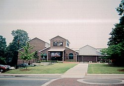
 Kennesaw City Hall | |
 Flag  Seal Logo | |
 Interactive map of Kennesaw | |
| Coordinates: 34°1′24″N84°36′55″W / 34.02333°N 84.61528°W | |
| Country | United States |
| State | Georgia |
| County | Cobb |
| Incorporated | September 21, 1887 |
| Government | |
| • Mayor | Derek Easterling (R) |
| Area | |
• Total | 9.82 sq mi (25.43 km2) |
| • Land | 9.71 sq mi (25.16 km2) |
| • Water | 0.10 sq mi (0.26 km2) |
| Elevation | 1,089 ft (332 m) |
| Population (2020) | |
• Total | 33,036 |
| • Density | 3,400.3/sq mi (1,312.88/km2) |
| Time zone | UTC−5 (EST) |
| • Summer (DST) | UTC−4 (EDT) |
| ZIP Codes | 30144 and 30152 |
| Area codes | |
| FIPS code | 13-43192 [2] |
| GNIS feature ID | 0316387 [3] |
| Website | kennesaw-ga.gov |
Kennesaw is a suburban city northwest of Atlanta in Cobb County, Georgia, United States, located within the greater Atlanta metropolitan area. Known from its original settlement in the 1830s until 1887 as Big Shanty, it became Kennesaw under an 1887 charter. According to the 2020 census, Kennesaw had a population of 33,036, a 10.9% increase in population over the preceding decade. [4] Kennesaw has an important place in railroad history. During the Civil War, Kennesaw was the staging ground for the Great Locomotive Chase on April 12, 1862. Kennesaw is home to Kennesaw State University, an R2 research institution and the third-largest public university in the state of Georgia.