Porterdale, Georgia | |
|---|---|
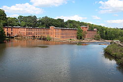 Porterdale Mill | |
 Flag Logo | |
 Location in Newton County and the state of Georgia | |
| Coordinates: 33°34′11″N83°53′53″W / 33.56972°N 83.89806°W | |
| Country | United States |
| State | Georgia |
| County | Newton |
| Area | |
• Total | 2.43 sq mi (6.29 km2) |
| • Land | 2.38 sq mi (6.16 km2) |
| • Water | 0.05 sq mi (0.13 km2) |
| Elevation | 699 ft (213 m) |
| Population (2020) | |
• Total | 1,799 |
| • Density | 756.20/sq mi (292.02/km2) |
| Time zone | UTC-5 (Eastern (EST)) |
| • Summer (DST) | UTC-4 (EDT) |
| ZIP code | 30014 |
| Area code | 770 |
| FIPS code | 13-62244 [2] |
| GNIS feature ID | 0332738 [3] |
| Website | Porterdale, Georgia Website |
Porterdale is a town in Newton County, Georgia, the United States. The population was 1,799 in 2020.

