Fairburn, Georgia | |
|---|---|
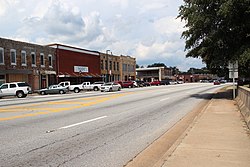 Downtown Fairburn | |
 Flag  Seal | |
| Motto: "Situated to Succeed" | |
 Location in Fulton County and the state of Georgia | |
 Fairburn | |
| Coordinates: 33°32′59″N84°35′29″W / 33.54972°N 84.59139°W [1] | |
| Country | United States |
| State | Georgia |
| County | Fulton |
| Government | |
| • Type | Mayor–council government |
| • Mayor | Hattie Portis-Jones [2] |
| • City Administrator | Tony Phillips [3] |
| Area | |
• Total | 17.12 sq mi (44.34 km2) |
| • Land | 16.91 sq mi (43.79 km2) |
| • Water | 0.21 sq mi (0.55 km2) |
| Elevation | 1,027 ft (313 m) |
| Population (2020) | |
• Total | 16,483 |
| • Density | 975/sq mi (376.4/km2) |
| • Demonym | Fairburnite |
| Time zone | UTC-5 (Eastern (EST)) |
| • Summer (DST) | UTC-4 (EDT) |
| ZIP code | 30213 |
| Area code | 770 |
| FIPS code | 13-28380 [5] |
| GNIS feature ID | 2403586 [1] |
| Website | www |
Fairburn is a city in Fulton County, Georgia, United States, with a population of 16,483, according to the 2020 census. [6] Though it has a rich history of its own, the city is now a closely linked suburb of Atlanta, which lies just 17 miles to the north.

