Baldwin County, Georgia

Last updated

Baldwin County
New Baldwin County Courthouse - panoramio.jpg
Baldwin County Courthouse
Map of Georgia highlighting Baldwin County.svg
Location within the U.S. state of Georgia
Georgia in United States.svg
Georgia's location within the U.S.
Coordinates: 33°04′N83°15′W / 33.07°N 83.25°W / 33.07; -83.25
CountryFlag of the United States.svg United States
StateFlag of Georgia (U.S. state).svg  Georgia
Founded1803;221 years ago (1803)
Named for Abraham Baldwin
Seat Milledgeville
Largest cityMilledgeville
Area
  Total267 sq mi (690 km2)
  Land258 sq mi (670 km2)
  Water9.6 sq mi (25 km2)  3.6%
Population
 (2020)
  Total43,799
  Density170/sq mi (70/km2)
Time zone UTC−5 (Eastern)
  Summer (DST) UTC−4 (EDT)
Congressional district 8th
Website www.baldwincountyga.com

Baldwin County is a county located in the central portion of the U.S. state of Georgia. As of the 2020 census, its population was 43,799. [1] The county seat is Milledgeville, [2] which was developed along the Oconee River. Baldwin County is part of the Milledgeville micropolitan statistical area.

Contents

History

For centuries, the land was occupied by the Creek Nation, and for thousands of years before them, varying cultures of indigenous peoples.

Part of the land ceded by the Creek people in the Treaty of Fort Wilkinson in 1802 was used to create Baldwin County on May 11, 1803, by the Georgia General Assembly, the state's legislative body.

The land west of the Oconee River was organized as Baldwin and Wilkinson Counties. The Treaty of Washington with the Creek in 1805 extended the state's western boundary to the Ocmulgee River. A legislative act on June 26, 1806, added some of this additional land to both counties.

The state legislature subsequently passed an act on December 10, 1807, that created four new counties from Baldwin County's 1806 borders. It expanded Baldwin to the east with land from Hancock and Washington Counties. The new counties were Morgan, Jones, Putnam, and present-day Jasper (originally named Randolph County at the time of the act).

The county is named for Abraham Baldwin, a signer of the United States Constitution, U.S. congressman representing Georgia, and the founder of the University of Georgia. [3] White settlers moved into the area and developed large cotton plantations, made possible by the labor of slaves. Since the invention of the cotton gin, short-staple cotton could be profitably processed, and it was well-suited to the uplands of Georgia. What became known as the Black Belt of Georgia, an arc of fertile soil, was one of the destinations for slaves being sold from the Upper South, as well as from the Low Country.

The county seat of Milledgeville, formerly the state capital of Georgia (1804–1868), is one of only 3 planned capital cities in the United States along with Washington, D.C. and Indianapolis, IN.

Because of its central location within the state and its abundant supply of water from the Oconee River, Milledgeville grew rapidly into a bustling frontier town. On November 2, 1807, the state legislature held its first session in the newly completed statehouse in Milledgeville. Georgia's first state penitentiary was also built within the historic city limits of Milledgeville in 1817. This site is now used as the main campus of Georgia College and State University. In 1837, the General Assembly provided for the establishment of the state's first mental asylum, today known as Central State Hospital.

When the state of Georgia seceded from the Union in January 1861, during a legislative session held in Milledgeville, Baldwin County became a target for Union forces. When Union general William T. Sherman made his devastating March to the Sea through Georgia, his troops occupied the capital city in November 1864. Sherman and his Union armies burned the state penitentiary, vandalized the city, and held a mock session of the legislature in the statehouse to repeal the state's ordinance of secession.

In 1868, after the Civil War (1861–65), Georgia's capital was moved from Milledgeville to its present location in Atlanta. Today, Milledgeville is home to two institutions of higher education: Georgia College and State University and Georgia Military College. Founded in 1889 as the Georgia Normal and Industrial College for Women, Georgia College and State University has since grown to become the state's premier public liberal-arts university. Georgia Military College, founded in 1879, now occupies the Old Capitol Building.

In addition to the Old Capitol and Governor's Mansion, visitors to Baldwin County can explore Andalusia, the family farm of writer Flannery O'Connor; Milledgeville's historic district; and the Lockerly Arboretum, a botanical garden and nature education center that hosts the Lockerly Heritage Festival each September.

Geography

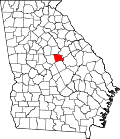
According to the U.S. Census Bureau, the county has a total area of 267 square miles (690 km2), of which 9.6 square miles (25 km2) (3.6%) is covered by water. [4]

The county is located along the fall line of the Eastern United States. The city of Milledgeville, which is located along the Oconee River, is an important city in the region. Because of its location, the northern part of the county tends to be more hilly due to its location in the Piedmont than the southern part of the county, which is in the far northern part of the Atlantic coastal plain.

Most of Baldwin County, south of Lake Sinclair, is located in the Lower Oconee River sub-basin of the Altamaha River basin. The northern portion of the county is located in the Upper Oconee River sub-basin of the same Altamaha River basin. [5]

Adjacent counties

Communities

City

Census-designated place

Unincorporated community

Demographics

Historical population
CensusPop.Note
1810 6,356
1820 7,73421.7%
1830 7,295−5.7%
1840 7,250−0.6%
1850 8,14812.4%
1860 9,07811.4%
1870 10,61817.0%
1880 13,80630.0%
1890 14,6085.8%
1900 17,76821.6%
1910 18,3543.3%
1920 19,7917.8%
1930 22,87815.6%
1940 24,1905.7%
1950 29,70622.8%
1960 34,06414.7%
1970 34,2400.5%
1980 34,6861.3%
1990 39,53014.0%
2000 44,70013.1%
2010 45,7202.3%
2020 43,799−4.2%
2023 (est.)43,396 [6] −0.9%
U.S. Decennial Census [7]
1790-1880 [8] 1890-1910 [9]
1920-1930 [10] 1930-1940 [11]
1940-1950 [12] 1960-1980 [13]
1980-2000 [14] 2010 [15]
Baldwin County racial composition as of 2020 [16]
RaceNum.Perc.
White (non-Hispanic)22,43251.22%
Black or African American (non-Hispanic)18,31841.82%
Native American 640.15%
Asian 5991.37%
Pacific Islander 270.06%
Other/mixed 1,2202.79%
Hispanic or Latino 1,1392.6%

As of the 2020 United States census, 43,799 people, 16,191 households, and 9,568 families were residing in the county.

Government

Members of the Baldwin County Board of Commissioners are responsible for administering the government to residents. Five members are on the board, elected from single-member districts. They serve four-year terms, and are up for election in a staggered fashion. The members of the board elect the chair from among themselves.

Board of commissioners
DistrictCommissionerParty
District 1Emily DavisDemocratic
District 2Kendrick ButtsDemocratic
District 3Sammy HallRepublican
District 4Henry CraigRepublican
District 5John WestmorelandRepublican

Politics

Baldwin County has been a Democratic-leaning swing county in recent presidential elections, with no candidate receiving more than 52.9% of the vote in any presidential election from 1992 onward. The county was the only one in Georgia that failed to give a majority to either major-party candidate in the 2018 gubernatorial election, with Democrat Stacey Abrams winning the county by only 58 votes over Republican Brian Kemp. [17] Baldwin County, along with neighboring Washington County, was one of 2 counties that gave a plurality of votes to Herschel Walker in the first round of the 2022 Senate election but then gave a majority of votes to Raphael Warnock in the subsequent run-off. [18]

United States presidential election results for Baldwin County, Georgia [19]
Year Republican Democratic Third party
No.%No.%No.%
2020 8,90348.75%9,14050.05%2181.19%
2016 7,69747.76%7,97049.45%4492.79%
2012 7,58946.64%8,48352.14%1981.22%
2008 7,82347.23%8,58751.84%1540.93%
2004 7,70952.89%6,77546.48%910.62%
2000 6,04149.82%5,89348.60%1921.58%
1996 4,57040.79%5,74051.23%8957.99%
1992 4,26236.16%5,81349.31%1,71314.53%
1988 5,85259.05%4,00840.44%510.51%
1984 5,71759.74%3,85340.26%00.00%
1980 3,63943.71%4,36852.46%3193.83%
1976 3,61243.59%4,67456.41%00.00%
1972 4,82677.08%1,43522.92%00.00%
1968 2,31832.60%2,11529.74%2,67837.66%
1964 3,43055.59%2,74044.41%00.00%
1960 1,26435.85%2,26264.15%00.00%
1956 1,08032.19%2,27567.81%00.00%
1952 1,02330.62%2,31869.38%00.00%
1948 55926.68%1,13254.03%40419.28%
1944 30719.02%1,30780.98%00.00%
1940 20313.36%1,31386.38%40.26%
1936 11312.20%81187.58%20.22%
1932 455.27%80193.79%80.94%
1928 27027.49%71272.51%00.00%
1924 10710.87%82683.94%515.18%
1920 9214.24%55485.76%00.00%
1916 659.48%57984.40%426.12%
1912 243.47%62189.74%476.79%

Education

Transportation

Major highways

Hiking and cycling

Notable people

See also

Related Research Articles

<span class="mw-page-title-main">Putnam County, Georgia</span> County in Georgia, United States

Putnam County is a county located in the central portion of the U.S. state of Georgia. As of the 2020 census, the population was 22,047. The county seat is Eatonton.

<span class="mw-page-title-main">Montgomery County, Georgia</span> County in Georgia, United States

Montgomery County is a county located in the central portion of the U.S. state of Georgia. As of the 2020 census, the population was 8,610. The county seat is Mount Vernon. Montgomery County is part of the Vidalia, GA micropolitan statistical area.

<span class="mw-page-title-main">Wilkinson County, Georgia</span> County in Georgia, United States

Wilkinson County is a county located in the central portion of the U.S. state of Georgia. As of the 2020 census, the population was 8,877. The county seat is Irwinton. The county was created on May 11, 1803, and named for General James Wilkinson (1757–1825).

<span class="mw-page-title-main">Wheeler County, Georgia</span> County in Georgia, United States

Wheeler County is a county located in the central portion of the U.S. state of Georgia. As of the 2020 census, the population was 7,471. The county seat is Alamo. The county is one of the most impoverished counties in the nation. The American Community Survey's 2009–2013 average reports that the county's per-capita income of $8,948 makes it the poorest county in the United States by this metric. The measurement however is misleading as Wheeler County is the site of Wheeler Correctional Facility, a large prison with a capacity of 2,874 prisoners, about 40 percent of the county's total population. Most prisoners have little income. The prison was opened in 1998 and the prison population may also account for the increased population of the county in the early 2000s.

<span class="mw-page-title-main">Wayne County, Georgia</span> County in Georgia, United States

Wayne County is a county located in the southeastern part of the U.S. state of Georgia. As of the 2020 census, the population was 30,144. The county seat is Jesup.

<span class="mw-page-title-main">Washington County, Georgia</span> County in Georgia, United States

Washington County is a county located in the U.S. state of Georgia. As of the 2020 census, the population was 19,988. The county seat is Sandersville. The county was established on February 25, 1784. It was named for Revolutionary War general George Washington.

<span class="mw-page-title-main">Twiggs County, Georgia</span> County in Georgia, United States

Twiggs County is a county located in the central portion of the U.S. state of Georgia. As of the 2020 census, the population was 8,022. The county seat is Jeffersonville. The county was created on December 14, 1809, and named for American Revolutionary War general John Twiggs.

<span class="mw-page-title-main">Treutlen County, Georgia</span> County in Georgia, United States

Treutlen County is a county located in the east central. & Magnolia midlands portion of the U.S. state of Georgia. As of the 2020 census, the population was 6,406. The county seat is Soperton. It is host to the Million Pines Arts and Crafts Festival which occurs during the first weekend in November.

<span class="mw-page-title-main">Oconee County, Georgia</span> County in Georgia, United States

Oconee County is a county located in the northeastern part of the U.S. state of Georgia. As of the 2020 census, the population was 41,799. The county seat is Watkinsville.

<span class="mw-page-title-main">Morgan County, Georgia</span> County in Georgia, United States

Morgan County is a county located in the north central Piedmont region and the lake country region of the U.S. state of Georgia. As of the 2020 census, the population was 20,097. The county seat is Madison.

<span class="mw-page-title-main">Laurens County, Georgia</span> County in Georgia, United States

Laurens County is a county located in the central part of the U.S. state of Georgia. As of the 2020 census, the population was 49,570, up from 48,434 in 2010. The county seat is Dublin. The county was founded on December 10, 1807, and named after Lieutenant Colonel John Laurens, an American soldier and statesman from South Carolina during the American Revolutionary War.

<span class="mw-page-title-main">Jones County, Georgia</span> County in Georgia, United States

Jones County is a county in the central portion of the U.S. state of Georgia. As of the 2020 census, the population was 28,347. The county seat is Gray. The county was created on December 10, 1807, and named after U.S. Representative James Jones.

<span class="mw-page-title-main">Johnson County, Georgia</span> County in Georgia, United States

Johnson County is a county located along the oconee River in the U.S. state of Georgia. As of the 2020 census, the population was 9,189. The county seat is Wrightsville. Johnson County is part of the Dublin, Georgia, micropolitan statistical area.

<span class="mw-page-title-main">Jasper County, Georgia</span> County in Georgia, United States

Jasper County is a county located in the central portion of the U.S. state of Georgia. As of the 2020 census, the population was 14,588, up from 13,900 in 2010. The county seat is Monticello. Jasper County is part of the Atlanta-Sandy Springs-Roswell MSA.

<span class="mw-page-title-main">Hancock County, Georgia</span> County in Georgia, United States

Hancock County is a county located in the East Central part of the U.S. state of Georgia. As of the 2020 census, the population was 8,735. The county seat is Sparta. The county was created on December 17, 1793, and named for John Hancock, a Founding Father of the American Revolution.

<span class="mw-page-title-main">Greene County, Georgia</span> County in Georgia, United States

Greene County is a county located in the east central portion & the Lake country region of the U.S. state of Georgia. As of the 2020 census, the population was 18,915. The county seat is Greensboro. The county was created on February 3, 1786, and is named for Nathanael Greene, an American Revolutionary War major general.

<span class="mw-page-title-main">Dodge County, Georgia</span> County in Georgia, United States

Dodge County is a county located in the central portion of the U.S. state of Georgia. As of 2020, the population was 19,925. The county seat is Eastman. Dodge County lies in the Historic South and Black Belt region of Georgia, an area that was devoted to cotton production in the antebellum years. It has significant historic buildings and plantations, has a substantial African-American population, and shows cultural aspects of the South.

<span class="mw-page-title-main">Clarke County, Georgia</span> County in Georgia, United States

Clarke County is located in the northeastern part of the U.S. state of Georgia. As of the 2020 census, the population was 128,671. Its county seat is Athens, with which it is a consolidated city-county.

<span class="mw-page-title-main">Bleckley County, Georgia</span> County in Georgia, United States

Bleckley County is a county located in the central portion of the U.S. state of Georgia. As of the 2020 census, the population was 12,583. The county seat is Cochran.

<span class="mw-page-title-main">Milledgeville, Georgia</span> City in Georgia, United States

Milledgeville is a city in and the county seat of Baldwin County in the U.S. state of Georgia. It is northeast of Macon and bordered on the east by the Oconee River. The rapid current of the river here made this an attractive location to build a city. It was the capital of Georgia from 1804 to 1868, including during the American Civil War. Milledgeville was preceded as the capital city by Louisville and was succeeded by Atlanta, the current capital. Today U.S. Highway 441 connects Milledgeville to Madison, Athens, and Dublin.

References

  1. "Census - Geography Profile: Baldwin County, Georgia". United States Census Bureau . Retrieved December 26, 2022.
  2. "Find a County". National Association of Counties. Archived from the original on May 31, 2011. Retrieved June 7, 2011.
  3. Krakow, Kenneth K. (1975). Georgia Place-Names: Their History and Origins (PDF). Macon, GA: Winship Press. p. 13. ISBN   0-915430-00-2. Archived (PDF) from the original on September 17, 2003.
  4. "US Gazetteer files: 2010, 2000, and 1990". United States Census Bureau. February 12, 2011. Retrieved April 23, 2011.
  5. "Georgia Soil and Water Conservation Commission Interactive Mapping Experience". Georgia Soil and Water Conservation Commission. Archived from the original on October 3, 2018. Retrieved November 21, 2015.
  6. "Annual Estimates of the Resident Population for Counties: April 1, 2020 to July 1, 2023". United States Census Bureau. Retrieved March 31, 2024.
  7. "Decennial Census of Population and Housing by Decades". US Census Bureau.
  8. "1880 Census Population by Counties 1790-1800" (PDF). US Census Bureau . 1880.
  9. "1910 Census of Population - Georgia" (PDF). US Census Bureau . 1910.
  10. "1930 Census of Population - Georgia" (PDF). US Census Bureau . 1930.
  11. "1940 Census of Population - Georgia" (PDF). US Census Bureau . 1940.
  12. "1950 Census of Population - Georgia -" (PDF). US Census Bureau . 1950.
  13. "1980 Census of Population - Number of Inhabitants - Georgia" (PDF). US Census Bureau . 1980.
  14. "2000 Census of Population - Population and Housing Unit Counts - Georgia" (PDF). US Census Bureau . 2000.
  15. "State & County QuickFacts". United States Census Bureau. Archived from the original on July 3, 2011. Retrieved June 17, 2014.
  16. "Explore Census Data". data.census.gov. Retrieved December 17, 2021.
  17. "Georgia Governor Election Results". The New York Times. ISSN   0362-4331 . Retrieved January 27, 2019.
  18. "Georgia U.S. Senate Runoff Election Results". The New York Times. ISSN   0362-4331 . Retrieved July 19, 2023.
  19. Leip, David. "Dave Leip's Atlas of U.S. Presidential Elections". uselectionatlas.org. Retrieved March 18, 2018.

Further reading

33°04′N83°15′W / 33.07°N 83.25°W / 33.07; -83.25