Lanier County, Georgia

Last updated

Lanier County
Lanier County Courthouse, Lakeland, GA, US.jpg
Lanier County Courthouse in Lakeland
Map of Georgia highlighting Lanier County.svg
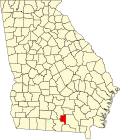
Location within the U.S. state of Georgia
Georgia in United States.svg
Georgia's location within the U.S.
Coordinates: 31°02′16″N83°03′46″W / 31.0378937°N 83.0626534°W / 31.0378937; -83.0626534
CountryFlag of the United States.svg United States
StateFlag of Georgia (U.S. state).svg  Georgia
FoundedAugust 7, 1920
Named for Sidney Lanier
Seat Lakeland
Largest cityLakeland
Area
  Total200 sq mi (500 km2)
  Land185 sq mi (480 km2)
  Water15 sq mi (40 km2)  7.3%
Population
 (2020)
  Total9,877
  Density53/sq mi (20/km2)
Time zone UTC−5 (Eastern)
  Summer (DST) UTC−4 (EDT)
Congressional district 8th
Website laniercountyboc.com
[1]

Lanier County is a county in the south central portion of the U.S. state of Georgia. As of the 2020 census, the population was 9,877. [2] The county seat and only incorporated municipality is Lakeland. [3] The county is named after the Georgia poet Sidney Lanier. [4]

Contents

Lanier County is part of the Valdosta, GA metropolitan statistical area. Lanier shares Moody Air Force Base with Lowndes County on its western boundary.

Geography

According to the U.S. Census Bureau, the county has an area of 200 square miles (520 km2), of which 185 square miles (480 km2) is land and 15 square miles (39 km2) (7.3%) is water. [5]

The vast majority of Lanier County is in the Alapaha River sub-basin of the Suwannee River basin. Just a narrow section of the western border of the county, northeast and southeast of Ray City, is in the Withlacoochee River sub-basin of the same Suwannee River basin, and a very narrow section of the eastern border of Lanier County is in the Upper Suwannee River sub-basin of the same Suwannee River basin. [6]

Major highways

Major waterways

Railways

Previous

Defunct

Adjacent counties

National protected area

Banks Lake National Wildlife Refuge sign Banks Lake National Wildlife Refuge Sign.jpg
Banks Lake National Wildlife Refuge sign

The Banks Lake National Wildlife Refuge, established in 1985, hosts approximately 20,000 visitors annually. It provides hiking, fishing, and boating opportunities on more than 4,000 acres (16 km2) of water, Banks Lake marsh, and swamp. The Robert Simpson III Nature Trail, dedicated in August 2001, is in the Lakeland, Georgia city limits on 75 acres (300,000 m2) of pine and hardwood forests. The county is known for its excellent fishing in the Alapaha River, Banks Lake National Wildlife Refuge as well as in its many small lakes.

Communities

Cities

Census-designated place

Demographics

Historical population
CensusPop.Note
1930 5,190
1940 5,6328.5%
1950 5,151−8.5%
1960 5,097−1.0%
1970 5,031−1.3%
1980 5,65412.4%
1990 5,531−2.2%
2000 7,84741.9%
2010 10,07828.4%
2020 9,877−2.0%
2023 (est.)10,452 [7] 5.8%
U.S. Decennial Census [8]
1790-1880 [9] 1890-1910 [10]
1920-1930 [11] 1930-1940 [12]
1940-1950 [13] 1960-1980 [14]
1980-2000 [15] 2010 [16]
Lanier County racial composition as of 2020 [17]
RaceNum.Perc.
White (non-Hispanic)6,59566.77%
Black or African American (non-Hispanic)2,13821.65%
Native American 310.31%
Asian 810.82%
Pacific Islander 140.14%
Other/Mixed 4464.52%
Hispanic or Latino 5725.79%

As of the 2020 United States census, there were 9,877 people, 3,714 households, and 2,536 families residing in the county.

Economy

The county's economy has remained rural in nature, but the educational, health and social service sector was the largest employment category in 2006. Factors contributing to this economy include the presence of Moody Air Force Base (shared by adjoining Lowndes County), the several lakes and nature reserve, the hospital, and a large state correctional facility.

The top ten employers in Lanier County are:[ citation needed ]

Media

Historic sites

Historic sites include Governor Eurith D. Rivers' home, which was moved from its original spot on Banks Lake to West Main Street in Lakeland in the early 1980s; Union Baptist Church, located near Georgia Highway 135; and Fender Cemetery, located east of Lakeland at the junction of U.S. 221 and Georgia Highway 37 on land that once belonged to David Fender. The site of the cemetery, in which many of the area's first settlers are buried, was chosen so that mourners would not have to ferry their dead across the river for burial. Also, the "Murals of Milltown," which depict community life in the 1920s, grace the exteriors of buildings in downtown Lakeland.

Education

Lanier County School District headquarters Lanier County Board of Education.JPG
Lanier County School District headquarters

The Lanier County School District operates four schools: Lanier County Primary School, Lanier County Elementary School, Lanier County Middle School, and Lanier County High School.

Politics

United States presidential election results for Lanier County, Georgia [18]
Year Republican Democratic Third party
No.%No.%No.%
2020 2,50970.16%1,01928.50%481.34%
2016 1,98469.10%80628.07%812.82%
2012 1,82061.11%1,11437.41%441.48%
2008 1,78762.05%1,06236.88%311.08%
2004 1,64163.38%93135.96%170.66%
2000 1,04855.04%83243.70%241.26%
1996 51934.55%81854.46%16510.99%
1992 60035.03%81147.34%30217.63%
1988 72550.81%69848.91%40.28%
1984 85253.48%74146.52%00.00%
1980 47029.30%1,11669.58%181.12%
1976 20714.02%1,26985.98%00.00%
1972 85081.50%19318.50%00.00%
1968 24115.63%27717.96%1,02466.41%
1964 71952.10%66147.90%00.00%
1960 19815.88%1,04984.12%00.00%
1956 15214.59%89085.41%00.00%
1952 17016.75%84583.25%00.00%
1948 9213.53%48671.47%10215.00%
1944 406.02%62593.98%00.00%
1940 162.56%60797.12%20.32%
1936 303.59%80095.81%50.60%
1932 31.38%21197.24%31.38%
1928 13831.29%30368.71%00.00%
1924 4611.41%35688.34%10.25%

See also

Notes

  1. "Lanier County Act Amended, No. 505". Acts of the General Assembly of the State of Georgia. 1920. pp. 45–48. Retrieved November 13, 2022.
  2. "Census - Geography Profile: Lanier County, Georgia". United States Census Bureau . Retrieved December 27, 2022.
  3. "Find a County". National Association of Counties. Retrieved June 7, 2011.
  4. Krakow, Kenneth K. (1975). Georgia Place-Names: Their History and Origins (PDF). Macon, GA: Winship Press. p. 129. ISBN   0-915430-00-2. Archived (PDF) from the original on April 14, 2004.
  5. "US Gazetteer files: 2010, 2000, and 1990". United States Census Bureau. February 12, 2011. Retrieved April 23, 2011.
  6. "Georgia Soil and Water Conservation Commission Interactive Mapping Experience". Georgia Soil and Water Conservation Commission. Retrieved November 27, 2015.
  7. "Annual Estimates of the Resident Population for Counties: April 1, 2020 to July 1, 2023". United States Census Bureau. Retrieved March 31, 2024.
  8. "Decennial Census of Population and Housing by Decades". United States Census Bureau.
  9. "1880 Census Population by Counties 1790-1800" (PDF). United States Census Bureau. 1880.
  10. "1910 Census of Population - Georgia" (PDF). United States Census Bureau. 1910.
  11. "1930 Census of Population - Georgia" (PDF). United States Census Bureau. 1930.
  12. "1940 Census of Population - Georgia" (PDF). United States Census Bureau. 1940.
  13. "1950 Census of Population - Georgia -" (PDF). United States Census Bureau. 1950.
  14. "1980 Census of Population - Number of Inhabitants - Georgia" (PDF). United States Census Bureau. 1980.
  15. "2000 Census of Population - Population and Housing Unit Counts - Georgia" (PDF). United States Census Bureau. 2000.
  16. "State & County QuickFacts". United States Census Bureau. Archived from the original on June 7, 2011. Retrieved June 23, 2014.
  17. "Explore Census Data". data.census.gov. Retrieved December 18, 2021.
  18. Leip, David. "Dave Leip's Atlas of U.S. Presidential Elections". uselectionatlas.org. Retrieved March 20, 2018.

Related Research Articles

<span class="mw-page-title-main">Ware County, Georgia</span> County in Georgia, United States

Ware County is a county located in the southeastern part of the U.S. state of Georgia. As of the 2020 census, the population was 36,251. The county seat and only incorporated place is Waycross. Ware County is part of the Waycross, Georgia micropolitan statistical area.

<span class="mw-page-title-main">Turner County, Georgia</span> County in Georgia, United States

Turner County is a county located in the south central portion of the U.S. state of Georgia. As of the 2020 census, the population was 9,006. The county seat is Ashburn. The county was created on August 18, 1905, and named for Henry Gray Turner, U.S. representative and Georgia state Supreme Court justice.

<span class="mw-page-title-main">Tift County, Georgia</span> County in Georgia, United States

Tift County is a county located in the south central portion of the U.S. state of Georgia. As of the 2020 census, the population was 41,344. The county seat is Tifton.

<span class="mw-page-title-main">Lowndes County, Georgia</span> County in Georgia, United States

Lowndes County is a county located in the south-central portion of the U.S. state of Georgia. As of the 2020 census, the population was 118,251. The county seat is Valdosta. The county was created December 23, 1825.

<span class="mw-page-title-main">Irwin County, Georgia</span> County in Georgia, United States

Irwin County is a county located in the U.S. state of Georgia. As of the 2020 census, the population was 9,666. The county seat is Ocilla. The county was created on December 15, 1818. It was named for Governor Jared Irwin.

<span class="mw-page-title-main">Echols County, Georgia</span> County in Georgia, United States

Echols County is a county located in the southeastern part of the U.S. state of Georgia. As of the 2020 census, the population was 3,697. The county seat is Statenville. Since 2008, Statenville is a disincorporated municipality. Echols and Webster counties are the only two counties in Georgia to currently have no incorporated municipalities. The county was established in 1858 and named in honor of Robert Milner Echols (1798–1847).

<span class="mw-page-title-main">Dooly County, Georgia</span> County in Georgia, United States

Dooly County is a county located in the central portion of the U.S. state of Georgia. As of the 2020 census, the population was 11,208. The county seat is Vienna. The county was created by an act of the Georgia General Assembly on May 15, 1821, and named for Colonel John Dooly, a Georgia American Revolutionary War fighter. It was one of the original landlot counties created from land ceded from the Creek Nation.

<span class="mw-page-title-main">Crisp County, Georgia</span> County in Georgia, United States

Crisp County is a county located in the central portion of the U.S. state of Georgia. As of the 2020 census, the population was 20,128. The county seat is Cordele. The county was created on August 17, 1905, from Dooly County and named for Georgia Congressman Charles Frederick Crisp.

<span class="mw-page-title-main">Cook County, Georgia</span> County in Georgia, United States

Cook County is a county located in the south central portion of the U.S. state of Georgia. As of the 2020 census, the population was 17,229. The county seat is Adel. The constitutional amendment to create the county was proposed July 30, 1918, and ratified November 5, 1918. It is named for former Civil War general Philip Cook of the Confederate States Army.

<span class="mw-page-title-main">Colquitt County, Georgia</span> County in Georgia, United States

Colquitt County is a county in the U.S. state of Georgia. As of the 2020 census, the population was 45,898. The county seat is Moultrie. The county was created on February 25, 1856, and is named for Walter Terry Colquitt, a U.S. senator. Colquitt County comprises the Moultrie, GA micropolitan statistical area.

<span class="mw-page-title-main">Coffee County, Georgia</span> County in Georgia, United States

Coffee County is a county located in the southeastern part of the U.S. state of Georgia. As of the 2020 census, the population was 43,092, up from 42,356 at the 2010 census. The county seat is Douglas.

<span class="mw-page-title-main">Clinch County, Georgia</span> County in Georgia, United States

Clinch County is a county located in the southeastern part of the U.S. state of Georgia. As of the 2020 census, the population was 6,749. The county seat is Homerville. The county was created on February 14, 1850, named in honor of Duncan Lamont Clinch.

<span class="mw-page-title-main">Brooks County, Georgia</span> County in Georgia, United States

Brooks County is a county located in the U.S. state of Georgia, on its southern border with Florida. As of the 2020 census, the population was 16,301. The county seat is Quitman. The county was created in 1858 from portions of Lowndes and Thomas counties by an act of the Georgia General Assembly and was named for pro-slavery U.S. Representative Preston Brooks, after he severely beat abolitionist Senator Charles Sumner with a cane for delivering a speech attacking slavery.

<span class="mw-page-title-main">Brantley County, Georgia</span> County in Georgia, United States

Brantley County is a county located in the southeastern part of the U.S. state of Georgia. As of the 2020 census, the population was 18,021. The county seat is Nahunta. Brantley County is part of the Brunswick, Georgia metropolitan statistical area.

<span class="mw-page-title-main">Berrien County, Georgia</span> County in Georgia, United States

Berrien County is a county located in the south central portion of the U.S. state of Georgia. As of the 2020 census, the population was 18,160. The county seat is Nashville. The county was created February 25, 1856, out of portions of Coffee, Irwin and Lowndes counties by an act of the Georgia General Assembly. It is named after Georgia senator John M. Berrien.

<span class="mw-page-title-main">Atkinson County, Georgia</span> County in Georgia, United States

Atkinson County is a county located in the southeastern region of the U.S. state of Georgia. As of the 2020 census, the county's population was 8,286. The county seat is Pearson. The county was formed in 1917 from parts of Coffee and Clinch counties. It is named for William Yates Atkinson, Democratic governor of Georgia from 1894 to 1898. In 2003, it had the highest illiteracy rate of any U.S. county at 36%.

<span class="mw-page-title-main">Lakeland, Georgia</span> City in Georgia, United States

Lakeland is a city and the county seat of Lanier County, Georgia, United States. The city is the county seat of Lanier County. It is part of the Valdosta, Georgia metropolitan statistical area. The population was 2,875 at the 2020 census.

<span class="mw-page-title-main">Lower Coastal Plain (Georgia)</span> Subregion

Southeast Georgia's Lower Coastal Plain, often referred to as the "Coastal Empire", is a subregion that encompasses the lowest-lying areas of the Atlantic coastal plain in the state, containing barrier islands, marshes, and swampy lowlands, as well as flat plains and low terraces. It differs from Georgia's Upper Coastal Plain in that it is lower in elevation with less relief and wetter soils. The United States Environmental Protection Agency defines the Lower Coastal Plain as an ecoregion, part of the larger, interstate Southern Coastal Plain.

<span class="mw-page-title-main">Stockton, Georgia</span> Place in Georgia, United States

Stockton is an unincorporated community and census-designated place (CDP) in Lanier County, Georgia, United States.

<span class="mw-page-title-main">Georgia State Route 122</span> State highway in Georgia

State Route 122 (SR 122) is a 98.2-mile-long (158.0 km) state highway that travels west-to-east through portions of Thomas, Brooks, Lowndes, Lanier, Clinch, and Ware counties in the southern part of the U.S. state of Georgia. The highway connects the cities of Thomasville and Waycross, via Lakeland.

References